
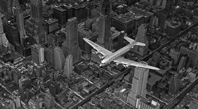
The simplicity of the New York grid system, seen overhead in a 1939 classic photo by Margaret Bourke-White.
PODCAST The Commissioners Plan of 1811 How did Manhattan get its orderly rows of numbered streets and avenues? In the early 19th century, New York was growing rapidly, but the new development was confined on an island, giving city planners a rare opportunity to mold a modern city that was orderly, sophisticated and even (they thought at the time) healthy. With the Commissioners Plan of 1811, uniform blocks were created without regards to hills and streams or even to the owners of the property!
Join us as we recount this monumental event in New York’s history — how land above Houston Street was radically transformed and also how the city revolted in many places. What about those avenues A, B, C and D? Why doesn’t the West Village snap to the grid? And why on earth did the early planners not arrange for any major parks?!
ALSO: A podcast within a podcast as we focus on the biography of one of those commissioners. Give it up for Gouverneur Morris, the casanova with Constitutional connections, a Bronx estate and a wooden pegleg.
CORRECTION: Due to my complete misreading of my own handwritten notes and in the flurry of wrapping up the show, I said that Manhattanhenge occurs on March 28 and July 12 or July 13. I meant MAY 28, not March 28. Chalk this one up to my senility. I apologize for the error.
An early view of the area that would one day become the Lower East Side, SoHo and Chinatown: a network of farms and jagged roads, with some organization on individual properties. This map features details of James DeLancey’s farm. That property would be carved up after the war. (You can check out the whole 1767 map here.)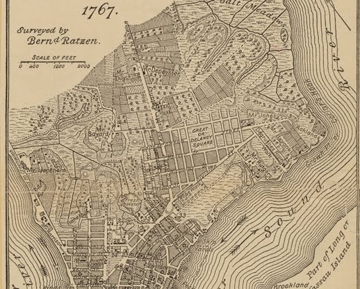
Gouverneur Morris, the Founding Father who led the commission to plan New York’s future streets and avenue.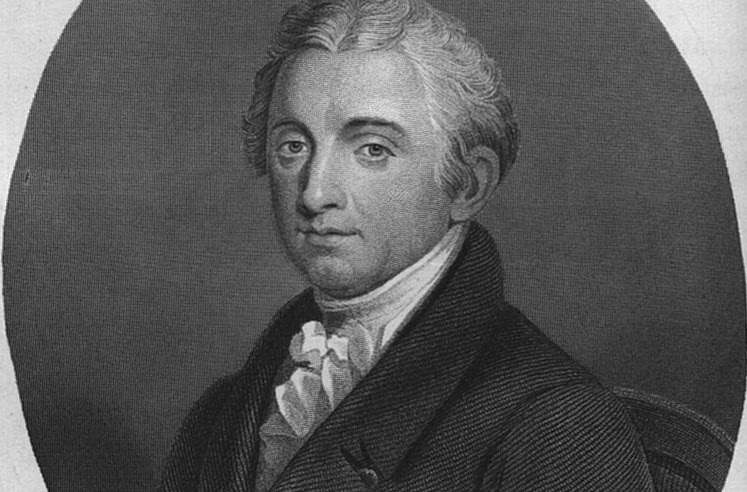
A detail from the original 1811 grid plan map of John Randel. The grid starts at irregular intervals due to keeping Greenwich Village intact, but begins right about Houston Street to the east. As it heads north, two big interupptions were planned — a market place in east around 10th-11th Street and a ‘parade ground’ about 23rd Street. 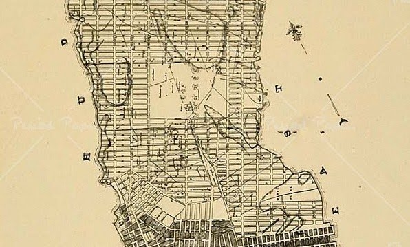
A close-up on the parade ground. 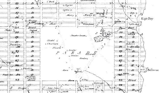
Not everything conforms to the original plan. Take Stuyvestant Street in the East Village. A main thoroughfare into the original estate of the Stuyvesant family, the small road was allowed to break the block between 9th and 10th streets. The street is hardly recognizable in this extraordinary photo from 1856, but the top of St. Mark’s Church gives away the location. (Courtesy East Village Transitions)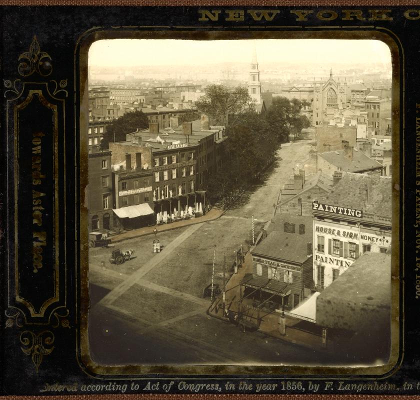
Crossroads: Herald Square, on a hot summers day in 1936. The intersection was partially created by the grid plan (the intersection of 34th Street and Sixth Avenue) and by one feature that later city planners ignored: Broadway which, according to the plan, was never supposed to extend past 23rd Street. (NYPL) 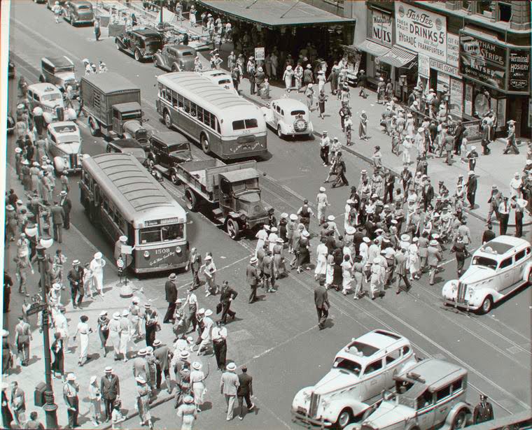
Here’s a look at the entire Randel map in color.
Check out the New York Times wonderful interactive map, overlaying the original plan on top of modern changes to the city.
3 replies on “Building Blocks: The Commissioners Plan of 1811, inventing a New York grid of streets and avenues”
Love your podcast! This one was especially interesting. Thanks.
helped me with my term paper so much! thank you!
[…] something like The 1811 Commissioner’s Plan for New York City (great minds choose the same WordPress themes, Bowery Boys), the one that laid out the famous grid […]