Categories
Bowery Boys Bookshelf

The beauty and artistry of early American maps

HOLIDAY HISTORY GIFT GUIDE Each week for the rest of the year, the Bowery Boys will recommend a newly released book that you might like to include on your holiday wish list. For other book suggestions, check out other entries on the Bowery Boys Bookshelf.


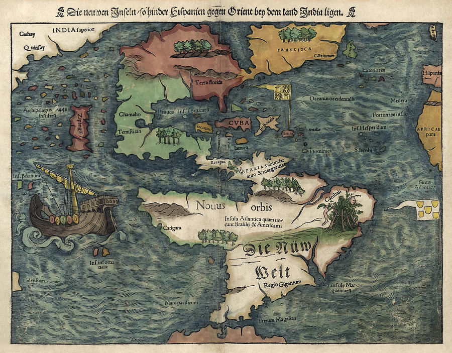
Pretend GPS was never invented or that man never sent a satellite into order. Imagine going back to a time when people had no idea what continents looked like.

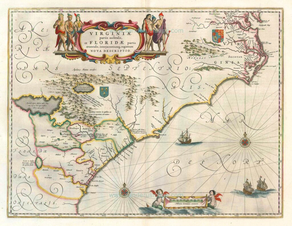
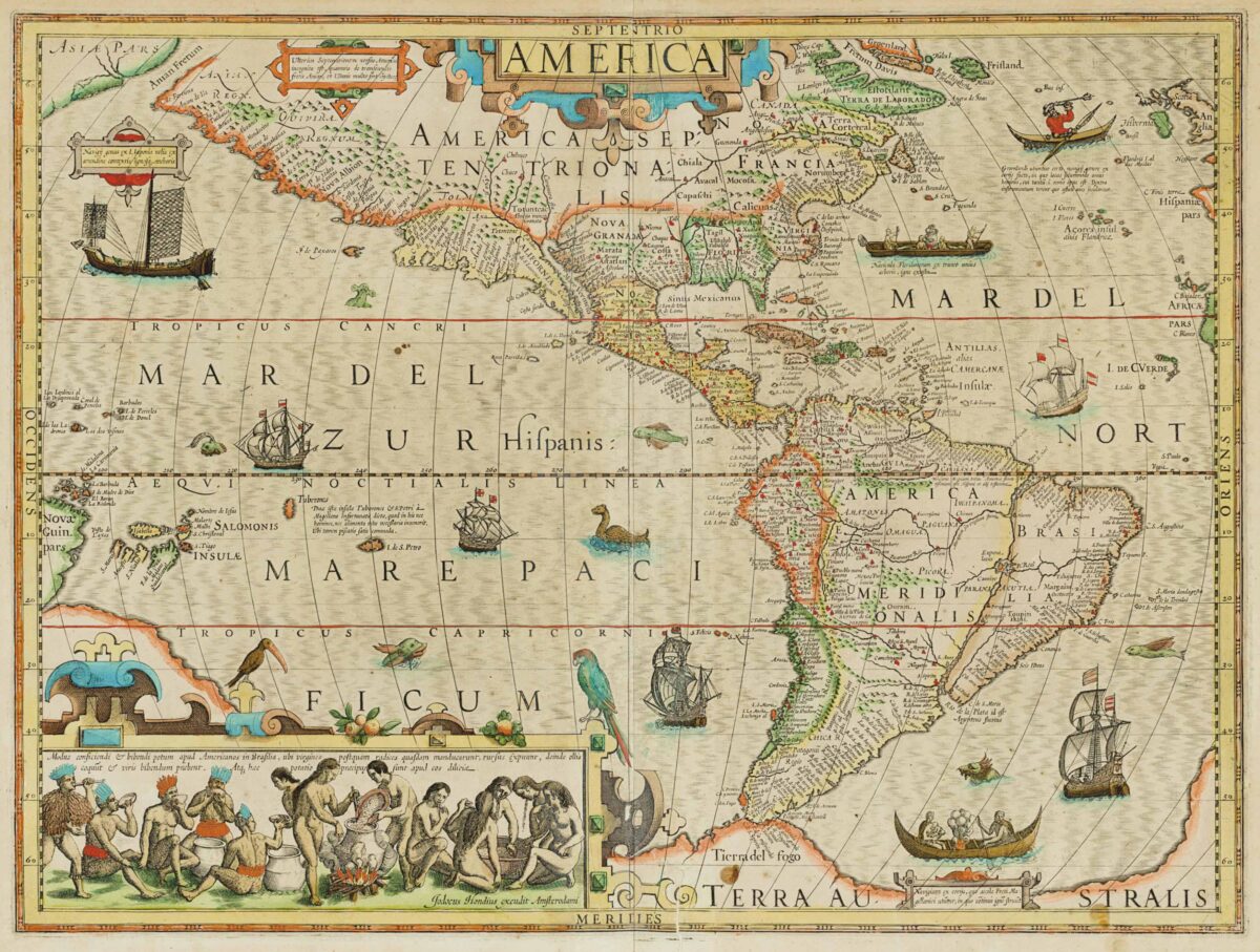
The glory of the most beautiful early maps is that they’re never 100% precise. Early cartographers carefully pieced together observations to create maps that were close to accurate. And where details were not known, artist inspiration filled in the blanks.
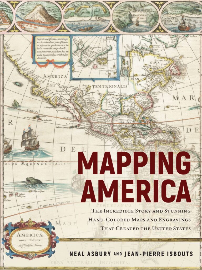
MAPPING AMERICA
The Incredible Story and Stunning Hand-Colored Maps and Engravings That Created the United States

Neal Asbury and Jean-Pierre Isbouts

When the great European colonizers first sent explorations out towards the New World, almost nothing was known of the Americas’ size and shape. With each expedition — from Christopher Columbus to Henry Hudson — a bit more of the puzzle was revealed.

In Mapping America, the colorful new history of map making by rare map collector (and radio host) Neal Asbury and National Geographic historian Jean-Pierre Isbouts, the continents reveal themselves slowly in wild and vividly flamboyant illustrations that resonate like the creation of literary fantasy.

1550 map of the Western Hemisphere by Sebastian Münster.

The maps beautifully presented in Mapping America are essentially souvenirs of colonization, and their ravishing and sometimes quizzical charms can belie the dominance of empire which produced them.

This is especially true of the marvelous Dutch maps of rival cartographers Jodocus Hondius and Willem Blaeu whose depictions of America were deeply detailed — to a point. (“Some of Hondius’s changes,” write the authors, “such as the depiction of the River May [in today’s South Carolina], were erroneous and would confound explorers for the next 150 years.”)

Robert Morden’s 1685 Map of the English Empire in North America

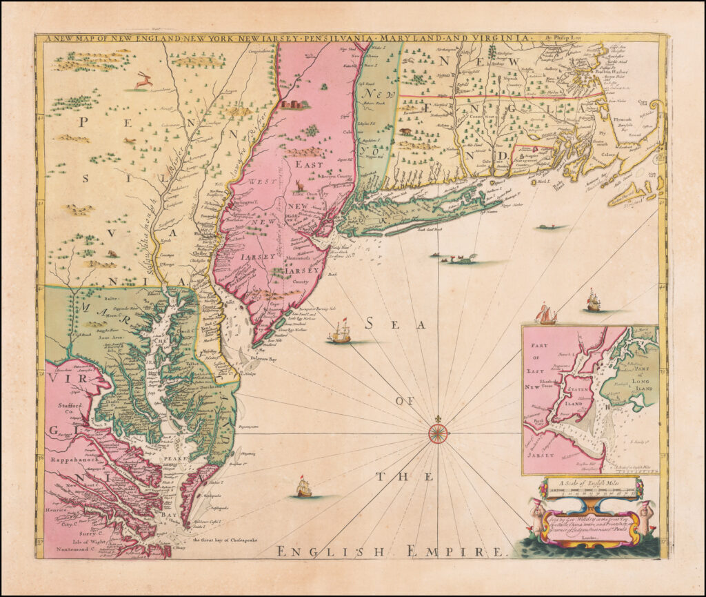
But as collected here, these maps can also feel stunningly revolutionary, watching the shape of the continents change (or rather man’s deduction of the continents’ shape) over time.

Mapping America begins in the 15th century and navigates through the history of map-making until the end of the Revolutionary War when cartographers made their first observations of the North American interior.

The maps range from just slightly inaccurate to completely wrong. The colors and artistry will make Google Maps look dull and depressing.

Willem Blaeu map of Virginia and the Southern east coast, 1649-55
Categories
Mysterious Stories Queens History

MYSTERY! “Doctor Busted” and the skeleton of College Point

Above is an illustrated bird’s eye view of College Point, Queens, from a 1917 guidebook “Illustrated Flushing and vicinity.”

As that book goes on to describe, “COLLEGE POINT is essentially a manufacturing town—the industrial center of the Flushing District.  It is an old settlement like Flushing and Whitestone, both of which it immediately adjoins on Flushing Bay, and like both, it is rich in its possession of old trees and old houses. It has many fine modern residences, too; and even the proximity of its scores of factories doesn’t seem to spoil its charm as one of New York City’s pretty home suburbs.”

But for a ‘pretty home suburb’, you never know what you’re going to find as you’re digging up out in your yard.  I found the following disturbing notice in the Brooklyn Daily Eagle, October 7, 1914:

“College Point, LI, October 7 — The police of the College Point station thought they had a first-class mystery on their hands today for a time after John Kanter of 622 North Fourteenth Street [sic] dug up in his yard the skeleton of a man.

Just when the keenest Sherlock Holmeses in the College Point service were beginning to concentrate their minds on the subject, however, it was recalled by an old policeman at the station that the premises had been occupied until his death a few years ago by Dr. Busted whom, the police believe, buried the body after using it for dissecting purposes.”

It’s more likely the doctor’s name was Busteed.  Dr. Busted sounds like a character from a 1980s horror film.

Here’s a proper mystery: Would somebody like to figure out where 622 North 14th Street in College Point, Queens, is today?  Many streets and roads in Queens were renumbered in the 1920s.  I believe the house mentioned in the article above is on today’s 14th Avenue, but there’s also a 14th Road.  And neither of them is numbered in the 600s.

If there was one skeleton in the yard, might there still be others?

Below: A College Point home from the brochure described at top, belonging to a silk manufacturer.  From the brochure:

“As a bit of prophecy, the reader is asked to lay aside this book for ten years and then compare this portrayal of College Point-Flushing conditions as they now exist with those of a decade hence. It is pretty safe to say that the two old mansions, pictures of which are printed with this article—the Stratton and Graham homesteads — that today stand as landmarks on the trolley line between College Point and Flushing will long since have disappeared, and in their places and on their surrounding acre swill have risen many beautiful, modern residences and apartment  houses, and that the meadows some distance away will have been covered with manufacturing plants all th eway from the hills to the waters of Flushing Bay.”