Categories
Health and Living

Quarantine on the Lower East Side: A frightening tale from 1892

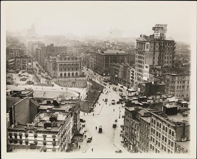
The neighborhood converging at the intersections of Essex Street, Rutgers Street, Canal Street and East Broadway on the Lower East Side — officially called Straus Square** — somehow seems exactly as it might have looked 125 years ago.

Anchored by Seward Park and its beautiful Carnegie library, it retains some of its turn-of-the-century character, while allowing for both Chinese-run restaurants and bakeries and trendier spillover in the form of designer restaurants and music lounges. There’s even a church from the 1840s (St. Teresa’s, at Rutgers and Henry Streets)

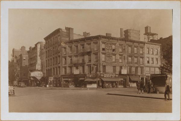
But one building that was once in the center of it all harbors a secret — 5 Essex Street.  

It was at this address in the winter of 1892 that dozens of victims of the dreaded typhus disease were quarantined.

A map of typhus outbreaks from the year 1864. Courtesy the Museum of the City of New York

Thousands of immigrants were arriving in New York harbor by the late 19th century and making their home here on the Lower East Side, where aid organizations would often house families without means to support themselves. By 1892, the Lower East Side had become one of the most densely populated places on earth.

These were also the opening days of Ellis Island, and the strict examination that would make the immigrant center infamous had not yet been established. New York had safeguards in place to stop the spread of diseases, but they weren’t perfect.

Courtesy Clyde Ships

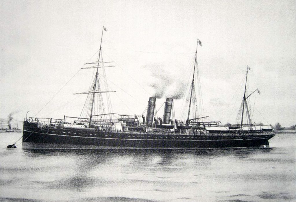
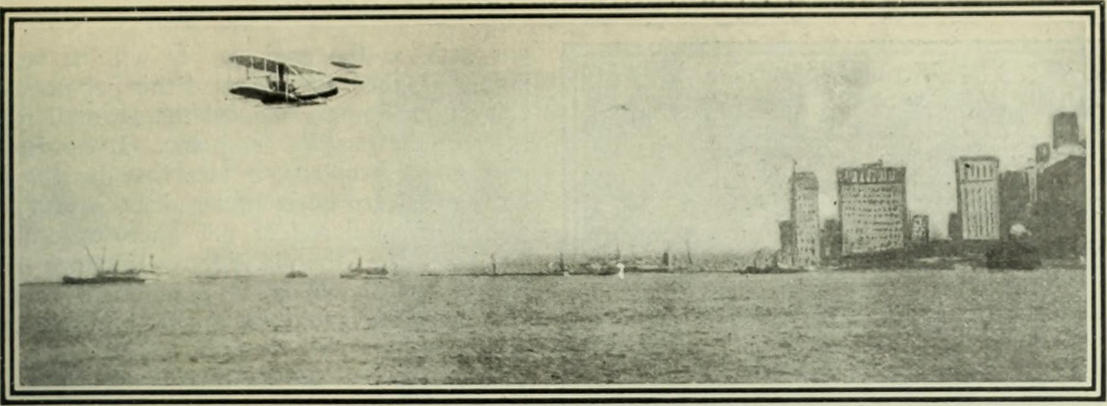
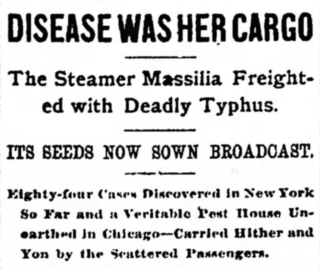
The steamship Massilia (pictured above) arrived during Ellis Island’s first month of operation, January 1892, carrying over 700 hopefuls, most of them Italians and Russian Jewish immigrants escaping persecution.

Most of them ended up on the Lower East Side, including members of the Mermer family, who the United Hebrew Charities organization arranged to live in the small tenement at 5 Essex Street.

1 Essex, 3 Essex and 5 Essex, seen from Straus Square, 1927. (Courtesy New York Public Library)

The passengers had not been properly checked for various diseases, including typhus, a devastating affliction that had swept through America during much of the 19th century. It would reach its height of destruction in Europe during World War I, where it would kill millions.

This horrifying sickness, spread by fleas or mites, was on the Massilia. And its passengers were now spread throughout the Lower East Side.

The condescending press of the day described the ship’s passengers as “the impoverished, unkempt class that usually comes from that land, and of the kind that such a scourge as typhus would be likely to mark as its own.”

Headline from the Brooklyn Daily Eagle, Feb. 12, 1892

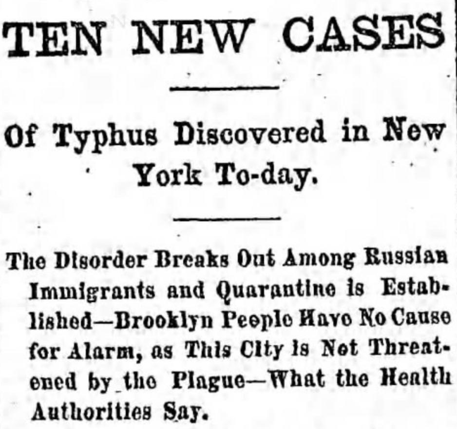
It was first noticed among 15 Massilia passengers at another address, 42 East 12th Street. The city and the United Hebrew Charities scoured the city for all the remaining Massilia immigrants and found out to their horror that over 70 of them had typhus, including members of the Mermer family at 5 Essex.

Those with symptoms of the disease were transported out to North Brother Island. However all other passengers were forced into the two addresses — 5 Essex Street and 42 East 12th Street — and quarantined there, with police guarding the doors to make sure that nobody could go in. Or escape.

The remaining members of the Mermer family were now trapped at 5 Essex.

A melodramatic headline from the Middleton Times-Press, Feb 16, 1892. (Newspapers.com)

The mother Fayer was dead and two symptomatic children (who would later survive) were taken away. They were now quarantined in their home with dozens of others, unsure if they would all succumb to the same fate.

Even with increased precautions, the disease still found its way out. There had been little spread of typhus in the 1890s; now, with the arrival of the Massilia, dozens of cases were reported up and down the major cities of the East Coast.

Fearing a new outbreak, city officials did something drastic. In March, they emptied the two quarantined buildings and placed everybody who lived there on North Brother Island, whether they had the sickness or not.

It would be a nerve-racking month, a disturbing introduction to America. After a few weeks, if patients were without symptoms, they would finally be allowed to leave.

The quarantine seemed to do the trick; less than 50 people died from this potentially disastrous outbreak that struck the heart of the most densely populated neighborhood in New York.

Image courtesy the Lo Down

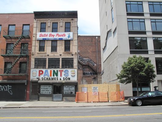
UPDATE: When I first published a version of this article back in 2008, 5 Essex Street was still standing. But the building was not landmarked and this area of the Lower East Side is not contained in a historic district.

But in 2010 it was torn down by a developer — and left empty. For the past three years, a cactus store greenhouse have sat on this spot.

_________________________________________________

Further contemporary news reports of the quarantine house at 5 Essex can be found here.

Picture at top (of Straus Square in 1928) courtesy the Museum of the City of New York

**Straus Square is named for Nathan Straus, the philantropist and co-owner of Macy’s Department Store. Coincidentally, Nathan’s brother Oscar would become Secretary of Commerce under Theodore Roosevelt and oversee the administration of Ellis Island. Nathan’s other brother Isidor would die on the Titanic.

Categories
Wartime New York

Governors Island: New York’s newly transformed monument (NPS 100)

This month America celebrates the 100th anniversary of the National Park Service, the organization which protects the great natural and historical treasures of the United States. There are a number of NPS locations in the five borough areas. Throughout the next few weeks, we will focus on a few of our favorites.   For more information, you can visit National Parks Centennial for a complete list of parks and monuments throughout the country.  For more blog posts in this series, click here.
The following also features an excerpt from the Bowery Boys Adventures In Old New York, now available for sale wherever books are sold and online at Amazon or Barnes and Noble.
IMG_0761
GOVERNORS ISLAND NATIONAL MONUMENT
NEW YORK HARBOR

Governors Island has now inched a little closer to becoming an actual exotic island.

The cone-like southern portion, a landfill addition once populated with former U.S. Coast Guard buildings and an airstrip, has now sprouted fanciful hills of various shapes and sizes, providing extremely unique views of the surrounding harbor. The Hills feel both ancient and new, barren of trees but shaped like ancient landmasses which have conveniently emerged from the water, just in time for summer. Palm trees would not feel out of place.

IMG_0756

Graciously carved paths lead from the historic side of the island to these new topographical features, and along the way, you’ll be tempted to stop in the hammock grove or perhaps the urban farm with its tiny population of tiny goats.

The Hills are the latest addition to one of New York’s most secretive historical corners, a new diversion for an island blessed with so many unusual stories.

IMG_0758

Of the three small islands that sit in New York Harbor between Staten Island and Manhattan, two of them (Ellis Island and Liberty Island) have been embedded into the American consciousness as icons of freedom and opportunity. The third, Governors Island, is often overlooked by both visitors and residents.

However, for much of the city’s history, this ice-cream-cone shaped island, separated from Brooklyn by the richly named Buttermilk Channel, has been critically important to the nation’s defense. Fortunately, its most treasured historical landmarks are still around more than 200 years after they were constructed.

In 1624, when the Dutch brought the first settlers to the New World to establish what would become New Netherland, they deposited eight men on this small island, which they named Noten (Nut) Island. It was a convenient spot, just a short rowing distance from the future settlements of New Amsterdam and Breukelen. But it would be the British who would give it the name Governors Island after taking charge of the colony in 1664, as the royal governors of the New York colony would indeed live here.

Governors Island in 1824, the harbor’s military sentry even in times of peace.

Courtesy Museum of City of New York

The island would be less hospitable to the British a century later, when in 1776 the Continental Army constructed earthen forts here to ward off British war vessels during the early years of the Revolutionary War. While its guns did scare off two British ships on July 12, 1776, the British succeeded in driving the Continental Army out of New York during the Battle of Long Island. They would occupy Governors Island—and all of New York—throughout the conflict.

In 1783, at the end of the war, the new Americans ushered the British out of the harbor with gusto. But fears of their return continued for decades afterward, presenting the young government
with the alarming thought of New York being recaptured.

A view of Castle Williams from the interior of the island.

IMG_0744

And so, with tensions mounting in the run-up to the War of 1812, two very different fortresses were constructed here. Fort Jay, sitting on the site of the original Revolutionary War defense, was designed like a five-pointed star fort surrounded by a dry moat.

Castle Williams, sitting on the shoreline, was given an almost completely circular shape, punctured with openings for dozens of cannons. Both fortifications have survived and can be visited today, most likely because neither ever saw an actual battle.

Aware of the island’s strategic location for defending the nation’s most important city and harbor, the U.S. Army moved out to Governors Island in the 1830s, and would remain stationed there until 1965.

The shady lawn separating the officers homes from the administrative buildings.

IMG_0755

During the Civil War, the forts were reworked into holding cells for Confederate soldiers, Union deserters, and criminals. Captured Confederate officers were held in relatively posh quarters at Fort Jay while regular soldiers were thrown into the much less comfortable prison at Castle Williams.

As Lower Manhattan developed skyward in the late nineteenth century, the close proximity of two military forts to the nation’s largest city was a bit, well, surreal. Meanwhile a sort of small-town life developed here on the island, and by the 1880s, rows of elegant Victorian brick houses were constructed for Army officers and their families. A genteel life among the cannons!

In the first years of the twentieth century, the island more than doubled in size —the “cone” was added to the ice-cream scoop—with landfill mostly taken from excavations of New York’s subway system, which opened in 1904.

Wright’s historic flight from Governors Island over the harbor to Manhattan.

14597026607_42d37427e1_h
Internet Book Archive

This new flat expanse, located so close to lower Manhattan, was an ideal spot for the city’s first airstrip. In 1909 Wilbur Wright lifted off here in his flying machine, coasting around the Statue of Liberty and later up the West Side as far as Grant’s Tomb. It seemed like such a logical base for air transport that in the 1930s Mayor Fiorello La Guardia tried to build the city’s first permanent airport there.

The gigantic Building 400 (later renamed Liggett Hall) was the largest military building in the world when it was completed in 1930. The structure separates the original section of the island from its twentieth-century addition and lends the island something of a college campus feel. You can easily imagine how charming it must have been in the 1940s—there’s even a playhouse where Irving Berlin debuted a revue in 1942 called This Is the Army. Of course, charming revues couldn’t mask a more harrowing reality: The island’s residents were fully engaged in fighting World War II.

The ‘new’ section of Governors Island does feature a few artifacts from the past.

IMG_0765

In 1966, the island changed administrative hands, as the Coast Guard moved in and increased the population by nearly 4,000 people. The leafy lanes became ever more bucolic, as small-town amenities were added, including a bowling alley and a supermarket.  By 1996, the Coast Guard had departed for roomier shores, leaving the island desolate.

Governors Island had been the property of the federal government since the early nineteenth century. When in 2008 the island was sold to New York City, many wondered what could possibly become of the now-abandoned settlement. That same year the island opened its shores on weekends to visitors—they were free to explore, often with great astonishment, some of the empty structures, as if they were wandering ancient ruins.

Today, after more than a decade of thoughtful preservation and promotion, thousands of New Yorkers enjoy the island during the summer, visiting the officers’ homes (now home to arts and music groups), newly landscaped parks (in the landfilled “cone” section), and weekend arts and food festivals.

And after all this time, Fort Jay and Castle Williams, now maintained by the National Park Service, still stand watch over the harbor. Oh, the things they’ve seen.

WANT MORE INFORMATION? Visit the NPS Governors Island National Monument site for more information, as well as the Governors Island Alliance.

LISTEN TO OUR PODCAST! We have an entire show on the history of Governors Island. It’s Episode #185. You can find it on iTunes or download it from here.