Categories
Wartime New York

Governors Island: New York’s newly transformed monument (NPS 100)

This month America celebrates the 100th anniversary of the National Park Service, the organization which protects the great natural and historical treasures of the United States. There are a number of NPS locations in the five borough areas. Throughout the next few weeks, we will focus on a few of our favorites.   For more information, you can visit National Parks Centennial for a complete list of parks and monuments throughout the country.  For more blog posts in this series, click here.
The following also features an excerpt from the Bowery Boys Adventures In Old New York, now available for sale wherever books are sold and online at Amazon or Barnes and Noble.
IMG_0761
GOVERNORS ISLAND NATIONAL MONUMENT
NEW YORK HARBOR

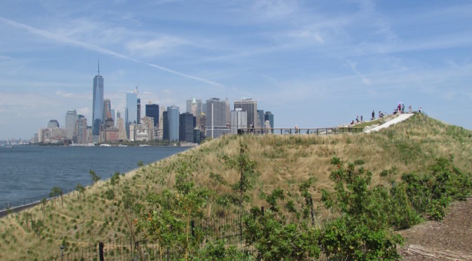
Governors Island has now inched a little closer to becoming an actual exotic island.

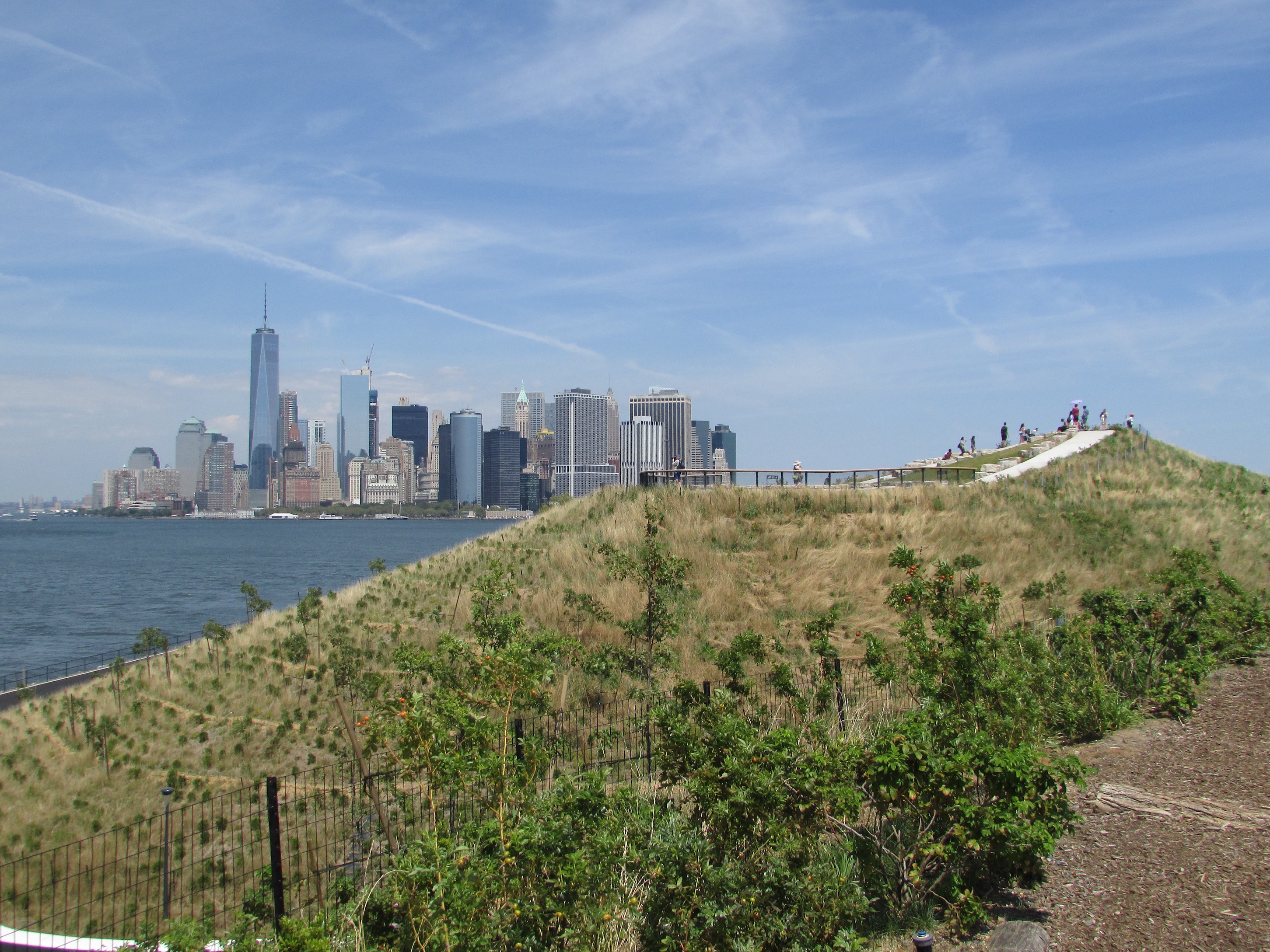
The cone-like southern portion, a landfill addition once populated with former U.S. Coast Guard buildings and an airstrip, has now sprouted fanciful hills of various shapes and sizes, providing extremely unique views of the surrounding harbor. The Hills feel both ancient and new, barren of trees but shaped like ancient landmasses which have conveniently emerged from the water, just in time for summer. Palm trees would not feel out of place.

IMG_0756

Graciously carved paths lead from the historic side of the island to these new topographical features, and along the way, you’ll be tempted to stop in the hammock grove or perhaps the urban farm with its tiny population of tiny goats.

The Hills are the latest addition to one of New York’s most secretive historical corners, a new diversion for an island blessed with so many unusual stories.

IMG_0758

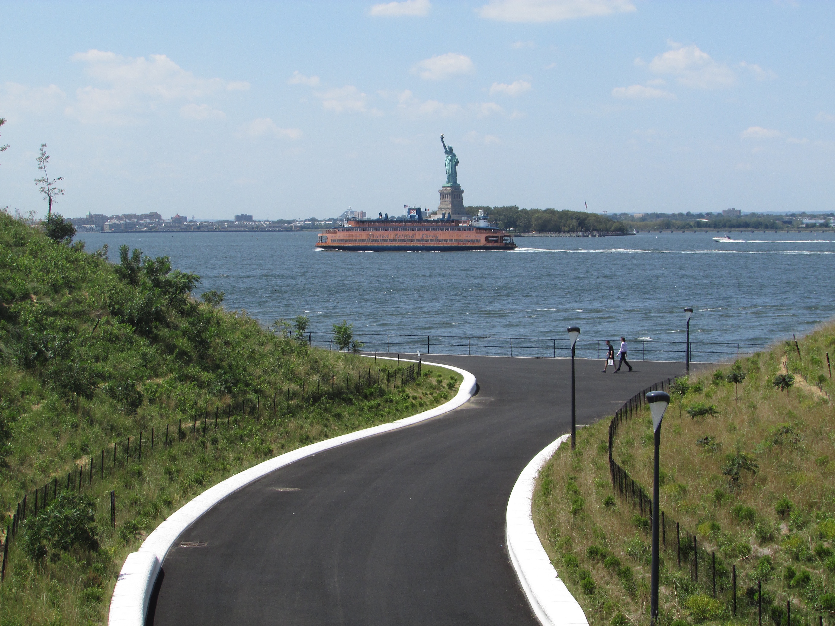
Of the three small islands that sit in New York Harbor between Staten Island and Manhattan, two of them (Ellis Island and Liberty Island) have been embedded into the American consciousness as icons of freedom and opportunity. The third, Governors Island, is often overlooked by both visitors and residents.

However, for much of the city’s history, this ice-cream-cone shaped island, separated from Brooklyn by the richly named Buttermilk Channel, has been critically important to the nation’s defense. Fortunately, its most treasured historical landmarks are still around more than 200 years after they were constructed.

In 1624, when the Dutch brought the first settlers to the New World to establish what would become New Netherland, they deposited eight men on this small island, which they named Noten (Nut) Island. It was a convenient spot, just a short rowing distance from the future settlements of New Amsterdam and Breukelen. But it would be the British who would give it the name Governors Island after taking charge of the colony in 1664, as the royal governors of the New York colony would indeed live here.

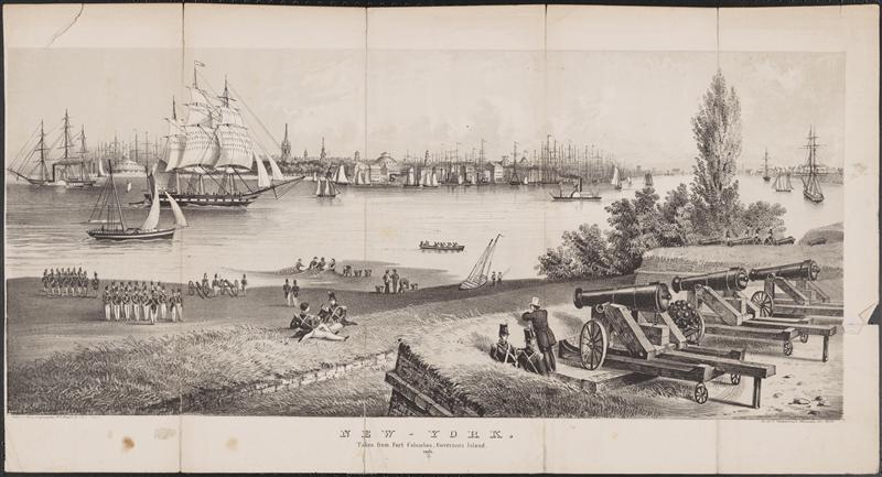
Governors Island in 1824, the harbor’s military sentry even in times of peace.

Courtesy Museum of City of New York

The island would be less hospitable to the British a century later, when in 1776 the Continental Army constructed earthen forts here to ward off British war vessels during the early years of the Revolutionary War. While its guns did scare off two British ships on July 12, 1776, the British succeeded in driving the Continental Army out of New York during the Battle of Long Island. They would occupy Governors Island—and all of New York—throughout the conflict.

In 1783, at the end of the war, the new Americans ushered the British out of the harbor with gusto. But fears of their return continued for decades afterward, presenting the young government
with the alarming thought of New York being recaptured.

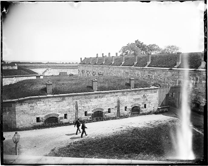
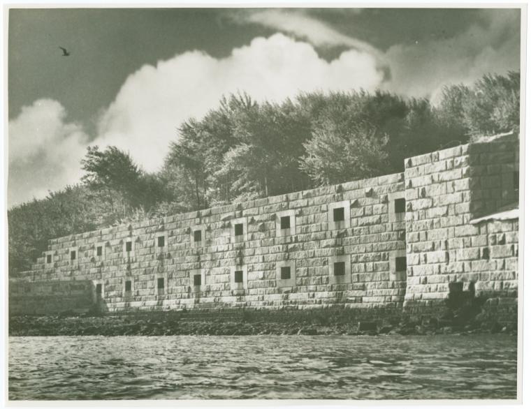
A view of Castle Williams from the interior of the island.

IMG_0744

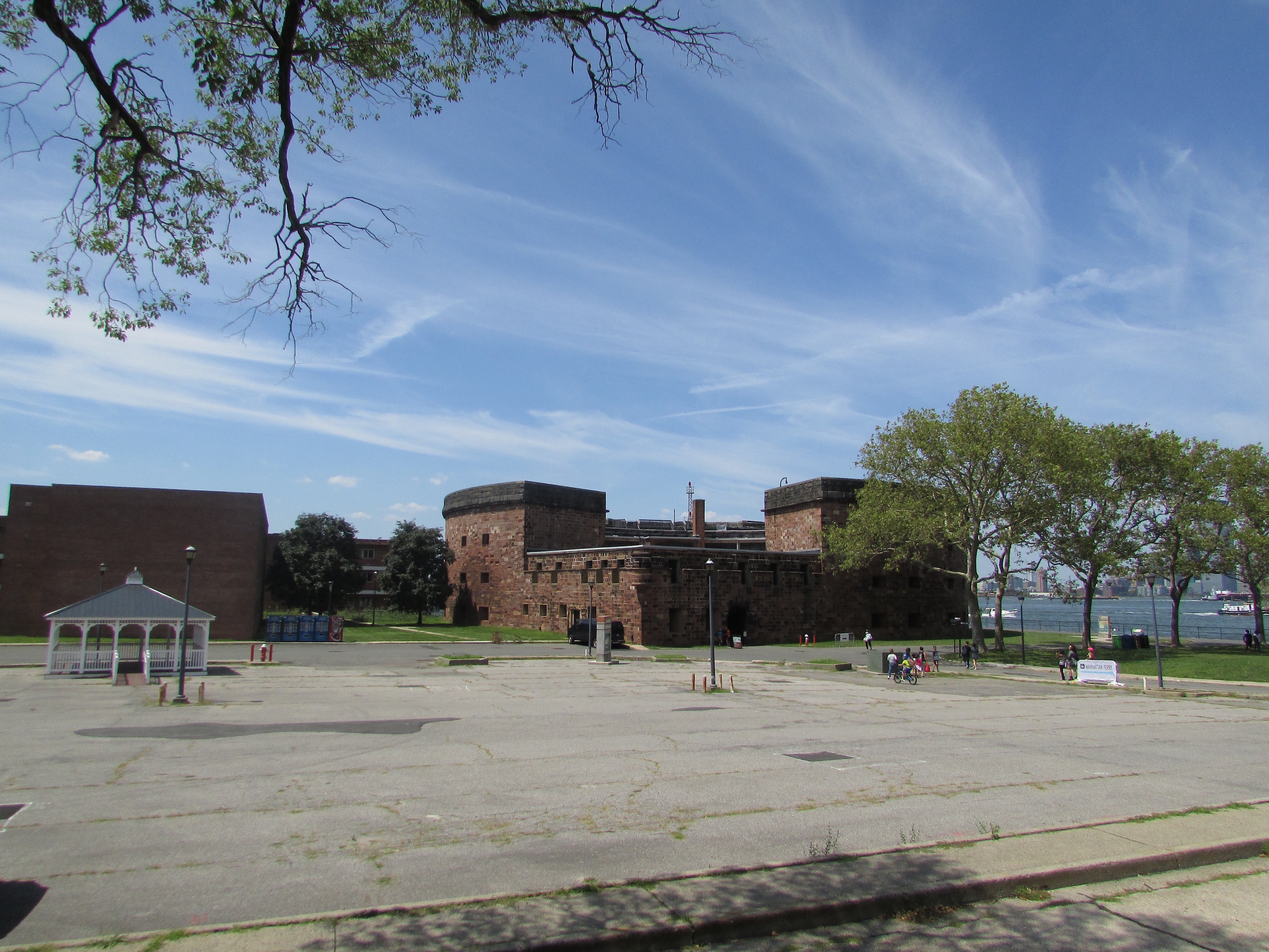
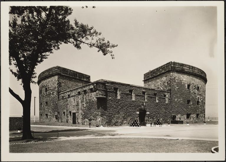
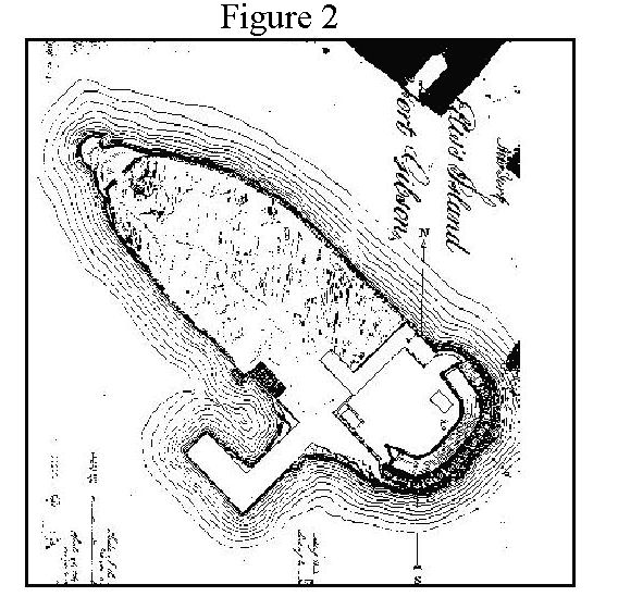
And so, with tensions mounting in the run-up to the War of 1812, two very different fortresses were constructed here. Fort Jay, sitting on the site of the original Revolutionary War defense, was designed like a five-pointed star fort surrounded by a dry moat.

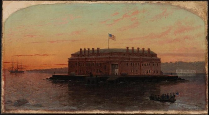
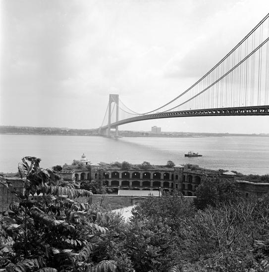
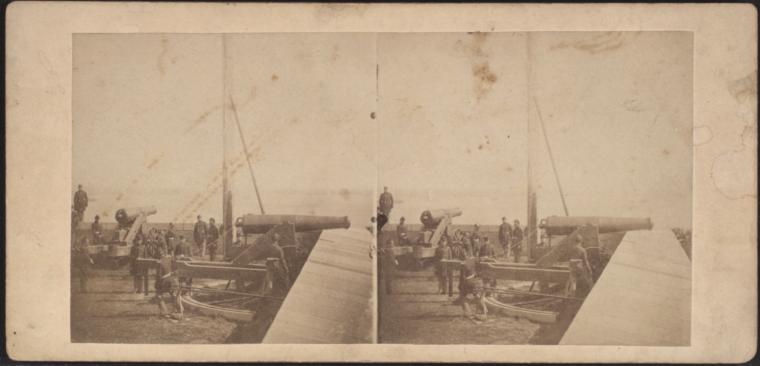
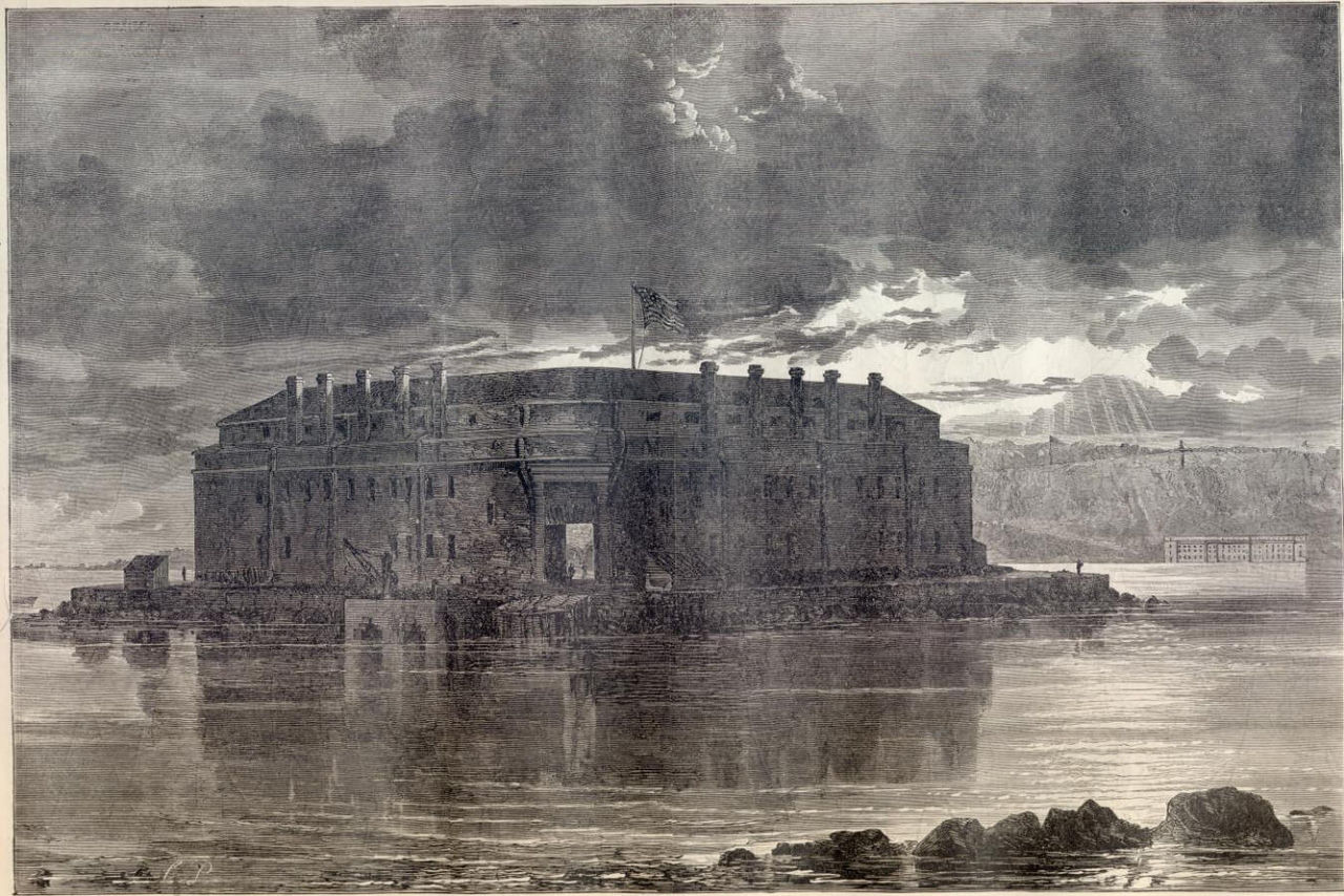
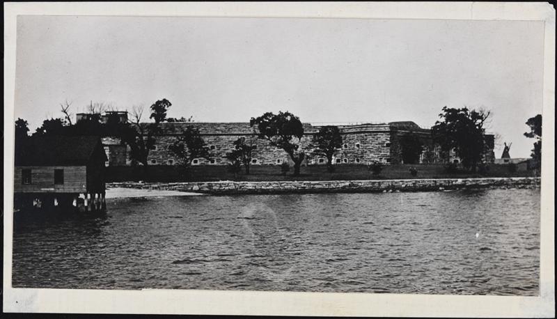
Castle Williams, sitting on the shoreline, was given an almost completely circular shape, punctured with openings for dozens of cannons. Both fortifications have survived and can be visited today, most likely because neither ever saw an actual battle.

Aware of the island’s strategic location for defending the nation’s most important city and harbor, the U.S. Army moved out to Governors Island in the 1830s, and would remain stationed there until 1965.

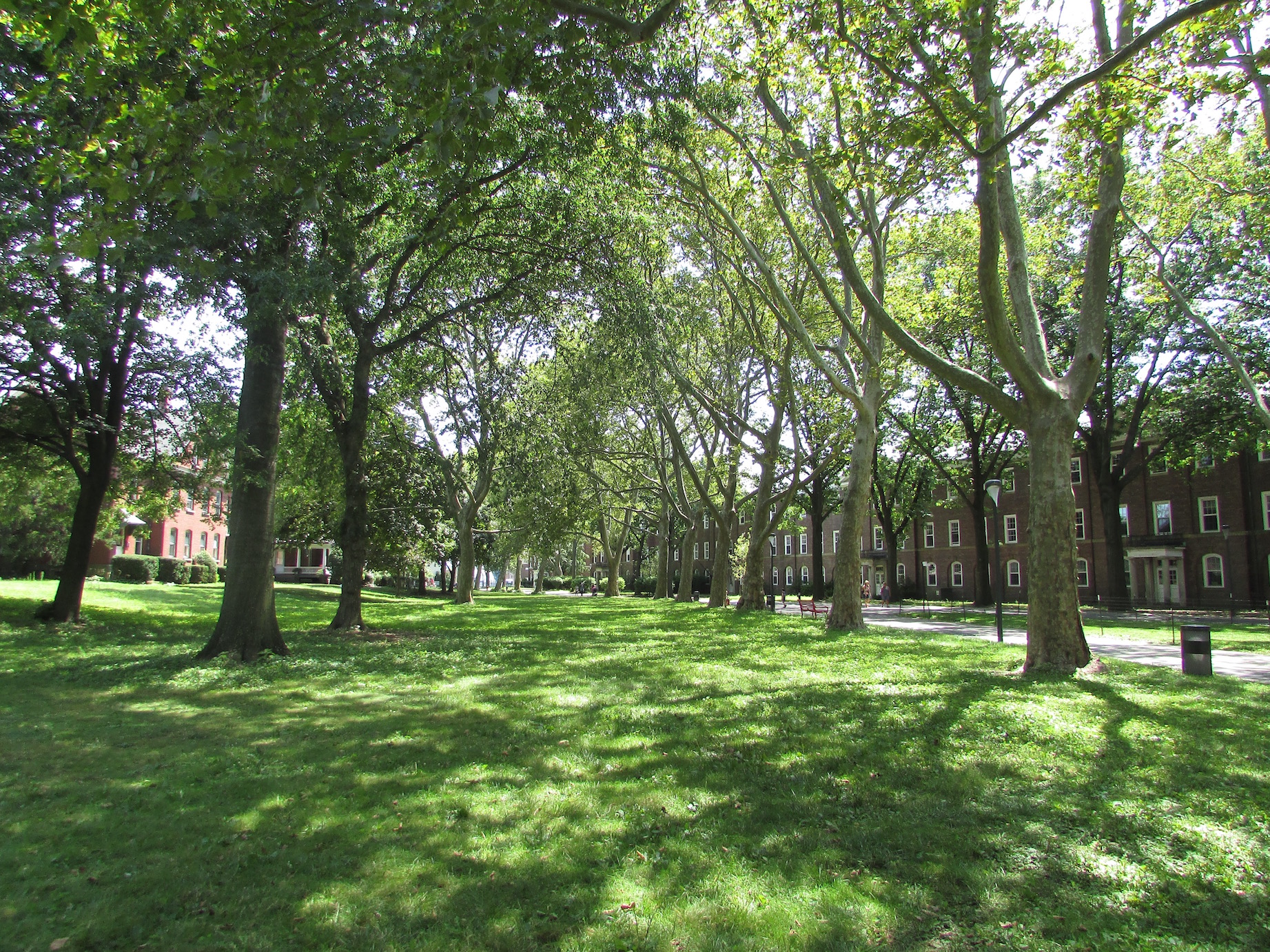
The shady lawn separating the officers homes from the administrative buildings.

IMG_0755

During the Civil War, the forts were reworked into holding cells for Confederate soldiers, Union deserters, and criminals. Captured Confederate officers were held in relatively posh quarters at Fort Jay while regular soldiers were thrown into the much less comfortable prison at Castle Williams.

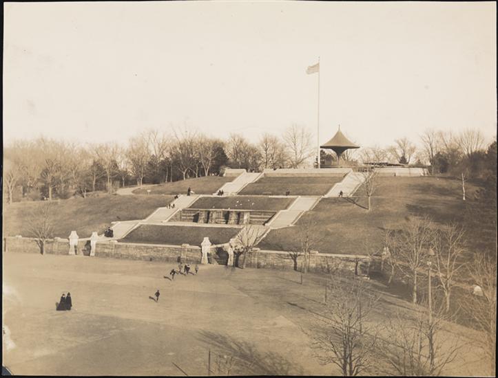
As Lower Manhattan developed skyward in the late nineteenth century, the close proximity of two military forts to the nation’s largest city was a bit, well, surreal. Meanwhile a sort of small-town life developed here on the island, and by the 1880s, rows of elegant Victorian brick houses were constructed for Army officers and their families. A genteel life among the cannons!

In the first years of the twentieth century, the island more than doubled in size —the “cone” was added to the ice-cream scoop—with landfill mostly taken from excavations of New York’s subway system, which opened in 1904.

Wright’s historic flight from Governors Island over the harbor to Manhattan.

14597026607_42d37427e1_h
Internet Book Archive

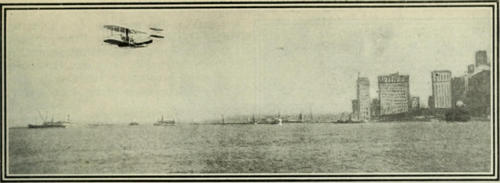
This new flat expanse, located so close to lower Manhattan, was an ideal spot for the city’s first airstrip. In 1909 Wilbur Wright lifted off here in his flying machine, coasting around the Statue of Liberty and later up the West Side as far as Grant’s Tomb. It seemed like such a logical base for air transport that in the 1930s Mayor Fiorello La Guardia tried to build the city’s first permanent airport there.

The gigantic Building 400 (later renamed Liggett Hall) was the largest military building in the world when it was completed in 1930. The structure separates the original section of the island from its twentieth-century addition and lends the island something of a college campus feel. You can easily imagine how charming it must have been in the 1940s—there’s even a playhouse where Irving Berlin debuted a revue in 1942 called This Is the Army. Of course, charming revues couldn’t mask a more harrowing reality: The island’s residents were fully engaged in fighting World War II.

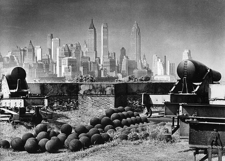
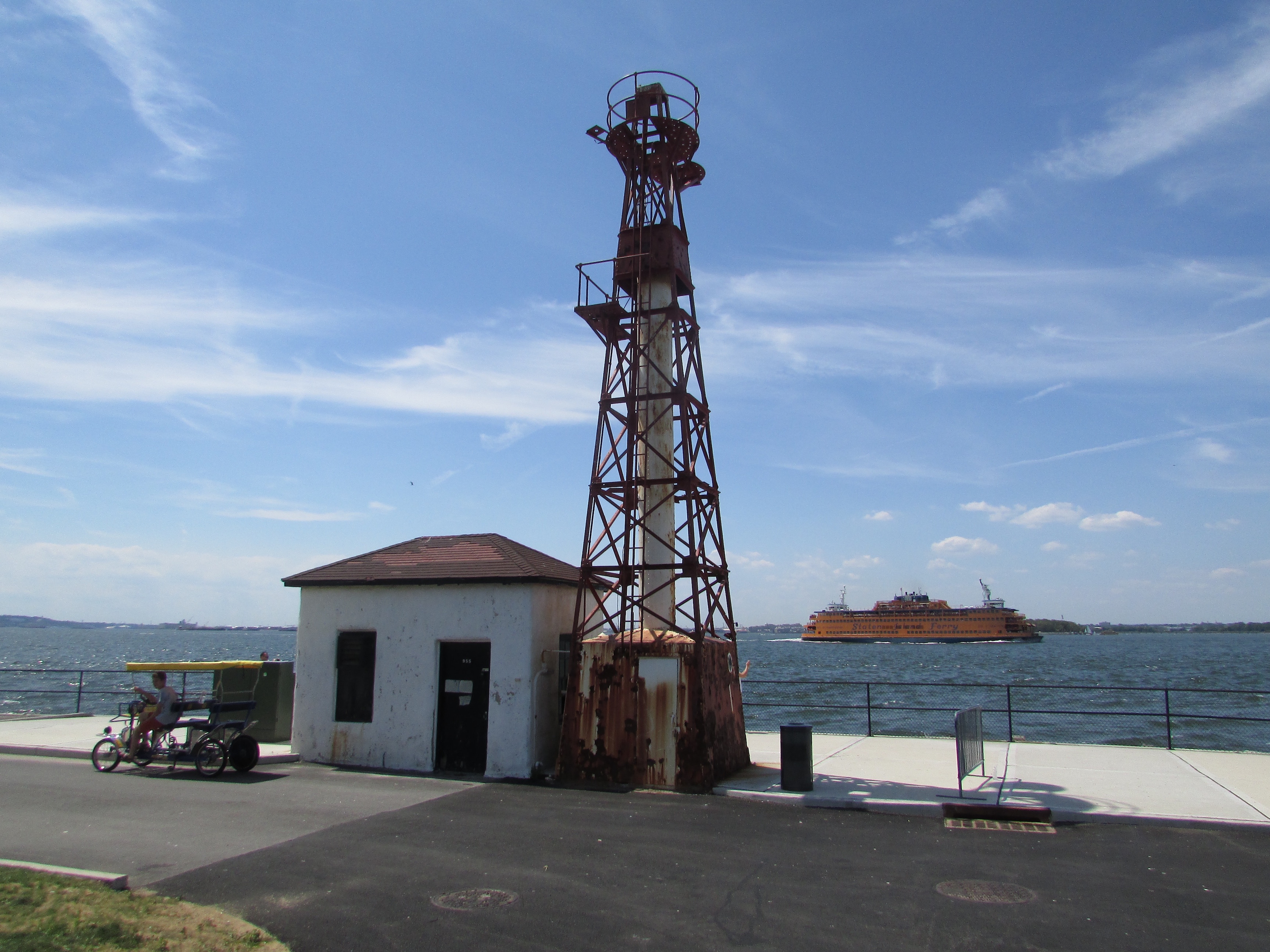
The ‘new’ section of Governors Island does feature a few artifacts from the past.

IMG_0765

In 1966, the island changed administrative hands, as the Coast Guard moved in and increased the population by nearly 4,000 people. The leafy lanes became ever more bucolic, as small-town amenities were added, including a bowling alley and a supermarket.  By 1996, the Coast Guard had departed for roomier shores, leaving the island desolate.

Governors Island had been the property of the federal government since the early nineteenth century. When in 2008 the island was sold to New York City, many wondered what could possibly become of the now-abandoned settlement. That same year the island opened its shores on weekends to visitors—they were free to explore, often with great astonishment, some of the empty structures, as if they were wandering ancient ruins.

Today, after more than a decade of thoughtful preservation and promotion, thousands of New Yorkers enjoy the island during the summer, visiting the officers’ homes (now home to arts and music groups), newly landscaped parks (in the landfilled “cone” section), and weekend arts and food festivals.

And after all this time, Fort Jay and Castle Williams, now maintained by the National Park Service, still stand watch over the harbor. Oh, the things they’ve seen.

WANT MORE INFORMATION? Visit the NPS Governors Island National Monument site for more information, as well as the Governors Island Alliance.

LISTEN TO OUR PODCAST! We have an entire show on the history of Governors Island. It’s Episode #185. You can find it on iTunes or download it from here.

Categories
Wartime New York

New York: The City of Forts

The vestiges of America’s oldest wars surround us to this day.

New York City has had more military fortifications contained within it than perhaps any other major American city. Part of this has to do with its roots in the American Revolution and the subsequent fears of a return invasion in the early 19th century.

Today’s existing forts — and those that remain in part or in ruin — make for a stark architectural contrast to the modern city. Their walls of stone and brick may conjure up a history far older than New York’s or images of a made-up fantasy world. You could pretend, for a few moments, to be a character on Game of Thrones while exploring places like Fort Wadsworth or Castle Williams on Governors Island

Here’s a list of some of the best known forts in the New York City area. Most are still around in some form. Some exist only in commemorative markers.  Others are completely gone but they leave their names as a reminder of their existence.  How many of these have you seen in person?

1 Fort Wadsworth
Location: Staten Island
Placed at a strategic site on the Narrows, Wadsworth and its associated defense buildings are perhaps the most dramatic military remains in New York City. It traces to an old Revolutionary War-era fort called Flagstaff Fort.  While it serves minor military functions to this day, Wadsworth has become a popular Staten Island attraction.

1979, photographed by Edmund V. Gillon, Museum of the City of New York


2 Fort Jay (formerly Fort Columbus) 
Location: Governor Island
A star fort constructed from an original 1776 earthen defense. In 1806 its name was changed to Fort Columbus and changed back in the 20th century.

1


3 Castle Williams
Location: Governors Island
Specifically designed in 1807-1811 to defend the harbor from probable British invasion. While the British did invade America during the battles of the War of 1812, New York was spared. Today, its maintained by the National Park Service, as is Fort Jay.

1936, by Samuel Gottscho, courtesy Museum of the City of New York


4 Fort Gibson (or Crown Fort)
Location: Ellis Island
Built by the Army in 1795 and greatly upgraded in 1809 as part of the beefing up of harbor defenses. It was dismantled by the 1860s although the island was used to hold naval munitions for decades before its transformation into Ellis Island Immigration Station.  Today you can find exposed ruins outside the main building.

Courtesy NPS
Courtesy NPS

5 Fort Wood
Location: Liberty Island
This too was completed during the 1810s and was later named for Eleazer Derby Wood, an officer killed at a battle at the Battle of Lake Erie in 1814. Today the Statue of Liberty and her pedestal are affixed atop of the old fort. You can see a trace of the original brickwork on an exposed wall near the exit.

New York Public Library


6 Castle Clinton
Location: Manhattan (Battery Park)
Lower Manhattan was formerly guarded by Fort Amsterdam/Fort George, but that had been dismantled in 1790. (It stood where the Alexander Hamilton U.S. Custom House is today.) Castle Clinton — named for Governor DeWitt Clinton — was built in 1808-1811 to protect lower Manhattan.  It was originally set into the water and connected with a footbridge.  After stints as the performance hall Castle Garden, New York’s pre-Ellis Island immigration station and New  York Aquarium, it sits today as a national monument in its own right.

Library of Congress
Library of Congress


7 Fort Gansevoort
Location: Manhattan (Meat-Packing District)
Also called the White Fort, this forgotten redoubt once flanked the western waterfront, built at the same time as the harbor forts. It was named for General Peter Gansevoort (the grandfather of Herman Melville) and stood here until the 1850s. Nothing remains of this fort today but its name, found on the street which cuts through that area — Gansevoort Street.

New York Public Library


8 Blockhouse No. 1
Location: Manhattan (Central Park)
This curious little structure stands on the northern end of Central Park, a fortification almost two hundred years old.  Its the oldest structure contained within Central Park (although obviously Cleopatra’s Needle, which was moved here, is much, much older.)

Library of Congress
Library of Congress

9 Fort Washington
Location: Manhattan (Washington Heights)
This fort predates most of the rest, built as a companion for Fort Lee on the New Jersey side. It was here that the Battle of Washington Heights was fought on November 16, 1776, and the fort was captured by the British. While this particular fort is no longer there, some stone walls and a plaque mark its former location. Fort Washington Avenue also pays tribute.

7

10 Fort Tryon
Location: Washington Heights
This was actually a northern redoubt that was an extension of Fort Washington. When the British took it over, they renamed it for William Tryon, New York’s last British governor. For some reason, the name just stuck! Its location in preserved in the breathtaking Fort Tryon Park, completed in 1935 and designed by the son of Frederick Law Olmsted.

1


11 Fort Sterling
Location: Brooklyn (Brooklyn Heights)
This fort, tracing to the Revolutionary Era, is unique it that it was almost immediately dismantled once the British left.  There was another fort nearby called Fort Brooklyn that lasted a bit longer,demolished by the 1820s to allow for the growth of Brooklyn’s first wealthy neighborhood. Today, near the Brooklyn Heights Promenade, stands small Fort Sterling Park, with a plaque and a flagpole commemorating the location of this critical defense.

12 Cobble Hill Fort
Location: Brooklyn (Cobble Hill neighborhood)
This unusual corkscrew shaped fort — which we talked about in one of our previous ghost story podcasts — is notable for receiving George Washington as he observed his troops during the Battle of Long Island in 1776.  A handsome plaque on the old bank-turned-Trader-Joe’s at Atlantic Avenue and Court Street marks the location of this forgotten fortification.

Courtesy the blog South Brooklyn

13 Fort Greene
Location: Brooklyn (Fort Greene neighborhood)
There really was a fort here in the area of Fort Greene Park today, on the highest point of the hill, a traditional five-point fortification similar to that on Governors Island. In the 1840s it was torn down to construct one of Brooklyn’s oldest parks — called Washington Park. Oddly enough, the original fort here was called Fort Putnam. There was a Fort Greene (named for Nathaniel Greene) but it was in another area of Brooklyn, closer to today’s area of Boerum Hill.

Museum of the City of New York

14 Fort Hamilton
Location: Brooklyn (Bay Ridge)
This is the last active military headquarters in the New York City area. Built in the late 1820s-30s, it was named for Alexander Hamilton who was an officer in the Revolutionary War. Although an active site, you can visit the Harbor Defense Museum which is housed here.

Robert Bracklow, Museum of the City of New York


15 Fort Lafayette

Location: Off the coast of Brooklyn (Bay Ridge)
This imposing island fort was built in the 1810s and named for the Marquis De Lafayette. Like many of New York’s forts, it held Confederate and enemy prisoners during the Civil War. The fort was later dismantled for the construction of the Verrazano-Narrows Bridge. You can see where it would have stood as the bridge’s Brooklyn-side tower stands on the location today.

Fort-layafette


16 Fort Tilden
Location: Brooklyn (Rockaway Beach)
While defenses of various kinds have sat out on Rockaway Beach since the early 19th century, Fort Tilden was fully built up during World War I, named for Samuel J. Tilden. Today its ruins peering through overgrowth can be found near the beach as part of the Gateway National Recreation Area.

tilden


17 Fort Schuyler

Location: Bronx
Completed in the 1850s, this unique fortification protected New York for any possible attack from enemies approaching along the Long Island Sound. Abandoned for strictly military use in the 1920s, today it houses the State University of New York Maritime College and a maritime museum.

Museum of the City of New York


18 Fort Totten

Location: Queens
This fortification traces to worries relating to the Civil War. It was constructed in 1862 to protect the East River with its companion across the water Fort Schuyler.  You can still visit Fort Totten today as the area has been opened up as a public park with regular tours of the old buildings.

New York Public Library


At top: Fort Lafayette in a painting by Thomas Hicks (1861)

McGown’s Pass: the original tavern on the green

McGown’s Pass Tavern (date unknown, but possibly around 1913

We’re finally moving on from Central Park, but not before observing perhaps its most historically significant area — McGown’s Pass and the Block House.

Located on the northern portion of the park, next to the charming Harlem Meer, are a collection of hills and bluffs left over from its original topography. Not surprisingly, these higher altitudes played a pivotal role during the American Revolution.

A narrow passage between the hills was named McGown’s Pass after Andrew McGown, owner of a popular tavern that sat alongside here. Kept in the McGown family, the tavern was torn down early in the century but rebuilt in the 1880s. In 1895, McGown’s was strangely granted its own election district as, being inside the park, it lay outside normal district boundaries. “There were four voters in this territory last year,” declared the New York Times. “They are four men employed at McGown’s Pass Tavern.” The tavern was eventually torn down in 1917.

It was through McGown’s Pass that George Washington traveled on September 15, 1776. He and a portion of the Continental Army had escaped up to today’s Washington Heights area; when hearing that part of his army had been stopped by the British, Washington rode down the pass and led the remaining troops back up to their fortification in the Heights. He rode back through the pass again seven years later, this time as the victor.

The British and their Hessian mercenaries built forts here to cut Manhattan off from the mainland. Later New Yorkers would seize upon this idea during the early days of the War of 1812. Not willing to become property of the British once again, Manhattan mobilized for any potential battles, building forts all over the island and throughout the harbor. It was here at McGown’s pass that the erected a few fortifications, including Fort Clinton (not to be confused with the fort in Battery Park, although both were named for DeWitt Clinton) and Fort Fish, named after Major Nicholas Fish, father of the New York senator Hamilton Fish.

Nothing much remains of these two old forts, which were never used as the War of 1812 never made its way to the city. There are, however, two remaining structures from the early days. A stone ledge overlooking the meer is all that remains of Nutter’s Battery, named after a farmer who owned the property. And nearby stands the Block House, its stone face still fairly solid, once armed with cannons and used to hold ammunition — that was, of course, never needed. The Block House was fairly intact when Olmstead and Vaux included it in their plans for the park, using the building as a ‘picturesque ruin’ covered in vines.

Here’s an illustration of how the Block House looked in 1860:

For a short while, this military site was even used as a convent and hospital. In 1847 the Sisters of Charity of St. Vincent de Paul opened a ‘motherhouse’ and school called the Academy of St. Vincent. The nuns left when the area was incorportated into the park, however the building stood until the 1870s, when it burned down and was replaced with the refurbished new McGown’s Pass Tavern mentioned above. (This site has some great pictures of where the convent once stood.)

This is a bit tangental, but I love this story. A plaque was erected at the old site of Fort Clinton in 1906 and unveiled in a publicized community event for children. It was apparently difficult for some people to find the location and “several chivalrous lads” guided people through the park to the unveiling.

However, the Times reports an incident that might be the only real battle that ever occured at this storied historical spot:

“Among the boys interested in the tablet unveiling were several whose spirit of mischief overcame their sense of the proprieties. These made misleading arrow signs …. and caused a number of persons to go far afield and arrive at the exercises late and angry. These mischievous youngsters were caught at their annoying trick by boys who were more sober and serious. Then there was a short scrimmage, and the mischievous lads scurried away through the Park.”

Finally, from a 19th century book on the War of 1812 comes this spectacular map of the various fortifications built in anticipation of battle. Its dimensions are greatly distorted of course, but it lists the forts and blockhouses that stood in this area as well as those such as Fort Gansevoort and Fort Greene (click on the image to look at it more closely):