Categories
Parks and Recreation

Brooklyn’s Forgotten Lake: Pictures of Mount Prospect Reservoir

As you can see, the Bowery Boys: New York City  History blog has gone through some major changes this week.  We have a new URL (boweryboyshistory.com) and a dynamic new layout which will present articles, photographs and podcast audio is a more user-friendly way.  There’s still some backlogged clean up to do so thank you for your patience.  But we think this new format is more reader friendly and makes these old photographs look so much more amazing.

And so, on that note, I thought I’d test out the expanded-image waters here by presenting a few views of one of the most enchanting places from the 19th century, a place that no longer exists — the Mount Prospect Reservoir.

Photographed by Robert Bracklow, courtesy the Museum of the City of New York


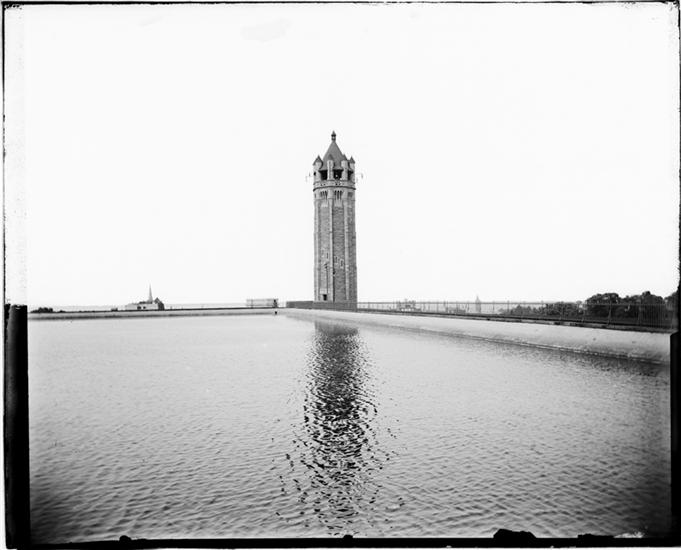
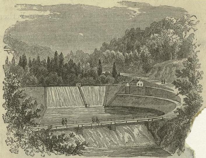
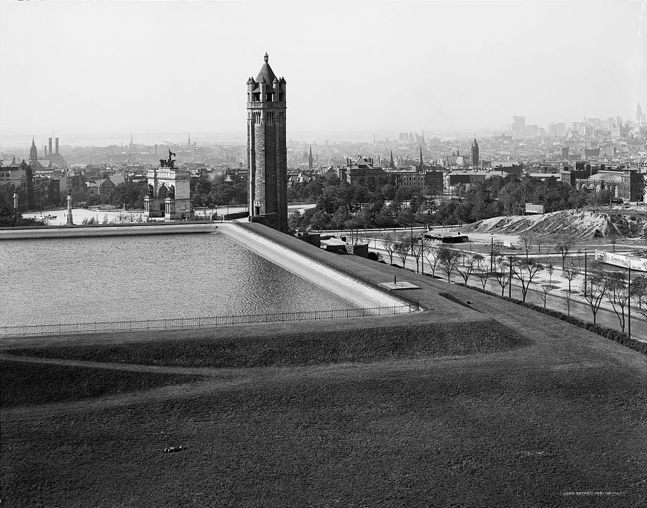
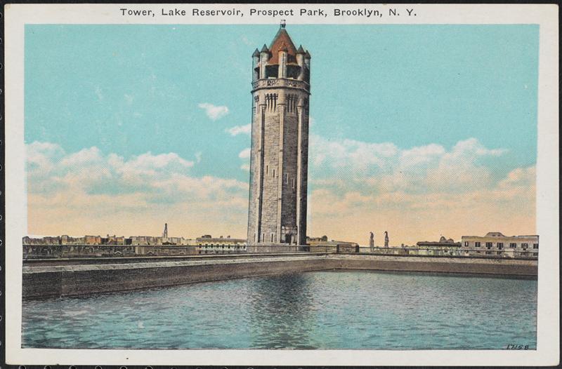
Back when it was an independent city, Brooklyn received most of its drinking water from Long Island, pumped into to a large receiving reservoir in Ridgewood.  Some of that was then send southward to a reservoir built in the late 1850s at the second highest point in Brooklyn — Mount Prospect — rising 200 feet above sea level.

The reservoir was 3 1/2 acres, holding 20 million gallons of water at a depth of 20 feet. Or, according to the Brooklyn Daily Eagle, “containing just about enough water to cook the breakfast of the people of Brooklyn for a week

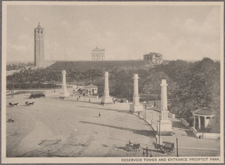
The elevation was not included in the original design of Prospect Park, conceived in the 1860s as Brooklyn’s own Central Park. ** Especially odd when you consider that Prospect Park takes its name from the hill where the reservoir resided.

Pump house at the old reservoir on the East Side Lands, with Flatbush Avenue behind it, and Prospect Park in the background.
Pump house at the old reservoir on the East Side Lands, with Flatbush Avenue behind it, and Prospect Park in the background. [Courtesy Museum of the City of New York]
 Standing besides the man made lake was a pumping station and a grand Gothic tower, 30 feet tall. The world could be seen from here. “From the top of the tower … could be afforded a grand view overlooking the Park and City of Brooklyn; south may be seen the Atlantic Ocean; west, Staten Island and New Jersey; north, the Bay and the City of New York; east, the Navy Yard, Williamsburgh and the East River, altogether affording one of the grandest views imaginable.” [source]

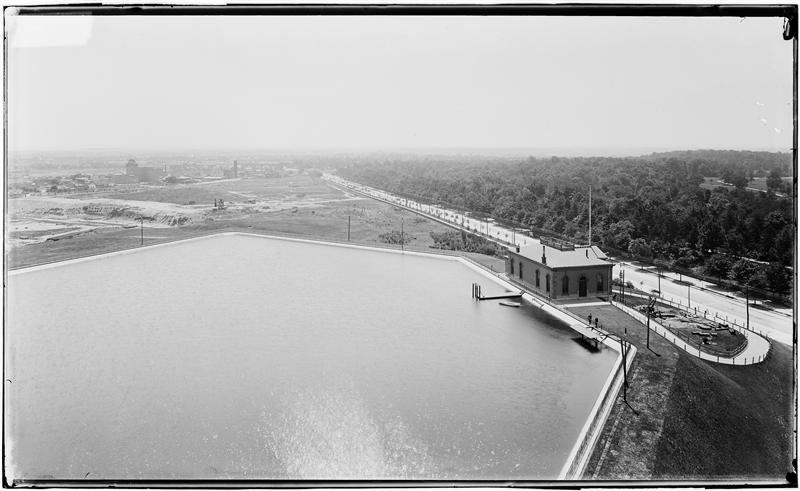
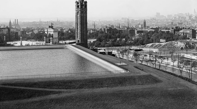
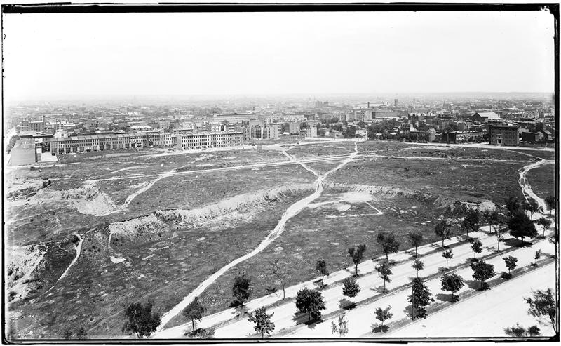
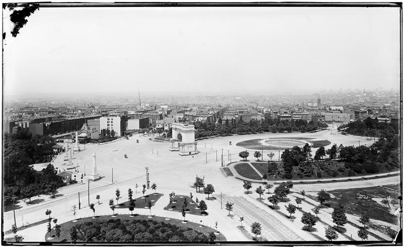
Below: Circa 1900, looking north from the reservoir over Eastern Parkway into what is today’s Prospect Heights neighborhood.  Below that, looking out over Grand Army Plaza. Photos by George Hall and Sons. Courtesy Museum of City of New York

3

4

When Brooklyn was incorporated into the consolidated Greater New York, they also were brought into New  York’s central water system (i.e. the Croton Aqueduct, later blended with the waters of the Delaware and the Catskills).  The Mount Prospect Reservoir was dismantled in 1940 and turned into a park. And the tower was torn down as well when the central branch of the Brooklyn Public Library was constructed.

According to BPL’s blog,  “The wrecking company in charge of tearing it down announced in the Eagle that the Connecticut pink granite used to build the tower would be made freely available to anyone who wanted it.”  So there may be pieces of the old tower incorporated into buildings all across the borough!

Looking over Brooklyn and Manhattan
Looking over Brooklyn and Manhattan (Library of Congress)


Unsurprisingly, the reservoir was a bit of a tourist attraction as evidenced by this postcard. (Courtesy the Museum of the City of New York)


Viewing the entrance to Prospect Park with the reservoir and tower behind it. From this vantage you can see the Brooklyn Museum and the Mount Prospect Laboratory.


** See Matthew’s comment below about Mount Prospect’s appearance in the original Prospect Park plan.

Categories
Podcasts

The Croton Aqueduct: How New York got its drinking water

Above: The Croton Reservoir in 1850, in what would soon become Central Park. (NYPL)

PODCAST One of the great challenges faced by a growing, 19th-century New York City was the need for a viable, clean water supply.

We take water for granted today. But before the 1830s, citizens relied on cisterns to collect rainwater, a series of city wells drilled down to bubbling, underground springs, and, of course, the infamously polluted Collect Pond. But these sources were spreading disease and clearly inadequate for a city whose international profile was raising thanks to the Erie Canal.

The solution lay miles north of the city in the Croton River. New York engineers embarked on one of the most ambitious projects in the city’s history — to tame the Croton, funnelling millions of gallons of waters through an aqueduct down to Manhattan, where it would be collected and stored in grand, Egyptian-style reservoirs to serve the city’s needs.

This is the story of both the old and new Croton Aqueducts, and of the many landmarks that are still with us — from New York’s oldest surviving bridge to a former Bronx racetrack that was turned into a gigantic reservoir.

FEATURING: An entire town moved on logs, a famous writer’s strange musings on Irish laborers, the birth of a banking titan, and guest appearances by Isaac Newton, DeWitt Clinton, and Gouverneur Morris (or, at least, men who share those names).


A fireman’s map of New York in 1834, detailing the location of the city water supply, in cisterns and hydrants fueled by the 13th Street Reservoir. (NYPL)

Wall Street in 1847. The Manhattan Company is at 40 Wall Street. Founded by Aaron Burr ostensibly as a public works to distribute water, the Company soon shed its water responsibilities to become a full-fledged financial institution.

The Croton Dam and the start of the aqueduct system. After a partial collapse in 1841, the dam was quickly rebuilt for the opening of the entire system the following year. Today, the location of this dam is submerged under the current Croton. (NYPL)

Examples of the various tunnels created to accommodate the various topographical challenges encountered during construction. Miles of these water tunnels were constructed by a team mostly comprised of Irish laborers. (NYPL)

The glorious High Bridge, the oldest surviving bridge in New York — although much of it has been replaced and quite altered. (NYPL)

High society flocked to Jerome Park Racetrack on the weekends in the 19th century. But the park was turned into a reservoir at the beginning of the 1900s. (NYPL)

Also: please see my post from yesterday The Art of the Reservoir for pictures of some of the receiving and distributing reservoirs used in the Croton system and others through the New York region.