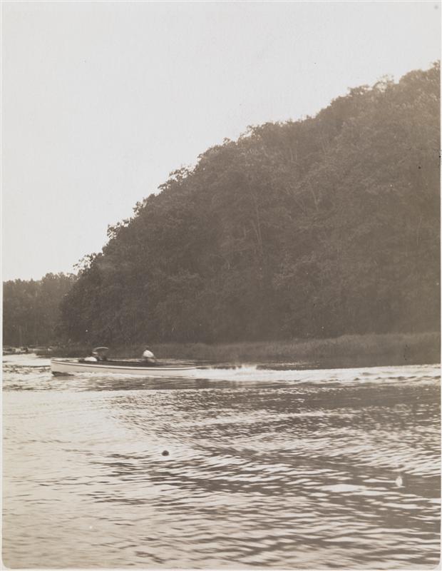
Instead of looking back to the history of New York City in this episode, we are looking forward to the future — to the new generation of creators who are celebrating New York and telling its story through mediums that are not podcasts or books.
Today we are honoring all the historians, journalists and photographers who bring New York City to life on social media platforms like Instagram.
There are a million different ways to tell a good story and the guests on today’s show are doing it with photography and short films, exposing new audiences to the best of New York City – its landmarks, its people, even its diners.
Featuring interviews with three of our favorite creators:
Nicolas Heller, aka New York Nico, the “unofficial talent scout of New York City,” the filmmaker and photographer who manages to capture the magic of the city’s most interesting and colorful characters
Riley Arthur, aka Diners of NYC, who explores the world of New York City diners, great and small, in hopes to bring awareness to many struggling local businesses
Tommy Silk, aka Landmarks of NY, who shares illuminating photos and videos featuring the city’s most interesting and sometimes overlooked architectural gems
Featuring stories of the Neptune Diner, the Green Lady, the Little Red Lighthouse, Junior’s Cheesecake, Tiger Hood and City Island
DUMBO, for Down Under Manhattan Bridge Overpass — a stretch to create an geographic acronym if there ever was one — is not the only neighborhood named by a bridge which passes by, through, or over it. It might be obvious but the neighborhood of Kingsbridge in the Bronx is named for an actual bridge, and the King’s Bridge at that.
The Spuyten Duyvil Creek, that short, narrow span of water that separates the far north edge of Manhattan from the west side of the Bronx, has vexed travelers for hundreds of years, due to choppy waters and devilish legends. One translation of its name has traditionally been ‘Devil’s Spout’. Folklore sent Anthony Van Corlaer to his death here. (Listen to our oldHaunted Tales podcastfor more information.)
Below: Marble Hill in the year 1900, an undeveloped parcel of land which was cut from Manhattan via a canal and eventually joined the mainland.
In the past 150 years, the course of this waterway has been re-routed, shut off and landfilled to accommodate needs of Harlem River shipping traffic. In fact the neighborhood of Marble Hill, once a part of Manhattan island, has been affixed to the Bronx by drilling a canal though its southern part (in 1895), then filling in the Spuyten Duyvil to its north (in 1914). This disembodied nub of Manhattan is still administratively considered part of the island.
But it’s not Marble Hill we’re looking at here, but rather the neighborhood to its east, Kingsbridge. Way before the Spuyten Duyvil was filled in, the creek posed a challenge for early Dutch farmers wishing to transport their wares into the city markets. However it was narrower than trying to attempt a crossing of the far-broader Harlem, and many farmers used their own boats to get across.
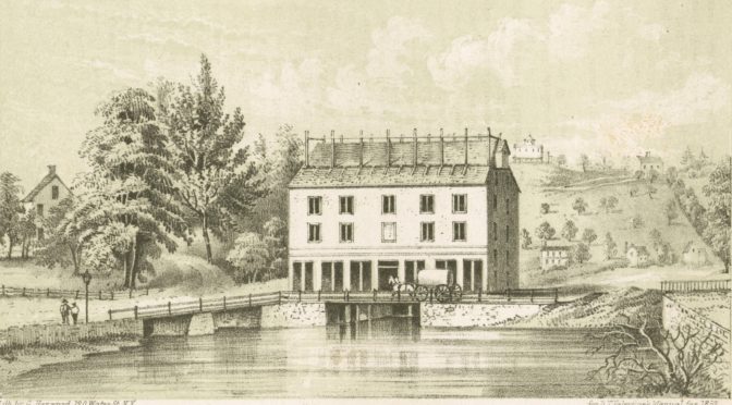
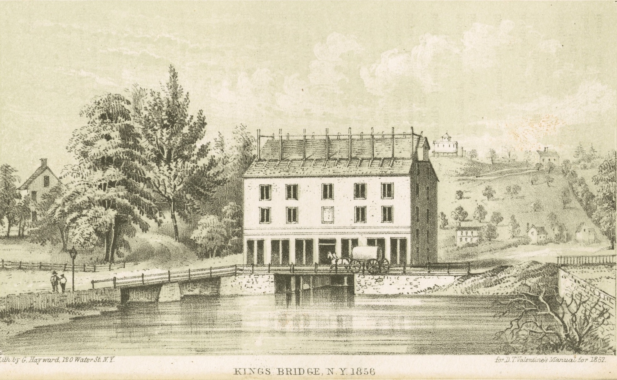
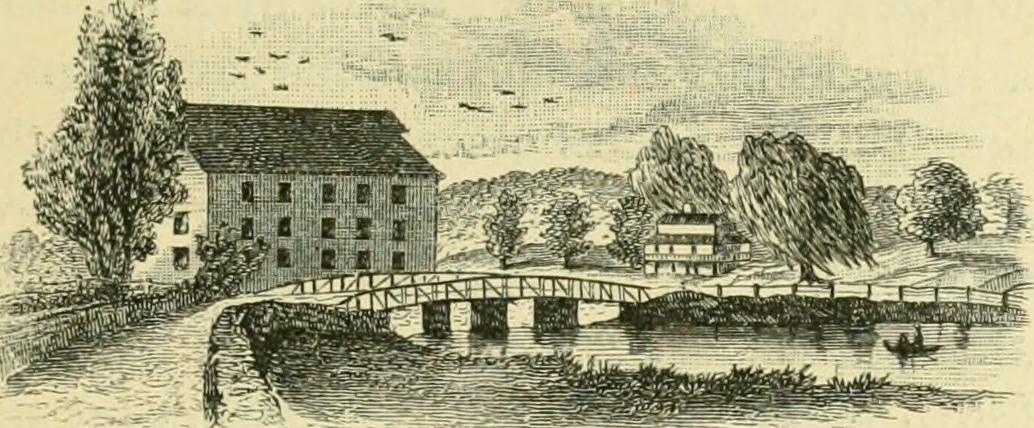
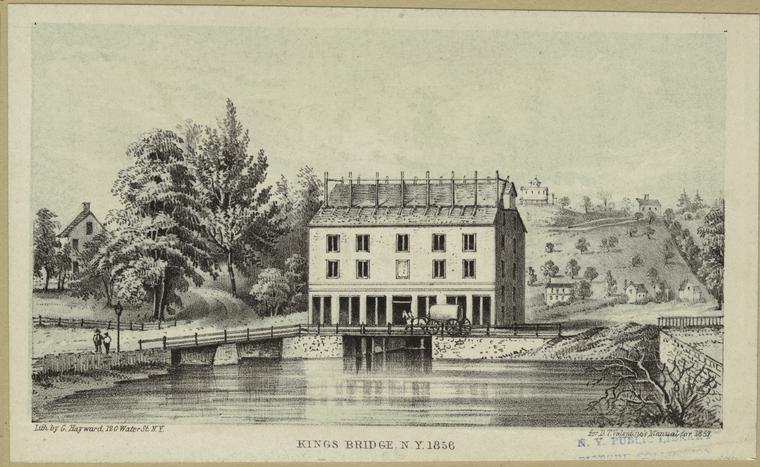
The rebuilt King’s Bridge in 1856
Courtesy NYPL
The earlier inhabitants of the land, the Lenape, simply used canoes when they wished to pass across it; it was at this spot that a well-trodden Indian trail led into the wilderness beyond. By the time of the Dutch, this path had been turned into a workable road. It would eventually become part of the Boston Post Road — appropriate the mail delivery route — which led into New York to the south and up the Albany to the north.
In 1669, in those tentative years of England’s early occupation of the former New Netherland colony, one enterprising Dutch farmer Johannes Verveelen set up a pay ferry service, at the area of the former creek today situated at 231st Street and Broadway— both to serve those who didn’t have their own vessels and to monetize those who had previously preferred their own.
This would be fine for awhile, until greater number of travelers to and from New York on the post road commanded that a more permanent solution be found.
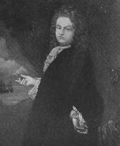
The first Frederick Philipse (formerly Flypsen)
Enter wealthy adventurer and servant to the crown Frederick Philipse. The enterprising and ambitious Dutchman (his original name was Flypsen) came to New Amsterdam in the 1650s and stayed for the transition into New York. He then married into money and soon became the wealthiest man in town, thanks partially to the slave trade.
He soon acquired an estate (or rather, “hunting ground”) encompassing land between the Spuyten Duyvil creek and the Croton River further upstate.
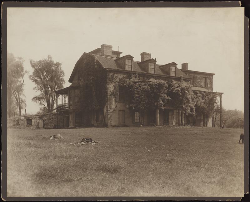
He built a lavish home here — the Manor of Philipsburg — with breathtaking views of the Hudson.
Several buildings from the original Philipsburg Manor property still stand in the Hudson River Valley, including the Philipse Manor Hall, built in 1682.
Photo courtesy CUNY
As author Stefan Bielinski explains, Philipse “was essentially a merchant with mercantile liaisons extending to several continents, but although he had acquired land for speculative purposes, he also hoped to one day generate the flour, grain, and other products which his own ships would then carry to the worldwide marketplace.” Of course he would “generate” these goods with the help of slave labor.
This land once had been owned by Lenape and later by Adriaen van der Donck, the Dutch lawyer who apparently met an unfortunate end. Now these thousands of acres were part of a wealthy lord’s estate, part of a vast area that would later become the western Bronx and Yonkers.
Of course, in the southern part of his estate, there was that pesky road — that former Lenape road — that abutted his property, heavily trafficed with people crossing at the creek. No matter. In 1693, he built a bridge — the King’s Bridge as it was “established by royal grant“ — and charged a fee, payable to the crown.
Internet Book Archive
The bridge was the only legitimate way to cross the river, the only way to deliver goods to Manhattan from the mainland. Naturally this monopoly was soon poorly received by local farmers who wanted to sell their bounty in the profitable New York markets down south.
Philipse’s toll bridge can be seen as a physical representation of the later unrest between England and the colonies. Philipse and his descendants were faithful to the English; his great-grandson would still own the property during the Revolutionary War and would flee when the British were kicked out in 1783.
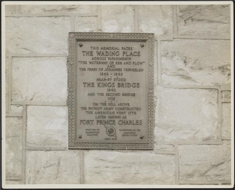
A plaque on nearby St. Stephen’s United Methodist Church commemorates both Verveelen’s ferry service and the site of the original King’s Bridge. Pictured here in 1932.
Museum of City of New York
Many decades later, a mild form of protest was practiced by neighboring farmers Benjamin Palmer and Jacob Dyckman, who built the aptly named wooden-plank Free Bridge in 1758, at around 226th and Broadway, with funds contributed by other perturbed locals.
This rebellion was celebrated with a wild feast, an ox roast, “thousands from the city and country …. rejoiced greatly.”
Palmer was the man responsible for developing City Island just three years later. Dyckman attempted to profit from the bridge by building a nearby tavern, later sold and known as Hyatt Tavern. The bridge was burned down by British soldiers in 1776, but they left the tavern still standing.
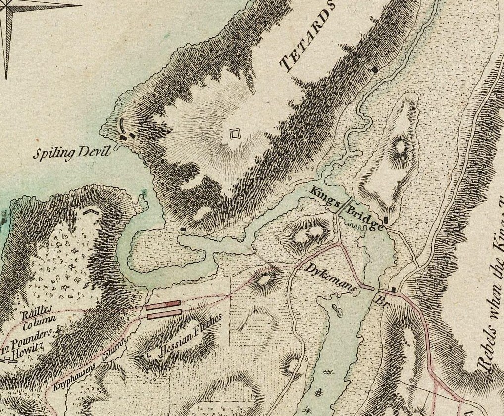
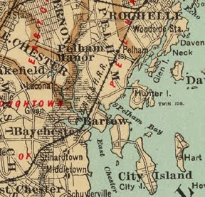
Below: Map showing the location of the King’s Bridge approximate to where the Free Bridge (or Dyckman’s Bridge) was. Â
Excerpt from the Battle Of Fort Washington Map By Sauthier showing original course of Spuyten Duyvil Creek, and locations of King’s Bridge, Dyckman’s Bridge, and Marble Hill area then part of Manhattan
As for the King’s Bridge, according to author Stephen Jenkins, it had fallen “into disuse, the gatekeeper gave up his position, and Colonel Philipse [great-grandson of Frederick] had to advertise for a new lease; from this time forth, it was virtually a free bridge also.”
It too was eventually destroyed — by Washington’s forces, as they fled in 1776 — but was rebuilt after the war, as was the Free Bridge. The pictures of the King’s Bridge you see in this post are of the rebuilt bridge.
The community that developed around King’s Bridge, losing the space and the apostrophe, was officially part of Yonkers until the city of New York annexed it in 1874, years before the creation of the Bronx borough.
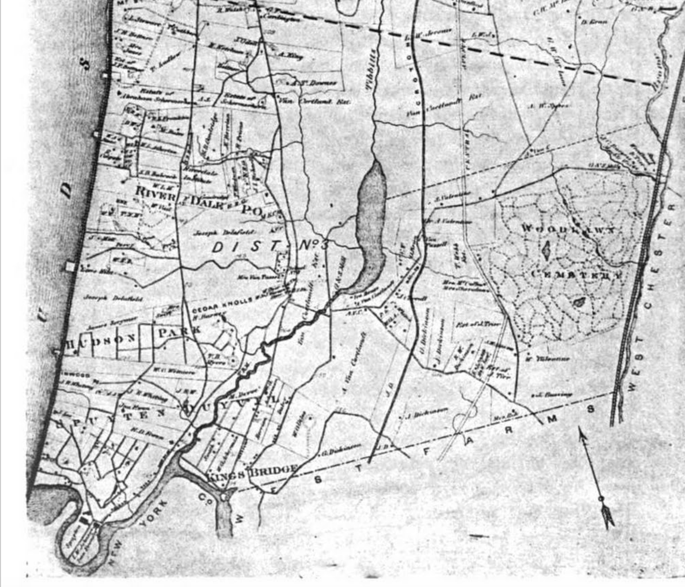
A map from 1867 showing King’s Bridge in the southern portion:
With the filling in of Spuyten Duyvil Creek in 1914, the city not only created this strange quirky place called Marble Hill, they also apparently buried the bridge without dismantling it. It may still technically exist under the roadway at 230th Street and Broadway. Is this a historic legend or does a little piece of old New York still reside in the neighborhood of Kingsbridge?
This article is based on an article I wrote back in 2010. You can see the original here.
We’ve received such an overwhelming positive response to our Bronx history podcast — and we’re just at Part One. You may know a few things about 20th century Bronx history, but it’s so important to familiarize yourself with the early stories as well. Almost all of these stories figure into the creation of the modern Bronx and will help shape the borough’s future.
But there’s need to wait for us to release Part Two next week. There are many institutions in the borough where you can experience the early history of the Bronx firsthand. May we suggest planning an afternoon adventure around a visit to these places? (NOTE: It’s always a good idea to call ahead before planning a visit. Some of these locations often host private events.)
For reasons which will become obvious, late summer and autumn are the perfect times to visit some of these sites. You’ll see why many people consider the Bronx to be the most beautiful borough in New York City.
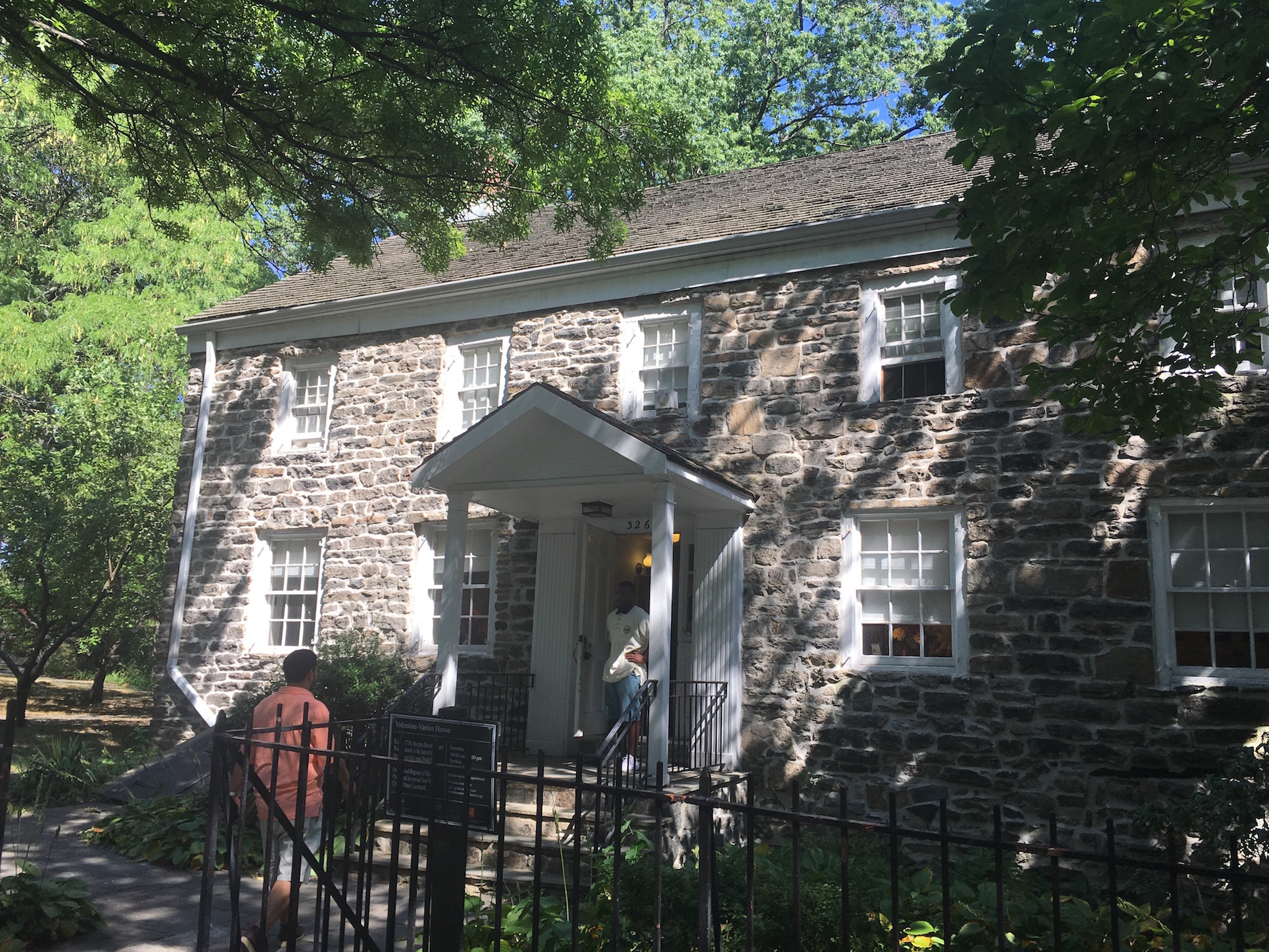
Start an exploration into Bronx history here, a non-profit organization located in the Valentine-Varian House, the oldest farmhouse in the Bronx (from 1758). As is the way with historical homes, this structure once owned by the family of New York mayor Isaac Varian and Bull’s Head Tavern owner Richard Varian was actually moved to its present location in the Williamsbridge Oval back in 1965. Inside you’ll find a complete display of exhibits and examples of colonial life in the Bronx.
LOCATION 3266 Bainbridge Avenue, Norwood, the Bronx WHY YOU SHOULD VISIT SOON A special exhibition (open until October 9) explores the history of Westchester Town, one of the earliest settlements in the region. We recommend pairing a visit to the home with a trip to New York Botanical Garden, just a short walk down Mosholu Parkway. HOURS AND ADMISSION Saturday 10AM-4PM; Sunday 1PM-5PM, $5 per adult, $3 for students, children and seniors HOW TO GET THERE BY SUBWAY — The D train to East 205th Street or the 4 train to Mosholu Parkway
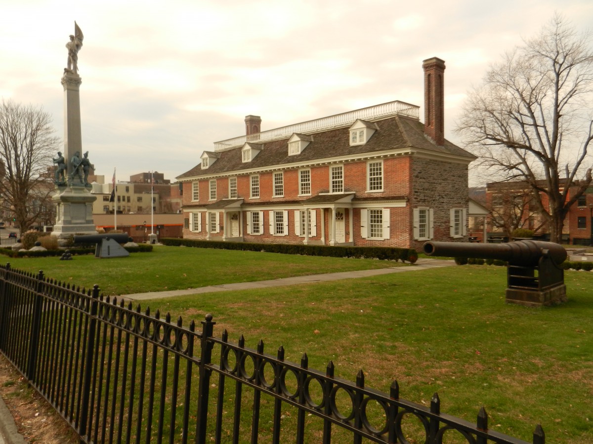
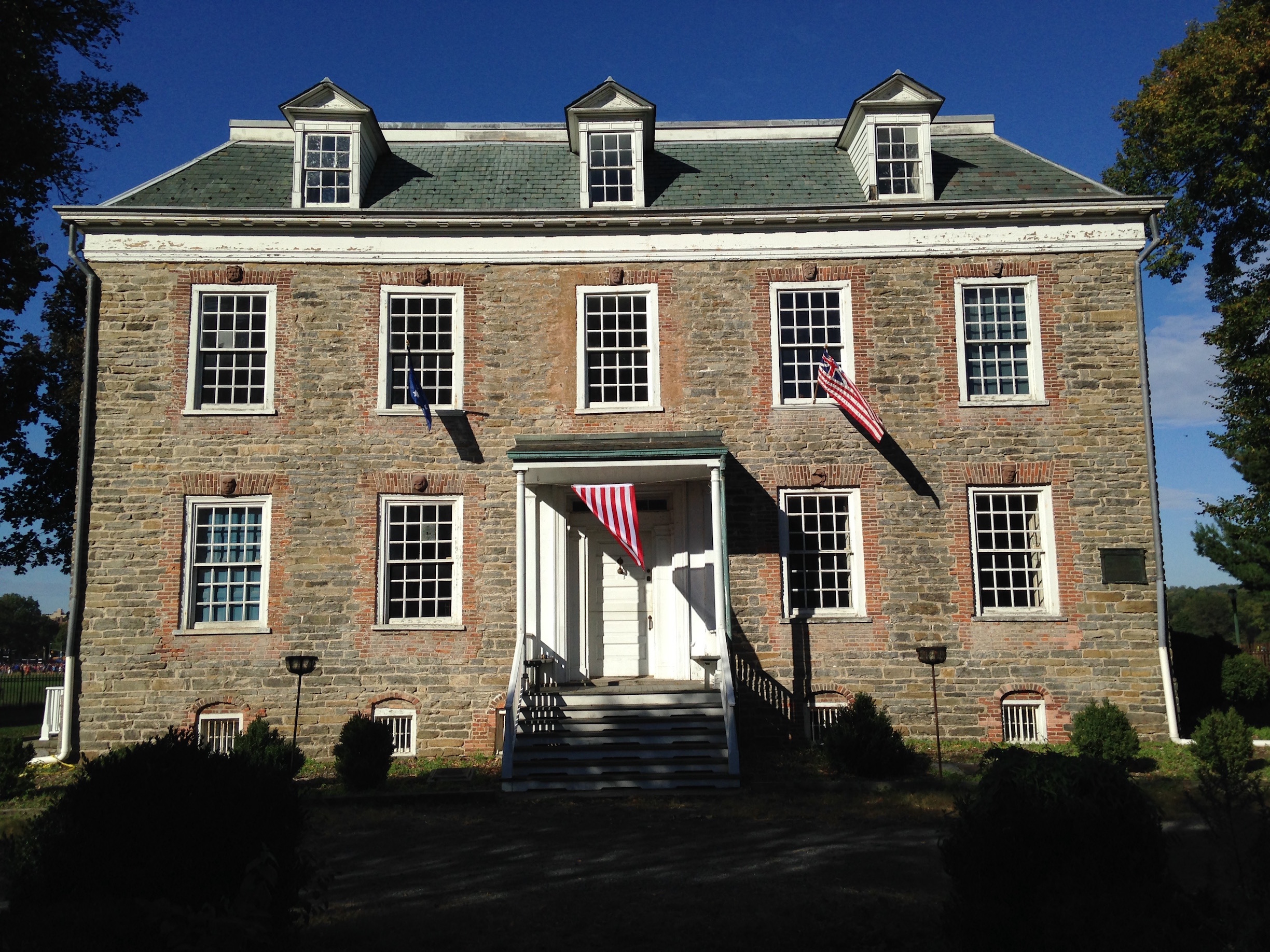
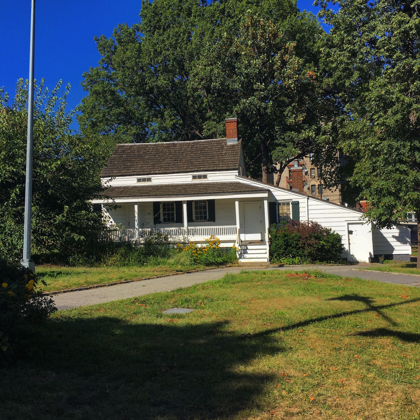
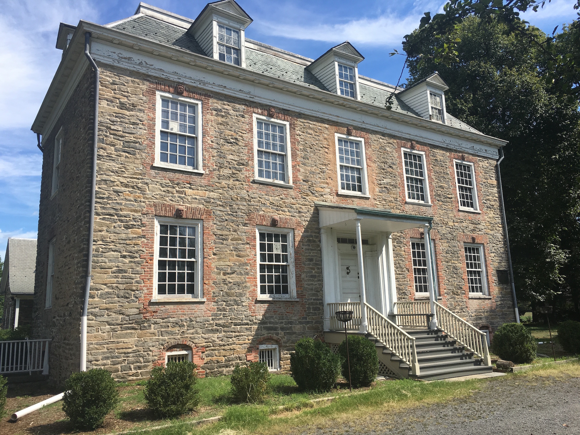
Few places in New York feel as authentically connected to the era of the Revolutionary War as the old 1748 home of the Van Cortlandts, sitting within the family’s former estate in the park named after them. Depending on the time you get there — call ahead just to be sure they’re open — you’ll take a guided tour (perhaps even with a costumed guide) or have the opportunity to explore the house yourself.
LOCATION 6036 Broadway, Van Cortlandt Park, the Bronx WHY YOU SHOULD VISIT SOON The park is popular with joggers and sports fans, so you may want to join in the fun after a visit. Plan a trip here on the same day you go to Wave Hill. HOURS AND ADMISSION Tuesday-Friday 10AM-4PM; Saturday and Sunday 11AM-4PM, $5 per adult, $3 for students, children and seniors, free on Wednesdays HOW TO GET THERE BY SUBWAY — The 1 train to the last stop West 242nd Street
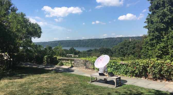
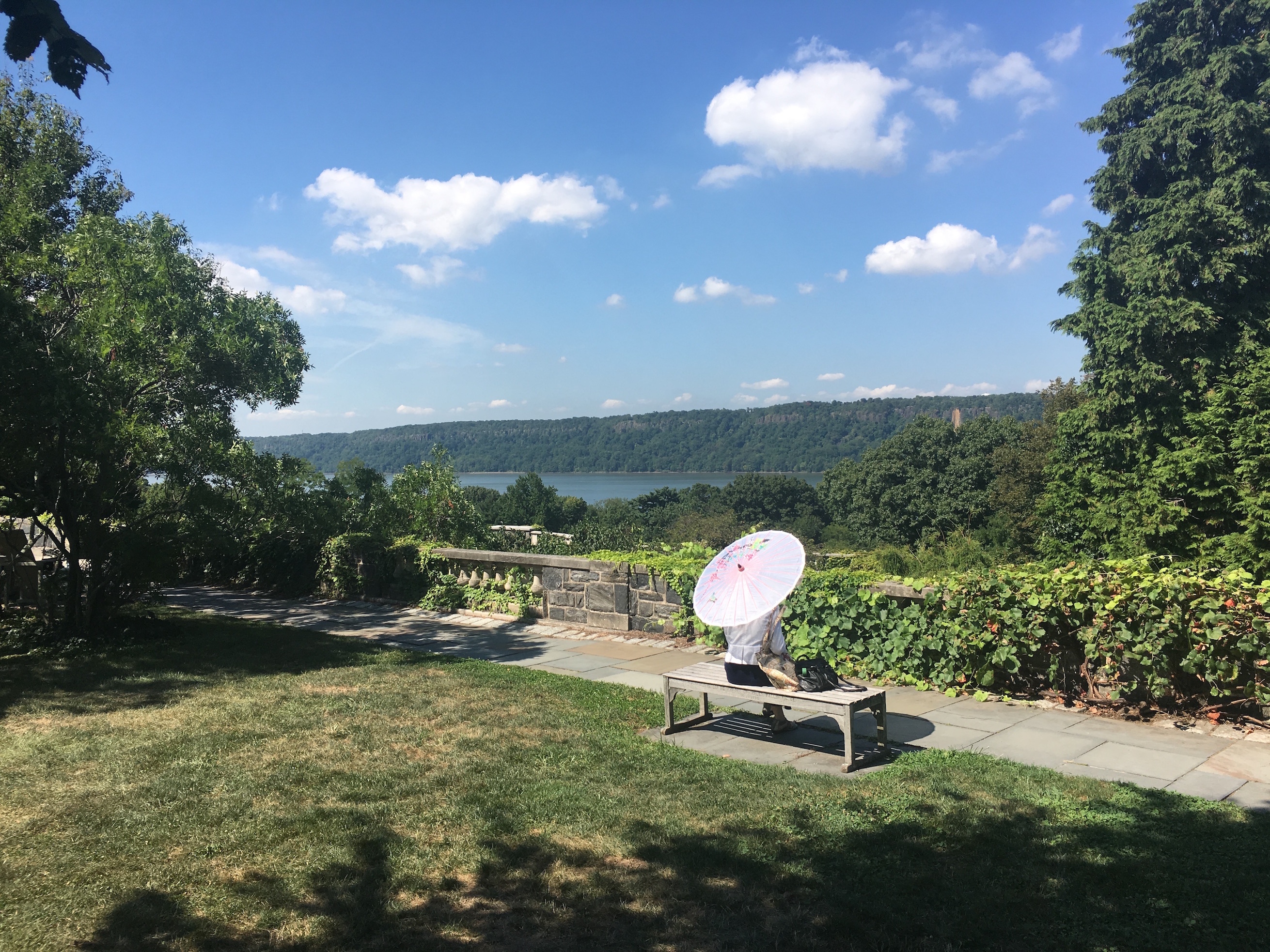
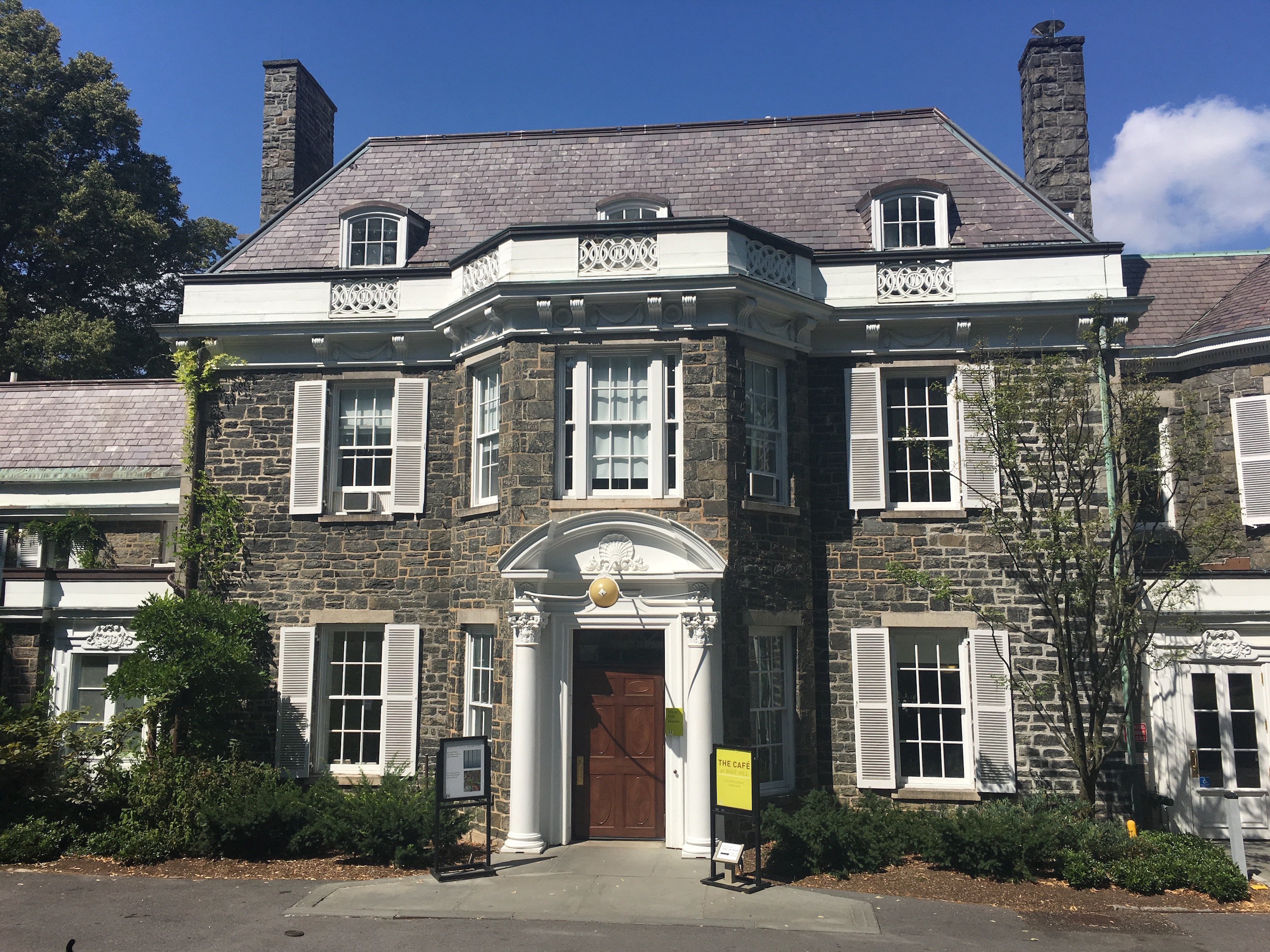
This is your home now! Well you can at least fantasize that this sumptuous 1843 mansion — and its 1927 companion Glyndor — is yours as you stroll the property, looking out at the splendid view of the Hudson River and the Palisades. The feeling of calm and isolation  you get from an afternoon here is almost impossible to find in the five boroughs.
LOCATION 649 W 249th St, Riverdale, the Bronx WHY YOU SHOULD VISIT SOON They encourage you to take your shoes off and walk in the grass. The already-gorgeous surroundings become even more extraordinary starting in the early fall. Perfect day-trip with the Van Cortlandt House Museum (see above) HOURS AND ADMISSION Tuesday-Sunday 9AM-5:30PM; $8 per adult, $4 for students and seniors, $2 children +2 (Parking is available) HOW TO GET THERE BY SUBWAY — The 1 train to the last stop West 242nd Street. A free Wave Hill shuttle van meets passengers on the west side of Broadway in front of Burger King (!) at 10 minutes past the hour, from 9:10am to 4:10pm. The shuttle van returns visitors to Broadway in front of Burger King, departing Wave Hill’s front gate on the hour, from 10am until 5pm. (You can also get here via Metro-North Railroad. See website for more information.)
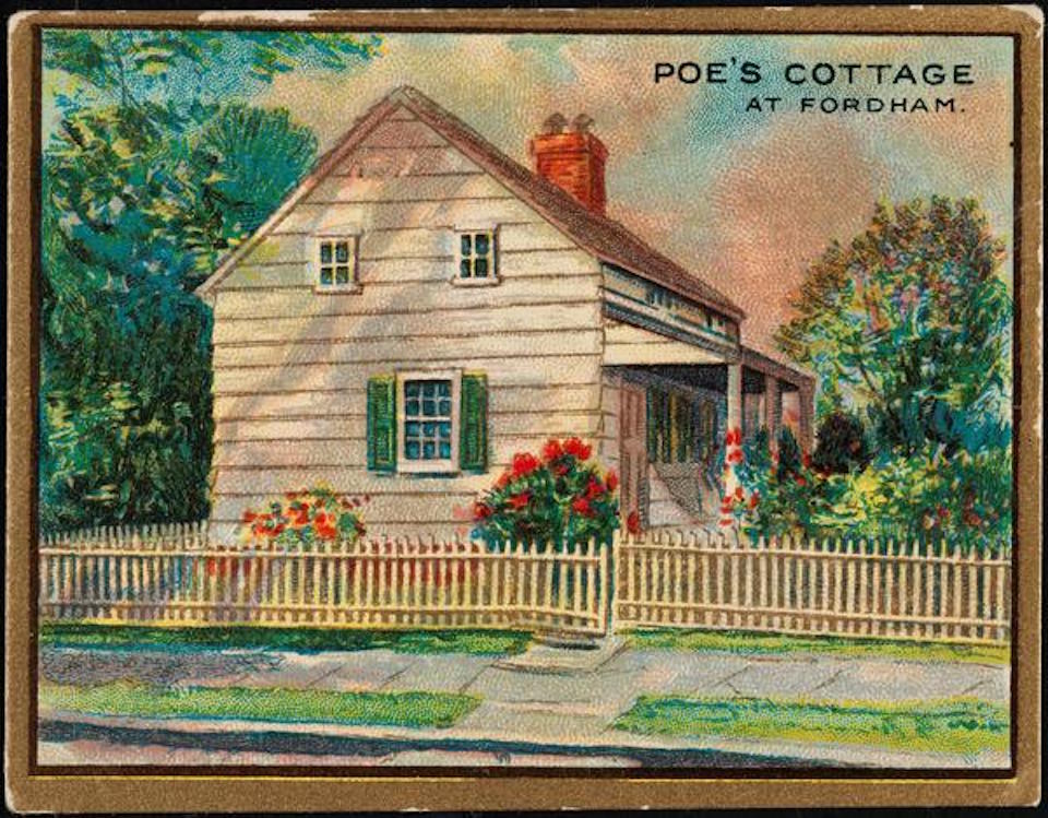
This remains one of the strangest literary landmarks in New York City. Positioned in charming Poe Park, right off the Grand Concourse, the cottage has lost all of its original context but none of its allure. Standing on the porch, the more creative among you may be able to close your eyes and imagine the dark, sullen worlds the poet was able to conjure from here. (A few of his most famous poems were written at the cottage, and the short story “Landor’s Cottage” is believed to be heavily inspired by this place.)
LOCATION 2640 Grand Concourse, Fordham Manor, the Bronx WHY YOU SHOULD VISIT SOON Fall is always the best time experience anything Poe-related.  You’re also a short walk to the culinary delights of Arthur Avenue. HOURS AND ADMISSION Tuesday-Friday 10AM-3PM; Saturday and 10AM-4PM, Sunday 1PM-5PM, $5 per adult, $3 for students, children and seniors HOW TO GET THERE BY SUBWAY — The D train to Kingsbridge Road lets you off right at the park, however the 4 train to Kingsbridge Road will also get you there too.
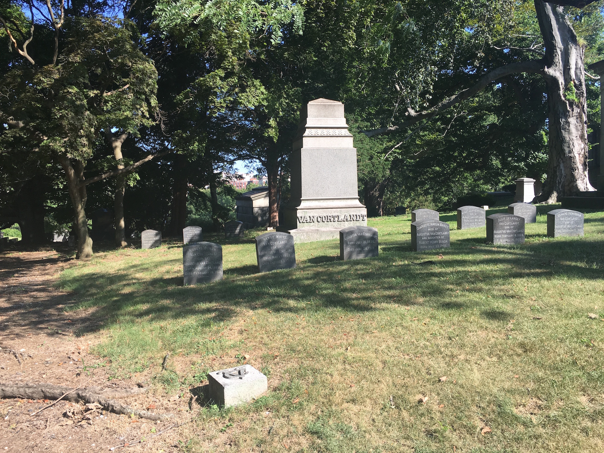
Sometimes you learn more about the great figures from the past by seeing how they’ve chosen to spend eternity. Woodlawn Cemetery, which opened in 1863 and was specifically notable for its access to the new railroad, is the final resting place of moguls, robber barons, politicians, socialites and musicians. A stroll along Woodlawn’s paths will tell you more about human vanity and the urge to preserve personal legacy than any college psych class.  (Above: the plot for members of the Van Cortlandt family — THE Van Cortlandt family — is relatively modest.)
LOCATION 517 E 233rd St, Woodlawn Heights, the Bronx WHY YOU SHOULD VISIT SOON There are an abundance of intriguing public programs planned for the next couple months. Our favorites — a concert by the Bardekova Quintet on September 25 and a special walking tour on October 9 called “Shuffle Along and the Stories of Black Broadway.”  Visit their website for more information. HOURS AND ADMISSION Monday-Sunday 8:30AM-4:30PM, free, no bicycles HOW TO GET THERE BY SUBWAY – The 4 train to Woodlawn Station or the 2 or 5 trains to E 233rd Street
The Bartow-Pell Mansion, tracing its lineage back to the original Pell family, may not have the breathtaking view of the Palisades that Wave Hill has, but it has something else equally lush — an extraordinary formal garden in the back. This lovely and occasionally surreal feature has only been part of the house since 1916. It makes a perfect addition to the family home, originally constructed between 1836 and 1842.
LOCATION 895 Shore Road North, Pelham Bay Park, the Bronx WHY YOU SHOULD VISIT SOON This is the 100th anniversary of that garden, and a new exhibit celebrating its centennial pairs the formal beauty with strange and unusual pieces of modern art. If you go this weekend, you’ll be able to pair your experience here with a trip to Orchard Beach, which closes for the season on September 11. HOURS AND ADMISSION The house – Wednesday, Saturday-Sunday Noon-4PM, $5 adults, $3 seniors and students, free for kids under 6. The gardens — open daily, free, from 8:30AM to dusk. HOW TO GET THERE BY SUBWAY – The 6 train to the Pelham Bay Park station, then transfer to a #45 bus. More information here.
This lovely and strange little museum is tucked away off the main road and feels like a old ship in a bottle, dusty and preserved. If you can time your visit to City Island to coincide with its opening hours, it’s well worth a visit. You may think you’re in a small town in Maine! (But then again, the whole island often feels like that.)
LOCATION  190 Fordham Street, City Island, the Bronx WHY YOU SHOULD VISIT SOON If you’re clinging on to the last scraps of summer, then a visit to City Island — and its delicious eateries on the southern point — will provide you with the inspiration you need. HOURS AND ADMISSION Saturday and Sundays only, from 1PM to 5PM. Also by appointment. HOW TO GET THERE BY SUBWAY – The 6 train to the Pelham Bay Park station, then transfer to a #29 bus to City Island.  More information here.
PODCAST A history of the land which would become the Bronx, from the first European settlement to its debut in 1874 as New York’s Annexed District.
The story of the borough of the Bronx is so large, so spectacular, that we had to spread it out over three separate podcasts!
In Part One — The Bronx Is Born — we look at the land that is today’s borough, back when it was a part of Westchester County, a natural expanse of heights, rivers and forests occasionally interrupted by farm-estates and modest villages. Settlers during the Dutch era faced grave turmoil; those that came afterwards managed to tame the land with varying results. Speculators were everyone; City Island was born from the promise of a relationship with the city down south.
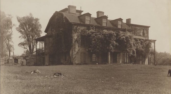
During the Revolutionary War, prominent families were faced with a dire choice — stay with the English or side with George Washington’s Continental Army? One prominent family would help shape the fate of the young nation and leave their name forever attached to one of the Bronx’s oldest neighborhoods. Sadly that family’s legacy is under-appreciated today.
By the 1840s, Westchester County was at last connected to New York via a new railroad line. It was a prosperous decade with the development of the area’s first college, a row of elegant homes and some of its very first ‘depot towns.’ Two decades later, the future borough would even cater to the dead — both the forgotten (at Hart Island) and the wealthy (Woodlawn Cemetery).
The year 1874 would mark a new chapter for a few quiet towns and begin the process of turning this area into the borough known as the Bronx.
FEATURING: Many places in the Bronx that you can visit today and experience this early history up close, including Wave Hill, Pelham Bay Park, Woodlawn Cemetery, City Island and more.
The Bowery Boys: New York City History podcast is brought to you …. by you!
We are now producing a new Bowery Boys podcast every two weeks. We’re also looking to improve the show in other ways and expand in other ways as well — through publishing, social media, live events and other forms of media. But we can only do this with your help!
We are now a member of Patreon, a patronage platform where you can support your favorite content creators for as little as a $1 a month.
Please visitour page on Patreon and watch a short video of us recording the show and talking about our expansion plans. If you’d like to help out, there are five different pledge levels (and with clever names too — Mannahatta, New Amsterdam, Five Points, Gilded Age, Jazz Age and Empire State). Check them out and consider being a sponsor.
We greatly appreciate our listeners and readers and thank you for joining us on this journey so far. And the best is yet to come!
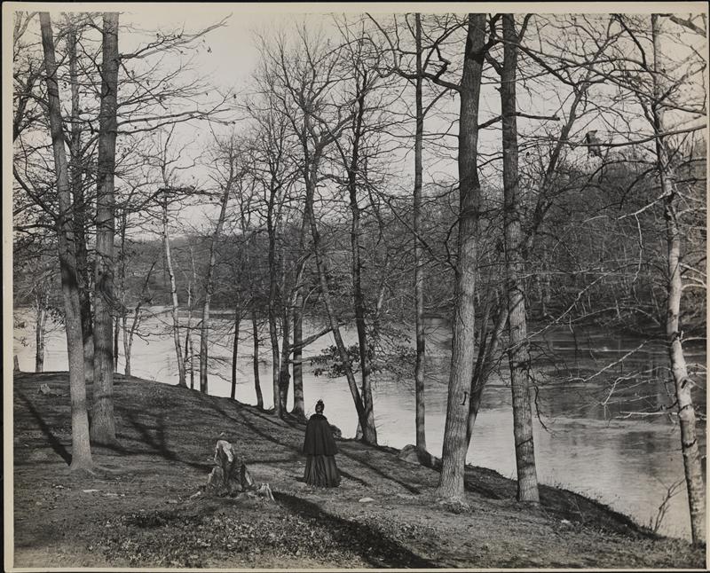
In this 1896 Robert Bracklow photograph, a solitary woman stands by the Bronx River, looking almost completely unchanged from how it would have looked when Jonas Bronck saw it.
Museum of the City of New York
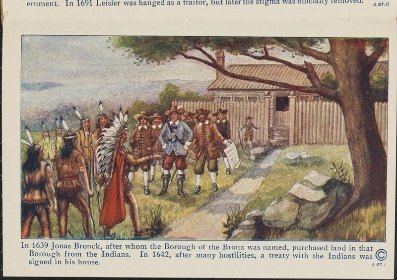
A 1914 illustration recounting the tale of Jonas Bronck:
Museum of the City of New York
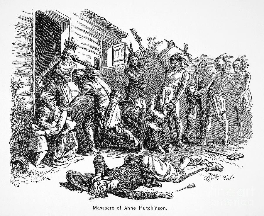
Another book illustration, this one of the massacre of Anne Hutchinson and her family.
NYPL
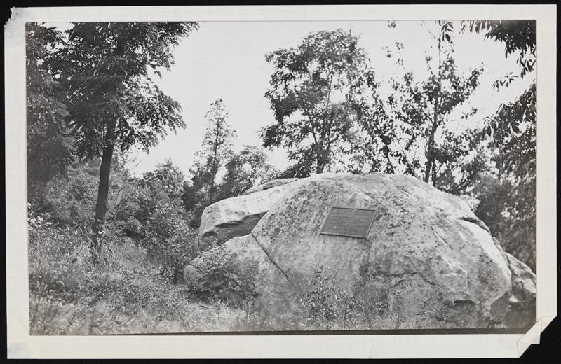
The Split Rock as it appeared in 1910, with a memorial plaque to Anne and her family and no highways anywhere around it. The rock today has no plaque but the impression of one can still be seen.
Courtesy MCNY
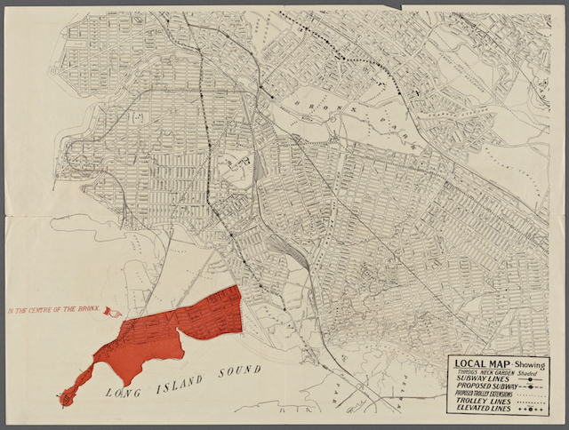
An auction map of the Bronx from 1910, highlighting the area of Throg’s Neck which gets its name from Throckmorton or Throgmorton.
NYPL
The King’s Bridge from an 1856 illustration.
NYPL
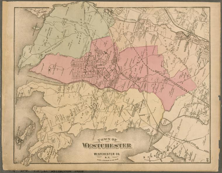
The town of Westchester in the East Bronx, pictured here in 1872. Throg’s Neck is in the lower portion of the map. Today’s neighborhood of Soundview comprises the green portion.
NYPL
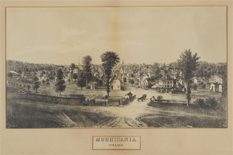
The village of Morrisania, pictured here in 1860, which arose from land owned by the Morrises after the railroad encouraged a row of ‘depot towns.’
MCNY
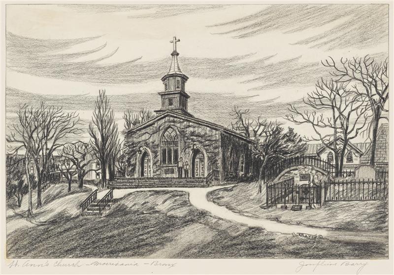
St Ann’s Episcopal Church in Morrisania, where both Lewis and Gouverneur Morris (and Gouverneur’s wife Ann) are buried.
Courtesy MCNY
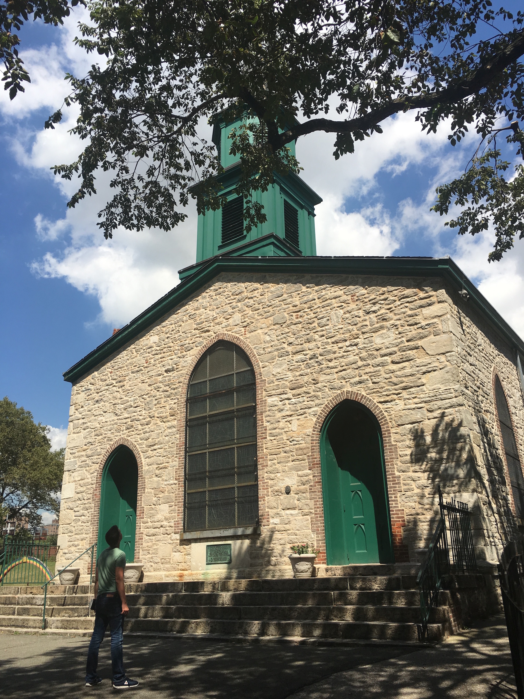
A view of St. Ann’s today:
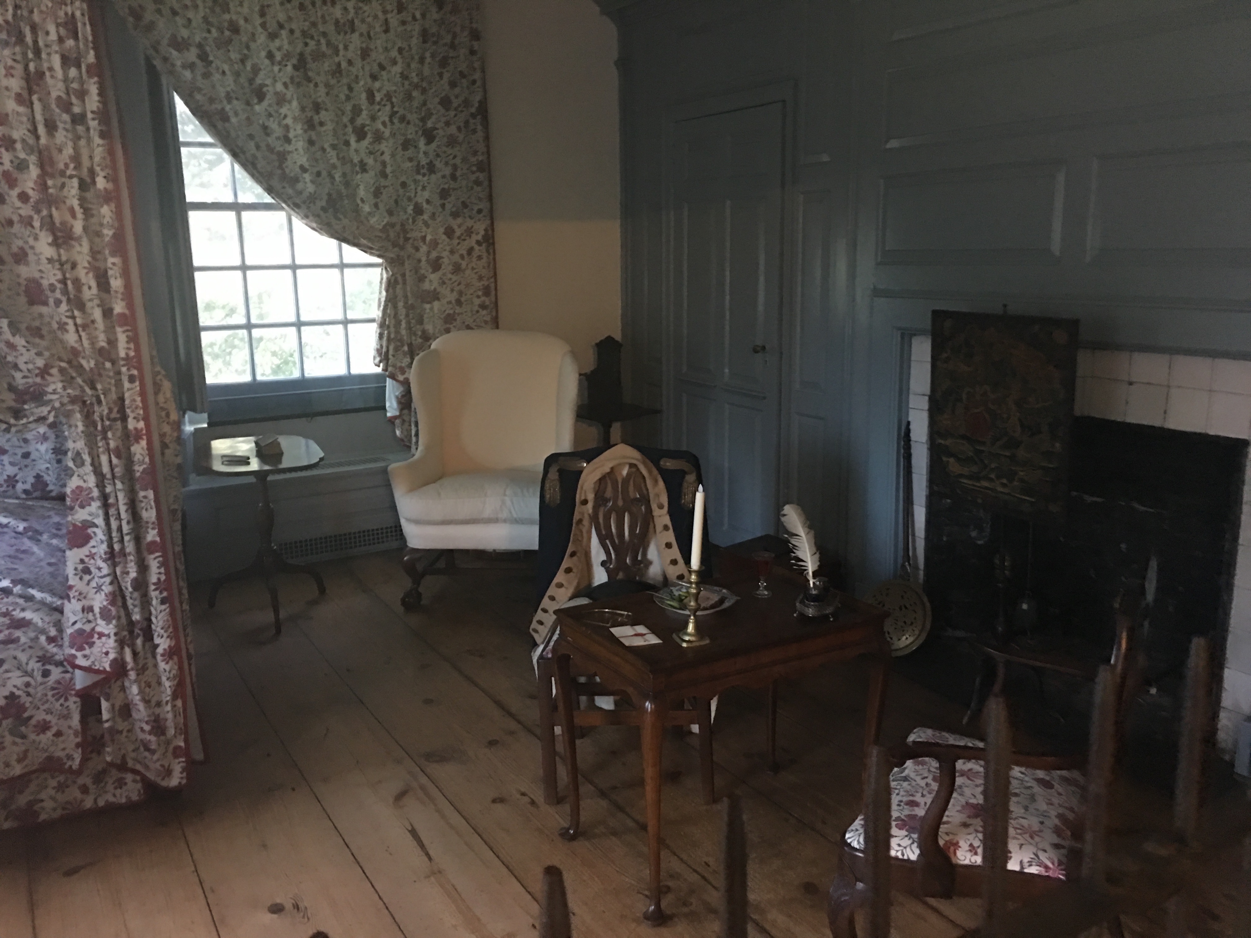
The Van Cortlandt Mansion then (in 1906)…
And today (featuring George Washington’s room):
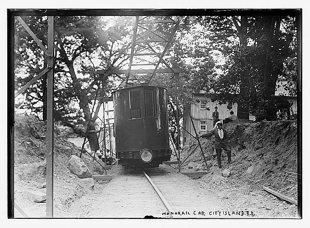
The old City Island monorail from 1910
LOC
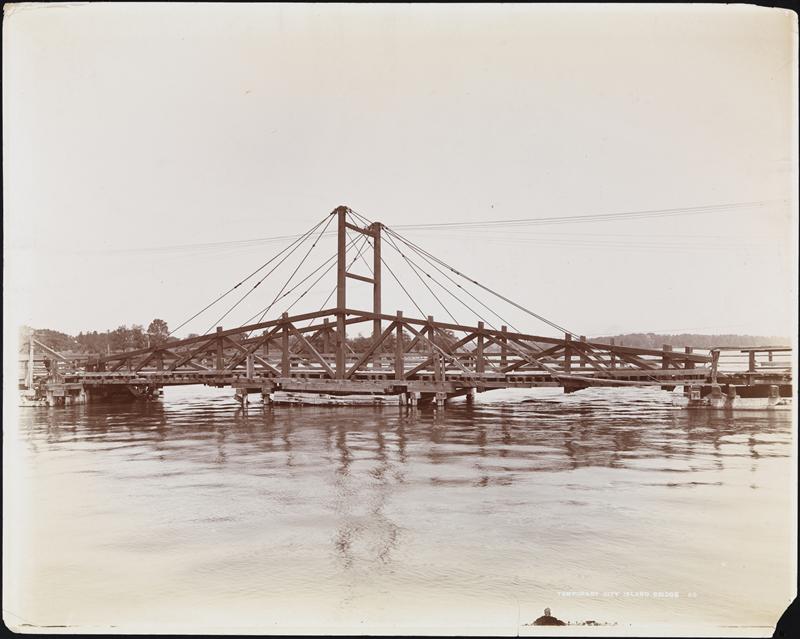
The old City Island Bridge, the only way on or off the island that’s not a boat. That remains true to this day, although the bridge is much sturdier-looking today!
MCNY
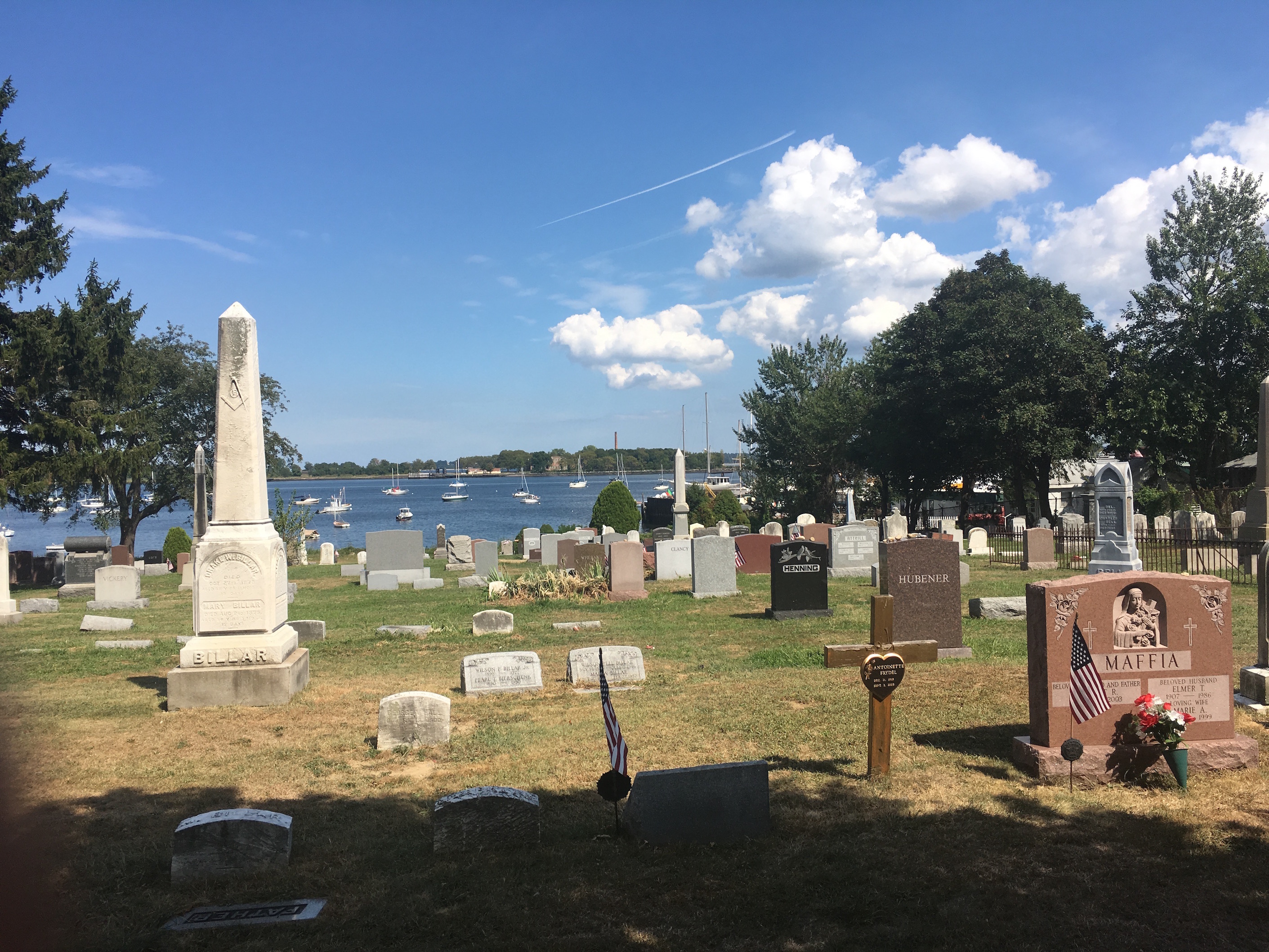
The old City Island Cemetery with Hart Island in the distance.
Breathtaking Wave Hill and the grounds which provide an unbelievable view of the Hudson River and the Palisades.
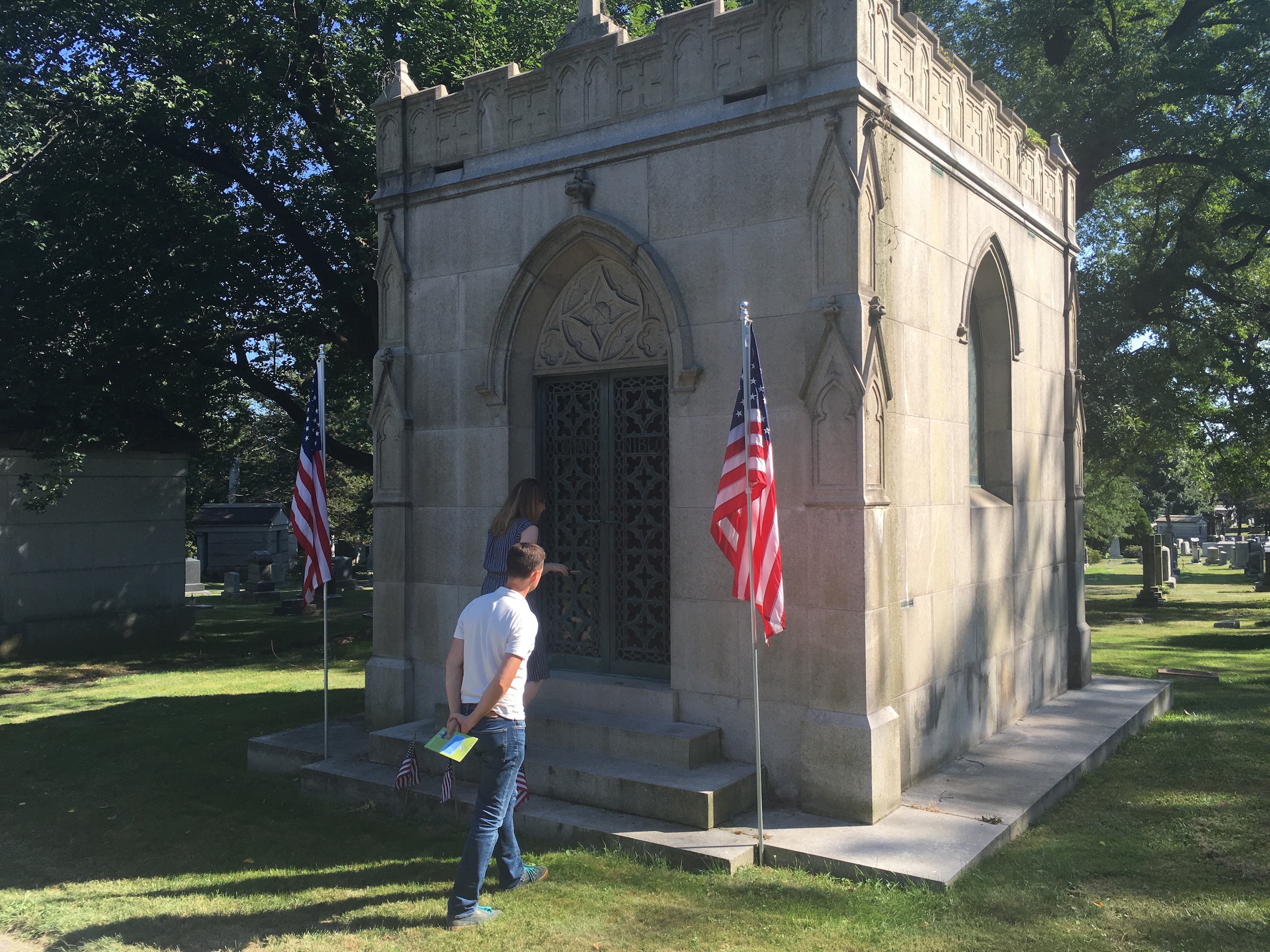
Here’s Tom, getting a peek inside George M Cohan’s mausoleum at Woodlawn Cemetery:
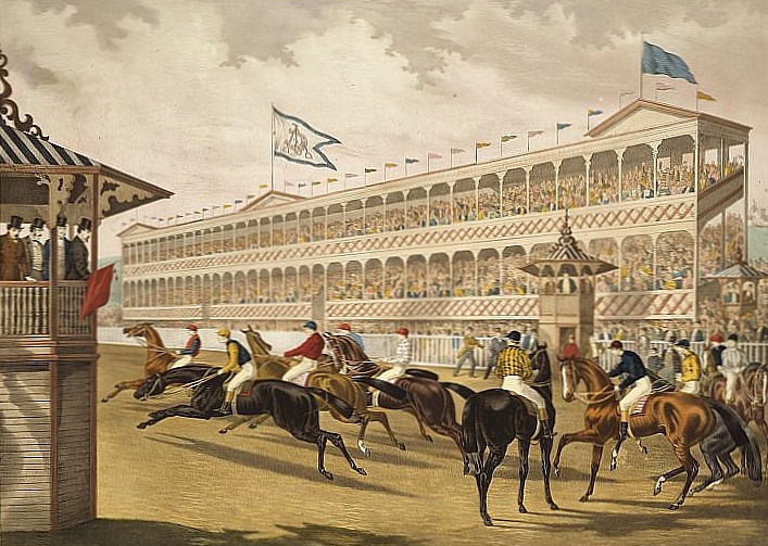
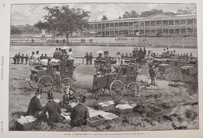
Jerome Park Racetrack where the Belmont Stakes were first run in 1867.
From Harpers Weekly, 1886:
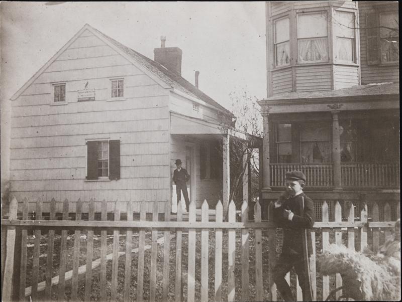
The former (awkward) location of Edgar Allan Poe’s cottage. It has since been moved to the Grand Concourse.
And finally — Gouverneur Morris’ mansion which — believe it or not — stood at the foot of St. Ann’s Avenue until the 20th century.
MCNY
We want to give a big thanks to the Bronx Historical Society, Wave Hill, Woodlawn Cemetery and St. Ann’s Episcopal Church for helping us with our research. Keep coming back to the blog throughout the month of September as we’ll have additional stories about these places and others.
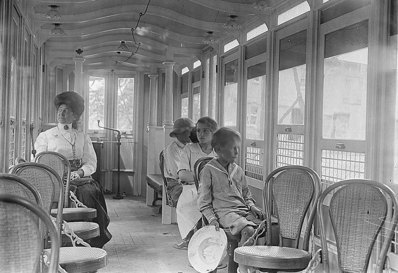
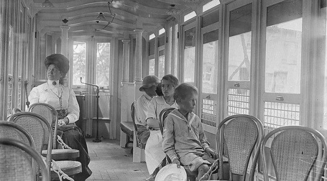
Taking their lives in their hands: riders of the City Island Monorail
On Friday’s podcast, I briefly talked about the Pelham Park & City Island Railroad (or, in the parlance of the day, Monoroad), an actual monorail system, three miles in length, linking the small fishing community of City Island with the Bronx mainland. This slender and awkward looking conveyance (with its “yellow, cigar shaped car“, you can see it a couple posts below), departing on its very first trip on July 17, 1910 crammed with over 100 passengers, promptly fell over, injuring dozens.
“Passengers were thrown one on top of the other on the floor, so that they lay literally in layers,” according to the Times. Not helping matters, the conductor locked the doors after the accident for fear passengers would touch the electrified rail, and the injured had to be passed through a couple small, open windows.
The monorail was being piloted by its creator Howard Hansel Tunis who had trumpeted his technology of a single ground rail with two elevated (and electrified) side railings. Some in the press had seen the monorail idea as being superior to the newly build subway train. However it had taken his Monoroad financiers almost two years to raise the money, and the construction of usable track had happened hastily — and with remarkable incompetence.
The ‘monoroad’ was to be a technological improvement of the horsecar line that serviced the route before 1910, picking up passengers at the long-vanished Bartow Station, located in Pelham Bay Park. One hundred years ago, New Yorkers took day trips up to enjoy the small, sandy beaches of City Island; most of that beach area is unavailable for bathers today, and anyway, Robert Moses sculpted a far grander Orchard Beach out of landfill in the 1930s, a more suitable option.
Despite the inaugural disaster, the City Island monorail system gave it another go a few months later, on October 12, 1910. On this, its second trip, the monorail hit an automobile, smashed it “to splinters” and injuring the driver and a passenger. They eventually seemed to work out the kinks, and the monorail began regular operation, although its irregular schedule and its inadequate connections to other lines never impressed local residents.
Its poor reputation may have held City Island back as a more popular place for recreation. An article on City Island from 1913 , while singing the monorail’s praises, inaccurately reported that people had been killed in the inaugural accident.
Its fate was sealed in 1914 when the powerful Third Avenue Railway bought it up, opened a traditional trolley line alongside it and unceremoniously closed the monorail by 1919.
Map above from Historic Pelham. Top photo from Wiki Commons.