Mistresses and misnomers: the story of Gay Street

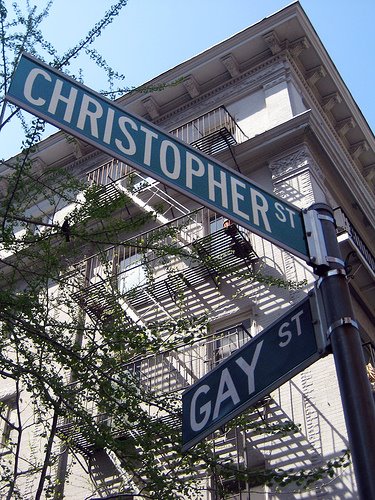
There are few streets in Manhattan as beautiful as Gay Street, that preciously bent path in the West Village that’s been the home to speakeasies and scandals, linking Waverly Place to Christopher Street. Due to its proximity to Christopher, the original heart of New York’s gay and lesbian culture, it also happens to have one of the most photographed street signs in the city.

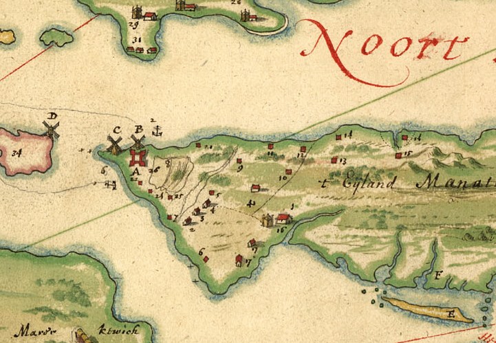
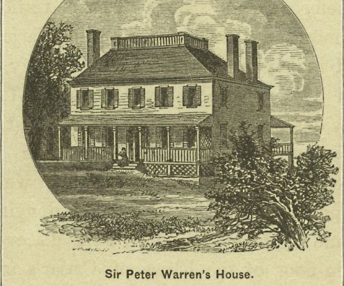
A huge misnomer hangs over the origin of the name of Gay Street. To expose it, we need to go all the way back to Wouter Van Twiller’s ownership of the land back in the Dutch days. Van Twiller reportedly had his very own brewery which stood on this very spot. Much later on, as part of the estate of Sir Peter Warren, a morgue allegedly stood here as well. Beer and death — the roots of Gay Street! (See yesterday’s story on the early origins of Greenwich Village and our prior article on the history of Christopher Street).

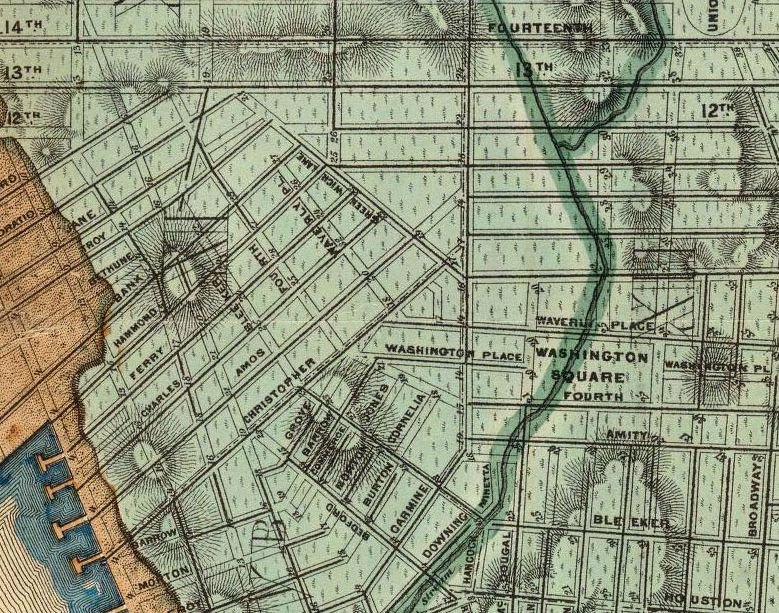
Before 1800, nearby Christopher Street was called Skinner Road and the area still retained a bit of its rural quality. But things were getting fancy over on Waverly Place.

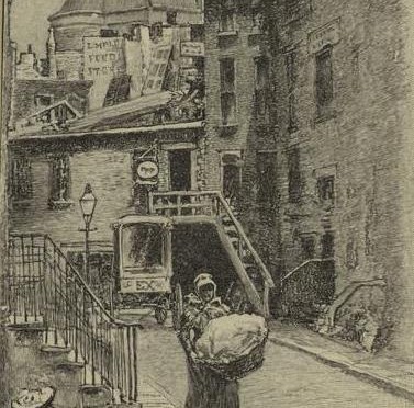
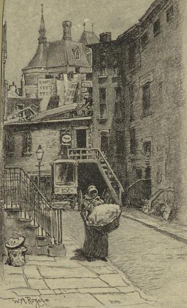
(W.A. Rogers illustration above from 1894, courtesy NYPL)

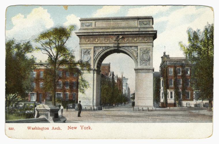
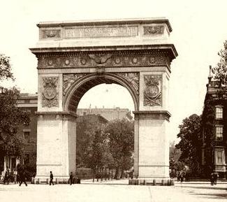
The eastern stretch of Waverly is actually the northern border of Washington Square. Because of that, it became the hottest street in town when the city built Washington Square in 1826, and the street became lined with attractive Greek Revival Style homes. The birth of Fifth Avenue culture really starts here, home to the city’s wealthiest well-to-do families of the 1820s.

Their horses had to go somewhere! And so Gay Street was built, not as a place for homes, but as a row of horse stables for people living on Waverly Place and other elegant homes nearby. Soon however, with the natural growth of the city, some of the stables made way for lower-income housing, mostly for servants employed in some of these same elegant homes. And in most cases these were African-American servants.

That’s where the misnomer about the name comes in. The city officially named it Gay Street in 1833, although it may have been called by that name unofficially many years previous. It’s popularly supposed that it was named after Sidney Howard Gay, a vanguard Boston abolitionist and editor of the National Anti-Slavery Standard newspaper. However, Gay was born in 1818 and came to prominence in the 1840s and 50s. Although I’m sure he was an outstanding teenager, no way did the city of New York name a street after a 15-year-old boy.

Theories abound as to the real identity of Gay. The closest anybody’s come to the truth is a classified ad found in a newspaper from 1775, an advertisement placed by one R. Gay who was selling off his gelding (i.e castrated male horse). The evidence is circumstantial, but does link to Gay Street’s early history as a stable alley.

The first homes were built in as early as 1827 and the street was officially widened for residential use in the 1830s. Many black residents stayed on the street and it became a home for black musicians. Given the general artistic bent of Greenwich Village as a whole, it’s no surprise then that Gay Street developed into a mini-haven for artists and writers by the turn of the 20th century.

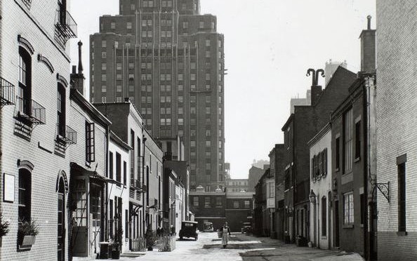
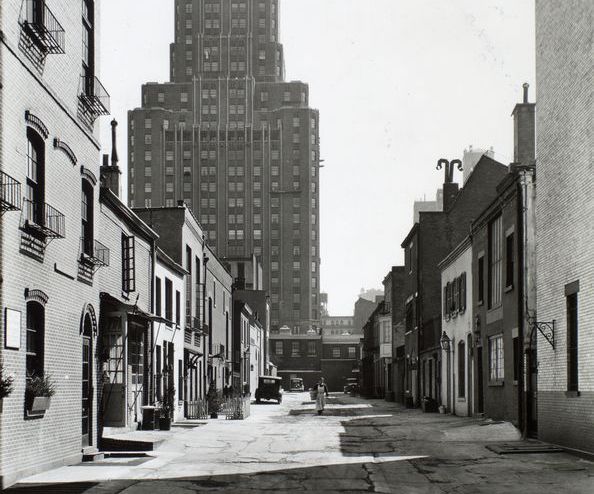
With its secretive, arched appearance and deceivingly quiet demeanor, Gay Street also became a natural location for speakeasies during the 20s, including one at 12 Gay Street called the Pirate’s Den, and possibly another on the corner called the Flower Pot.

That address 12 Gay Street has a hoppin’ history. The building was owned by mayor Jimmy Walker, who kept his girlfriend Betty Compton here. A bit later on, the creator of Howdy Doody, Frank Parris, built his famous puppet in the basement here. It’s even, reportedly haunted by an entity called the Gay Street Phantom.

Author Ruth McKenney lived in nearly 14 Gay Street best known for the book My Sister Eileen. Eileen, who was living with Ruth, died in 1940 in a car accident with her husband, writer Nathaniel West, a few days before a stage production of My Sister Eileen was to open.

Greenwich Village, when it was green and a village

Above: Macdougal Alley in 1936. The plantation home of New Amsterdam director-general Wouter van Twiller would have been situated very close to where this picture was taken. (Find the alley here.)

NAME THAT NEIGHBORHOOD Some New York neighborhoods are simply named for their location on a map (East Village, Midtown). Others are given prefabricated designations (SoHo, DUMBO). But a few retain names that link them intimately with their pasts. Other entries in this series can be found here.

Greenwich Village has been the heart of New York’s cultural identity for over 150 years, the birthplace of city bohemia, where the upper and lower classes collide, the iconic outsider neighborhood between midtown and the financial district. It’s been New York’s home for counter-culture, gay liberation, artistic inspiration, musical innovation and groundbreaking urban renewal. No surprise that it was named New York’s very first historic district in 1969, even as some of its greatest moments were yet to come.

But why do we even call it Greenwich in the first place? And was it ever really a village at all?

I should preface this early history of the Village by saying that the information below deals with Greenwich Village and its sub-neighborhoods the West Village and part of the Meatpacking District (which actually extends farther north). Despite its name, the East Village is actually considered separate from Greenwich, being part of the Lower East Side.

In the wild days of early Dutch occupation of Manhattan, the area of today’s Village district lay 2-3 miles outside the border of the primary Dutch settlement New Amsterdam. That border is approximately Wall Street today.

Imagine the distance between it and 14th street (the generally accepted northern border of Greenwich Village today) as a gradually populated area of hills, swamps and streams, with only a few dirt pathways cutting through the meadows and dense foliage to lands beyond. There was enough farm land to go around if you were brave enough to settle outside city walls, with fears of attacks from both Indians and other Europeans.

To get an idea of how green Greenwich Village used to be, head on over to the Mannahatta Project and type in any Village street name (start with Washington Square North or any listed below).

Back in the day the shore of Manhattan’s west side approximately lay along today’s Greenwich Street; the rest is landfill from later in Manhattan’s development. Near the location of Gansevoort Street today (yes, the Meatpacking District) lay the first village within the Greenwich Village area — the Lenape Indian settlement Sapokanikan or ‘land where the tobacoo grows’. Sapokanikan was essentially a trading settlement and docking point for many traveling native American tribes.

The Dutch took the tobacco reference to heart. The second director-general of New Amsterdam, the colorful Wouter Van Twiller, built a large tobacco plantation ostensibly for the Dutch West India Company but, Wouter being Wouter, mostly for his own personal profit. Wouter’s plantation occupied most of the West Village; his own home sat on plantation ground, at around the area of 8th Street and MacDougal Street. The plantation would be named for the old indian village and also referred to as Bossen Bouwerie (‘farm in the woods’).

Below: Wouter Van Twiller’s farm is marked #10 on this map by Johannes Vingboons from 1639, one of the earlier attempts at mapping the territory of New Netherland

Van Twiller was later dispatched from his duties as the colony’s leader, but he did grant some of his slaves certain freedoms to build their own smaller farms, defenseless along the Minetta Brook (a vital stream that coursed through the region) and on the southern part of today’s Washington Square Park.

Meanwhile, other Dutch companymen came to the region, including two brothers, Jacob and Paulus Van Der Grift, who moved from old Amsterdam to New Amsterdam in 1644 and into this lush area, “co-patroons” of an area that would become known as Nortwyck or Noortwyck (simply ‘north of the city’).

Below: from an 1874 water map designed by Egbert L. Viele, you can see the old Minetta Brook, which formerly cut through the Village district

By 1664, the year of the British takeover of the island, the area was essentially dominated by a handful of landowners who had carefully cultivated their property, but had not changed the general properties of the land.

With the British came further development, as well-to-do English citizens began scooping up property for their own lavish mansions. In fact, it became quite fashionable for the wealthier of British citizens, too refined to deal with the growing and quite crowded New York, to situate just outside the city. This is where Nortwyck, a loose assemblage of farms, becomes Greenwich, the domain of idyllic estates.

I’ve seen reference to the name change as reflecting that of the London district of Greenwich, a very tony British resort in the 17th century. But the name may have first come to the area long before the British elites did. According to the New Netherland Institute, a settler in the 1670s, Yellis Mandeville, bought a farm here and named it for an old Long Island Dutch town — Greenwijck, or Pine District.

Once the wealthy British came, it must have seemed natural to simply alter the name to Greenwich, with all the upper-class and luxurious implications that came with it.

There were several principal British landowners of the Village area at this time. One of note, Thomas Randall, would own the area around Washington Square; later, his son Robert Richard Randall would bequeath the area to the city as a respite for retired sea captains and sailors. The city, seeing far greater value to this land for residential townhouses, instead moved the sailors rest home to the northern shore of Staten Island and called it Snug Harbor.

Another, Captain Thomas Clarke, would retire on property further north and call his mansion Chelsea, also named for a London neighborhood (or specifically for a hospital there).

Below: an engraving of the Greenwich Village home of Peter Warren (courtesy NYPL)

But the real forebear of the Village was an Irishman. Sir Peter Warren, vice-admiral of the British Navy and commander of its New York fleet, who amassed a vast land tract here in the 1740s, almost the entire ‘Green Village’. Warren was without a doubt one of New York’s more renown British citizens. Like the great old New York families that would influence society in the 19th century, Warren’s presence assured that other British clans would race to buy up countryside to create Manhattan’s first suburbia.

By the 18th century, these massive lots would be divvied up and sold off, as demand grew from New Yorkers fleeing the city to escape disease and overcrowding. In these years before far-thinking city planning, the Greenwich lots were haphazardly divided with unorganized streets. This urban chaos was preserved by the 1811 Commissioners Plan, which chopped most of the entire island into uniform blocks but left the Village in its uniquely confounding geography.

Still today, after so many years of living in the city, I routinely get lost there.

Categories
Uncategorized

Where are New York City’s oldest living trees?

The oldest living New Yorkers outdate all the skyscrapers, the highways and the parks in which most of them live. They have seen generations of New Yorkers come and go. And at least one of them even remembers the region’s original indigenous people.

We’re talking about the native trees of New York City, those that were planted naturally and not transplanted from elsewhere, giants that have weathered storms and interactions with humans long gone.

Of course it is impossible to know with absolute certainty the oldest trees as not every single one has been measured. There are, in fact, according to MillionTreesNYC, 5. 2 million trees in New York City, about a tenth of which are actually on the streets.

Some other wonderful trivia from MillionTreesNYC:

“– Standing trunk to trunk, New York City street trees would form a line 118 miles long–the distance from Manhattan to Hartford.

— Number of tree species: 168

— Percent of land covered in trees: 24%  “

I was not able to find complete info for all five boroughs, and I will indicate where I could not come to a definitive answer. If you have any leads, please post them in the comments section.

I’m obviously no arborist, so the details below are based on the research of others. However maybe someday I’ll trek out to these various sites armed with a tape measure and an layman’s knowledge on how to evaluate tree age.

Hattie Carthan, Brooklyn’s tree saviour

BROOKLYN
It appears that the oldest tree in the borough — among, as Betty Smith well knows, the many, many trees that grow in Brooklyn — is undetermined. Most likely it sits in Prospect Park which contains most of the borough’s remaining natural forest — about 100 acres.

Formerly, the title holder was a 220-year old black oak which once stood here; sadly it uprooted during a storm many years ago and tumbled into the ravine.

However, one of Brooklyn’s most famous trees sits in the neighborhood of Bedford-Stuyvesant — a southern magnolia tree Magnolia Grandiflora, brought to Brooklyn from North Carolina in 1885 and located near 667 Lafayette St.

It happens to be the only landmarked living tree in the city, thanks to community leader and nature lover Hattie Carthan, back in 1970.

BRONX
With the borough’s thousands of acres of park land, the real candidate for borough’s oldest may as yet be undiscovered.

However, the leading candidate is currently a handsome white oak tree around the 18th hole of the Split Rock Golf Course in Pelham Bay Park. The oak is well ‘over 200 years old’ although its location by a golf course can’t be good for its health.

Hangin’ around with New York’s oldest and most legendary elm

MANHATTAN
One might naturally assume Manhattan’s oldest tree must be in Central Park. It’s a very manicured place though, and most of its older vegetation was transplanted here. However, the great London plane tree near the Reservoir (pictured below) is said possibly pre-date its construction in 1862.

There are two other candidates for oldest tree on the island. One is in Washington Heights, a 110-foot elm at 163rd Street and St. Nicholas. Known as the Dinosaur, it reportedly shaded George Washington as he surveyed his shifting fortunes during the Battle of Washington Heights.

The most renown candidate is, of course, the Hangman’s Elm, in Washington Square Park. At a reported 310 years old, this arboreal old man in the northwest corner of the park most likely never really saw any hangings as its legend indicates, but its certainly fun to morbidly gander at its branches.

The top two candidates for New York’s oldest tree have been the fascination of tree lovers since their discovery.

Below: The London plane tree near the Reservoir, most likely Central Park’s oldest tree (pic courtesy Central Park 2000)

STATEN ISLAND
The two oldest trees in New York happen to be tulip trees, a common tree of the region named for its flower-shaped leaves. The charming Clove Lakes Park, at Forest Avenue and Clove Road, takes its name from the Dutch word “kloven” or cleft. Its granddaddy entry into the tree race is known as the Clove Lakes Colossus is a monstrous 119 feet tall with a circumference of 21.4 feet.

It’s reported to be well over 300 years old, predating all but the most rudimentary European settlement here in Staten Island. It’s actually a thicker tree than the tulip which is New York’s oldest, but that’s due to more ideal growing conditions. Unlike many other ‘oldest tree’ candidates, Clove Lakes takes good care of its elders, easily located at the park’s north end near a paved path.

QUEENS
Say hello to the Queens Giant (pictured at top), the grandmother of all native New York City plants. Located along a secluded trail in Queens’ Alley Pond Park, this monster is also one of the city’s tallest trees at 133.8 feet — just 20 feet shorter than the Statue of Liberty.

It may be one of the few remaining living things from the era before Henry Hudson sailed into New York harbor, with its age calculated at anywhere from 350 to 450 years old. This would make it one of New York’s truly extraordinary natural features. Interestingly, in the past, the city has taken a stance of ‘benign neglect‘ to the tree, arguing that it shouldn’t be better accessed in order to protect it.

Revised from a previous article which ran in 2009

At last! Washington Square Park returns

The Washington Square arch, in quieter times

The newly symmetrical, freshly renovated Washington Square Park took down the security fences yesterday, finally allowing people back in to enjoy one of Manhattan’s oldest parks.

Gothamist has photographs from the park’s grand re-opening yesterday. You might also like to check out our podcast on Washington Square Park — one of our very first shows! — which you can download for free in iTunes or listen to right here, then head on over and take a gander at the accompanying photo page.

Bowery Boys Recommend: Belle of New York


BOWERY BOYS RECOMMEND is an occasional feature where we find an unusual movie or TV show that — whether by accident or design — uniquely captures an era of New York City better than any reference or history book. Other entrants in this particular film festival can be found HERE.

Sometimes a movie can tell you all about an era in New York City history just by what it willfully avoids.

With the exception of one truly remarkable scene (which I’ll describe below), turn-of-the-century ‘The Belle of New York’ could be set in any city, or rather, no real city. It exists in a poor neighborhood with no poor people, in the cleanest version of the Bowery ever devised for cinema. This place looks too spotless, even for a backlot.

Musicals shouldn’t be realistic, and ‘Belle’ certainly isn’t. Fred Astaire stars as Charlie Hill, an uptown playboy literally awash in beautiful girls, most of him he’s broken off engagements with. In real life, a person of this nature would be reviled, thrown on the cover of the New York Post and labeled a loathsome cad. But because he’s Astaire — and because this is bubbly, champagne New York — he’s allowed to dance down a boulevard of broken hearts.

One day he ends up in Washington Square Park and overhears the singing voice of Angela (played by Vera-Ellen), a beautiful volunteer from the Bowery Mission. Angela rejects Charlie’s advances until he can prove to have a charitable heart. In the next scene, Astaire begins dutifully cleaning the Bowery in a crisp white uniform, dancing past pushcart sellers and card games. In real life, he would be beaten to a pulp and left for dead within five minutes. (Or maybe not. The opening title number features dozens of Bowery dandies singing up to Angela in the mission window.)

In the next scene, Charlie’s driving a streetcar. “Up the Bowery, across Cherry, into Grand, down Rivington and through Mulberry,” is how he describes his impossible route.

The hilarity comes in knowing your history and observing everything that ‘Belle’ cheerfully avoids. Overall, it’s not Astaire’s greatest moment. However, I’m recommending this for one single scene, using a New York landmark in one of the most surreal ways I’ve ever seen. In a fit of love-struck delirium, Astaire suddenly floats to the top of the Washington Square Arch to perform an elaborate solo dance number.

The McKim, Mead and White-designed arch would have been less ten years old in 1900, remade in marble after an earlier version was met with community approval. Certainly nobody would have approved of a drunken playboy hopping upon its delicate marble carvings. Although I have to say it looks awfully fun.

ABOVE: The Washington Square arch as it would have looked in 1900