Categories
Landmarks Podcasts

The Origin of Broadway: The Story of a Street

PODCAST What makes a street so extraordinary that it becomes a destination in itself? What makes it Broadway? This is the history of New York City’s most famous street and a progression through the entire history of the city.

In this episode, Tom is joined by Fran Leadon, the author of a new history of Broadway, called Broadway: A History of New York in 13 Miles.

We’ve discussed Broadway, the street, in just about every show we’ve done — as so many of the city’s key events have taken place along Broadway or near it. And that’s also the point of Fran’s book — by telling the story of a street, you’re actually telling the story of the entire city.

On today’s show, we’ll be discussing how Broadway moved north — literally, how did it expand, overcoming natural obstacles and merging with… or avoiding… old, pre-existing roads, and how did it take such an unusual route?

And perhaps most surprisingly, how did Broadway survive the Commissioner’s Plan of 1811 which imposed a rigid street grid on the city?

You’re in for a few surprises.

To download this episode and subscribe to our show for free, visit iTunes or other podcasting services or get it straight from our satellite site.

You can also listen to the show on OvercastGoogle Music and Stitcher streaming radio.

________________________________________________________

The Bowery Boys: New York City History podcast is brought to you …. by you!

We are now producing a new Bowery Boys podcast every other week. We’re also looking to improve the show in other ways and expand in other ways as well — through publishing, social media, live events and other forms of media. But we can only do this with your help!

We are now a member of Patreon, a patronage platform where you can support your favorite content creators for as little as a $1 a month.

Please visit our page on Patreon and watch a short video of us recording the show and talking about our expansion plans. If you’d like to help out, there are five different pledge levels (and with clever names too — Mannahatta, New Amsterdam, Five Points, Gilded Age, Jazz Age and Empire State). Check them out and consider being a sponsor.

We greatly appreciate our listeners and readers and thank you for joining us on this journey so far.

_______________________________________________________

You can read Greg’s review of Fran Leadon’s book from a couple months ago here. “Fran Leadon, an architect and co-author of fifth edition of the AIA Guide to New York City, is a perfect biographer for Broadway, a main character in the development of one of the world’s great cities. His book is dense, richly written and researched, loaded with a million fun anecdotes.”

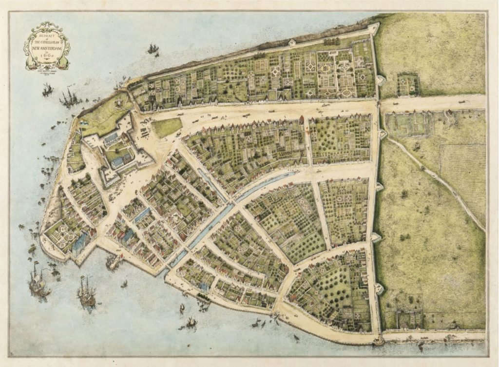
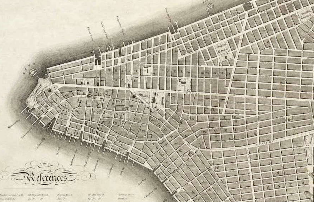
The beginning of Broadway — from a map of New Amsterdam and one from the Commissioners Plan

New York Public Library

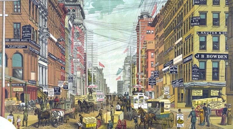
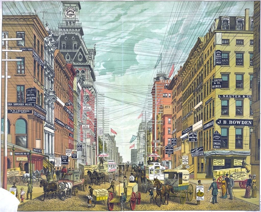
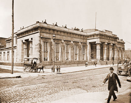
Undated image of the commerce of Broadway. The Western Union building was located on Broadway and Dey Street, placing this view in lower Manhattan. Note the telephone and telegraph wires!

Library of Congress [No Date Recorded on Shelflist Card]

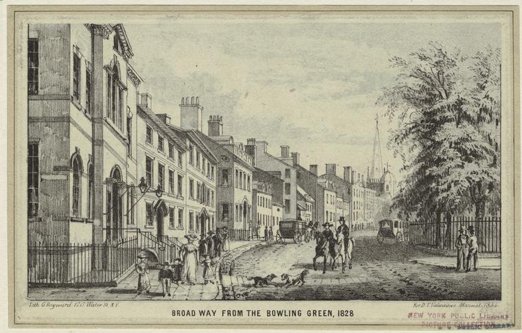
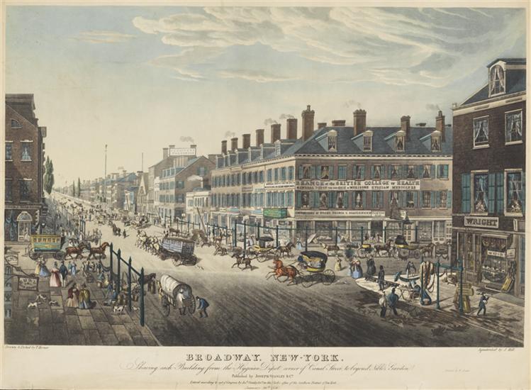
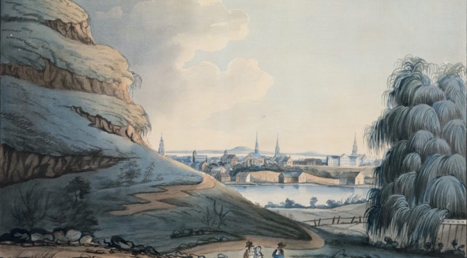
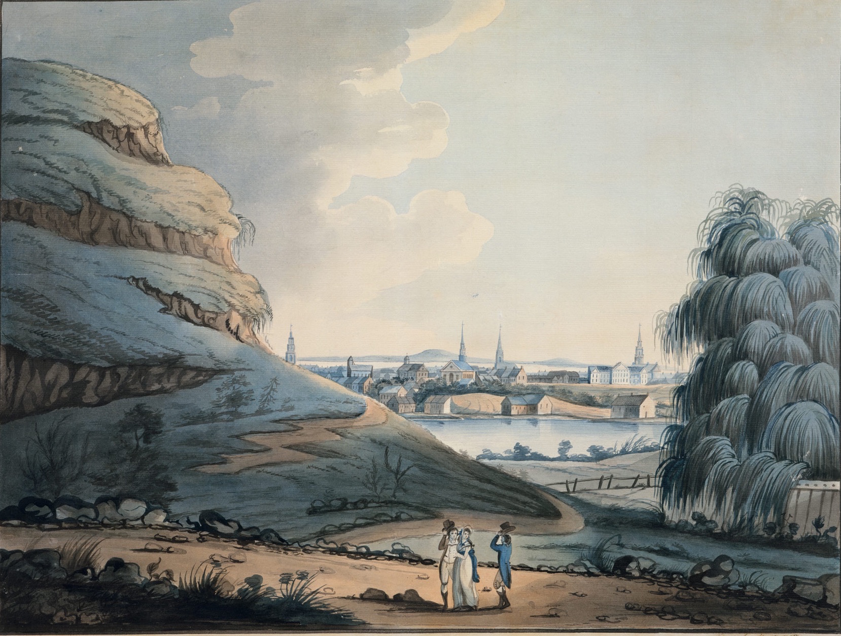
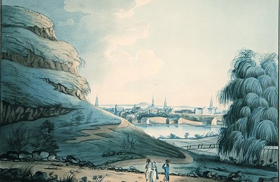
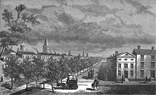
Broadway at Canal Street, 1836, in a lithograph by T. Hornor

Museum of the City of New York

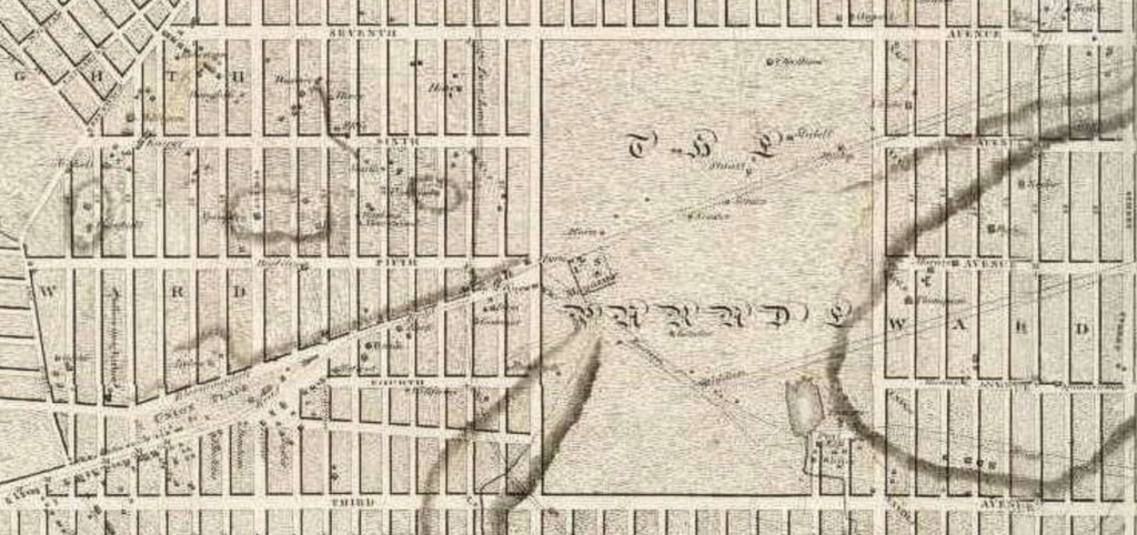
The unique ‘Broadway bend’ that begins on 10th Street, attributed, some say, to the farm of Henry Brevoort.

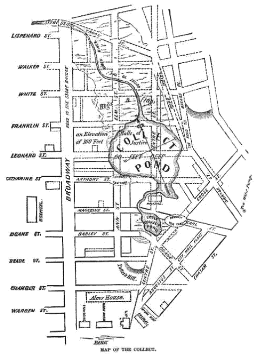
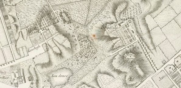
From the Commissioners Plan of 1811, both Broadway and the Bowery were to ‘disappear’ into a massive open space called the Parade.

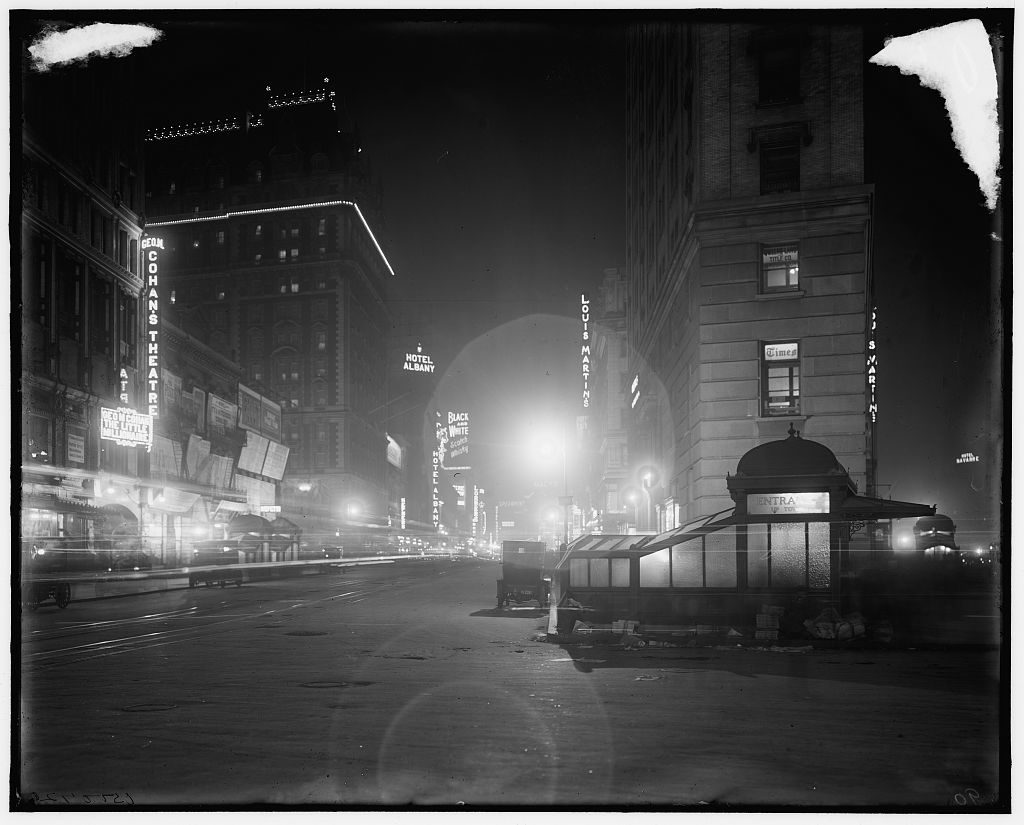
The glamour of Broadway and 42nd Street as it heads into Times Square. Broadway’s many ‘accidental’ plazas are responsible for most of New York’s cultural hubs. Thanks to the subway and proximity to the two major train stations, the ‘center of it all’ seemed to remain in Times Square, even as the city continued to move further northwards.

Library of Congress

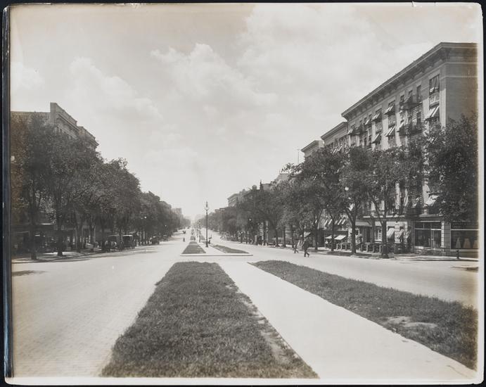
Broadway at West 62nd Street and at West 153rd Street, circa 1900-1915. City planners had an opportunity to make Broadway in upper Manhattan into a grand boulevard, Paris-style.

Museum of the City of New York
Museum City of New York
Categories
Adventures In Old New York

The Story of Bayard’s Mount, Lower Manhattan’s Missing Mountain

Bayard’s Mount, one of the highest points in Manhattan, has been gone for more than two hundred years. Where other hills and high points have been incorporated into the modern topography New York, this old hill was wiped from the map.

Bayard’s Mount used to sit at around where Mott and Grand Streets meet today, in today’s Little Italy. Indeed, back when nearby SoHo was but a dense thicket of oak and tulip trees, the Mount was the best place to view the waters of Collect Pond, the wild northern orchards, and the flat tidal creeks to the west.

A smaller hilltop, called Mount Pleasant, sat to its east and, with the introduction of Europeans, a farm road (Bowery) ran along it. Sitting atop Bayard’s Mount, a person could wile away the day watching travelers going along the Bowery, to and from the city.

A watercolor by artist Archibald Robertson in 1798, looking south, with Bayard’s Mount/Bunker Hill to the left and Collect Pond dead center.

Some reminiscences refer to Bayard’s Mount and Mount Pleasant as the same hill, and they were close enough they seem to be part of the same ridge.

After the territory went from Dutch to British hands in the mid-17th century, most of this property fell into the hands of Nicholas Bayard, and the “small, cone-shaped mount” took on the name of its landowner, who built his sturdy estate just to its north. Even by the early 18th century, Bayard’s family would still have few neighbors; swampy ground prevented much development west, while property to the east eventually belonged to James DeLancey, the governor of the colony.

Below: A later 19th century property map highlights the broken western border of Bayard’s farm. The wetlands known as Lispenard’s Meadow prevented the estate from developing further westward.

The mount took on a more serious purpose with the onset of the Revolutionary War. In March of 1776, “One third of the citizens were ordered out to erect new works; they began a fort upon Mr. Bayard’s Mount near the Bowery.” [source]

This fortification, built in anticipation of a messy battle with the British, was named after a critical battle the year previous at Bunker Hill in Boston; soon, the hill itself took on the name, and in most histories after 1776, this place at today’s Mott and Grand Streets is officially known as Bunker Hill. Notably stationed here at Bunker Hill was Nathan Hale.

There would be no significant altercations here between British troops and the Continental Army. No, in fact, the bloodshed would wait until after the war, when the hilltop would be known as a fashionable place to host your duel.

For instance, in 1787, a disagreement between two French men ended in a duel here and the death of one of them, a “Monsieur Chevalier de Longchamps” who was apparently no stranger to offense and violent response.

Below: From Montressor’s map of Manhattan, 1755, you can see Bayard’s property and both hills — Bayard’s Mount and Mount Pleasant, the elongated hill. The Bowery runs along the bottom right hand of the illustration, with Collect Pond in the bottom left corner. You can also see the grid plan of Bayard’s farm (which was ultimately adapted for the modern street plan of SoHo).


In July 1788, to celebrate the federal ratification of the Constitution, a procession marched through the city and ended its revelry at Bayard’s Mount/Bunker Hill, where “ten enormous tables laden with provisions” and hundreds of pounds of roasted ox were served to hungry patriots. Several years later, in 1795, a different gathering, angered by their governor John Jay over his (perceived) treasonous treaty with the British, burned his portrait in a bonfire here.

Another curious pastime at the hilltop was the British sport of ‘bull baiting’, where a bull would be tied to a stake and slowly tortured by angry dogs. Why this is of any visible amusement is beyond me, although its cousin ‘bear baiting’ is still sometimes practiced in Pakistan.

Below: A bit of this nasty little pastime out in Long Island as it was advertised in 1774

New York was outgrowing the southern point of Manhattan, and former deterrents for expansion — the marshes of Lispinard’s Meadow, polluted Collect Pond, and of course, Bayard’s Mount — were slated for elimination. The ponds and marshes would soon be drained, creating Canal Street, and Broadway expanded further north. (Listen to our podcast on Collect Pond and Canal Street for more information.) By then, Bayard’s was but a memory.

Beginning in 1802, workmen began levelling Bayard’s Mount and Mount Pleasant which also included moving the old Bayard family crypt which had its entrance at the bottom of the hill. Unfortunately, it was discovered that a “hermit or ragman” had moved into the vault and turned it into his very own macabre home. Remarkably, the man was allowed to live there — “he was somewhat feared and not much troubled by visitors” — until he was found one day dead in the vault.

By the time Collect Pond was completely drained (around 1811), the hills to its north had gone, replaced with land lots and the first hints of townhouses and new businesses.

Below: From an 1821 New York Evening Post, an advertisement for plots on the old Bayard farm — at Bayard Street and Mott Street, just a couple blocks south of the location of the Mount

Another clipping from an 1888 New York Evening World, recalling the landscape here:


Below: The approximate position of where Bayard’s Mount would have been:


View Larger Map


A version of this article originally ran in October 2010

Categories
Podcasts

PODCAST: Collect Pond and Canal Street

Collect Pond (and what I assume to be Bunker Hill) as depicted in watercolors by artist Archibald Robertson in 1798

We celebrate a year of New York City history podcasting by re-visiting the topic of our very first show.

Downtown Civic Center used to have a big ole pond in the middle of it which provided drinking water for the island’s first inhabitants.

What happened to it, why is it important today and how did it give rise to Canal Street, New York’s biggest traffic thoroughfare?

From the Mannahatta Project, a visualization of downtown Manhattan, with Collect Pond and acres of forest

Hard to believe, but this is downtown Manhattan and Collect Pond

An early 19th century map of Collect Pond and the streets that usurped it. (Click into it to see details.)

A mid-century depiction of Five Points, this corner in particular being where Paradise Square sprang up, an ambitious residential project doomed by soggy land and noxious odors

The Tombs Prison, in 1890, before being condemned. Its squalid conditions are legendary and are due in part to unsatisfactory construction over the former Collect Pond area

The early days of Canal Street. The actual foul-smellin canal was concealed with a row of lovely trees shielding the new tenements and businesses surrounding it

A tiny park surrounded by government buildings pays homage to the early (and far more natural) days

The most dramatic reminder of the neighborhood’s early days, however, is the African Burial Ground Memorial, which opened last year