Categories
It's Showtime Podcasts

The Broadway Musical: A trip through American theater history


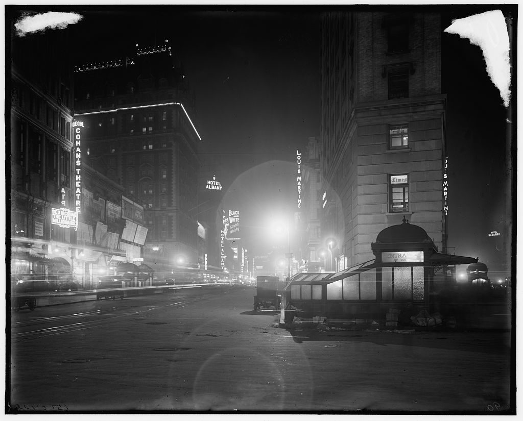
The Broadway Musical is one of New York City’s greatest inventions, over 150 years in the making! It’s one of the truly American art forms, fueling one of the city’s most vibrant entertainment businesses and defining its most popular tourist attraction — Times Square.

 But why Broadway, exactly? Why not the Bowery or Fifth Avenue? And how did our fair city go from simple vaudeville and minstrel shows to Shuffle Along, Irene and Show Boat, surely the most influential musical of the Jazz Age?

This podcast is an epic, a wild musical adventure in itself, full of musical interludes, zipping through the evolution of musical entertainment in New York City, as it races up the ‘main seam’ of Manhattan — the avenue of Broadway.

We are proud to present a tour up New York City’s most famous street, past some of the greatest theaters and shows that have ever won acclaim here, from the wacky (and highly copied) imports of Gilbert & Sullivan to the dancing girls and singing sensations of the Ziegfeld revue tradition.

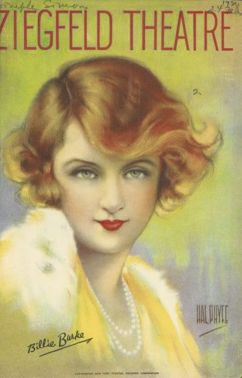
CO-STARRING: Well, some of the biggest names in songwriting, composing and singing. And even a dog who talks in German!  At right: Billie Burke from a latter-year Follies. (NYPL)

This show, originally recorded in 2013, has been re-edited, remastered and even includes extra material which was cut from the original episode.

LISTEN NOW: THE BIRTH OF THE BROADWAY MUSICAL


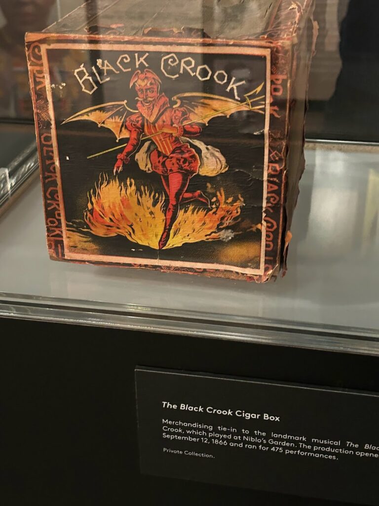
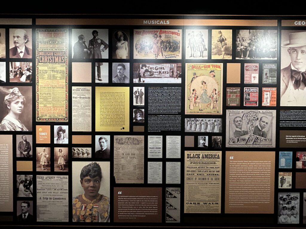
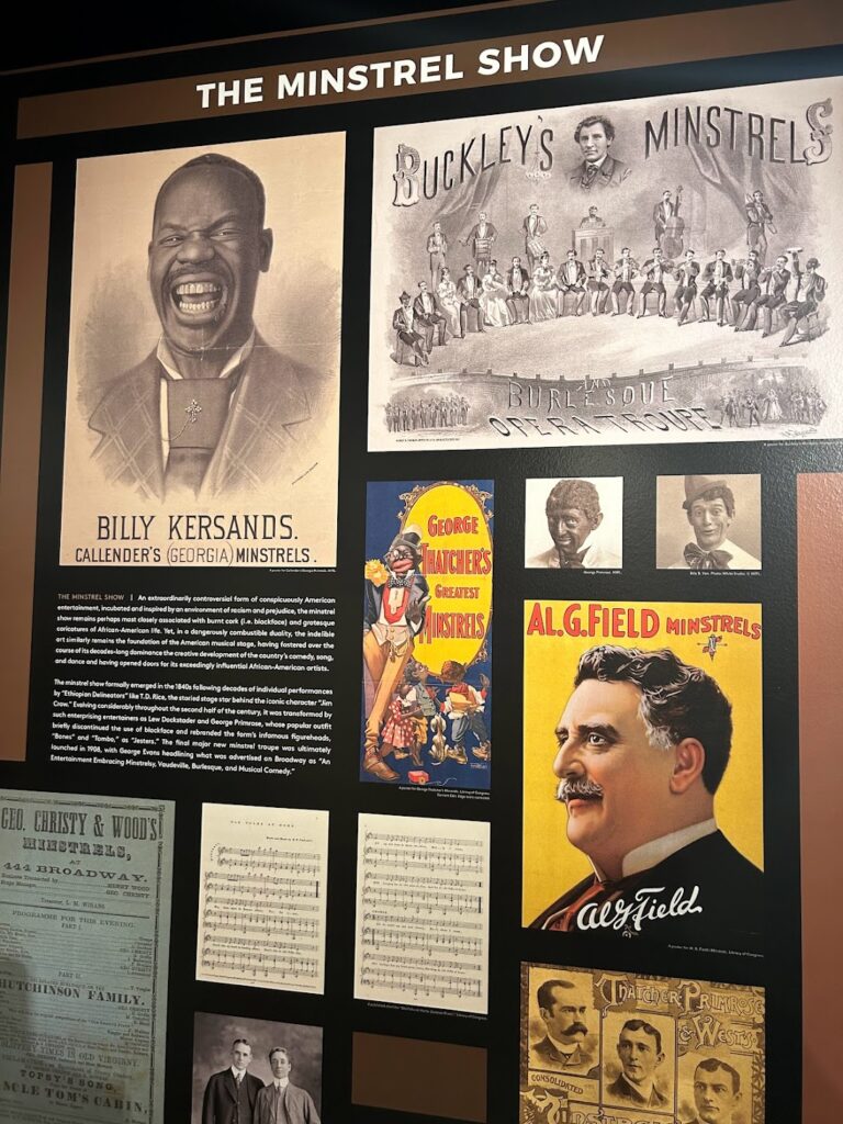
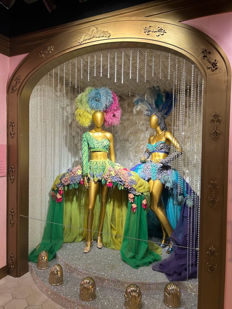
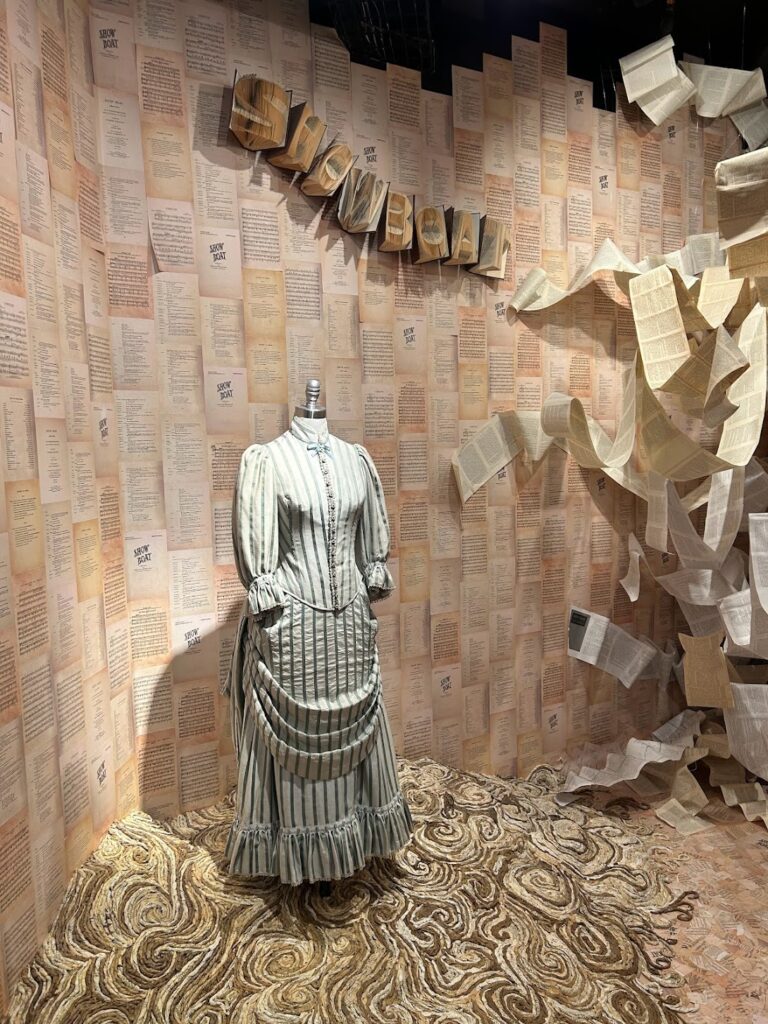
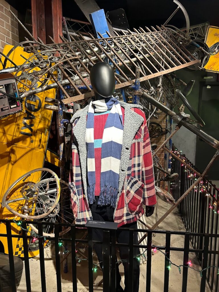
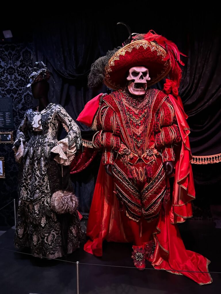
A few images from Greg’s trip to the Museum of Broadway at 145 West 45th Street.

The Black Crook
Ziegfeld Follies
Showboat
Rent
The Phantom of the Opera

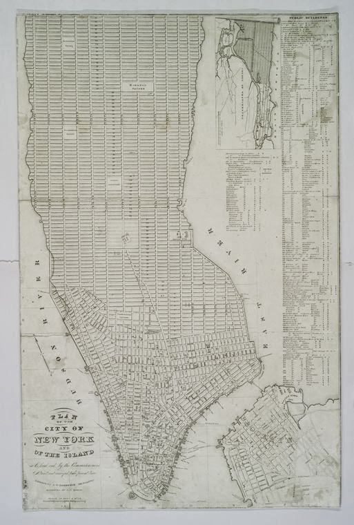
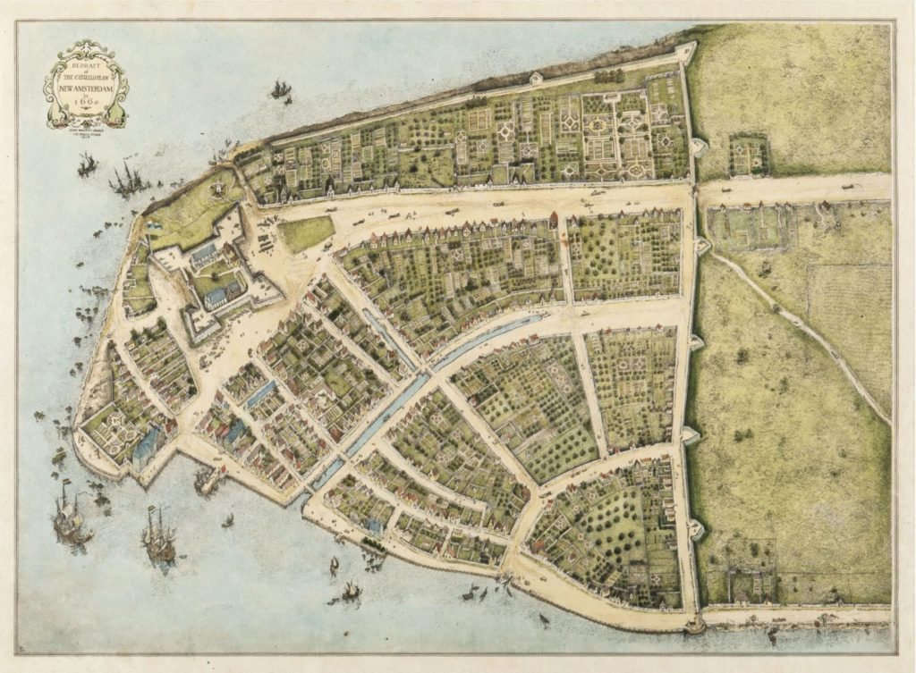
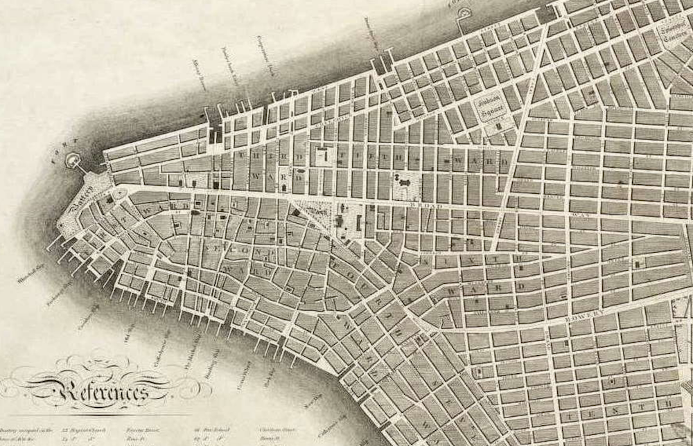
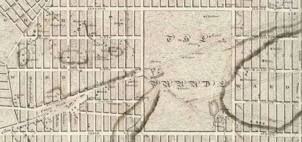
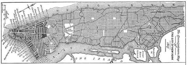
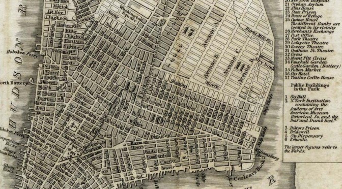
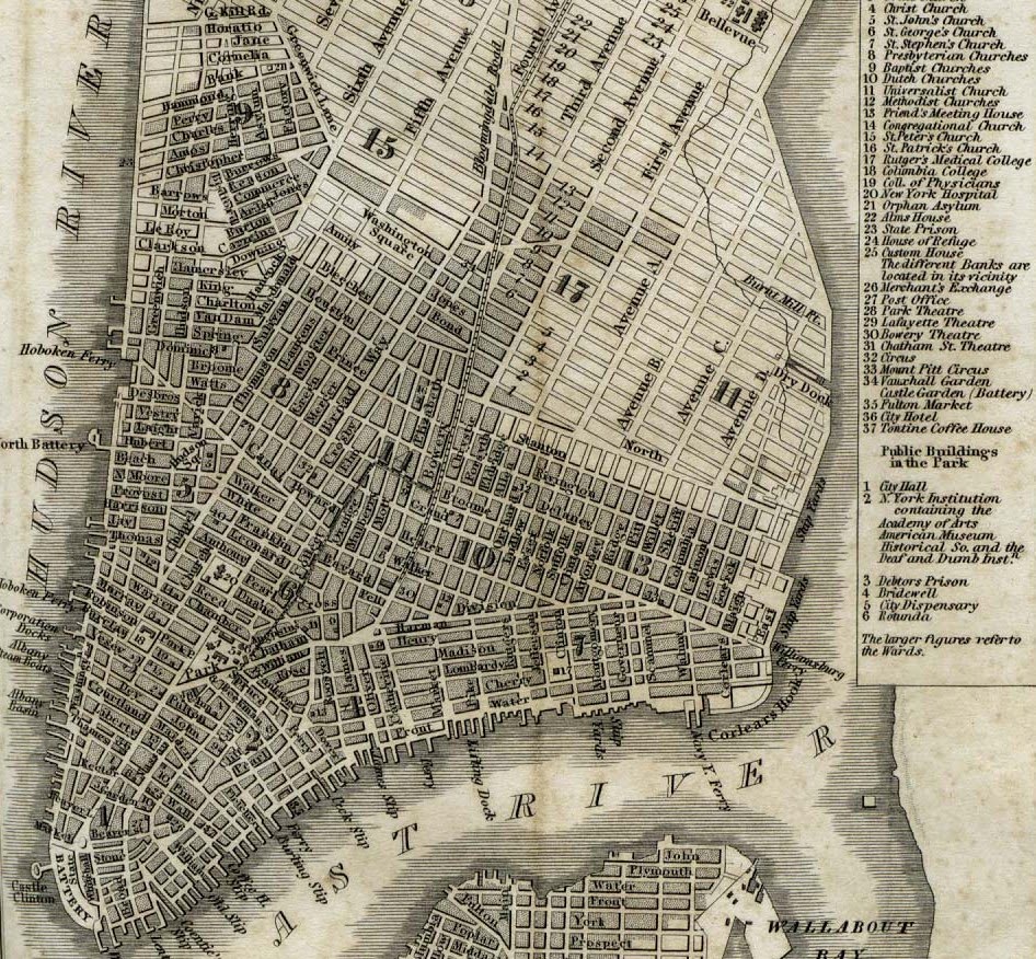
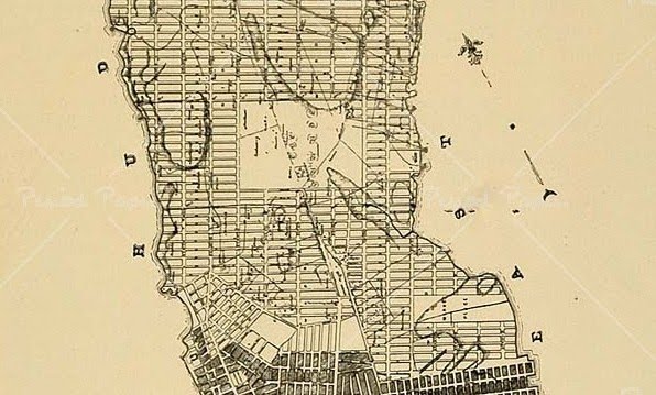
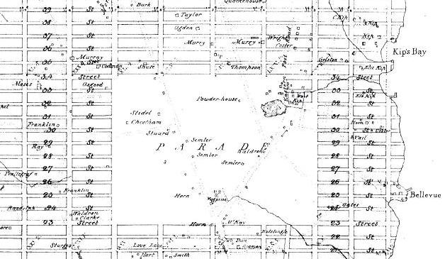
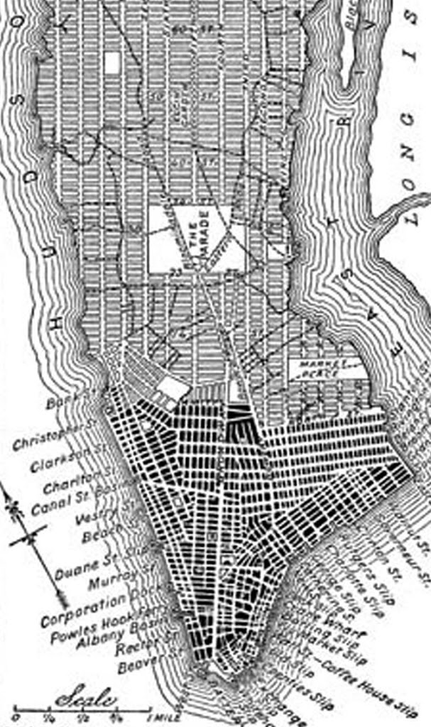
The original grid plan from 1811. As you can see, Broadway was not meant to extend further than the Parade Ground, the largest planned plaza from the Commissioner’s Plan. Years later, the Parade Ground was reduced (becoming Madison Square) and Broadway was allowed to break the grid, creating plazas conducive for transportation and public gathering. (NYPL)

New York Public Library

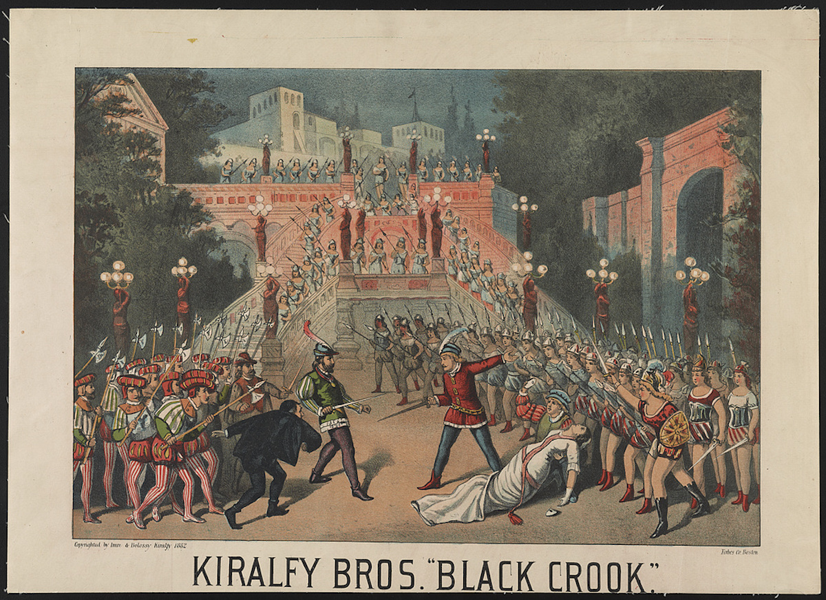
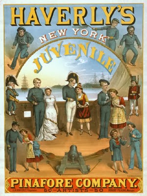
One of dozens of knock-off productions of HMS Pinafore, this one featuring children:

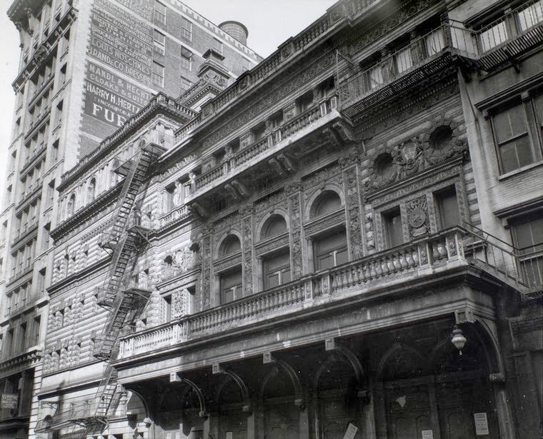
The facade of the Fifth Avenue Theater, once located at 1185 Broadway. Why was it called the Fifth Avenue Theater then? Possibly to just make the society ladies feel at home here!  This was home to three Gilbert & Sullivan original productions, including the premiere of The Pirates of Penzance.

The Florodora girls, from the hugely successful 1900 musical comedy which debuted at the Casino Theater. (NYPL)

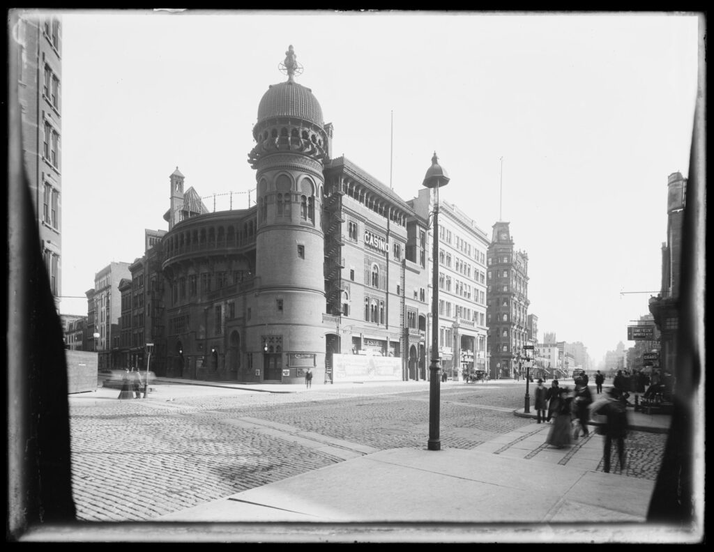
The Casino Theatre at West 39th Street and Broadway.

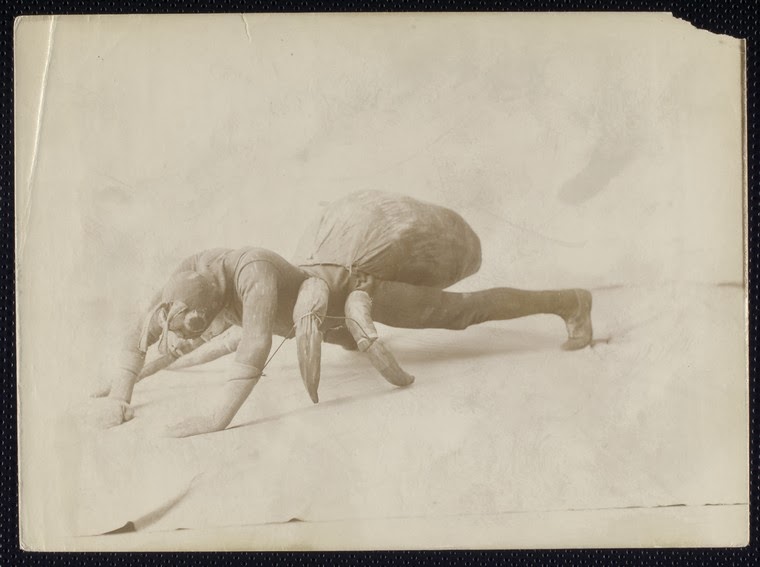
One of the more fantastic creatures from Victor Herbert’s Babes In Toyland, which made its debut in Columbus Circle’s Majectic Theater. You can read my article here on the musical which inspired Herbert’s show, the musical version of The Wizard of Oz. (NYPL)

New York Public Library

George M Cohan singing “Over There”

Video of a Ziegfeld Follies from 1929, a bit past their heyday, actually. They would only last until 1931:

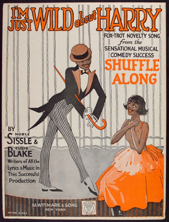
Sheet music from 1921 of one of the most famous songs from Shuffle Along (NYPL):

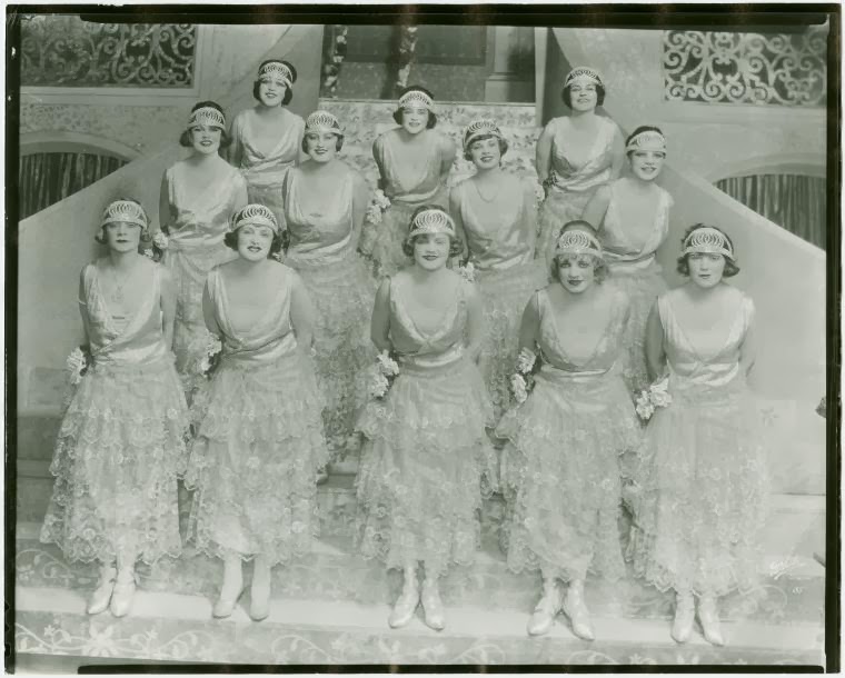
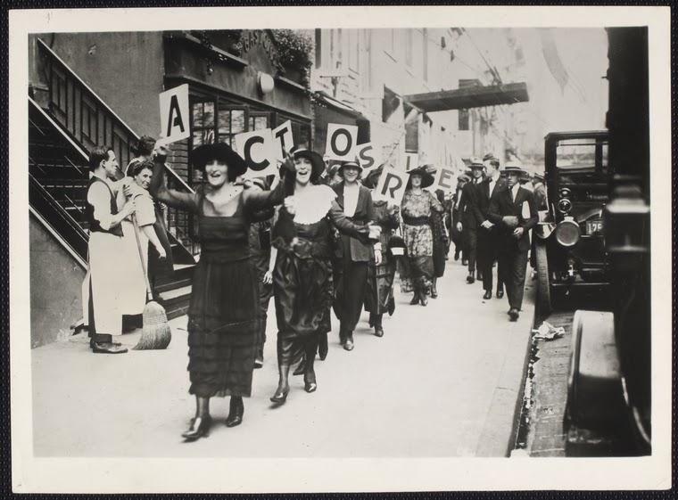
Dancing girls during the Actors Strike of 1919, which galvanized the industry and gave regular New Yorkers a window into the tough conditions faced by many background performers. (NYPL)

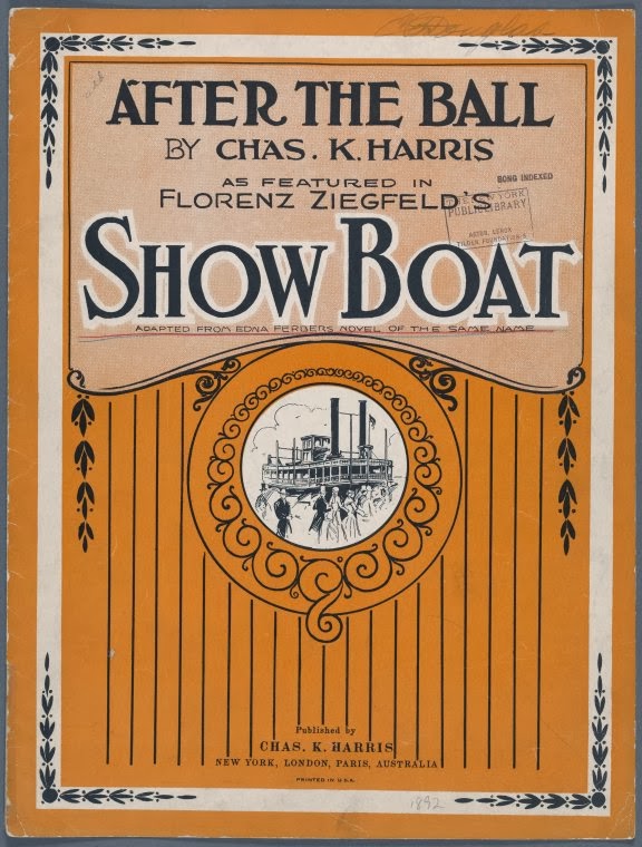
So the number ‘After The Ball’ — a huge hit song that made its stage debut in A Trip To Chinatown — made a return appearance to Broadway in 1927’s Show Boat!

Musical cues from this week’s show:
Give My Regards To Broadway and After the Ball performed by Billy Murray
A version of Make Believe recorded by Bing Crosby, and Ol Man River, performed by Paul Robeson, from a 1932 cast recording, featuring Victor Young and His Orchestra
Love Will Find A Way, from a 1921 recording by Eubie Blake
Selection from HMS Pinafore, from a 1914 recording by the Victory Light Opera Chorus

 And finally, a clip from the film version of ‘Show Boat’, featuring an iconic performance by Paul Robeson.
 

Categories
Landmarks Podcasts

The Origin of Broadway: The Story of a Street

PODCAST What makes a street so extraordinary that it becomes a destination in itself? What makes it Broadway? This is the history of New York City’s most famous street and a progression through the entire history of the city.

In this episode, Tom is joined by Fran Leadon, the author of a new history of Broadway, called Broadway: A History of New York in 13 Miles.

We’ve discussed Broadway, the street, in just about every show we’ve done — as so many of the city’s key events have taken place along Broadway or near it. And that’s also the point of Fran’s book — by telling the story of a street, you’re actually telling the story of the entire city.

On today’s show, we’ll be discussing how Broadway moved north — literally, how did it expand, overcoming natural obstacles and merging with… or avoiding… old, pre-existing roads, and how did it take such an unusual route?

And perhaps most surprisingly, how did Broadway survive the Commissioner’s Plan of 1811 which imposed a rigid street grid on the city?

You’re in for a few surprises.

To download this episode and subscribe to our show for free, visit iTunes or other podcasting services or get it straight from our satellite site.

You can also listen to the show on OvercastGoogle Music and Stitcher streaming radio.

________________________________________________________

The Bowery Boys: New York City History podcast is brought to you …. by you!

We are now producing a new Bowery Boys podcast every other week. We’re also looking to improve the show in other ways and expand in other ways as well — through publishing, social media, live events and other forms of media. But we can only do this with your help!

We are now a member of Patreon, a patronage platform where you can support your favorite content creators for as little as a $1 a month.

Please visit our page on Patreon and watch a short video of us recording the show and talking about our expansion plans. If you’d like to help out, there are five different pledge levels (and with clever names too — Mannahatta, New Amsterdam, Five Points, Gilded Age, Jazz Age and Empire State). Check them out and consider being a sponsor.

We greatly appreciate our listeners and readers and thank you for joining us on this journey so far.

_______________________________________________________

You can read Greg’s review of Fran Leadon’s book from a couple months ago here. “Fran Leadon, an architect and co-author of fifth edition of the AIA Guide to New York City, is a perfect biographer for Broadway, a main character in the development of one of the world’s great cities. His book is dense, richly written and researched, loaded with a million fun anecdotes.”

The beginning of Broadway — from a map of New Amsterdam and one from the Commissioners Plan

New York Public Library

Undated image of the commerce of Broadway. The Western Union building was located on Broadway and Dey Street, placing this view in lower Manhattan. Note the telephone and telegraph wires!

Library of Congress [No Date Recorded on Shelflist Card]

Broadway at Canal Street, 1836, in a lithograph by T. Hornor

Museum of the City of New York

The unique ‘Broadway bend’ that begins on 10th Street, attributed, some say, to the farm of Henry Brevoort.

From the Commissioners Plan of 1811, both Broadway and the Bowery were to ‘disappear’ into a massive open space called the Parade.

The glamour of Broadway and 42nd Street as it heads into Times Square. Broadway’s many ‘accidental’ plazas are responsible for most of New York’s cultural hubs. Thanks to the subway and proximity to the two major train stations, the ‘center of it all’ seemed to remain in Times Square, even as the city continued to move further northwards.

Library of Congress

Broadway at West 62nd Street and at West 153rd Street, circa 1900-1915. City planners had an opportunity to make Broadway in upper Manhattan into a grand boulevard, Paris-style.

Museum of the City of New York
Museum City of New York
Categories
Parks and Recreation

Marks of the grid: A remarkable find in Central Park

So this random little bolt in a rock may not look like much, but it could be the last remaining on-site evidence of the creation of New York City’s grid plan.

Inspired by Marguerite Holloway’s book ‘The Measure of Manhattan‘, I went looking for this unusual object hidden in Central Park, discovered by geographers several years ago and believed to be a bolt used in the original survey of Manhattan by John Randel Jr. in the 1810s.

Randel and his team poured over the island, marking spots along a delineated grid that would become the intersection of streets and avenues.  Reuben Sky Rose-Redwood, one of the researchers who discovered the odd bolt, believes it’s from Randel’s original survey due to its placement.

Indeed this would have be the exact location of an upper Manhattan intersection had Central Park not been carved out in the 1850s.  If this random little bolt is indeed part of that original survey, then it’s truly an extraordinary link to New York City history.

I’m not going to reveal the location of the bolt, but you can search around the web for clues to its whereabouts.  Needless to say, if you do go on a hunt for this potential key to the Manhattan grid plan, please leave it be if you find it.  (Also, this means you’re a bonafide history geek like me. Congratulations!)

If it’s ever definitively confirmed to be a tool of Randel’s, hopefully the park will provide some kind of protection.  Rarely does one find historical objects in situ.

Categories
Bowery Boys Bookshelf

‘The Measure of Manhattan’: The grid plan of New York comes to life, as does its eccentric creator


BOWERY BOYS BOOK OF THE MONTH Each month I’ll pick a book — either brand new or old, fiction or non-fiction — that offers an intriguing take on New York City history, something that uses history in a way that’s unconventional and different or exposes a previously unseen corner of our city’s complicated past.  Then over the next month, I’ll run an article or two about some of historical themes that are brought up in the selection. 


The Measure of Manhattan: 
The Tumultuous Career and Surprising Legacy of John Randel Jr.
by Marguerite Holloway
WW Norton & Company

The man at the center of Marguerite Holloway’s ‘The Measure of Manhattan’ is a genuine riddle.

The surveyor John Randel Jr. rarely wrote about himself, jotting down observations of land elevation and incompetent workmen as he mapped out the legendary grid plan along the island of Manhattan.

This ambitious task, occurring early in his career, would assure his place as a pivotal, if quiet, figure in American history.  During this period, he is studious, focused and, let’s just say it, a mite uninteresting.  But just as the grid is completed, Randel’s personal story comes to life.

A traditional historian might not know what to do with the life of Randel, a man who ages into astonishing eccentricity and temperament.  But.Holloway, a journalism professor at Columbia University, treats this story as a two-fold mystery, turning something that could into a real unexpected — and often unpredictable — treat.

Her first concern is the grid itself, the orderly row of streets and avenues that arose out of the former hills and streams of Manhattan, following researchers who are attempting to determine how drastically the landscape has been altered over the years.

Evidence of the original surveying job — which sliced through private property and reorganized nature into something unrelenting and orderly — can be found in Central Park.  In fact, a bolt sits lodged in a rock, the last remaining evidence of Randel’s assiduous work.  It’s an astonishing discovery.

As is Randel, the man who probably put it there.  The young surveyor, taken under wing by the well connected DeWitt family at the start of the 19th century, worked on the grids to Manhattan and Albany before he was 30 years old, braving the wrath of farmers to mark rectangles in the landscape.  So unusual was the island’s terrain that Randel invented his own surveying equipment specifically suited for the job at hand.

But even as Holloway goes deep into Randel’s technique, there appears to be a vacuum at the center of the story.  Randel’s personality seems opaque, even non-existent.  But wait.

The most fascinating aspects to Randel’s character come after the grid is completed, when the surveyor attempts to cash in on his remarkable accomplishment.  He naturally attempts to sell copies of his maps but, in these heady days before copyright, is thwarted by a competitor who basically duplicates his work

From that point, he seems to spend as much time in lawsuits as he does doing field work.  He goes to work on an upstate length of the Erie Canal, only to annoy his peers and tarnish his reputation.  Is it professional jealousy at Randel’s enormous skills, or is the great, embittered surveyor becoming obstinate?

As Benjamin Wright, canal engineer and enemy of Randel’s, once said of his rival in 1824: “I think him the most complete hypocritical lying nincompoop (and I might say scoundrel if it was a Gentlemanly word)…..”

At left: A notice for another of Randel’s great projects, the New Castle and Frenchtown railroad, the first railroad in Delaware 

Far from a career of increasingly applauded works, Randel becomes stepped in controversy at every turn, even as he moves from canals to railroads.  He’s perpetually strapped for cash, even attempting to build his own estate (amusingly called Randelia) with unfortunate results.  In a desperate act of “piracy”, according to the author, he even attempts to collect his very own tolls from a canal he himself surveyed and engineered!

Holloway, employing an extraordinary depth of research, describes a man of great talent who gets ripped asunder by America’s rapid growth, defined not by accomplishment but debt.  In a way, this is as pure an American story as it gets.

The tale often pulls back at times to modern day, constantly reminding us of Randel’s most stunning accomplishment, a New York grid plan so implanted that it seems impossible to imagine that anything else ever existed here.  In particular she turns her focus to Eric Sanderson and his amazing 2009 Mannahatta project, pulling a reverse-Randel in trying to map out the original landscape as it appeared in the year 1609.

Randel returns to New York near the end of his life for the industrial exhibition held at the Crystal Palace in 1853, America’s first great show of its technological prowess. It is here that Randel reveals his last, greatest idea — an elevated railroad transporting passengers up and down the length of avenues he had himself marked over forty years earlier.

His visionary ideas were rejected.  Over fifteen years later, well after Randel’s death, New York built an elevated railroad anyway.

Categories
Bowery Boys Bookshelf

‘The Greatest Grid’ and an even greater book

Reason to love New York No. 12,306: A museum honoring the city’s history has a hit on its hands with an elaborate show about surveying and real estate.

The Greatest Grid: The Master Plan of Manhattan 1811-2011, the smash-hit exhibition at the Museum of the City of New York, is the most fully realized and in-depth show they’ve produced in a few years, and it’s done almost entirely without the help of traditional three-dimensional objects.  (The show has also been extended, until July 15.)

The story of the Commissioners Plan of 1811 and the effects of the Manhattan grid plan are wondrously illustrated with an extraordinary collection of maps and photographs, documenting the island’s almost century-long conversion into a major metropolis. The most substantial, non-printed object is a small marble surveying post.

But there’s a problem with a show based on maps. You actually want to touch things, draw your finger along familiar areas, and stand staring at pictures unfamiliar landscapes, trying to find evidence of your present street corner. More than once I caught myself poking an artifact in sudden amazement. (My apologizes to the museum curators.)

This is what makes the exhibit’s companion volume ‘The Greatest Grid: The Master Plan of Manhattan 1811-2011‘, edited by Hilary Ballon, pretty much invaluable. Published in a slender landscape binding, the book condenses the exhibition but allows for unabated curiosity and imaginative wanderings over vivid prints of aged topography.

This exhibit stands in contrast with Mannahatta/Manhattan, another excellent show from 2009 which aroused New York history lovers. Mannahatta was map-based, but pure speculation, an imagining of what the island was like before European habitation. ‘The Greatest Grid’ starts from many of the same sources — the Mannahatta Project was built upon early 18th century topographical maps — but elaborates forth upon the present landscape with stunningly detailed drawings of almost every inch of Manhattan.

While the show gives nods to the original three commissioners — and of course to John Randel, the surveyor tasked with outlining every foot of land — it’s the later applications of the grid plan that I found most fascinating. The book reprints images of country homes next to street plans that would shortly cut through the property. It’s a melancholy display, I guess, the destruction of natural beauty has rarely been as fascinating.

Original surveying maps are complemented with lithographs and photography illustrating the final product, in some cases carved blocks with lonely structures, waiting for the city to catch up to them. The companion guide, stuffed with short essays and full-bodied artifact descriptions by museum staff, reprints almost every image from the show.

Many such exhibition books suffer from the transfer. As an extreme example, last year’s lustrous, blockbuster Alexander McQueen exhibit at the Metropolitan Museum of Art was rendered into a diminutive curio with its accompanying companion book. ‘The Greatest Grid’ suffers no such problem, especially to those of us who find tinted topographical maps and black-and-white images of old New York as scintillating as haute couture.

——
Our podcast on the Commissioners Plan of 1811 merely skims the surface of material presented in ‘The Greatest Grid’, but I think it makes for a fine introduction. And I’m not ashamed to say we spend quite a bit of time talking about Gouverneur Morris. [You can download it from here.]

Categories
Uncategorized

Notes from the Podcast (#122) The Manhattan Grid Plan

From H.S. Tanner’s ‘The American Traveller; or Guide Through the United States’, 1836 (book published book 1840)

Stuyvesant Street is mentioned as one of the few streets in New York that was allowed to break the grid, and its diagonal path between Second and Third avenues is a reminder of the original farm grid of Peter Stuyvesant. But as a few listeners have pointed out, it holds another unique distinction.

The original estate owners of Manhattan often carved up their own lands into the shape of small grids. For instance, the grid of the DeLancey farm is still impressed upon the Lower East Side below Delancey Street. The Stuyvesants also had a system of streets on their property that ran true east to west. (Manhattan is obviously not on a true north-south axis, and its grid streets do not truly run east to west, but progress at a slight diagonal. Charles Petzold has a very detailed article on the island’s true orientation.)

Thus, Stuyvesant Street is the only street in Manhattan that actually runs east to west. Walk its length with a compass and be amazed!

—–

Not too far from Stuyvesant Street is the beginning of grid plan, First Street and First Avenue, Kramer’s “nexus of the universe”. This is the spot were near-uniformity along New York’s streets and avenues begins.

The southern border of the grid plan was, ironically, called North Street at the time, for it was truly north of the city. As I mentioned back in the Niblo’s Garden podcast, today’s Houston Street is actually the adjoining of two roads, the other being a path that cut through the property of Nicholas Bayard, land that is today’s SoHo. Bayard renamed his street after his daughter’s new husband, the esteemed Georgian patriot William Houstoun. Later, it made sense to link Houstoun’s street to North Street, and thus the whole thing was called Houston Street (with a ‘u’ vanishing in the process).
—–

The occasion of the Commissioners Plan is presents a good opportunity to peer into the extraordinary collection of old New York maps in the David Rumsey Collection. The original 1811 Randel maps are there, as well as others that chart the course of development during the 19th Century. This Tanner map from 1836 shows the grid progressing nicely.
—–

So, if I didn’t quite get it across on the show, let me say it now: Gouverneur Morris is awesome. I devoured two different biographies on the controversial Founding Father, and I highly recommended them both. Although Richard Brookhiser’s “Gentleman Revolutionary” is a breezier read, the quieter “Gouverneur Morris: An Independent Life” by William Howard Adams still makes room for some salacious details.
—–

And to repeat one major CORRECTION: Due to my complete misreading of my own handwritten notes and in the flurry of wrapping up the show, I said that Manhattanhenge occurs on March 28 and July 12 or July 13. I meant MAY 28, not March 28.

Categories
Health and Living Podcasts

Building Blocks: The Commissioners Plan of 1811, inventing a New York grid of streets and avenues

The simplicity of the New York grid system, seen overhead in a 1939 classic photo by Margaret Bourke-White.

PODCAST The Commissioners Plan of 1811 How did Manhattan get its orderly rows of numbered streets and avenues? In the early 19th century, New York was growing rapidly, but the new development was confined on an island, giving city planners a rare opportunity to mold a modern city that was orderly, sophisticated and even (they thought at the time) healthy. With the Commissioners Plan of 1811, uniform blocks were created without regards to hills and streams or even to the owners of the property!

Join us as we recount this monumental event in New York’s history — how land above Houston Street was radically transformed and also how the city revolted in many places. What about those avenues A, B, C and D? Why doesn’t the West Village snap to the grid? And why on earth did the early planners not arrange for any major parks?!

ALSO: A podcast within a podcast as we focus on the biography of one of those commissioners. Give it up for Gouverneur Morris, the casanova with Constitutional connections, a Bronx estate and a wooden pegleg.


CORRECTION: Due to my complete misreading of my own handwritten notes and in the flurry of wrapping up the show, I said that Manhattanhenge occurs on March 28 and July 12 or July 13. I meant MAY 28, not March 28. Chalk this one up to my senility. I apologize for the error.

An early view of the area that would one day become the Lower East Side, SoHo and Chinatown: a network of farms and jagged roads, with some organization on individual properties. This map features details of James DeLancey’s farm. That property would be carved up after the war. (You can check out the whole 1767 map here.)

Gouverneur Morris, the Founding Father who led the commission to plan New York’s future streets and avenue.

A detail from the original 1811 grid plan map of John Randel. The grid starts at irregular intervals due to keeping Greenwich Village intact, but begins right about Houston Street to the east. As it heads north, two big interupptions were planned — a market place in east around 10th-11th Street and a ‘parade ground’ about 23rd Street.

A close-up on the parade ground.

Not everything conforms to the original plan. Take Stuyvestant Street in the East Village. A main thoroughfare into the original estate of the Stuyvesant family, the small road was allowed to break the block between 9th and 10th streets. The street is hardly recognizable in this extraordinary photo from 1856, but the top of St. Mark’s Church gives away the location. (Courtesy East Village Transitions)

Crossroads: Herald Square, on a hot summers day in 1936. The intersection was partially created by the grid plan (the intersection of 34th Street and Sixth Avenue) and by one feature that later city planners ignored: Broadway which, according to the plan, was never supposed to extend past 23rd Street. (NYPL)

Here’s a look at the entire Randel map in color.

Check out the New York Times wonderful interactive map, overlaying the original plan on top of modern changes to the city.

Bloomberg’s Time Square plan: a blast from the past?

ABOVE: Park Avenue — before the cars came

I’ve posted the extraordinary picture above of pre-1920s Park Avenue a couple times in the past, but I wanted to do so again in light of Michael Bloomberg’s recent proposal to turn Times Square and Herald Square into partial traffic-free plazas. His plan calls for “traffic lanes along Broadway from 42nd to 47th streets and from 32nd to 35th streets” to be “transformed into pedestrian lanes”, with the residual traffic flowing down a Seventh Avenue refitted for four lanes.

The notion of creating public space out of vehicular traffic areas in Manhattan flies in the face of what used to be called ‘progress’ — at least in the Fiorello Laguardia/Robert Moses definition of the word.

In a way, you can say this type of reversal for the benefit of pedestrians actually began in the 19th century, before the roads were paved. When the original commissioners plan of 1811 was initiated, the intention was to direct the city’s growth and organize a rational method of parcelling out the city to developers. In doing so, it sliced up Manhattan as though it were an ice tray, rows of uniform blocks in a cross-section of streets and avenues. However, there were few parks in that original plan (at right).

In practice, however, some virtual streets were transformed into public spaces once it seemed obvious that uninterrupted rows of development would cause for an unlivable city. Notably, Central Park was envisioned in the 1850s as a way to break up the grid. (The Parks Department actually has a nice short history on this 19th century struggle.)

Another major shift towards a pedestrian driven city occurred with the disappearance of the elevated trains and creation of the subway system, opening up darkened city streets and creating new public spaces. Additionally, as in the picture above, once Grand Central began hiding its train tracks underground, the newly created real estate above it became, you know, a park avenue.

Social activism at the turn of the century, led by Jacob Riis and others, made a play at eliminating decrepit slums in exchange for pedestrian areas. For instance, Most of Five Points was wiped from the map to become Columbus Park and various governmental buildings. Swaths of land in the Lower East Side were cleared of tenements to become open space, like the Sara Delano Roosevelt Park.

Below: In this picture from 1932, tenements between Chrystie and Forsyth have been eliminated to make way for the future Sara Delano Roosevelt Park.

Robert Moses liked his parks, but he also loved his expressways, and he created both at the expense of the neighborhoods they were supposedly to have served. But Manhattan was becoming a latticework of traffic congestion well before that; everywhere you looked, streets were widened to accomodate vehicles — first carriages and trolleys, later cars and buses.

Bloomberg’s ambitions stem from a more environmental motivation, with newly installed bike lanes, pedestrian spaces in the Meatpacking District and Madison Square, and last year’s temporary no-traffic days on Park Avenue. His midtown plans, to be installed this summer, may become permanent. Below: A rendering of his virtual Herald Square:

Who is Christopher? The story of a street

The events of the Stonewall Riots so reverberate within the international gay community that the thousands-strong Pride Parade every June ends here every year, while over in Europe (specifically major cities in Germany), their annual celebration is actually called Christopher Street Day. But the Christopher of Christopher Street would most likely be scandalized to learn the how his name is being used.

As we mentioned in this week’s podcast, the quirky street patterns of the West Village are a preservation of many original footpaths from the neighborhood’s early days as farm land. When the 1811 Commissioners’ Plan neatly divided the city into an easily navigable grid, the citizens of the village bucked the city’s advances and kept most of its jagged character intact.

The path that would become Christopher Street passed along the edge of the estate of British admiral Sir Peter Warren, an Irish daring-do from the early 18th Century whose fervid support of imperial England belied a equal love for the town of New York. He also owned one of the largest mansions in New York’s rich countryside, i.e. today’s Greenwich Village.

Warren’s wife kept reign over the manor (and their many slave holdings) while Warren was away on war adventures, and her daughters married well, including her youngest who was betrothed to another Manhattan landowner James De Lancey, who provides his name to Delancey Street today. Another daughter married a British colonel William Skinner, and the Warrens honored the engagement by naming the path that bordered their property Skinner Road.

The descendants of Warren clan kept their countryside property even in post-Revolutionary New York, but as the city crept past its original border, their lands became more valuable and they were eventually parceled into smaller lots. In 1799 the property that included Skinner Road fell into the hands of a trustee of the Warren estate Richard Amos.

Amos was quick to lob off sections of the property and sell to others. But he kept a sizable portion and passed it to his relative Charles Christopher Amos, who then apparently took to the unoriginal idea of giving the roads on his property various parts of his own name — Amos Street (today’s 10th Street), Charles Street (which still exists today), and the former Skinner Road, now newly named Christopher Street. By the 1820s, the former farmland had lost its bucolic character and became a part of the New York urban landscape, with Christopher Street, lined with businesses, the Village’s commercial center.

By the way, the white sculpture of Christopher Park are designed by George Segal and were placed in the park in 1992. The piece entitled Gay Liberation features two gay male figures standing next two seated lesbians. Depending on the time of day, the sculptures are either extremely charming or a little creepy.