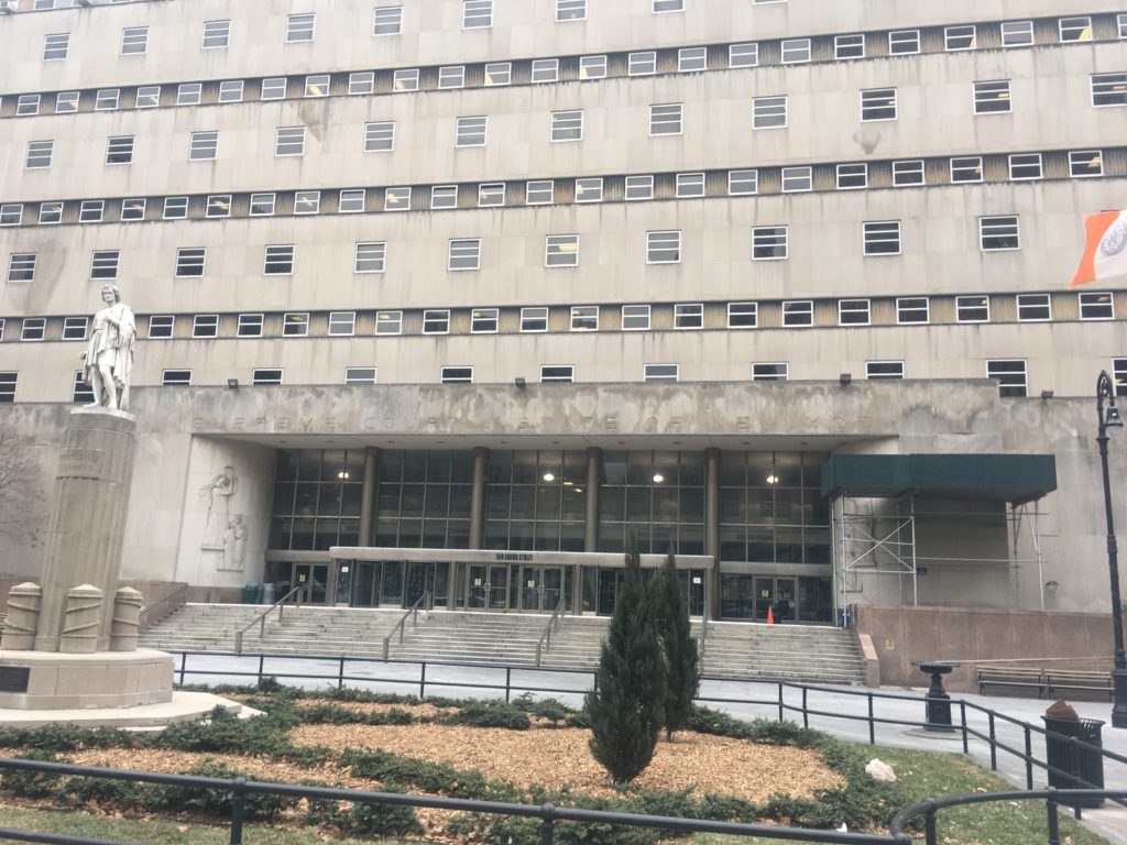
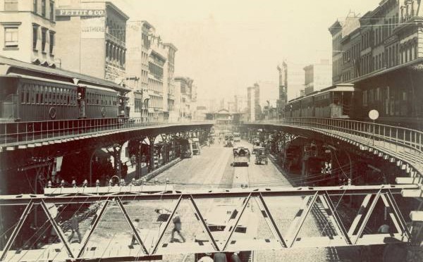
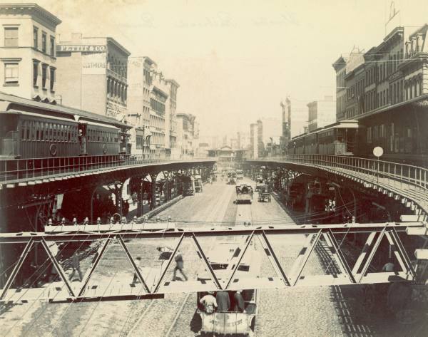
EPISODE 331 During the Gilded Age, New York City had one form of rapid transit — the elevated railroad.
The city’s population had massively grown by the 1870s thanks to large waves of immigration from Ireland and Germany. Yet its transportation options — mostly horse-drawn streetcars — were slow and cumbersome.
As a result, people rarely lived far from where they worked. And in the case of most working class New Yorkers, that meant staying in overcrowded neighborhoods like the Lower East Side.
In the 1870s, New York hoped to alleviate the population pressure by constructing four elevated railroad lines — along 2nd, 3rd, 6th and 9th Avenues — in the hopes that people would begin inhabiting Upper Manhattan and the newly acquired portion of Westchester County known as the Annexed District (today’s South Bronx).
In this show, we focus on the two eastern-most lines and their effects on the city’s growth. Take a ride with us — through Lower Manhattan, the Lower East Side, Midtown Manhattan, Yorkville, East Harlem and Mott Haven!
FEATURING an interview with elevated expert and tour guide Michael Morgenthal.
This episode is brought to you by the Historic Districts Council. Funding for this episode is provided by public funds from the New York City Department of Cultural Affairs in partnership with the City Council and Council Member Benjamin Kallos.
Listen to our podcast on the history of New York City’s East Side Elevatedshere:
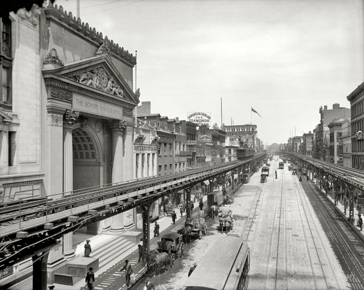
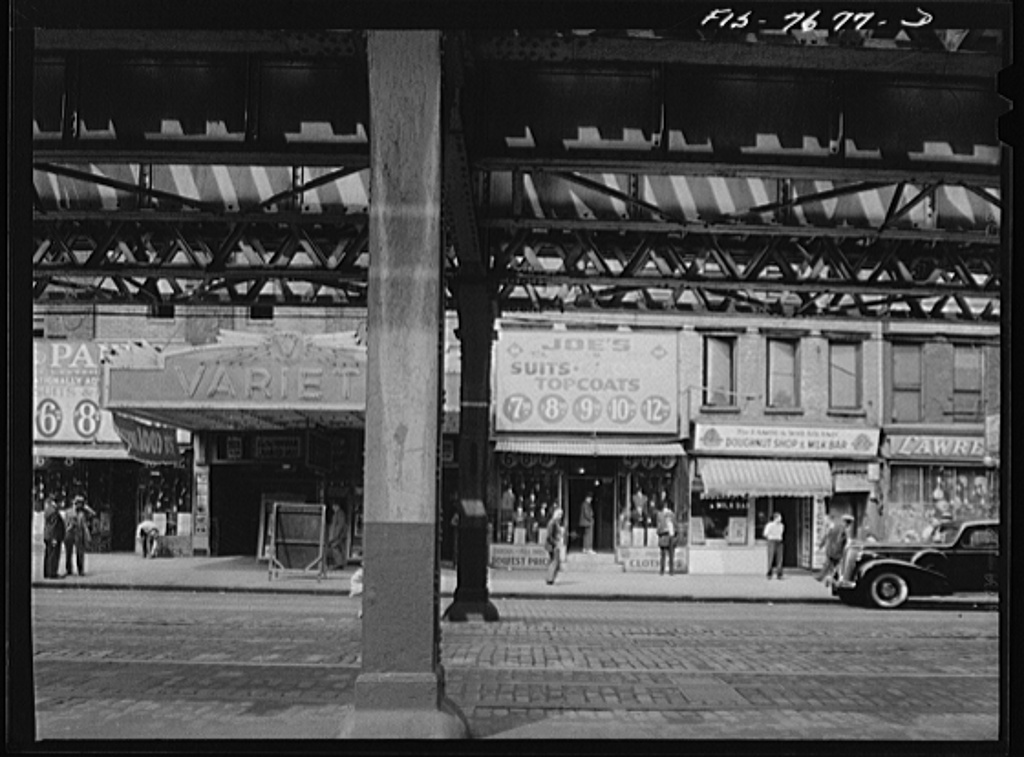
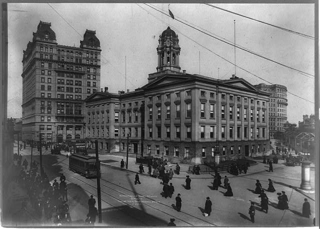
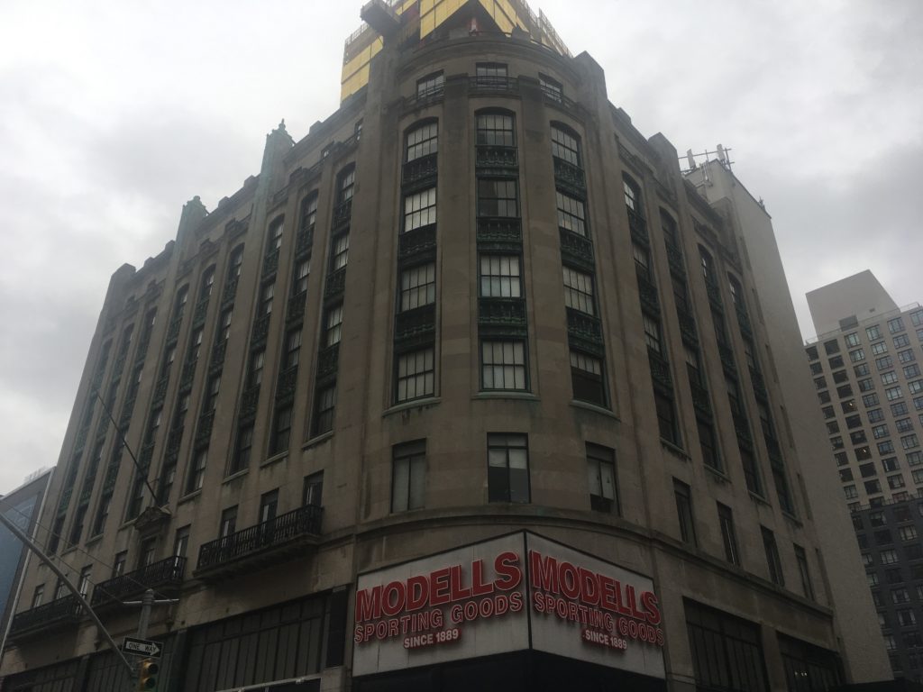
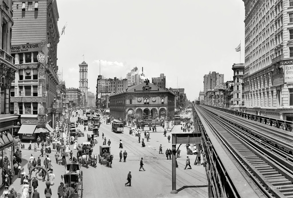
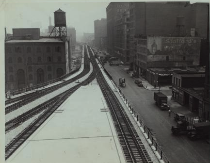
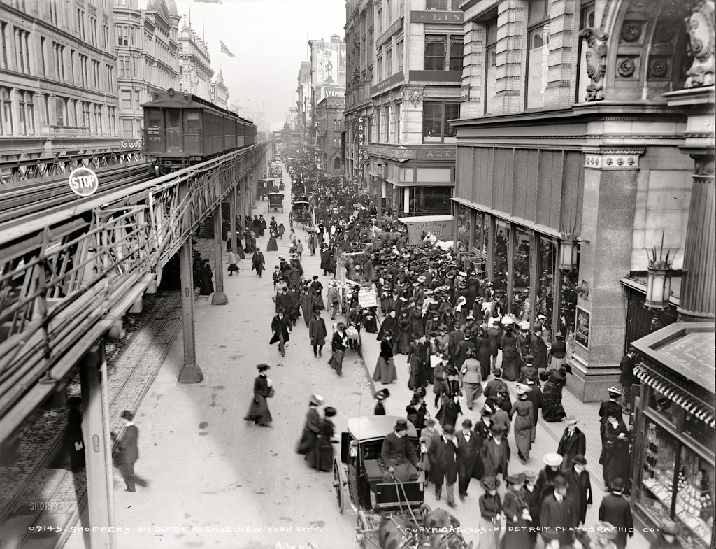
The Third Avenue elevated, 1910 — Image courtesy Shorpy. (Click here for a Hi-Res version with great detail)The Third Avenue El at 18th Street, September 1942. Courtesy Marjory Collins, United States Office of War Information.Signaller on the track of the Third Avenue elevated railway near 14th Street in the early morning, September 1942. Photographer Marjory Collins, courtesy United States Office of War Information.Elevated railway station at Fourteenth Street and Third Avenue, September 1942. Photographer Marjory Collins, courtesy United States Office of War Information. Second Avenue elevated railway at 14th Street in the midst of demolition, September 1942. Photographer Marjory Collins, courtesy United States Office of War Information.94th Street. Station of the Third Avenue elevated railway at 8 a.m. September 1942. Photographer Marjory Collins, courtesy United States Office of War Information.
FURTHER LISTENING
After listening to this episode, check out these past Bowery Boys episodes on subjects featured in the latest show.
The Bowery Boys: New York City History podcast is brought to you …. by you!
We are now producing a new Bowery Boys podcast every week. We’re also looking to improve and expand the show in other ways — publishing, social media, live events and other forms of media. But we can only do this with your help!
We are now a creator on Patreon, a patronage platform where you can support your favorite content creators.
Please visit our page on Patreon and watch a short video of us recording the show and talking about our expansion plans.
If you’d like to help out, there are six different pledge levels. Check them out and consider being a sponsor.
We greatly appreciate our listeners and readers and thank you for joining us on this journey so far.
PODCAST The fascinating history of Brooklyn’s most bustling — and most frequently misunderstood — neighborhood.
Downtown Brooklyn has a history that is often overlooked by New Yorkers. You’d be forgiven if you thought Brooklyn’s civic center — with a bustling shopping district and even an industrial tech campus — seemed to lack significant remnants of Brooklyn’s past; many areas have been radically altered and hundreds of old structures have been cleared over the decades.
But, in fact, Downtown Brooklyn is one of the few areas to still hold evidence of the borough’s glorious past — its days as an independent city and one of the largest urban centers in 19th century America.
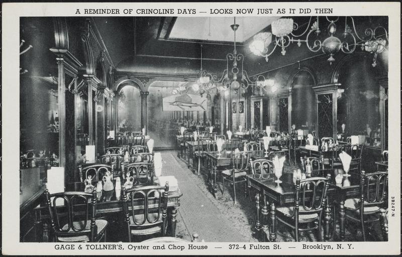
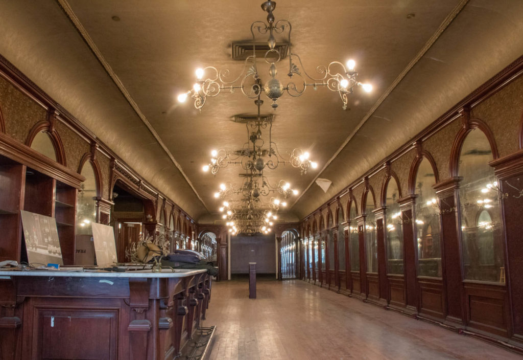
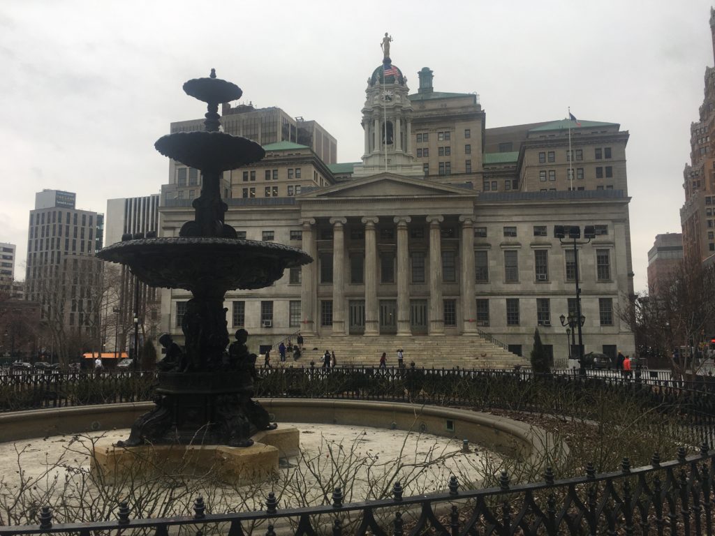
Around Brooklyn City Hall (now Borough Hall) swirled all aspects of Brooklyn’s Gilded Age society. With the construction of the Brooklyn Bridge and a network of elevated railroad lines, Downtown Brooklyn became a major destination with premier department stores on Fulton Street, entertainment venues like the Brooklyn Academy of Music and exclusive restaurants like Gage & Tollners.
The 20th century brought a new designation for Brooklyn — a borough of Greater New York — and a series of major developments that attempted to modernize the district — from the creation of Cadman Plaza to New York’s very own ‘tech hub’. In 2004 a major zoning change brought a new addition to the multi-purpose neighborhood — high-end residential towers. What will the future hold for the original heart of the City of Brooklyn?
The Bowery Boys: New York City History podcast is brought to you …. by you!
We are now producing a new Bowery Boys podcast every other week. We’re also looking to improve the show in other ways and expand in other ways as well — through publishing, social media, live events and other forms of media. But we can only do this with your help!
We are now a member of Patreon, a patronage platform where you can support your favorite content creators for as little as a $1 a month.
Please visit our page on Patreon and watch a short video of us recording the show and talking about our expansion plans. If you’d like to help out, there are five different pledge levels (and with clever names too — Mannahatta, New Amsterdam, Five Points, Gilded Age, Jazz Age and Empire State). Check them out and consider being a sponsor.
And join us for the next episode of the Bowery Boys Movie Club, an exclusive podcast provided to our supporters on Patreon.
We greatly appreciate our listeners and readers and thank you for joining us on this journey so far.
And a video about the history of MetroTech Center from NYU Polytechnic
The scene just north of Brooklyn Borough Hall, in a photo taken in the early 1900s. The Henry Ward Beecher monument would be moved further north with the creation of Cadman Plaza.
Detroit Publishing Company / Library of Congress
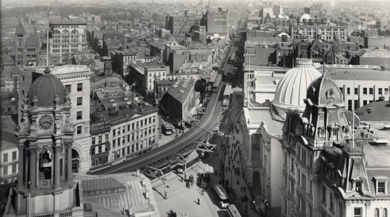
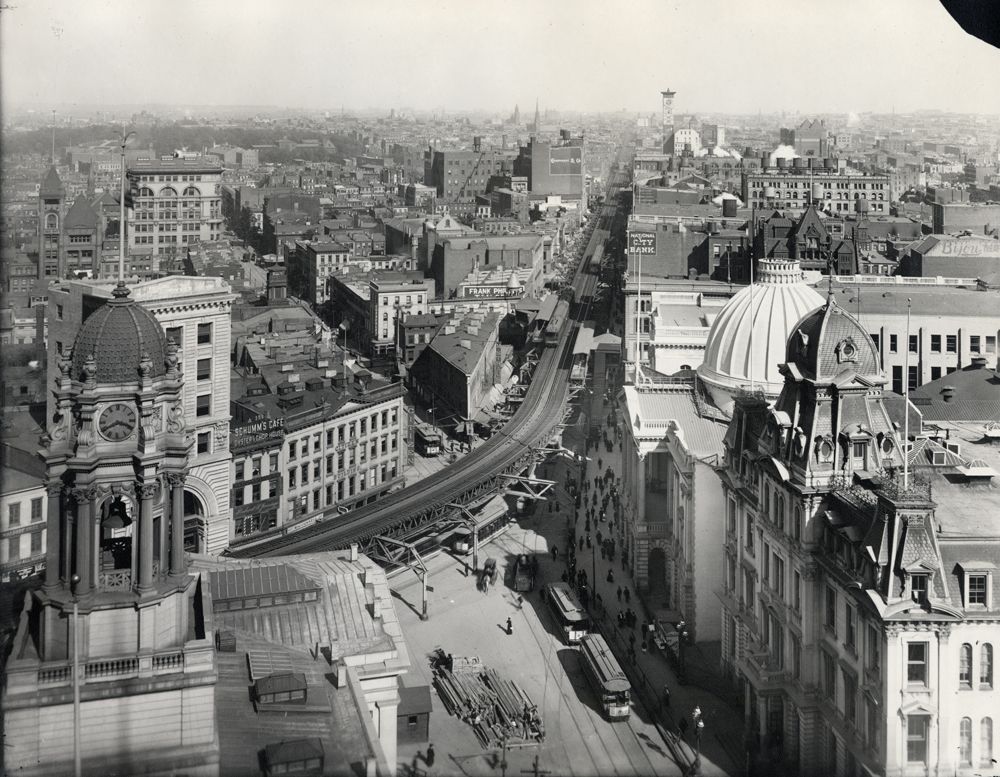
Downtown Brooklyn in 1892, a year of momentous change for the neighborhood. Here you see the elevated railroad snaking up Fulton Street with Brooklyn City Hall on the far left.
The classic interiors of Gage & Tollner’s exclusive restaurant on Fulton Street. The interiors are landmarks and you can actually peer into the storefront on Fulton Street to see them (although no business currently occupies the space.)
Museum of the City of New YorkSusan De Vries/Brownstoner
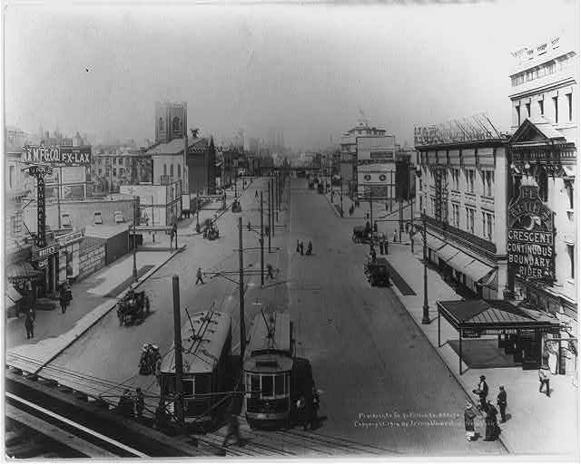
Flatbush Avenue Extension from Fulton Street, 1914 (a few years after the opening of the Manhattan Bridge). Note the Crescent Theatre to the far right. It opened as a vaudeville/burlesque house and transitioned to silent films.
Library of Congress
Brooklyn Borough Hall in 1908 with its new neighbor, the Temple Court Building (constructed 1901).
Irving Underhill/Library of Congress/ 1908
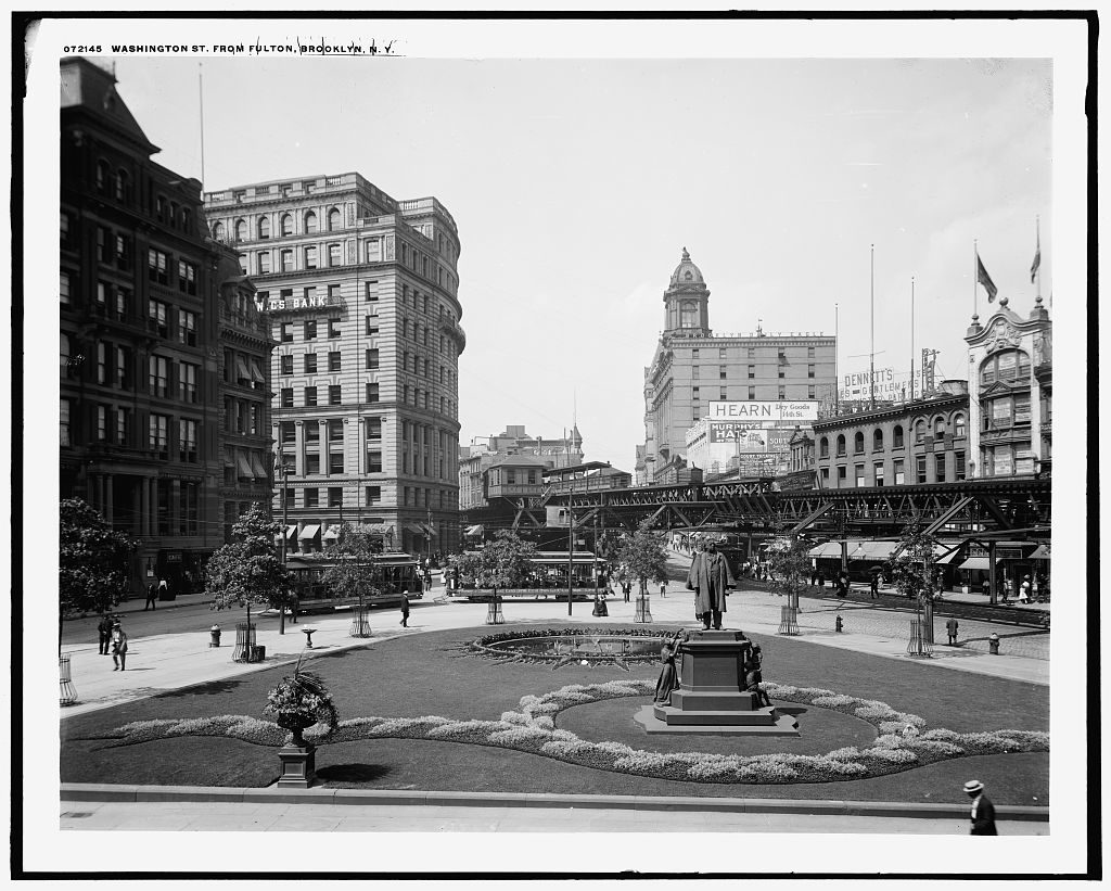
The post office was once next to the Brooklyn Daily Eagle offices. The Eagle building was demolished, as was Washington Street. (It became Cadman Plaza East.)
Museum of the City of New YorkMuseum of the City of New York
The post office building on Cadman Plaza in 1976, with the newly situated Henry Ward Beecher monument.
Edmund Vincent Gillon, Museum of the City of New York
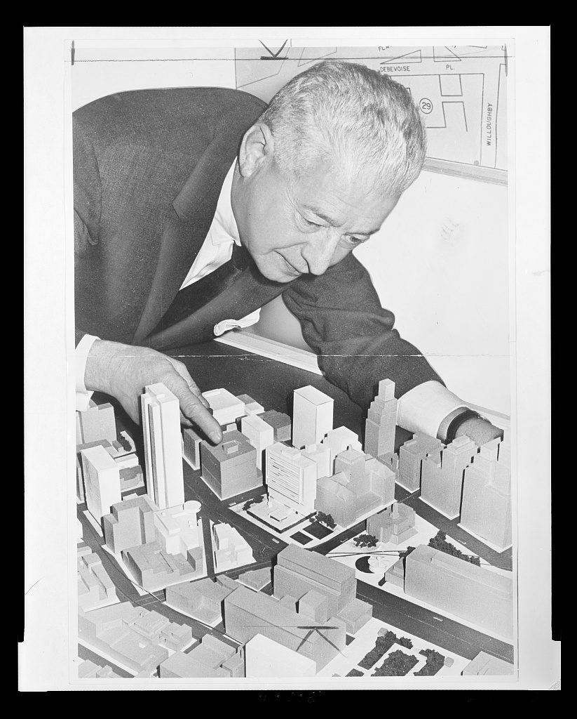
A 1963 photo of Abe Stark, Brooklyn borough president, hovering over a model of the ‘new’ civic center plan for downtown Brooklyn.
Higgins, Roger, photographer/Library of Congress
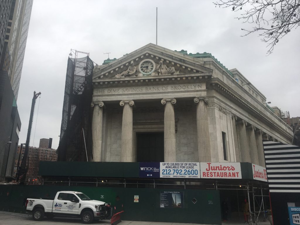
The Dime Savings Bank of Brooklyn is an oddity among the old retail shops of Fulton Street but its classical architecture has helped it survive the wrecking ball.
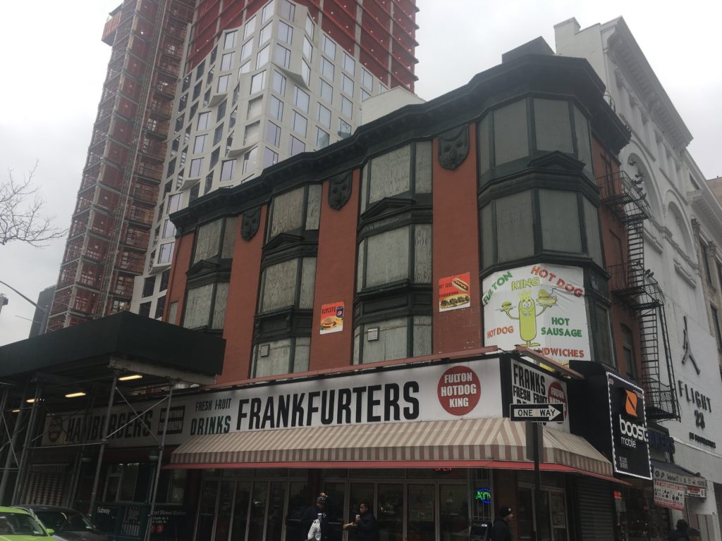
Look above the first or second floors on Fulton Street and you’ll find some curious and spectacular architectural finery.
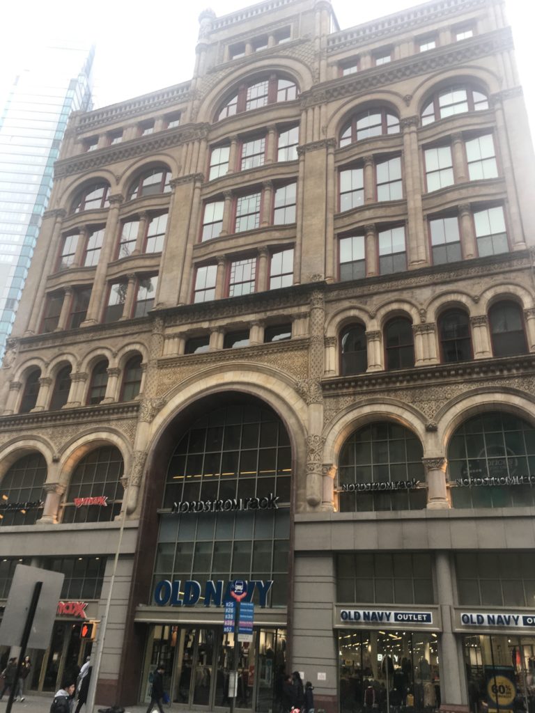
The landmarked Offerman Building, the most beautiful former department store on Fulton Street.
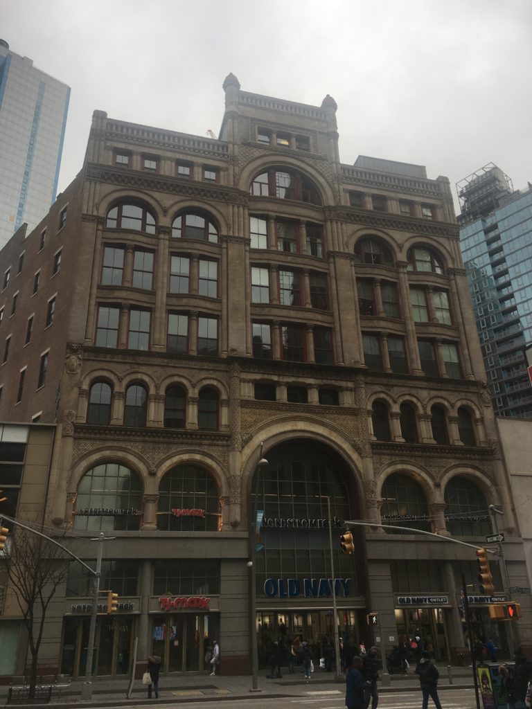
More department store richness:
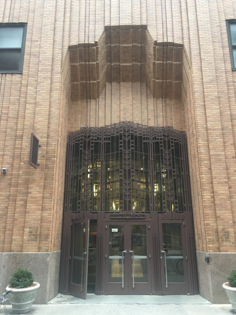
The New York Telephone Company Building and the NY and NJ Telephone and Telegraph Building both remain standing amid a sea of new supertall residential construction.
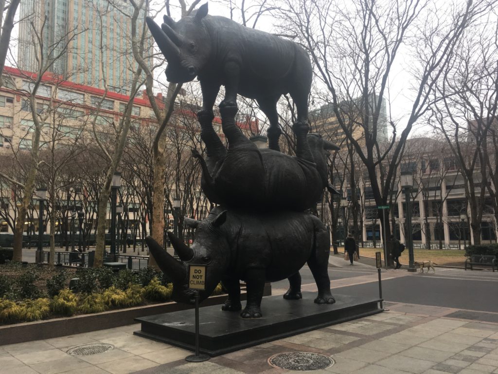
Some curious features of MetroTech Commons — two whimsical animal-themed sculptures and the Bridge Street Church, a historical landmark associated with the Underground Railroad.
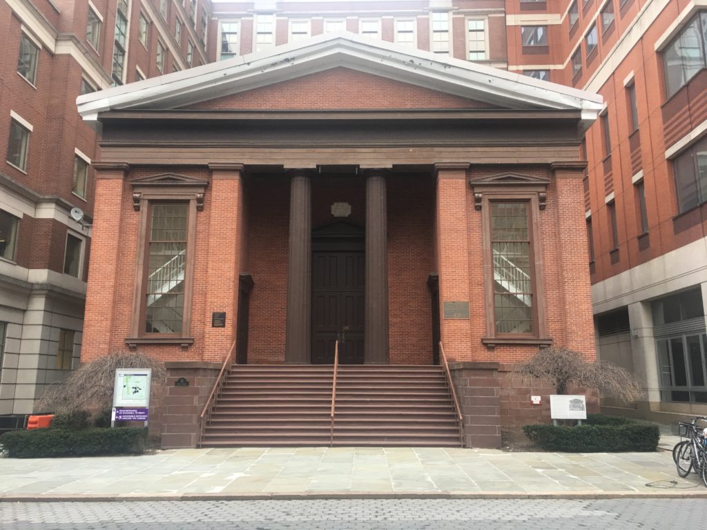
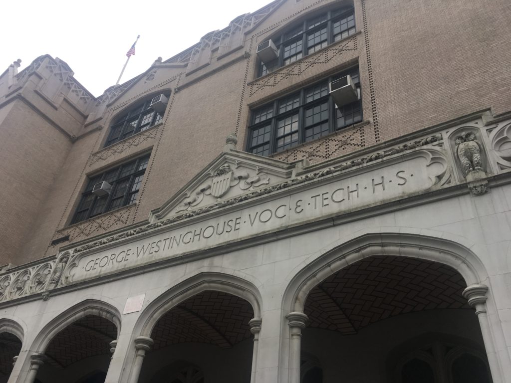
A block north of MetroTech Commons, you’ll find the historic George Westinghouse High School.
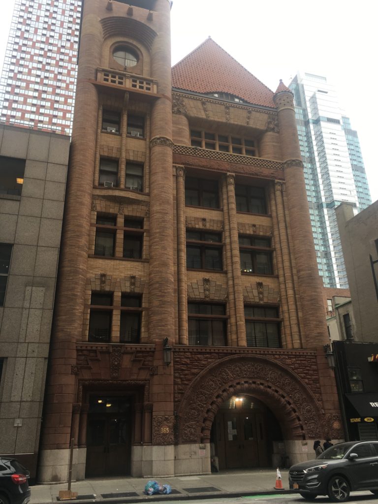
The old Brooklyn Fire Headquarters on Jay Street, built in 1892 in a style most unusual for the neighborhood — Richardsonian Romanesque Revival.
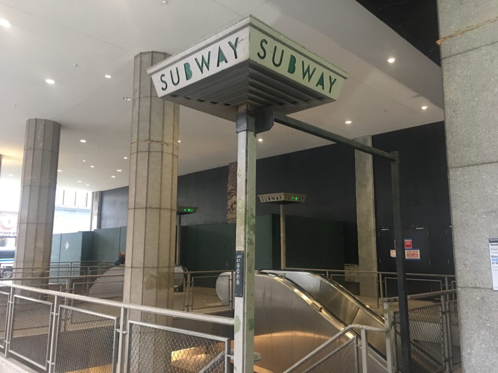
The Jay Street-MetroTech station still contains some quirky details from the past.
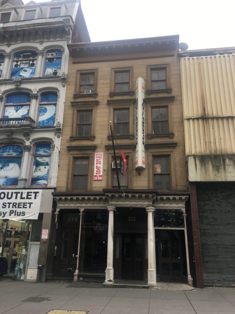
This undistinguished old building was once the home of Gage & Tollner’s, the most exclusive restaurant in Brooklyn.
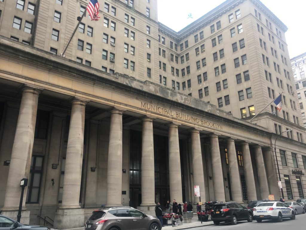
The austere Municipal Building was constructed in 1924 and the skyscrapers which surround it also joined the neighborhood in the same decade.
Brooklyn Borough Hall and Columbus Park:
The 1892 Federal Building and Post Office with a tribute to Henry Ward Beecher (which once sat closer to Brooklyn Borough Hall).
Further Listening:
If you like Brooklyn history, check out these episodes from our back catalog that are referenced in this week’s show.
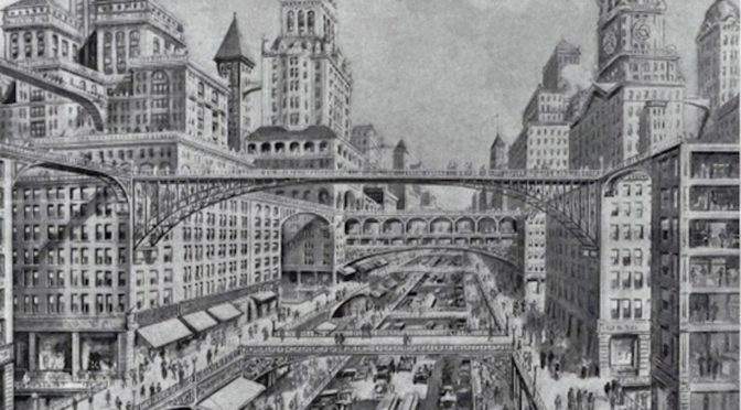
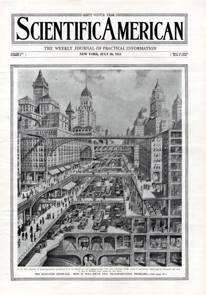
Imagine a city where the High Line isn’t just a novel park, but the primary form of urban conveyance.
In 1913, with the proliferation of the automobile, it seemed humans were being crowded out at ground level.  People were beginning to think of themselves as removed from the street.  Daredevils were experimenting with flight, and small, single-man crafts began appearing over the skies of Manhattan.  The world’s tallest building, the Woolworth Building, had been completed a few months before.  Perhaps the streets themselves could elevate, granting pedestrians a space of their own?
Scientific American suggested the possibilities of a city of elevated layers in its July 26, 1913 issue. “The Elevated Sidewalk: How It Will Solve City Transportation Problems,” written by engineer and science writer Henry Harrison Suplee, posits that humans and automobiles are simply incompatible and opposing engines upon ground level, and that one will have to give way to the other.
“One of the greatest impediments to city transport today is the continuance of the obsolete method of attempting to conduct foot and vehicular traffic upon the same highways.”
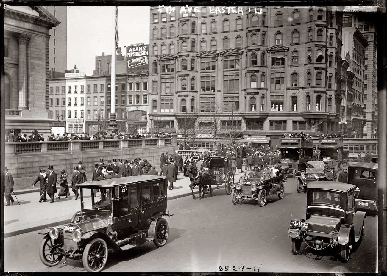
Below: Cars and people seem to co-exist peacefully on Fifth Avenue (pictured here in 1913). But, darn it, automobiles are meant to go fast!Â
Courtesy Shorpy
After all, cars are meant to go fast. Â “In nearly every large city today there appears a tendency to enforce traffic regulations intended to permit the most conflicting elements to be operated together and the result is naturally the impeding of the very traffic which it is desired to help.”
By keeping people and automobiles on the same plane, one risks lives, sure, but more importantly, it slows progress by keeping the potential of auto motion on a short leash.
Suplee’s solution: “Take the foot passengers off the surface of the street entirely, and leave the highways solely for vehicles!”
Below: Evidence of the incompatibility of foot and automobile was being amply displayed all over New York City, most notably on “Death Avenue,” the trecherous tangle of roads on Manhattan’s West Side. Eventually the elevated freight railroad today known as the High Line was built to relieve this issue.
New York had many precedents for this. Â The great passages over the East River (the Brooklyn, the Williamsburg and Manhattan bridges) had all been completed with elevated pathways for pedestrians, situated over or alongside those paths for vehicular traffic. Â Trains were either elevated overhead along the avenues, or buried underneath the ground.
Suplee doesn’t imagine a world were pedestrians become smarter, or any type of place with sophisticated traffic lights or crosswalks. Â Instead, elevated sidewalks would hover over the major thoroughfares; “[S]uch sidewalks might be built on Broadway from the Battery to Union Square, there sloping down to the surface level until further extensions were required,” he writes.
In a city of skyscrapers, bridges could be constructed several stories above the street. Â Store fronts would appear on the second or third floors, while the ground floor would be exclusively used for delivery and store. Â Life would essentially reside many feet above the ground.
Bicycles figure nowhere in his model, but he does carve out one exception to his pedestrian only level. Â “The power vehicles should be kept absolutely to the surface, and there given unrestricted facilities for speed, weight, and numbers; and the foot levels maintained for absolute freedom for pedestrians, with the possible exception of carriages for small children.”
As commenter Boris mentions below, while New York City never adhered to this suggestion, other cities certain did — to a certain extent.
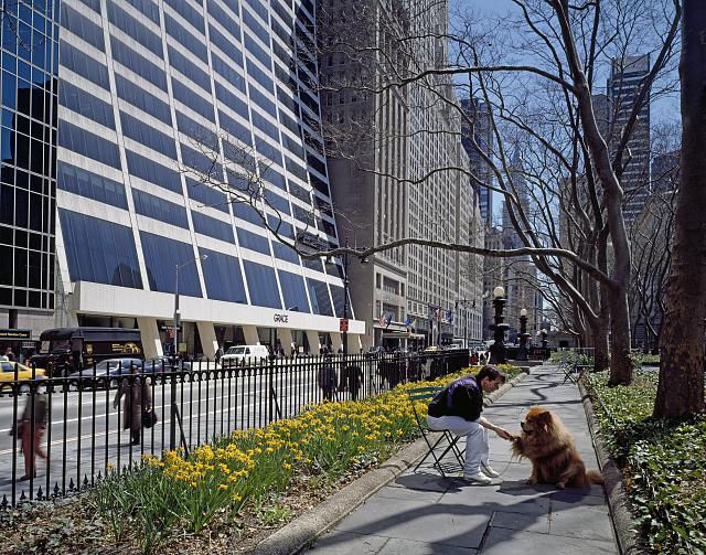
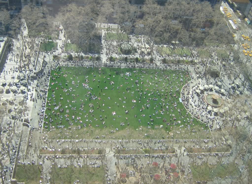
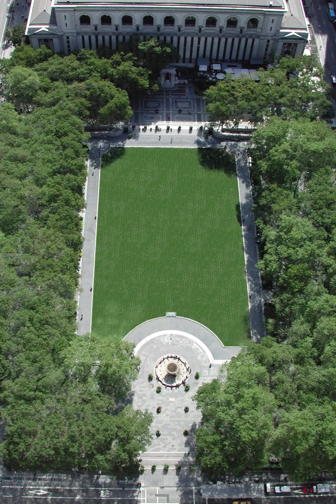
NEW PODCAST In our last show, we left the space that would become Bryant Park as a disaster area; its former inhabitant, the old Crystal Palace, had tragically burned to the ground in 1858. The area was called Reservoir Square for its proximity to the imposing Egyptian-like structure to its east, but it wouldn’t keep that name for long.
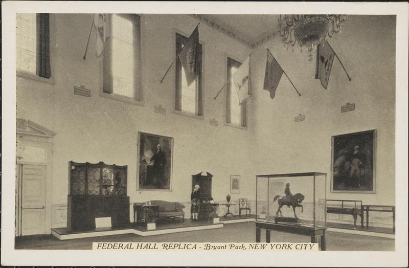
William Cullen Bryant was a key proponent to the creation of Central Park, but it would here that the poet and editor would receive a belated honor in the 1884. With the glorious addition of the New York Public Library in 1911, the park received some substantial upgrades, including its well-known fountain. Over twenty years later, it took on another curious present — a replica of Federal Hall as a tribute to George Washington.
By the 1970s Bryant Park was well known as a destination for drug dealers and most people shied away from its shady paths, even during the day. It would take a unique plan to bring the park back to life and a little help from Hollywood and the fashion world to turn it into New York’s most elegant park.
The Bowery Boys: New York City History podcast is brought to you …. by you!
Starting with this episode, we are doubling our number of episodes per month. Now you’ll hear a new Bowery Boys podcast every two weeks. We’re also looking to improve the show in other ways and expand in other ways as well — through publishing, social media, live events and other forms of media. And we need your help to make these expansion plans happen.
We are now a member of Patreon, a patronage platform where you can support your favorite content creators for as little as a $1 a month.
Please visitour page on Patreon and watch a short video of us recording the show and talking about our expansion plans. If you’d like to help out, there are five different pledge levels (and with clever names too — Mannahatta, New Amsterdam, Five Points, Gilded Age, Jazz Age and Empire State). Check them out and consider being a sponsor.
We greatly appreciate our listeners and readers and thank you for joining us on this journey so far. And the best is yet to come!
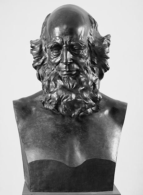
William Cullen Bryant, photo taken by Matthew Brady
William Cullen Bryant in bust form, but Launt Thompson. It seems this bust has made its way back to the Metropolitan Museum of Art!
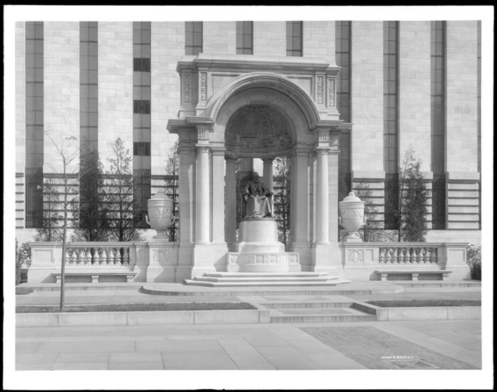
William Cullen Bryant installed in his marble niche behind the New York Public Library. This picture was taken in 1910, well before the radical redesign of the park in the 1930s. (Museum of the City of New York).
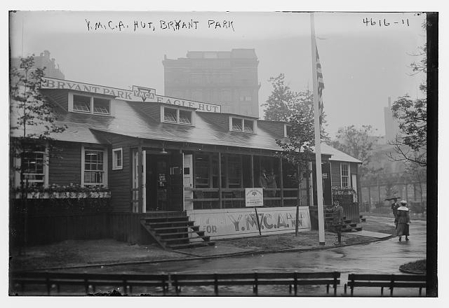
During World War I, the YMCA had a special ‘Eagle Hut’ built in the park for traveling servicemen. (Library of Congress)
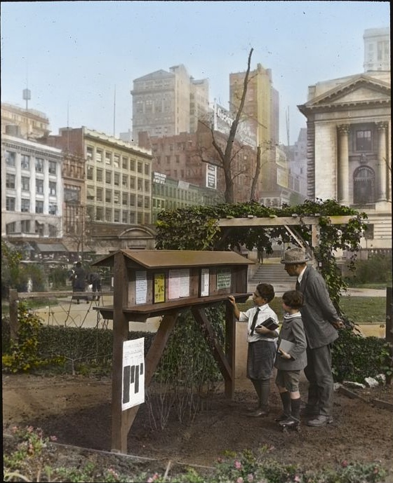
A colorful depiction of the Bryant Park ‘demonstration gardens’ that were planted during the war. (Library of Congress)
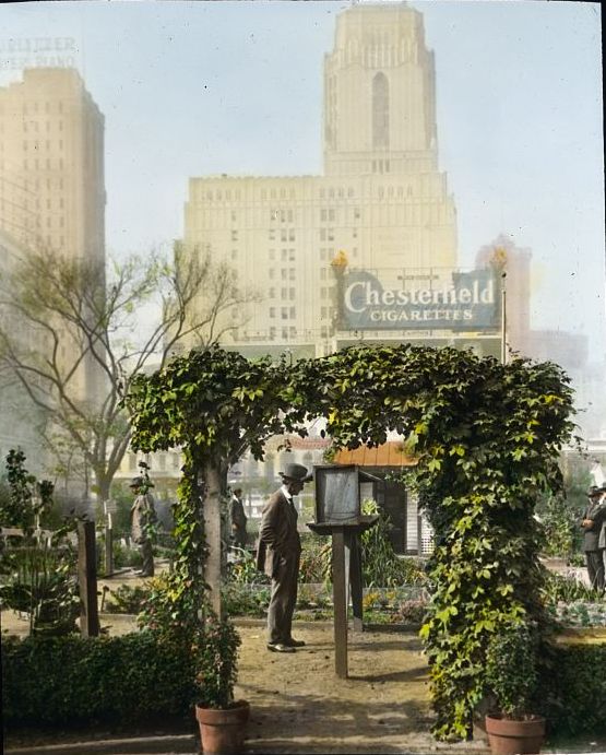
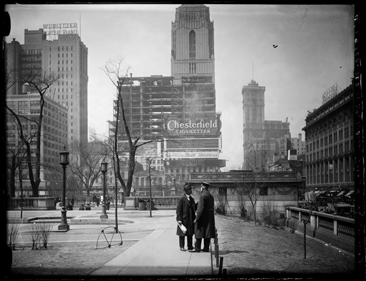
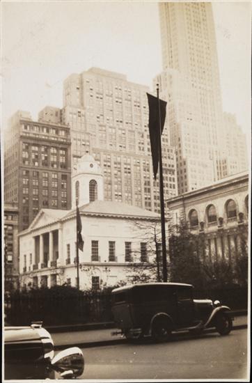
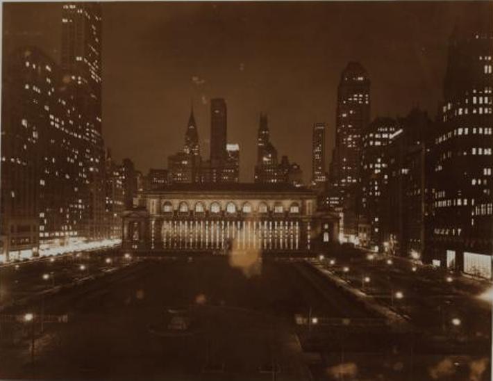
Bryant Park in 1920. Looking west on 42nd Street at 6th Avenue (you can see the elevated railroad!) In the distance is One Times Square. Note the reappearance of the Chesterfield Cigarettes billboard from the picture above. (Museum of the City of New York)
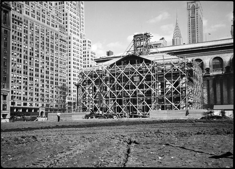
Constructing a replica of Federal Hall in a barren Bryant Park. (Picture taken by the Wurts Brothers, Museum of the City of New York)
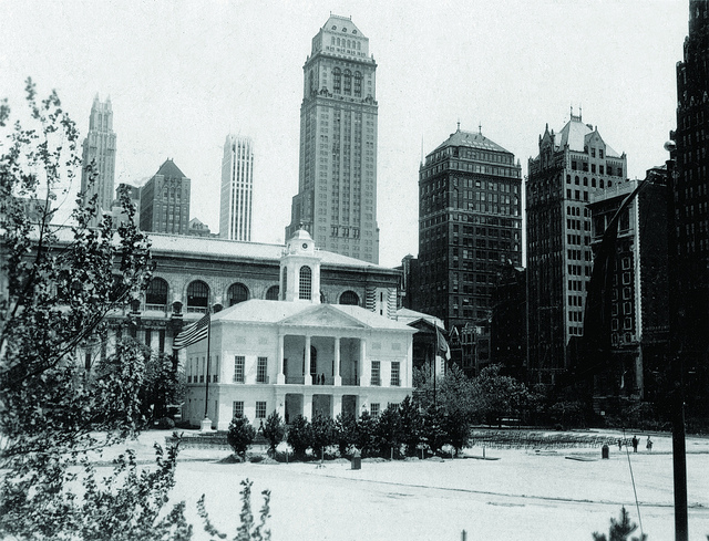
The Federal Hall reconstruction had a corporate sponsor — Sears Roebuck & Co. Here’s how it looked in better days. Believe it or not, the reproduction of Mount Vernon actually did get built in New York —in Prospect Park in Brooklyn! (Bryant Park Corporation)
Bryant Park’s Federal Hall, May 1932. (Museum of the City of New York)
The interior of Bryant Park’s Federal Hall. (Museum of the City of New York)
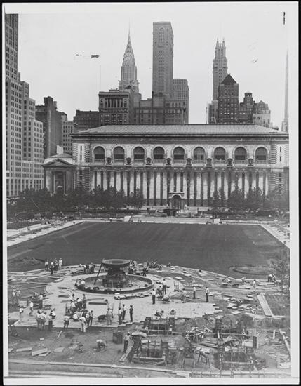
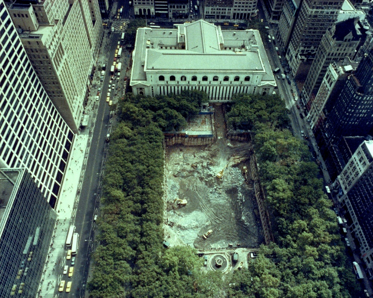
The reconstruction of Bryant Park in 1934, overseen by new Parks Commissioner Robert Moses
This photo was taken by Stanley Kubrick during his years as a photographer for Look Magazine. The caption reads “Park Bench Nuisance [Woman reading a newspaper, while a man reads over her shoulder.]” Courtesy Museum of the City of New York
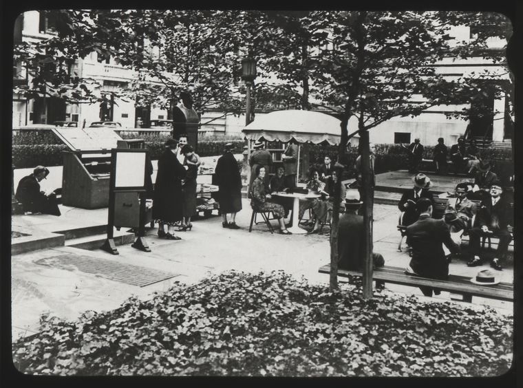
People enjoying the New York Public Library’s outdoor reading room, 1930s. (New York Public Library)
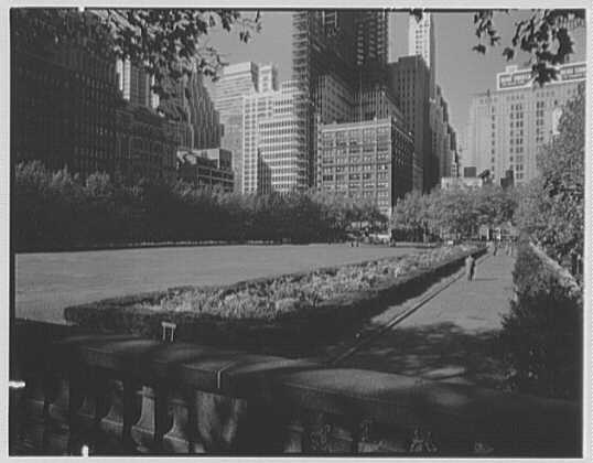
The hedges of the central lawn, photo taken in 1957. These were removed in the desperate effort to clean up the park in the late 1980s. (Library of Congress)
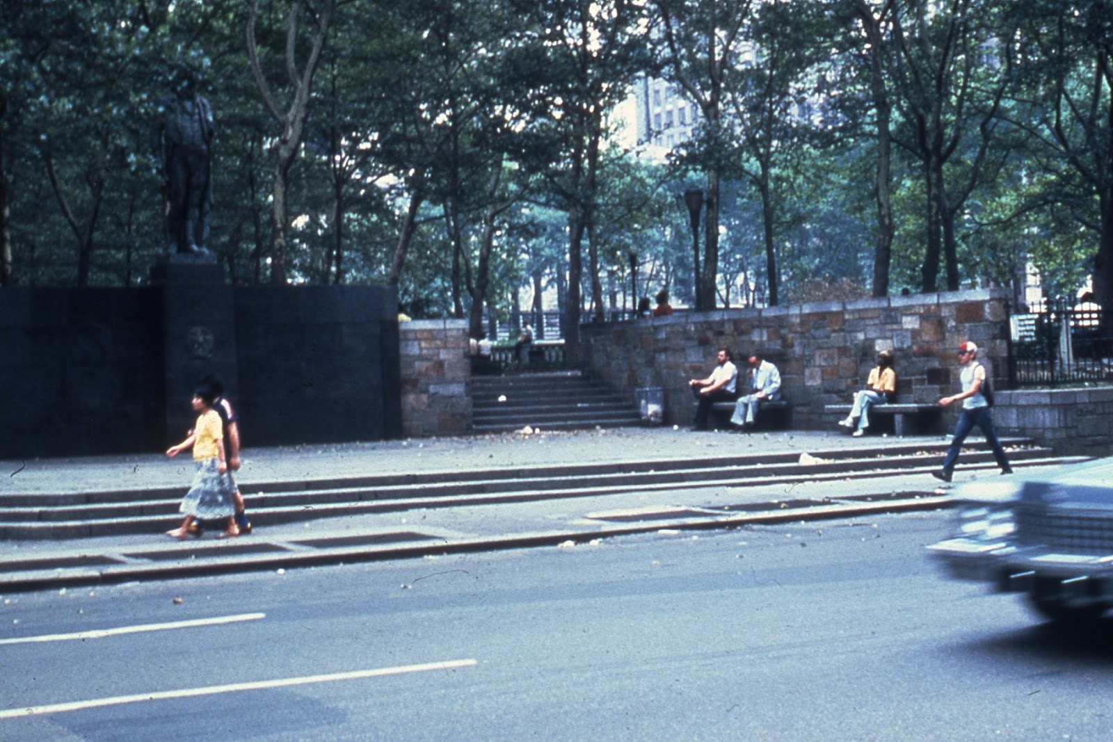
Bryant Park in the 1980s. High walls allowed for suspicious behavior to occur in the at all hours of the day. (Bryant Park Conservancy)
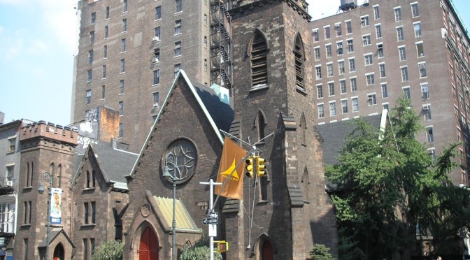
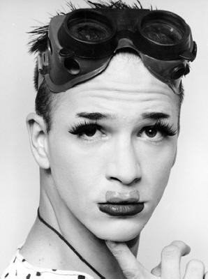
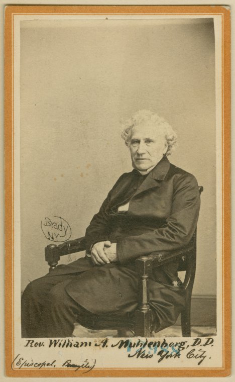
Above: The Church of the Holy Communion — and once the quite infamous nightclub Limelight — as the less lauded follow-up, called Avalon. Within a couple years, the club would be transformed again — into a high-end retail experience. Below: Michael Alig, one of its more notorious nightly residents. (source) PODCAST If you had told 1840s religious leader William Augustus Muhlenberg that his innovative new Church of the Holy Communion, designed by renown architect Richard Upjohn, would become the glittering seat of drugs and debauchery 150 years later, he might have burned it down then and there.
But thankfully, this lovely building is still with us, proving to be one of the most flexible examples of building use in New York City history.
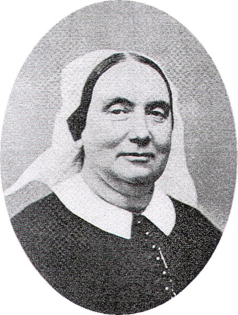
This unusual tale begins with the captivating relationship between Muhlenberg (the grandson of America’s first Speaker of the House) and Anne Ayres, the First Sister in charge of the Sisterhood of the Holy Communion. The two of them helped create one of New York’s great hospital centers. But was something else going on between them?
The Church of the Holy Communion survives the elevated railroad and the fashionable stores of Ladies Mile, and weathers the various fortunes of the neighborhood. When it is finally sold and deconsecrated, it briefly houses an intellectual collective and a drug rehabilitation center before being bought by Canadian club impresario Peter Gatien, who turns it into the Limelight, an iconic and sacrilegious symbol of New York nightlife. And in recent years, the old church has morphed into a rather unique retail experience — shopping mall and department store!
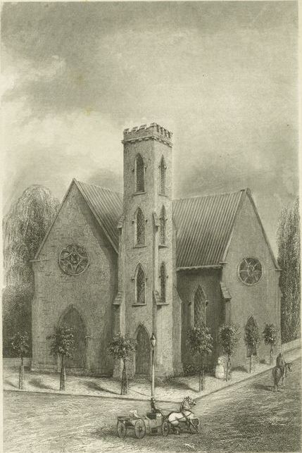
The Church of the Holy Communion in 1846, from an illustration by TD Booth. The asymmetrical shape of the church was innovative for the time, as was the irregular position of the brownstone bricks along its walls. It had every indication of being a medieval country church, but for the fact of it being on a street corner at Sixth Avenue and 20th Street! (NYPL)
William Augustus Muhlenberg, grandson of Frederick Muhlenberg (America’s first Speaker of the House), was a visionary religious leader. He opened Church of the Holy Communion as a way to further his progressive religious views. Pictured below in a carte de visite, probably in the 1860s. (Courtesy NYPL)
Muhlenberg’s reputation was greatly bolstered by Anne Ayres, who became the leading sister as the Reverend’s Sisterhood of the Holy Communion, the first Anglican convent of its kind in America. Ayres helped Muhlenberg with most of the church’s major projects and penned an ecstatic biography after his death. You can read Ayres’ biography of Muhlenberg here.
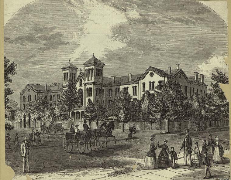
Muhlenberg and Ayres founded a small infirmary near the church, then later expanded it at Fifth Avenue and 54th Street, becoming the first location of St. Luke’s Hospital. As you can tell from the original hospital building, it seems to reflect a bit of the architecture of the Church of the Holy Communion. (Pic courtesy NYPL)
A view from 1895, possibly of a Sunday crowd leaving the church. Vendors like this pretzel seller gathered on the street below, selling treats to shoppers of Ladies Mile. The church would have been in the heart of New York’s major shopping district during the Gilded Age, with grand department stores stretching on either side of the street. (Courtesy the Museum of the City of New York)
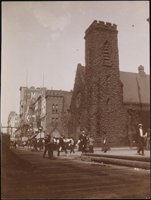
The Church of the Holy Communion, enveloped in thick ivy, as it looked in September 1907. It also appears this photo was taken in the early afternoon, as the shadow of the elevated railroad begins to creep across the street. (Courtesy Museum of the City of New York)
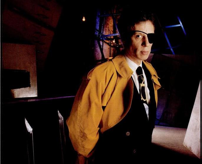
Peter Gatien, pictured here in a 1993 issue of New York Magazine. The Canadian club owner bought the old church and transformed it into a nightclub in 1983.
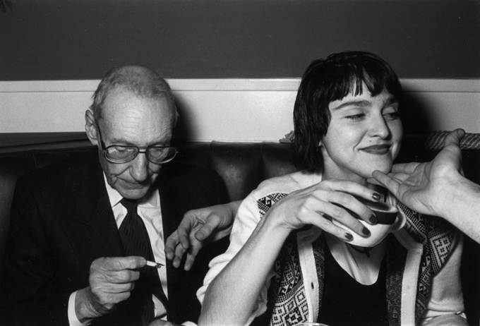
The Limelight was a celebrity hotspot from the very opening in 1983. When William Burroughs had his 70th birthday at the club in 1984, the young new superstar Madonna came by to wish him well. (Photo by Wolfgang Wesener, courtesy here)
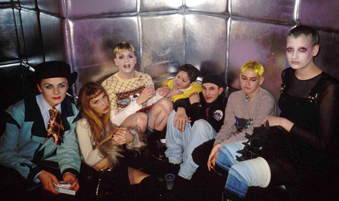
But why conjure real celebrities when you could make some yourself! By the early 1990s, the club kid set the tone for the Limelight, further turning the old church of Muhlenberg into a surreal playground of music and drugs.
BOWERY BOYS BOOK OF THE MONTH Each month I’ll pick a book — either brand new or old, fiction or non-fiction — that offers an intriguing take on New York City history, something that uses history in a way that’s unconventional and different or exposes a previously unseen corner of our city’s complicated past. Then over the next month, I’ll run an article or two about some of historical themes that are brought up in the selection.
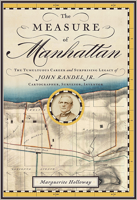
The Measure of Manhattan: The Tumultuous Career and Surprising Legacy of John Randel Jr. by Marguerite Holloway WW Norton & Company
The man at the center of Marguerite Holloway’s ‘The Measure of Manhattan’ is a genuine riddle.
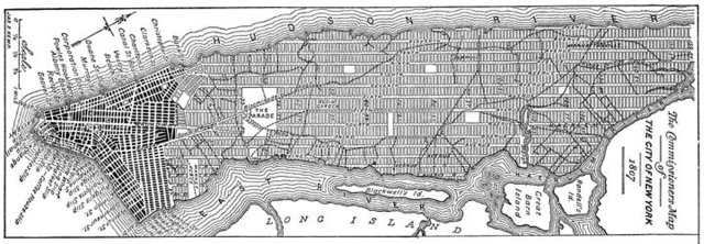
The surveyor John Randel Jr. rarely wrote about himself, jotting down observations of land elevation and incompetent workmen as he mapped out the legendary grid plan along the island of Manhattan.
This ambitious task, occurring early in his career, would assure his place as a pivotal, if quiet, figure in American history. During this period, he is studious, focused and, let’s just say it, a mite uninteresting. But just as the grid is completed, Randel’s personal story comes to life. A traditional historian might not know what to do with the life of Randel, a man who ages into astonishing eccentricity and temperament. But.Holloway, a journalism professor at Columbia University, treats this story as a two-fold mystery, turning something that could into a real unexpected — and often unpredictable — treat.
Her first concern is the grid itself, the orderly row of streets and avenues that arose out of the former hills and streams of Manhattan, following researchers who are attempting to determine how drastically the landscape has been altered over the years.
Evidence of the original surveying job — which sliced through private property and reorganized nature into something unrelenting and orderly — can be found in Central Park. In fact, a bolt sits lodged in a rock, the last remaining evidence of Randel’s assiduous work. It’s an astonishing discovery.
As is Randel, the man who probably put it there. The young surveyor, taken under wing by the well connected DeWitt family at the start of the 19th century, worked on the grids to Manhattan and Albany before he was 30 years old, braving the wrath of farmers to mark rectangles in the landscape. So unusual was the island’s terrain that Randel invented his own surveying equipment specifically suited for the job at hand.
But even as Holloway goes deep into Randel’s technique, there appears to be a vacuum at the center of the story. Randel’s personality seems opaque, even non-existent. But wait.
The most fascinating aspects to Randel’s character come after the grid is completed, when the surveyor attempts to cash in on his remarkable accomplishment. He naturally attempts to sell copies of his maps but, in these heady days before copyright, is thwarted by a competitor who basically duplicates his work
From that point, he seems to spend as much time in lawsuits as he does doing field work. He goes to work on an upstate length of the Erie Canal, only to annoy his peers and tarnish his reputation. Is it professional jealousy at Randel’s enormous skills, or is the great, embittered surveyor becoming obstinate?
As Benjamin Wright, canal engineer and enemy of Randel’s, once said of his rival in 1824: “I think him the most complete hypocritical lying nincompoop (and I might say scoundrel if it was a Gentlemanly word)…..”
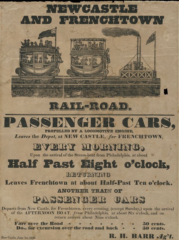
At left: A notice for another of Randel’s great projects, the New Castle and Frenchtown railroad, the first railroad in Delaware
Far from a career of increasingly applauded works, Randel becomes stepped in controversy at every turn, even as he moves from canals to railroads. He’s perpetually strapped for cash, even attempting to build his own estate (amusingly called Randelia) with unfortunate results. In a desperate act of “piracy”, according to the author, he even attempts to collect his very own tolls from a canal he himself surveyed and engineered!
Holloway, employing an extraordinary depth of research, describes a man of great talent who gets ripped asunder by America’s rapid growth, defined not by accomplishment but debt. In a way, this is as pure an American story as it gets.
The tale often pulls back at times to modern day, constantly reminding us of Randel’s most stunning accomplishment, a New York grid plan so implanted that it seems impossible to imagine that anything else ever existed here. In particular she turns her focus to Eric Sanderson and his amazing 2009 Mannahatta project, pulling a reverse-Randel in trying to map out the original landscape as it appeared in the year 1609.
Randel returns to New York near the end of his life for the industrial exhibition held at the Crystal Palace in 1853, America’s first great show of its technological prowess. It is here that Randel reveals his last, greatest idea — an elevated railroad transporting passengers up and down the length of avenues he had himself marked over forty years earlier.
His visionary ideas were rejected. Over fifteen years later, well after Randel’s death, New York built an elevated railroad anyway.
Click into the images within this post for a more closeup view!
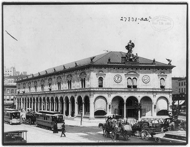
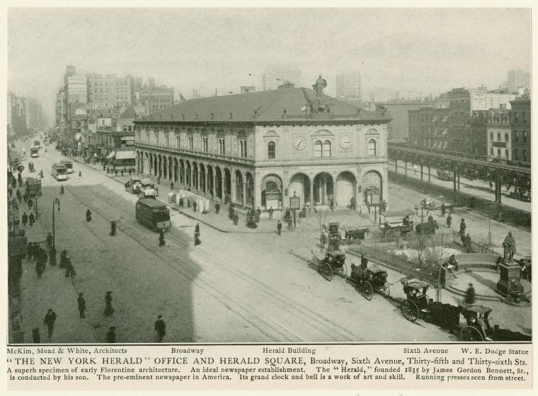
When the extravagant James Gordon Bennett Jr. decided to move the offices of the New York Herald from grimy, old Park Row to the frenzy of uptown Manhattan, he wanted something spectacular and eye-catching. As we mentioned in our newest podcast on the history of Herald Square, Bennett went the opposite direction of newspaper publisher Joseph Pulitzer, who remained on on Park Row and put his publication in the tallest building in the world (the New York World tower, completed in 1890).
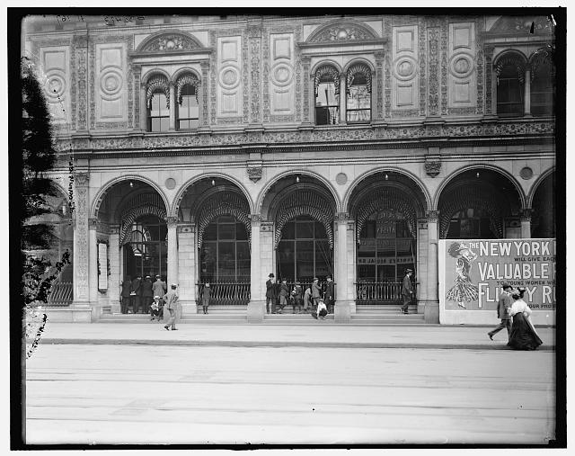
Bennett’s New York Herald Building, completed in 1894, sat at 35th Street between Sixth Avenue and Broadway, on the north side of the square his building would soon give its name. He wanted the structure to align with the theaters and hotels of the area; as designed by Stanford White, the New York Herald Building doesn’t tower over the neighborhood.
He wanted the newspaper to be essential to the rhythm and energy of this bustling intersection. It does so with its mysterious and fanciful ornamentation, its spooky owls, its ornate clock tower and its mechanical bell-ringers.
Below: the New York Herald Building, at 35th Street, between Sixth Avenue and Broadway, a frilly Italian-style structure at the nexus of a growing New York in the 1890s. [LOC]
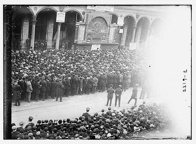
But the building became a component of the square with its open windows displaying the printing presses inside. Visitors would stand gawking as the presses furiously went about print the late-day editions. In the era before radio and television, the results of sporting events would be displayed on a billboard or “Play-o-Graph” that would attract thousands. It would be here that thousands of New Yorkers would gather to get the results of the World Series between the Red Sox and the Giants — occurring just uptown at the Polo Grounds!
The New York Herald Building became one of midtown Manhattan’s first big draws for regular New Yorkers and visitors to gather, get news, set their watches, dazzle at modern technology and ogle at the curious mix of high and low culture that sped through here. One decade later, Times Square would bring the same kind of excitement to another Broadway intersection.
Here are some additional views of the Herald Building, many romantic, most unbelievable, especially if you consider what sits there today:
Thousands of men gather to watch the results of the 1911 World Series — between the New York Giants and the Philadelphia Athletics — displayed on a “Play-o-Graph” at Herald Building. Sports results were telegraphed from inside the building, and a mini baseball diamond was regularly updated, mirroring the real time action. [LOC]
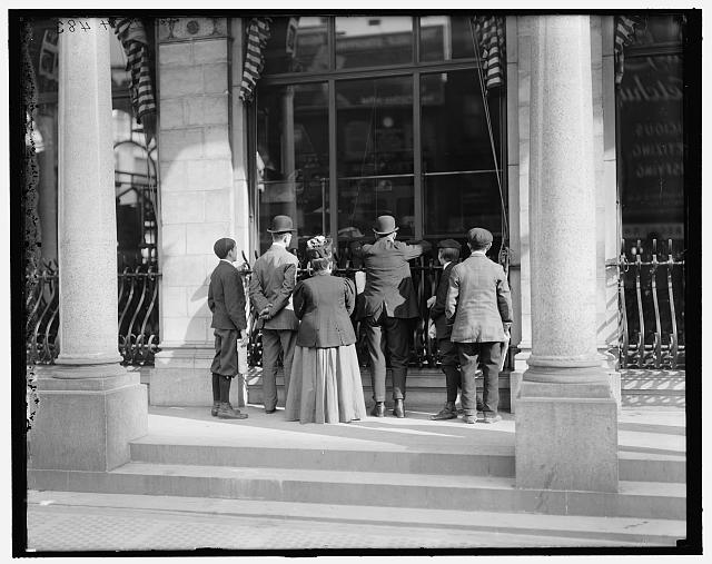
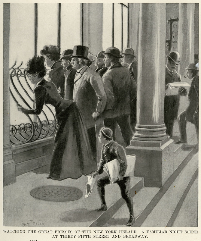
Spectators watch the Herald presses in action. {LOC}
From the Appleton publication The New Metropolis, 1899 (courtesy CUNY)
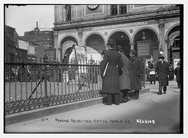
The square in front of the Herald Building would also be used for immediate announcement, often taken right from the telegraph. These men are reading a military recruitment advertisement. [LOC]
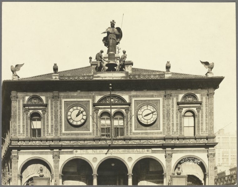
A closeup of the ornate clock, with the goddess Minerva, its two bell ringers Scruff and Guff, and the series of owls perched at various spots around the building. From March 1921 (Courtesy NYPL)
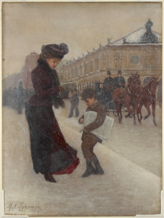
A painting by Herman Hyneman from 1899, depicting a Herald newsie and a customer in the snow. [NYPL]
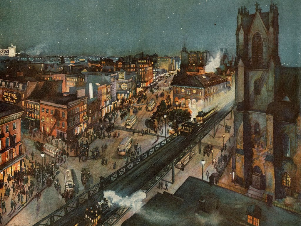
Also from The New Metropolis, an owl’s-eye view of Herald Square, from 1899. The caption: “This is a vibrant reproduction of a color print by Canadian-born artist Charles William Jefferys (1869-1951) who once worked at the New York Herald. The Broadway Tabernacle Church, the 6th Avenue elevated train, the Herald Building and several theatres, including Koster and Bial’s, are depicted. The streets are teaming with cable cars, horse drawn vehicles and pedestrians.” Courtesy CUNY
And finally, an overhead view of the entire square. This is an image that was cleaned up and published by the great photo blog Shorpy. Click into the picture to see a rather magnificent view of the surroundings. Trust me, you may waste five minutes just looking at this one….
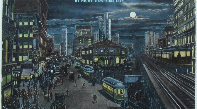
Herald Square at night, 1910, with the flurry of shoppers, the churn of printing presses, the clanking and soot exhaust of the elevated train, the rush of the streetcar. The theaters, the drinking, the dancing. (Courtesy the blog Ajax All Purpose Blog)
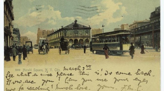
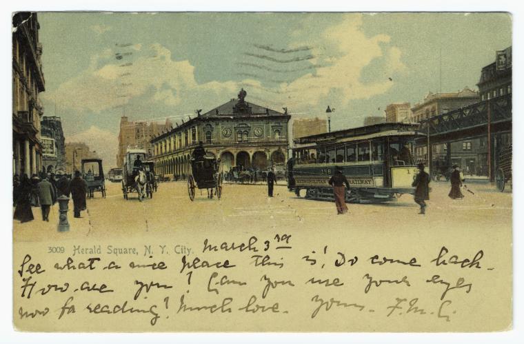
PODCAST Welcome to the secret history of Herald Square, New York City’s second favorite intersection — after Times Square, of course, just a few blocks north. But we think you may find this intersection at 34th Street, Sixth Avenue and Broadway perhaps even more interesting.
This is a tale of the Tenderloin, an entertainment and vice district which dominated the west side of midtown Manhattan in the late 19th century, and how it abutted the great cultural institutions that soon became attracted to Herald Square, from cheap aquariums to New York’s greatest opera house.
By the 1890s, newspapers arrived to the area, including the one that gives Herald Square its name. A remnant of the New York Herald Building still sits in Herald Square and is the cause of some serious conspiracy. (Especially if you’re afraid of owls!) But the Herald wasn’t the only publication that got its start here; in fact, one of America’s most famous magazines began in a curious office-slash-bachelor apartment facility just close by.
The department stores came at the start of the 20th century, and we bring you the tales of Macy’s, Saks and Gimbels, not to mention their later incarnations, the Herald Center and the Manhattan Mall.
ALSO: Where on 32nd Street were crazy parties featuring a who’s who of New York’s greatest freak show performers? Where did a silent fim stunt man meet his end? And where in New York can you get the best in Korean pop music?
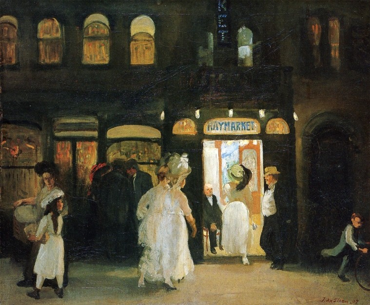
The bawdy Haymarket dance hall, at 30th Street and Sixth Avenue, in a magnificent painting by John Sloan (1907) that conjures up the glamour and winks at its secret pleasures. Several of Sloan’s works depict places located in the Tenderloin, a wide area of entertainment and vice west of Broadway. The original painting hangs in the Brooklyn Museum.
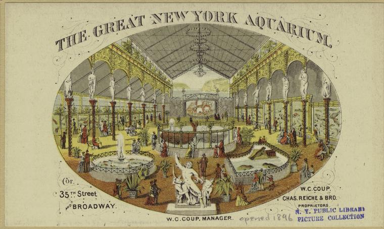
The Great New York Aquarium of W.C. Coup, bringing sea creatures to the corner of Broadway and 35th Street. (NYPL)
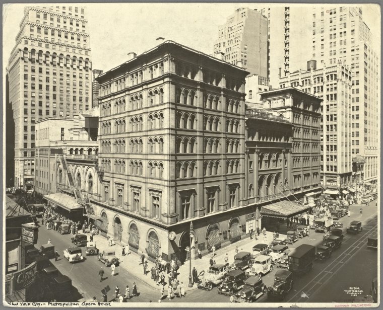
The character of Broadway between the intersections of 34th Street and 42nd Street (before they were known as Herald Square and Times Square, respectively) was changed forever with the construction of the Metropolitan Opera House, a vanity project for New York’s new wealthy class. It was all for show; there were plenty of loges for the rich, but so little backstage room that set pieces were stored on the street. (NYPL)
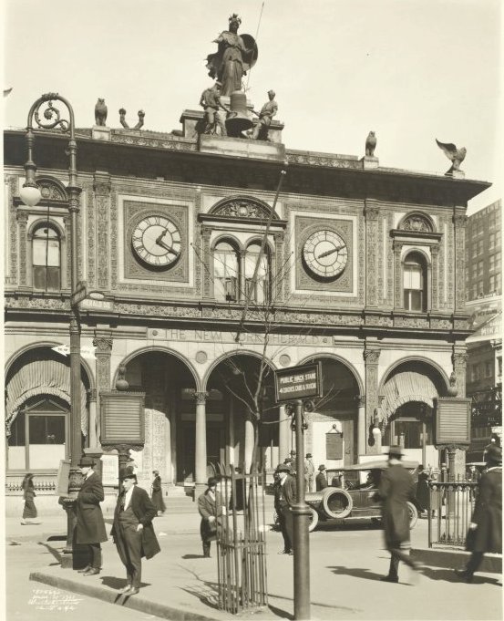
The front of the New York Herald building, with its ornate clock face and Minerva statue. Please note the owls on the corners. (NYPL)
The two most dominant structures in Herald Square in the 1890s — the Sixth Avenue Elevated and Stanford White’s Herald building. “Running presses seen from street.” (NYPL)
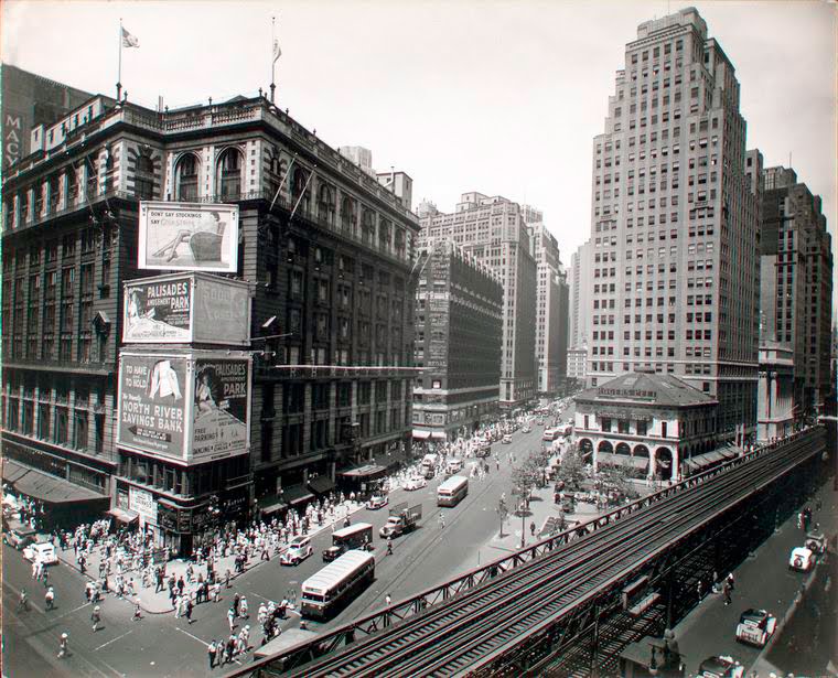
The Elevated and the Herald Building from another angle in 1936, with the new addition of Macy’s — and the little building which prevented Macy’s from taking up the entire block! Today, that’s still a Sunglass Hut. You can also see that the back of the Herald offices has already been demolished and replaced with an office building. The front would survive a bit longer and then too would be destroyed. (NYPL)
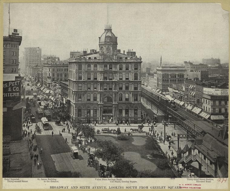
A view of Greeley Square, with the elevated to the right. This building is the Union Dime Saving Bank. The counting offices of the New York World were on the ground floor, however I’m not certain if they are there in the year this picture was taken (1899).
Now here’s a mystery for you — this is Greeley Square, named for the statue of Horace Greeley which was definitely installed in 1894. Hmm, but where is it?
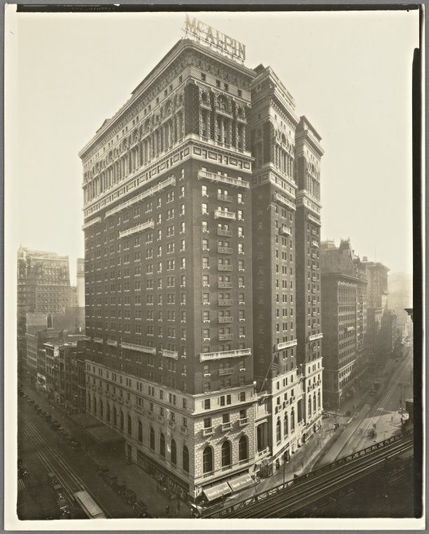
The Hotel McAlpin, at the southeast corner of 34th Street, the largest hotel in the world when it was built in 1912! Happy 100th anniversary to this accommodation, pivotal in New York City history.
Herald Square in an early (1896!) clip from Edison.
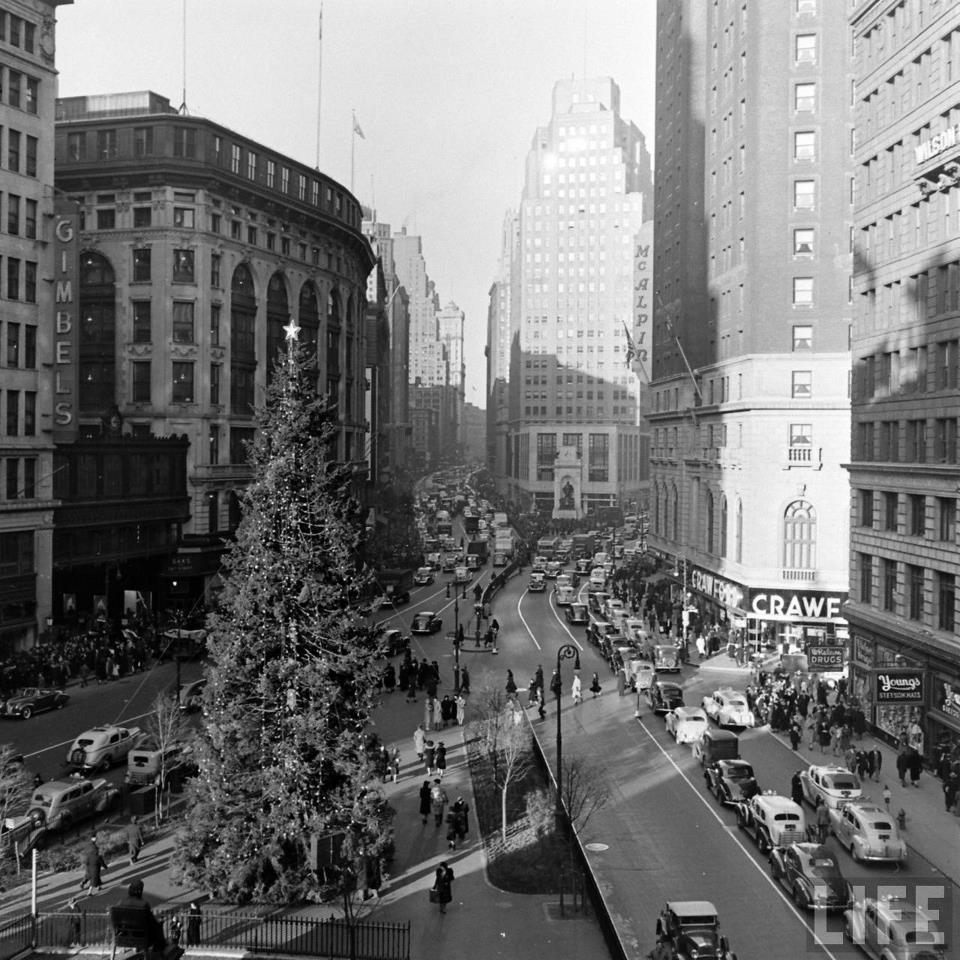
And an image for the holidays, from the 1940s! Courtesy Life Magazine
Joel Sternfeld’s extraordinary four-seasons photographs of the High Line — displayed in his 2002 show Walking The High Line — revealed a ribbon of nature surrounded by urbanity and presented a peek into forgotten history. These images greatly influenced the later design of the park, a mix of seamless design and tastefully untethered flora. Courtesy Joel Sternfeld
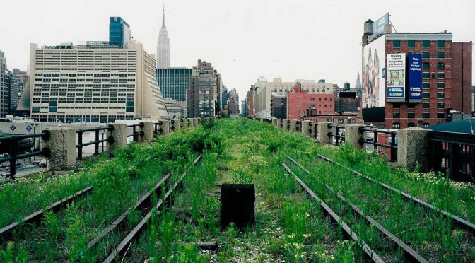
PODCAST The High Line, which snakes up New York’s west side, is an ambitious park project refitting abandoned elevated train lines into a breathtaking contemporary park. This is the remnant of a raised freight-delivery track system that supported New York’s thriving meat, produce and refrigeration industries that have defined the city’s western edges.
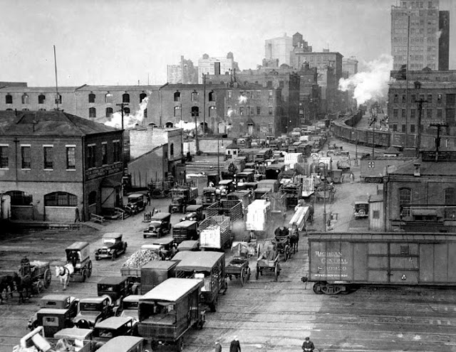
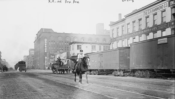
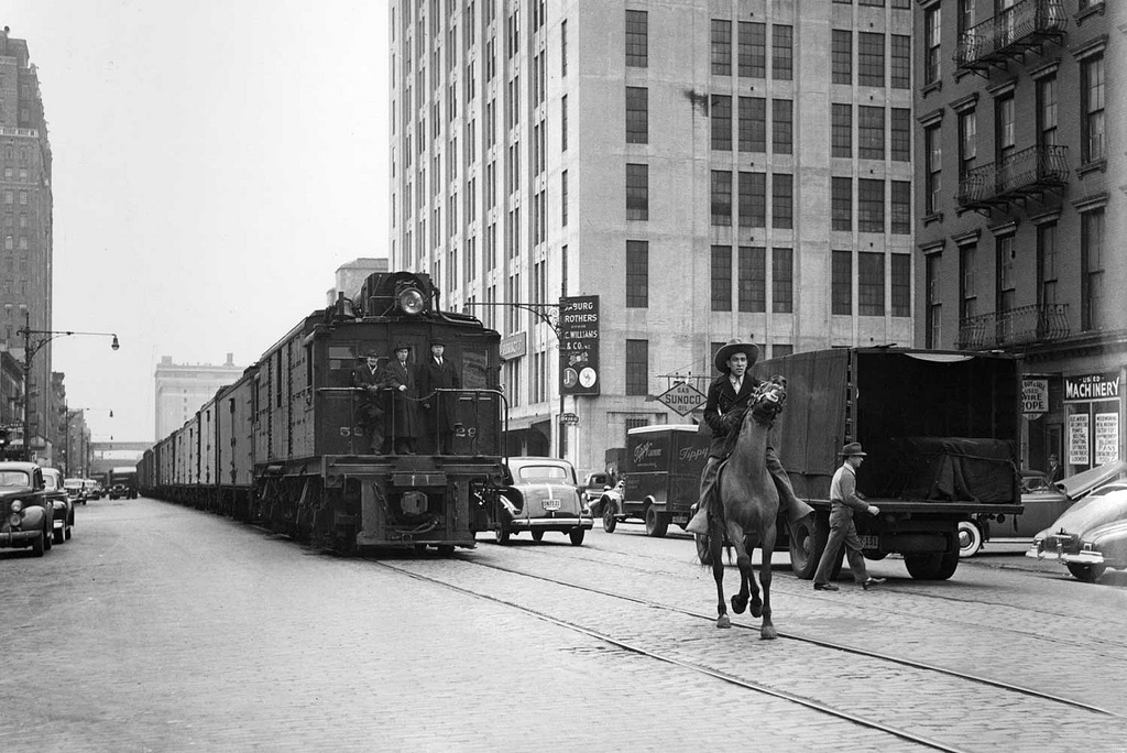
You can trace the footprints of this area back almost 200 years, to the introduction of the Hudson River Railroad and Cornelius Vanderbilt, who transformed the streets along the Hudson River into ‘the lifeline of New York’, filled with warehouses, marketplaces and abattoirs. And, of course, lots of traffic, turning 10th Avenue and 11th Avenue into ‘death avenues’, requiring New York’s first ‘urban cowboys’. The West Side Elevated Freight Railroad was meant to relieve some of trauma on the street. That’s not exactly how it worked out.
We’ll tell you about its downfall, its transformation during the 70s as a haven for counter-culture, and its reinterpretation as an innovative urban playground.
FEATURING: Cows, dining cars, Russian caviar and sex clubs!
St. John’s Freight Depot, built in 1871. The Cornelius Vanderbilt statue stood watch over the bustling activity until the building was demolished in the 1930s. Mr. Vanderbilt was then moved to Grand Central Terminal, where he still stands today. Pictures courtesy NYPL digital images
The businesses, the trains and the marketplaces of the west side created a nightmare traffic situation along 10th and 11th Avenues, resulting in dozens of death and the sinister moniker ‘Death Avenue’. (Picture courtesy Friends of the High Line)
Rangers of Eleventh Avenue: A railroad cowboy marches ahead of an approaching train. Below that, many years later, another cowboy has his work cut out for him going up the avenue in 1922, the era of automobiles.
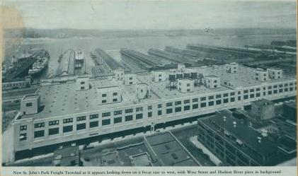
The relatively ‘modern’ St. Johns Terminal on Spring Street.
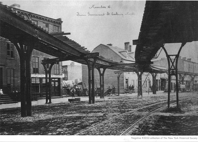
Building the elevated freight railroad: At Gansevoort Street, looking north. Picture courtesy the New York Historical Society
The elevated in 1934, West Street and Spring Street. This was one of the sections that was later ripped down. (Courtesy NYPL)
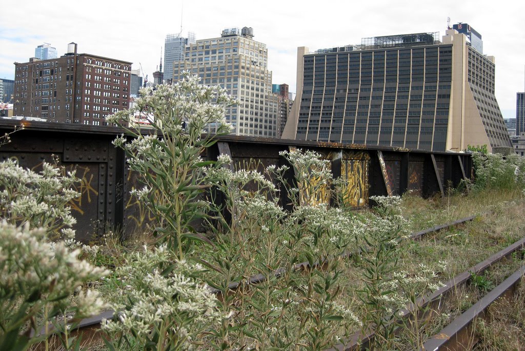
After the elevated railroad closed for good in 1980, the track sat abandoned, covered in natural overgrowth of the likes hardly seen anywhere else in Manhattan. ‘Urban explorers’ often traipsed along the mysterious rails, capturing the dichotomy between sudden natural landscape and metropolitan backdrop. (Photo courtesy wally g/Flickr)
The High Line Park opened in 2009, after almost a decade of awareness and fundraising. The linear park has helped transform the neighborhoods below it and has created a new must-see destination for tourists. (Courtesy Friends of the High Line)
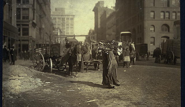
Gritty streets, circa 1912. Looking up Lafayette Street, below Astor Place. “The breaking point. A heavy load for an old woman.” The building to the right is the DeVinne Press Building, built in the 1880s, and today home to Astor Center Wine & Spirits. In the distance: the Wanamaker Department Store building, today the home to K-Mart! Look here and turn the angle north for the present view of this street. [Source: LOC]
Lewis Hine hit the streets of New York in 1912 looking for dirt. And he found it. The teacher-turned-social activist and photographer had found the camera a useful tool in illustrating poverty and had already drawn attention to deplorable child labor conditions. In the wake of early social crusaders like Jacob Riis, Hine’s photos helped the poorest New Yorkers by showcasing their daily toil in a landscape of decrepit quality.
Beyond the social commentary, however, these are still fascinating portraits of New York. None are more striking to me personally than his images taken one hundred years ago this month from Astor Place and along Lafayette Street. Many New Yorkers marveled that month at the exploits of daredevil pilot Frank Coffyn over New York harbor, but after the fun was over, many came home to this.
A highly energetic crossroads today, the destination of college students, shoppers, and theater goers, Astor Place has clearly cleaned up its act since Hine sat his tripod here a century ago. With these particular images, Hines was specifically commenting on ‘home-work’, poor women and children taking raw materials or clothing to mend back to their tenements, turning their confined living quarters into personal sweatshops.
They say other things to us today. The street conditions speak for themselves. But see if you can identify some of these street corners!
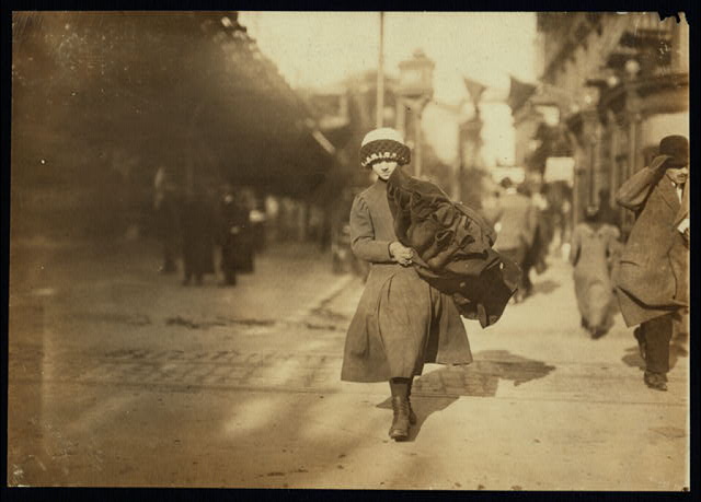
Caption “Woman crossing Astor Place with home-work”: Looking up Fourth Avenue, with the Wanamaker department store building (designed by the great Daniel Burnham in 1904) to the left.
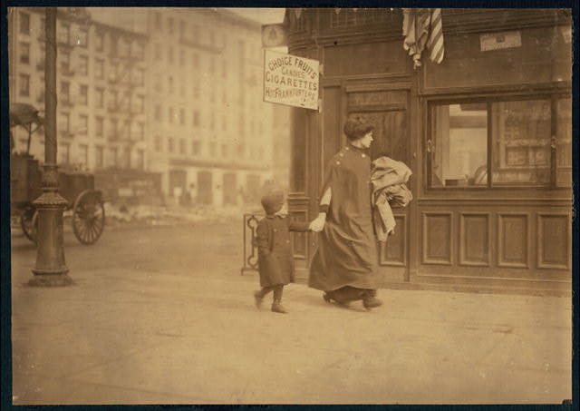
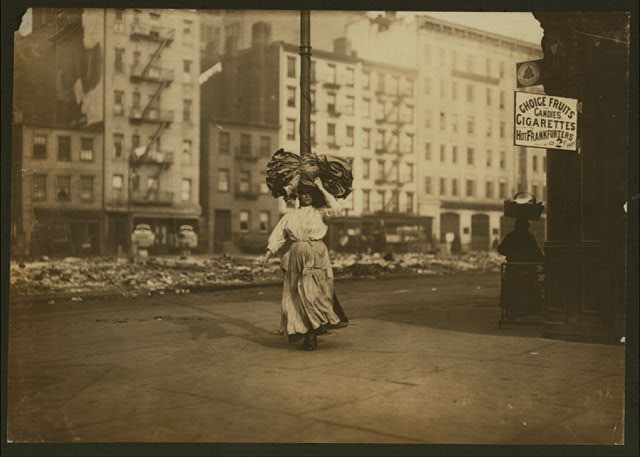
Two pictures on the same street corner. Notice the condition of the street in the background. The shop sign advertises ‘Choice Fruits, Candies, Cigarettes, Hot Frankfurters’. They also have a public AT&T telephone.
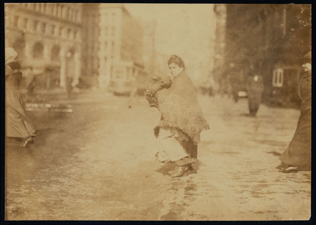
I find this one the most intriguing. “Young girl carrying bundle of coats home to be finished.” She’s clearly walking up (or down?) along the Third Avenue elevated train. Keep in mind, in context to last week’s post on the Coffyn flight, that it’s so cold in New York at this time that the East River has frozen over in many places.
Pictures courtesy of the Library of Congress. You can check out their digital archives for hundreds of other Hine photographs from this era.
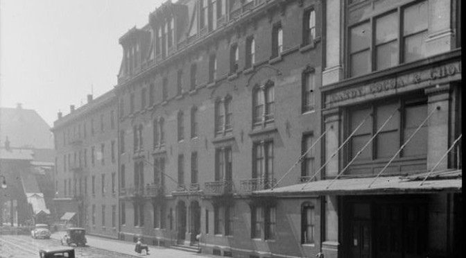
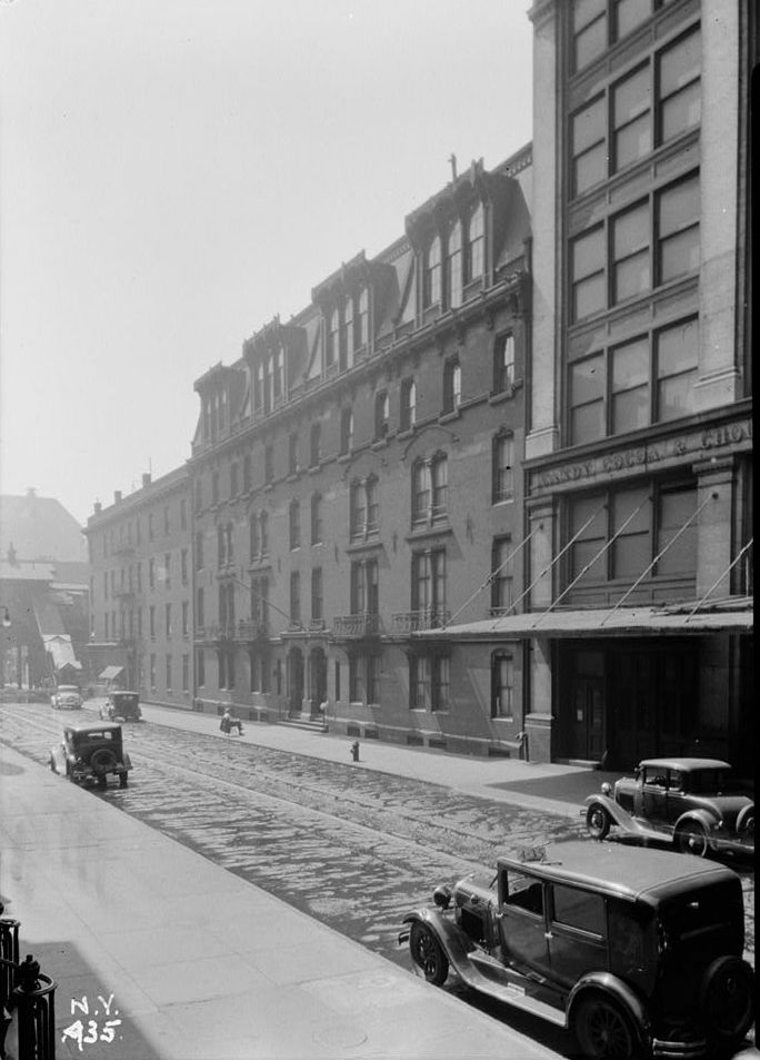
The Stuyvesant Apartments in 1934, already being dwarfed with a newer structure on the right. Please note the ornate entrance to the Third Avenue elevated train to the left of the picture, as well as the streetcar tracks, no longer in use along East 18th Street in 1934, running down the cobblestone street. And I’m fairly sure that’s a taxicab in the foreground.
Here are some notes on podcast #131: The First Apartment Building. To listen to the show, download it from iTunes or from here. And for those who have listened, thanks for making it one of iTunes top three individual programs in the travel/places podcasts section this weekend!
The Distinction of the ‘First’
How did the Stuyvesant Apartment become known as the true ‘first’ apartment? After all, it’s not like there was a banner over the door proclaiming “Welcome to the first apartment building ever! Come inside!” Urban dwellings were being developed of all shapes and sizes. As I mentioned, there’s not much that technically separates a tenement from an apartment, if you subtract social class and building amenities. There were indeed ‘fancy’ tenements. Some of those buildings are still around today and serve as rather lovely renovated apartments.
Author Elizabeth Collins Cromley (more on her later) suggests there were a couple other buildings in New York City that could have held this title built earlier, including another that Richard Morris Hunt built on Wooster Street. Those candidates, however, were smaller and less profitable. (One was even refashioned as a hotel.) The Stuyvesant was ambitious in size, glorious in architecture and glittering in its notable residents.
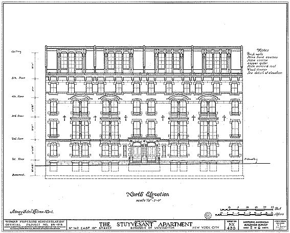
Below: Original drawings of the Stuyvesant Apartments, done by the Historic American Buildings Survey, courtesy Library of Congress
The Other Stuyvesant?
The research for this show became trickier once I realized there was another apartment building that was sometimes referred to the Stuyvesant just a few blocks away, and some scholars have confused the two in their research. For instance, I was quite excited to learn that Clara Clemens, the daughter of Mark Twain, lived at the Stuyvesant until I realized it was most likely the other Stuyvesant. (This author erroneously combines the two structures.)
The second building is right off of Stuyvesant Square, originally addressed 17 Livingston Place. That street no longer exists. Or to quote the wonderful Old Streets blog: Â “On December 3, 1953, in one of the goofier acts of the City Council, it changed the name of Livingston Place (on the east side of Stuyvesant Square) to Nathan D. Perlman Place and simultaneously–perhaps to mollify any offended Livingston descendants–changed the name of Birmingham Street to Livingston Place. The compensation was short-lived. The new Livingston Place was demapped in 1962.”
That building at 17 Livingston Place (valued at drastically less than the Stuyvesant) was apparently demolished too; Beth Israel Medical Center facilities have taken up that side of the square since the late 1910s.
That Stuyvesant Name!
The apartment structure was constructed on old Stuyvesant property. Check out this map of the borders of Stuyvesant farm, which consumes much of today’s East Village and the area dominated by Stuyvesant Town/Peter Cooper Village.
Rutherford Stuyvesant, creator of this luxury apartment, died in Paris, on July 4, 1909. His first wife, a member of the influential Brooklyn clan the Pierreponts, died a few years after the construction of the Stuyvesant Apartments. In 1902 Rutherford took a second wife whose name certainly equaled his own in terms of drama — the Countess Mathilde Elizabeth de Wassanaer [More bio details here]
Stuyvesant built a lavish mansion near Allamuchy, New Jersey called Tranquility Farms, populating the surrounding land with imported trees and animals. The mansion was consumed in fire in 1959. Although the ruins were demolished, many other ancient buildings on the property remain intact. Rusty Tagliareni has taken some fascinating, haunting photos earlier this year of the ruined area. Take a gander here.
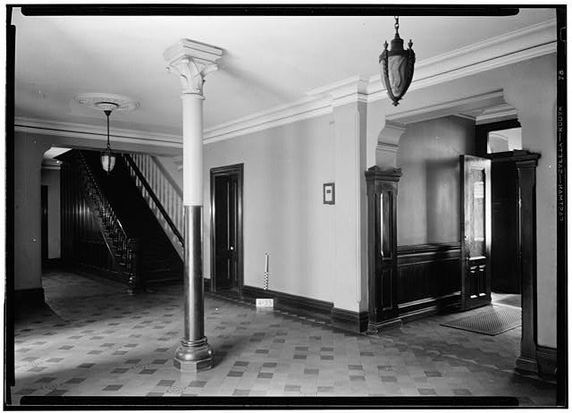
Below: Inside the lobby of the Stuyvesant, circa 1934.
For further reading
There’s a great many books on the history of New York real estate. Definitely invaluable to me this time was Elizabeth Collins Cromley’s ‘Alone Together: A History of New York’s Early Apartments’ and also Steven Gaines’ ‘The Sky’s The Limit’. I learned about the inestimable Mrs. Custer from Shirley A. Leckie’s book ‘Elizabeth Bacon Custer and the Making of a Myth.’
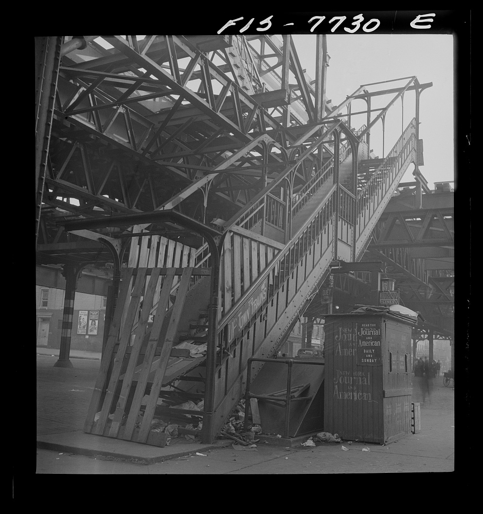
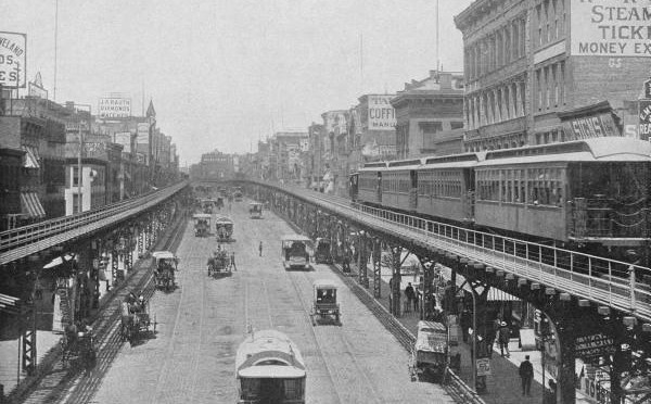
Above: The Third Avenue Line as it looked running along the Bowery, changing the nature of New York street life, even as its innovations helped expand the city.
PODCAST Before there were subways, New York City transported travelers up and down the length of Manhattan by elevated railroad, an almost unreal spectacle to consider today. Steam engines sat high above several avenues in the city, offering passengers not just a faster trek to the northern reaches of Manhattan, but a totally new way to see the city in the 19th century.
Welcome to our second podcast in our series Bowery Boys On The Go, a look at the history of New York City transportation. Before we get to those famous ‘El’ trains, we explore the earliest travel options in the city — the omnibuses and horse-drawn rail cars, the early steam successes of the New York and Harlem Railroad and Hudson River Railroads, and something affectionately nicknamed the one-legged railroad.
What were some of the more peculiar ideas for improving travel? And why was the idea of a subway immediately shot down by the city? Let’s just say — Boss Tweed and Jay Gould are involved.
ALSO: What were the different motivations driving transportation progress in the city of Brooklyn? Well, it has something to do with the beach.
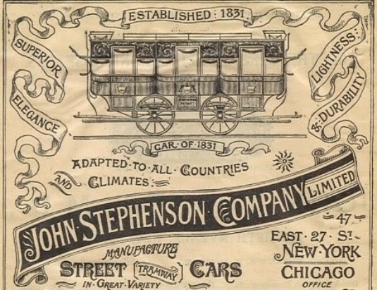
An illustration of the first traincar in the New York and Harlem Railroad system — the John Mason, named for the railroad’s president (Mason was also the president of Chemical Bank). It was designed by master engineer John Stephenson, who customized many of the New York and Harlem’s traincars.
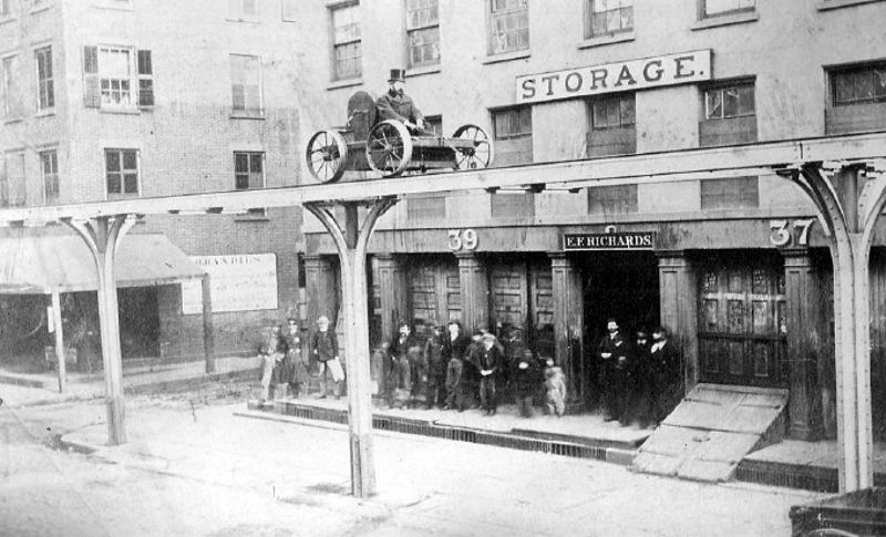
Charles Harvey developed the first elevated system for New York, essentially a cable/pulley system that stretched along the west side from the Battery. Below, Harvey gives his ‘one-legged’ line a tryout in 1867. (Pic courtesy Merritt Island Subway South)
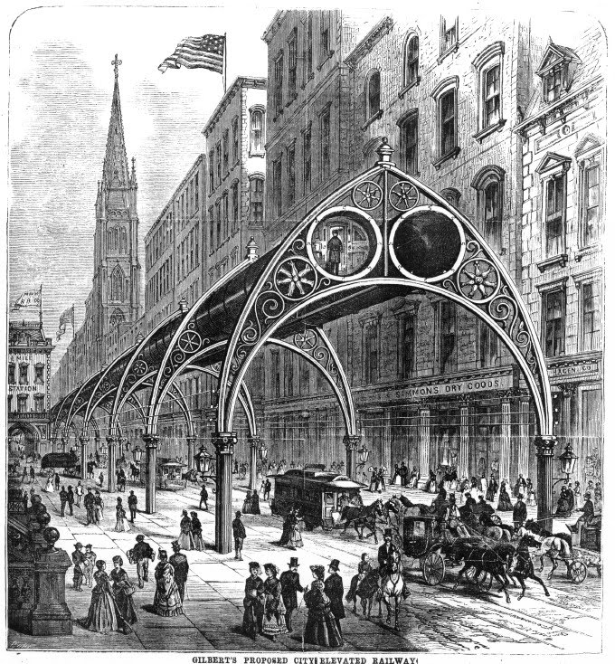
Rufus Gilbert, a Civil War physician, turned to trains after the war and dreamt up an imaginative pneumatic system, to zip passengers above the city in Gothic-themed arches. Gilbert was given the go-ahead to construct this oddity, but the love for steam and a financial crisis transformed the idea into a steam elevated line instead. (Courtesy Columbia U)
Ladies Mile along the Sixth Avenue elevated line. The trains might have made the city expand outwards, but it also made the streets smaller and darker. (Original pic from Shorpy)
The Third Avenue line, where it ran alongside Cooper Union and traveled south down through the Bowery. This intersectioni today still sits rather wide and empty, a vestige of the days when tracks hovered above the roads. [NYPL]
An ornate station for the Ninth Avenue line, at Christopher and Greenwich streets in the West Village.
The Brooklyn and Jamaica Railroad, the precursor to the Long Island Railroad. The section illustrated here is along Woodhaven Boulevard, but much of the line went along Atlantic Avenue.
Fifty-four years ago today, Manhattan passengers said goodbye a true vestige of 19th century New York — the elevated railroad.
The last ride on the Third Avenue El was taken on May 12, 1955. The line stretched up almost the entire length of Manhattan (from Chatham Square, just below Canal Street) all the way up to East 149th Street in the Bronx.Â
How did Manhattan look from the vantage point of an elevated train system in the 1950s? Check out this vintage short from 1950, letting the camera roll through a typical ride on the Third Avenue during a sunny day:Â


![This photo was taken by Stanley Kubrick during his years as a photographer for Look Magazine. The caption reads "Park Bench Nuisance [Woman reading a newspaper, while a man reads over her shoulder.]" Courtesy Museum of the City of New York](https://www.boweryboyshistory.com/wp-content/uploads/2015/04/4.jpg)
