Categories
Brooklyn History Podcasts

Treasures of Downtown Brooklyn: Remnants of the former independent city, hidden in plain sight

PODCAST The fascinating history of Brooklyn’s most bustling — and most frequently misunderstood — neighborhood.

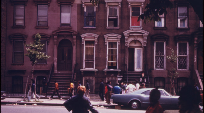
Downtown Brooklyn has a history that is often overlooked by New Yorkers. You’d be forgiven if you thought Brooklyn’s civic center — with a bustling shopping district and even an industrial tech campus — seemed to lack significant remnants of Brooklyn’s past; many areas have been radically altered and hundreds of old structures have been cleared over the decades.

But, in fact, Downtown Brooklyn is one of the few areas to still hold evidence of the borough’s glorious past — its days as an independent city and one of the largest urban centers in 19th century America.

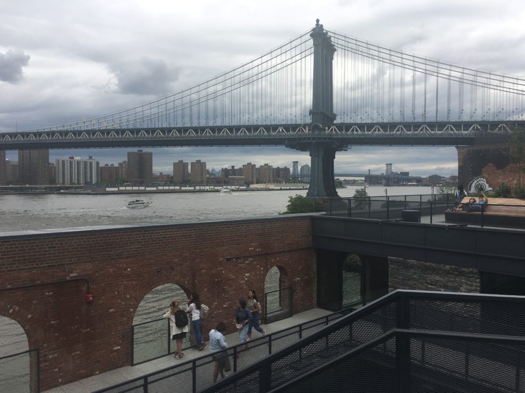
Around Brooklyn City Hall (now Borough Hall) swirled all aspects of Brooklyn’s Gilded Age society. With the construction of the Brooklyn Bridge and a network of elevated railroad lines, Downtown Brooklyn became a major destination with premier department stores on Fulton Street, entertainment venues like the Brooklyn Academy of Music and exclusive restaurants like Gage & Tollners.

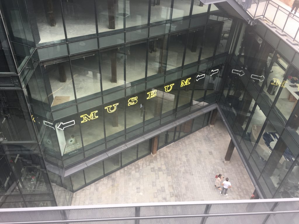
The 20th century brought a new designation for Brooklyn — a borough of Greater New  York — and a series of major developments that attempted to modernize the district — from the creation of Cadman Plaza to New York’s very own ‘tech hub’. In 2004 a major zoning change brought a new addition to the multi-purpose neighborhood — high-end residential towers. What will the future hold for the original heart of the City of Brooklyn?

LISTEN HERE:

_________________________________________________________

The Bowery Boys: New York City History podcast is brought to you …. by you!

We are now producing a new Bowery Boys podcast every other week. We’re also looking to improve the show in other ways and expand in other ways as well — through publishing, social media, live events and other forms of media. But we can only do this with your help!

We are now a member of Patreon, a patronage platform where you can support your favorite content creators for as little as a $1 a month.

Please visit our page on Patreon and watch a short video of us recording the show and talking about our expansion plans. If you’d like to help out, there are five different pledge levels (and with clever names too — Mannahatta, New Amsterdam, Five Points, Gilded Age, Jazz Age and Empire State). Check them out and consider being a sponsor.

And join us for the next episode of the Bowery Boys Movie Club, an exclusive podcast provided to our supporters on Patreon.

We greatly appreciate our listeners and readers and thank you for joining us on this journey so far.

__________________________________________________________

And a video about the history of MetroTech Center from NYU Polytechnic

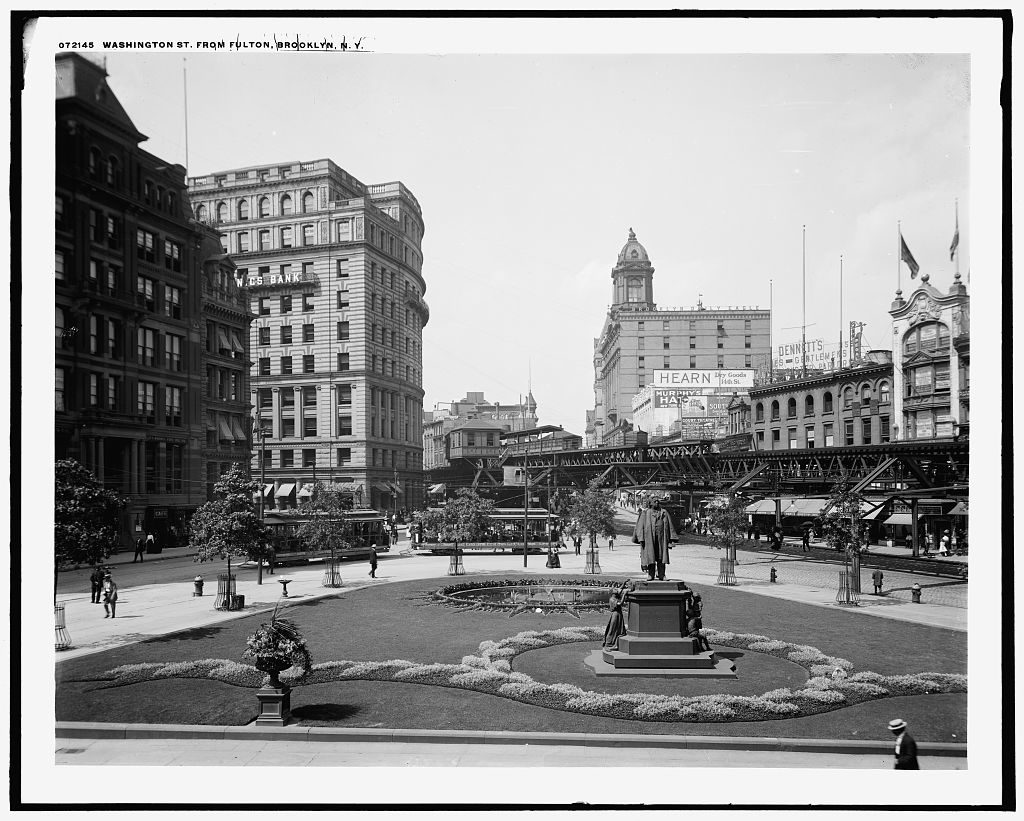
The scene just north of Brooklyn Borough Hall, in a photo taken in the early 1900s. The Henry Ward Beecher monument would be moved further north with the creation of Cadman Plaza.

Detroit Publishing Company / Library of Congress

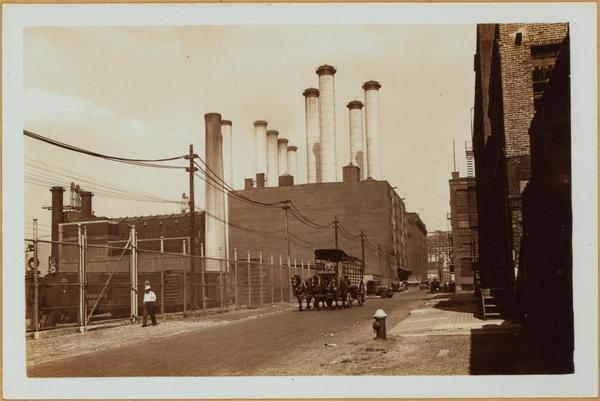
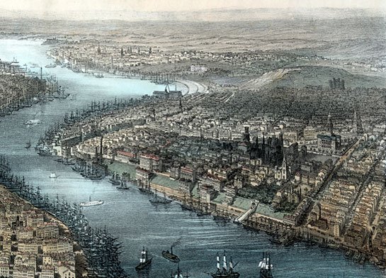
Downtown Brooklyn in 1892, a year of momentous change for the neighborhood. Here you see the elevated railroad snaking up Fulton Street with Brooklyn City Hall on the far left.

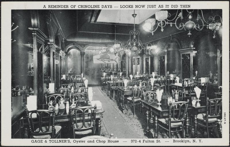
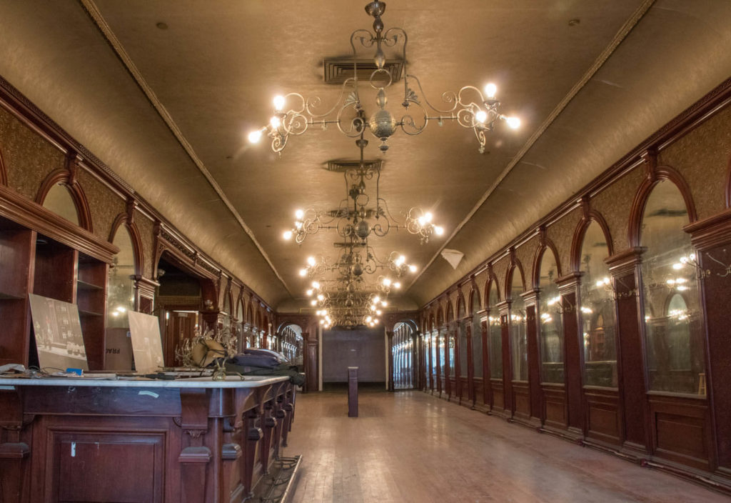
The classic interiors of Gage & Tollner’s exclusive restaurant on Fulton Street. The interiors are landmarks and you can actually peer into the storefront on Fulton Street to see them (although no business currently occupies the space.)

Museum of the City of New York
Susan De Vries/Brownstoner

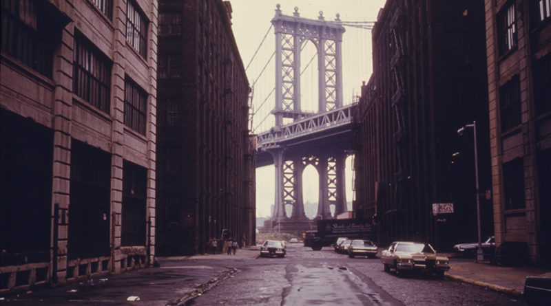
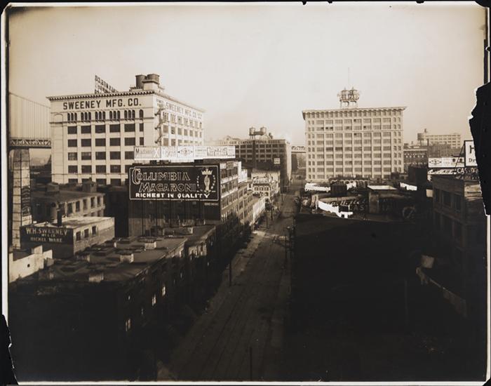
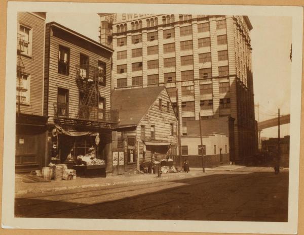
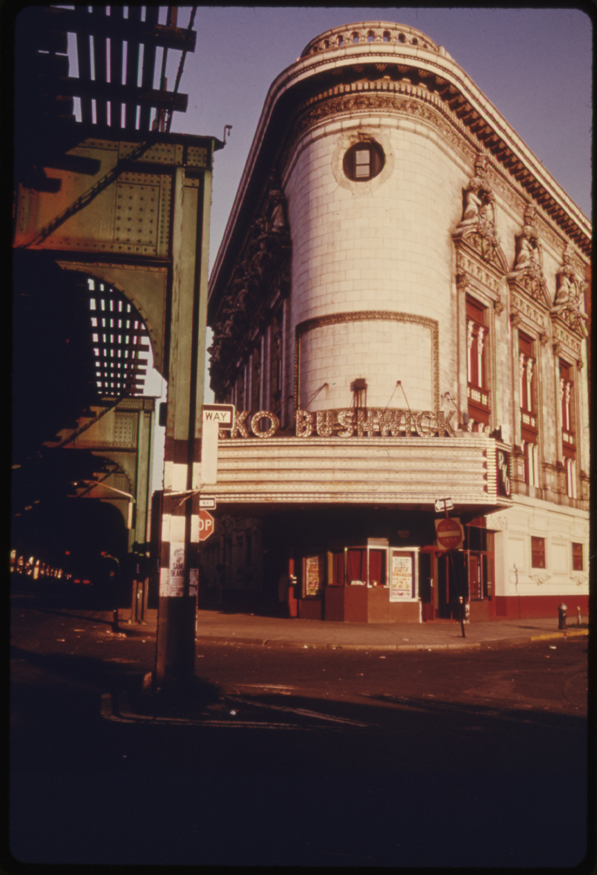
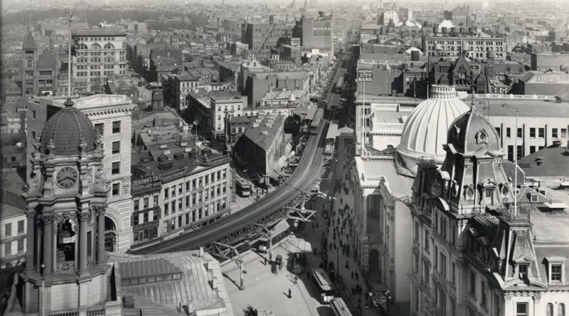
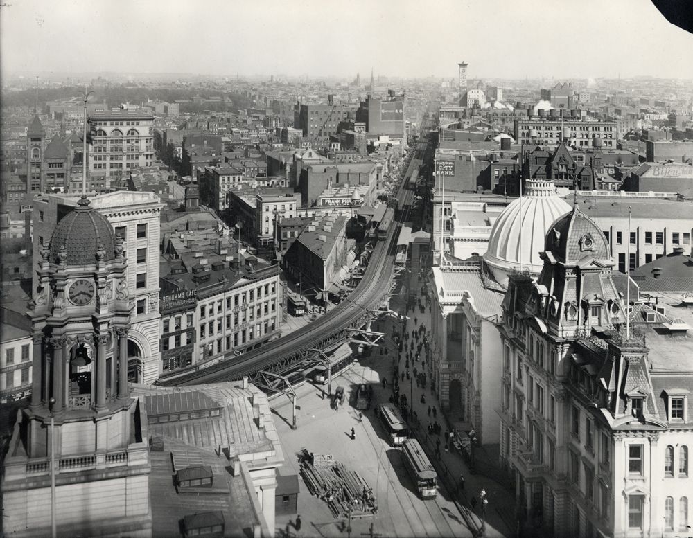
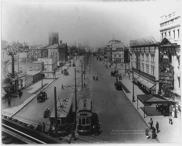
Flatbush Avenue Extension from Fulton Street, 1914 (a few years after the opening of the Manhattan Bridge). Note the Crescent Theatre to the far right. It opened as a vaudeville/burlesque house and transitioned to silent films.

Library of Congress

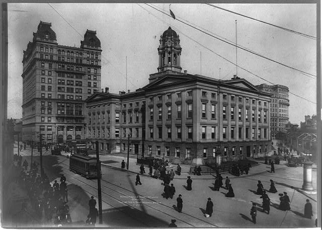
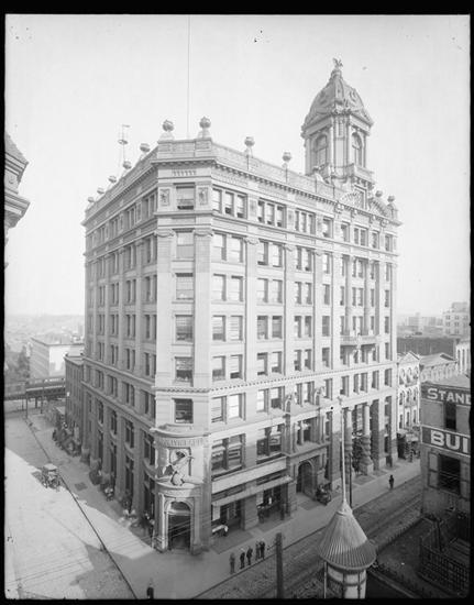
Brooklyn Borough Hall in 1908 with its new neighbor, the Temple Court Building (constructed 1901).

Irving Underhill/Library of Congress/ 1908

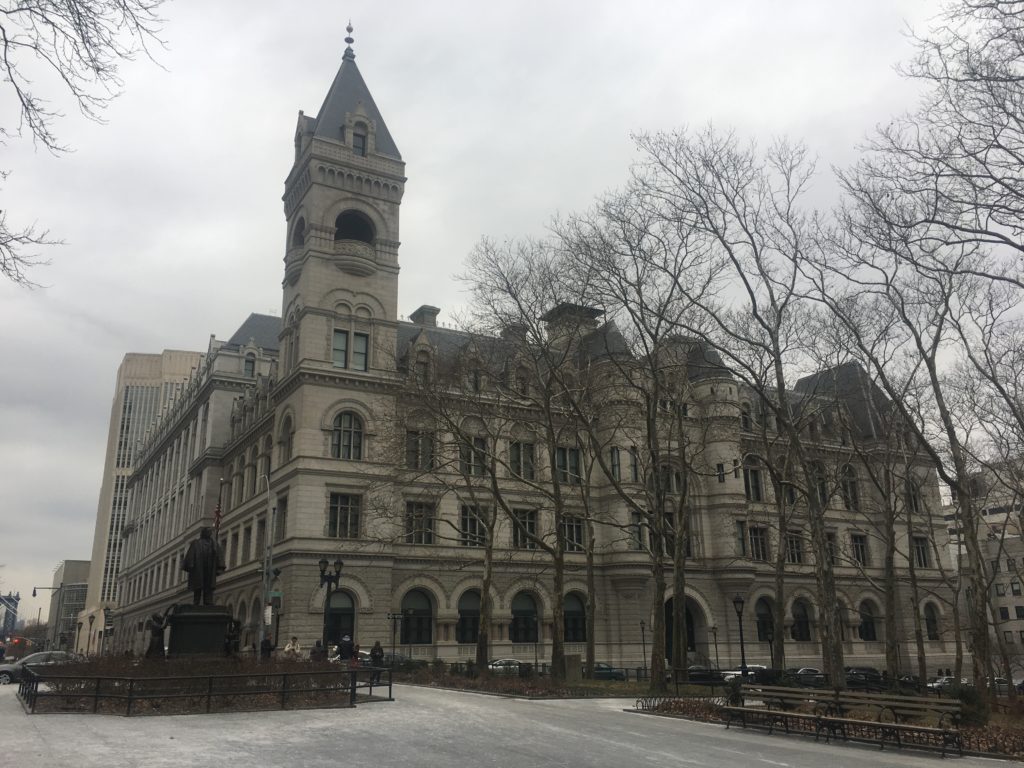
The post office was once next to the Brooklyn Daily Eagle offices. The Eagle building was demolished, as was Washington Street. (It became Cadman Plaza East.)

Museum of the City of New York

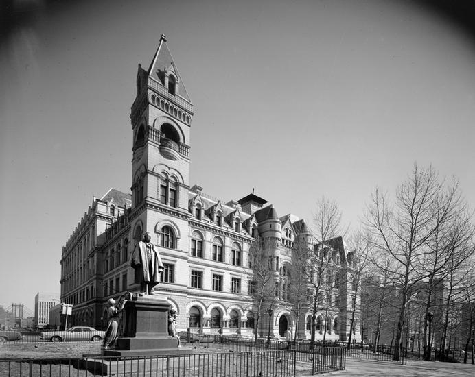
The post office building on Cadman Plaza in 1976, with the newly situated Henry Ward Beecher monument.

Edmund Vincent Gillon, Museum of the City of New York

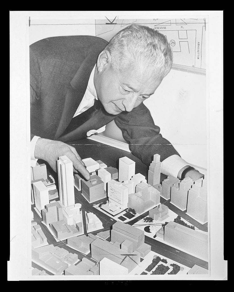
A 1963 photo of Abe Stark, Brooklyn borough president, hovering over a model of the ‘new’ civic center plan for downtown Brooklyn.

Higgins, Roger, photographer/Library of Congress

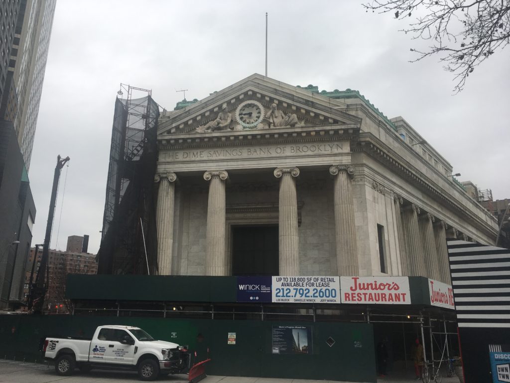
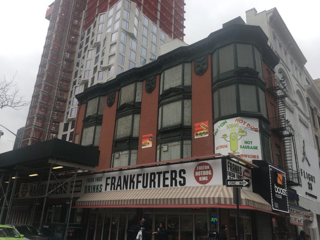
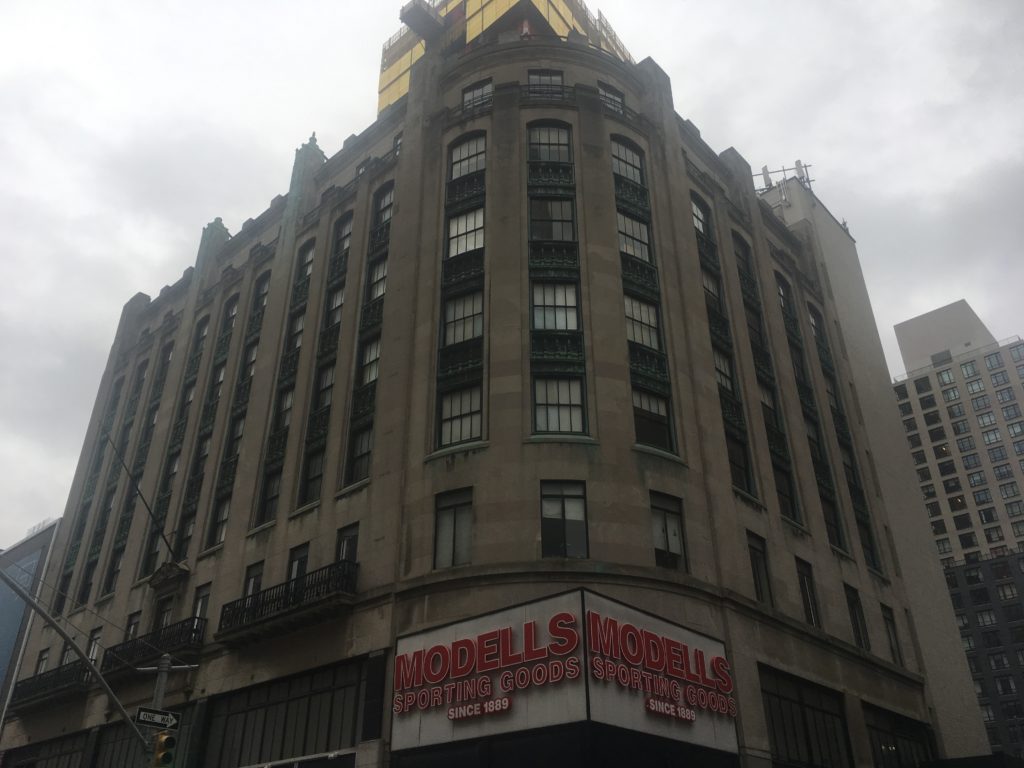
The Dime Savings Bank of Brooklyn is an oddity among the old retail shops of Fulton Street but its classical architecture has helped it survive the wrecking ball.

Look above the first or second floors on Fulton Street and you’ll find some curious and spectacular architectural finery.

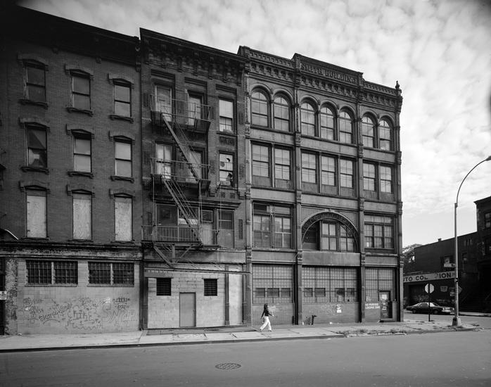
The landmarked Offerman Building, the most beautiful former department store on Fulton Street.

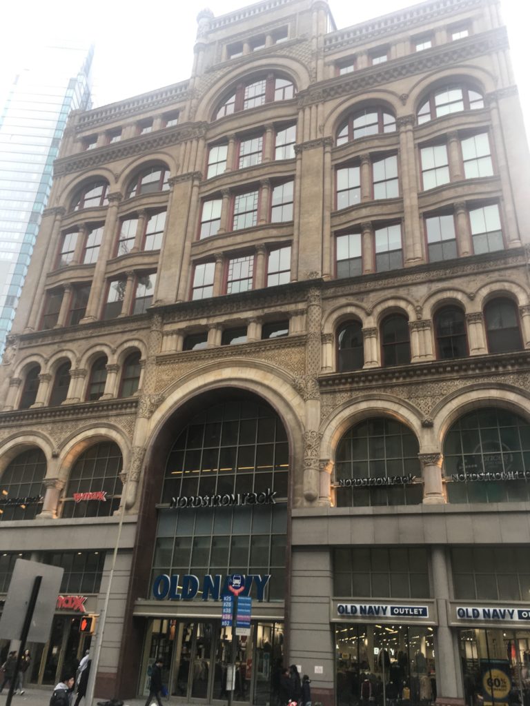
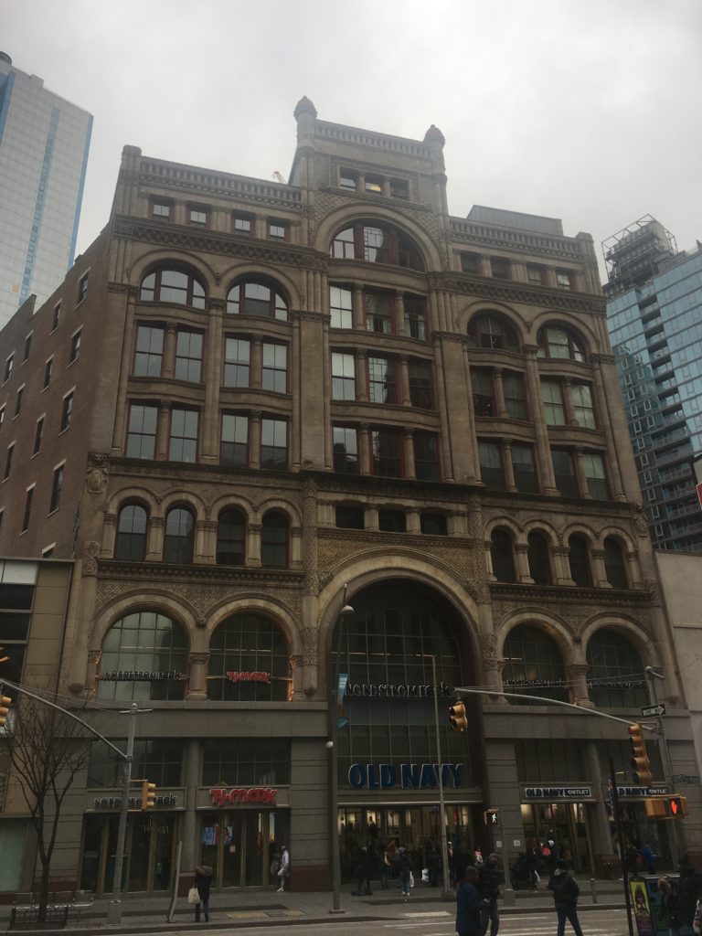
More department store richness:

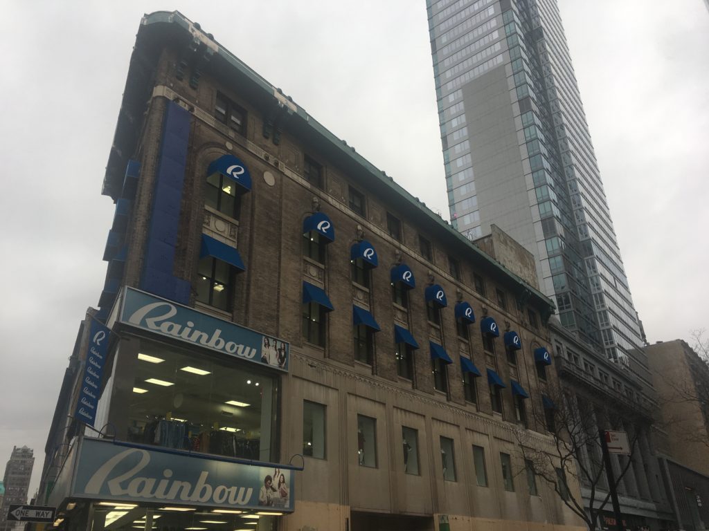
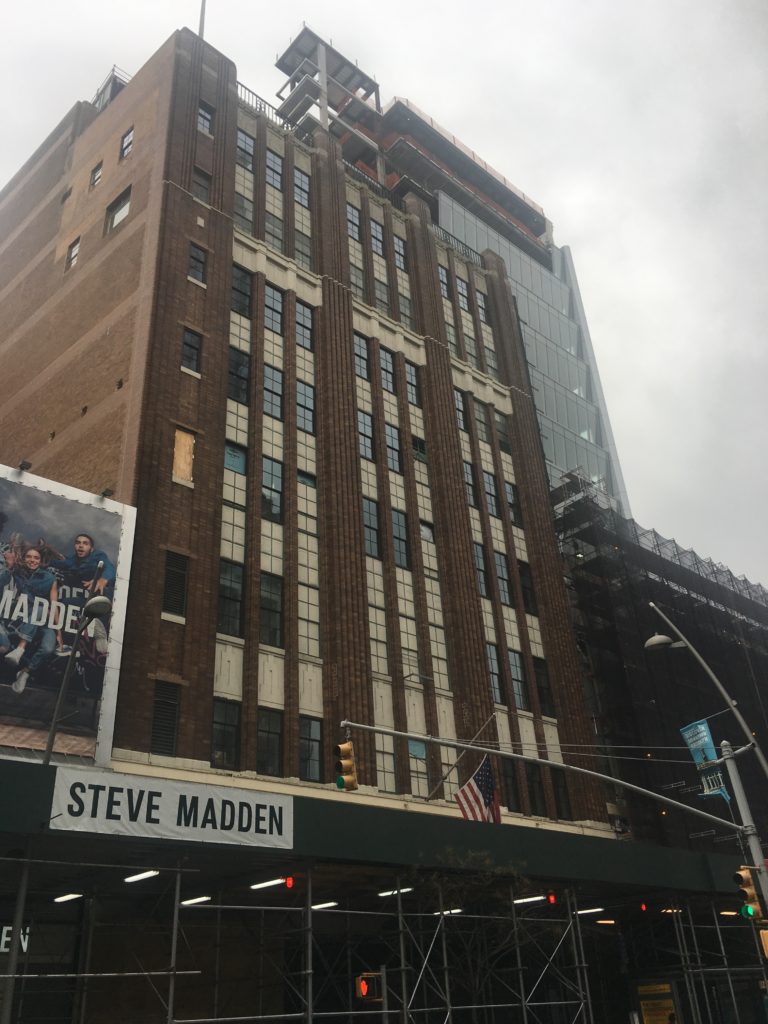
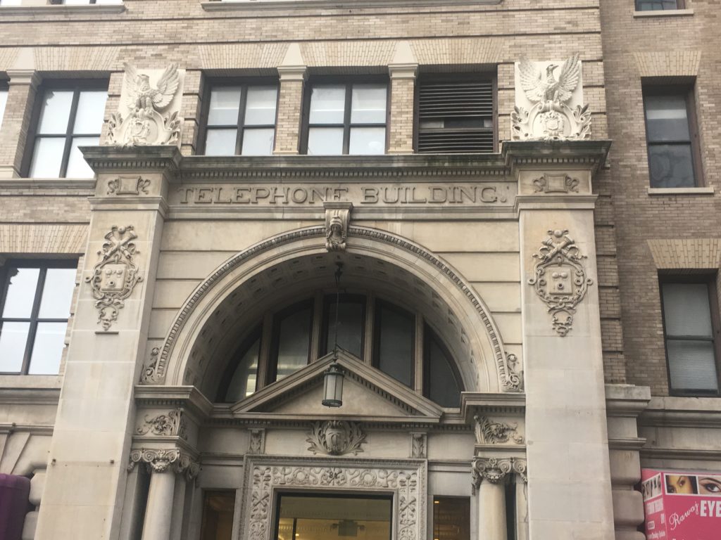
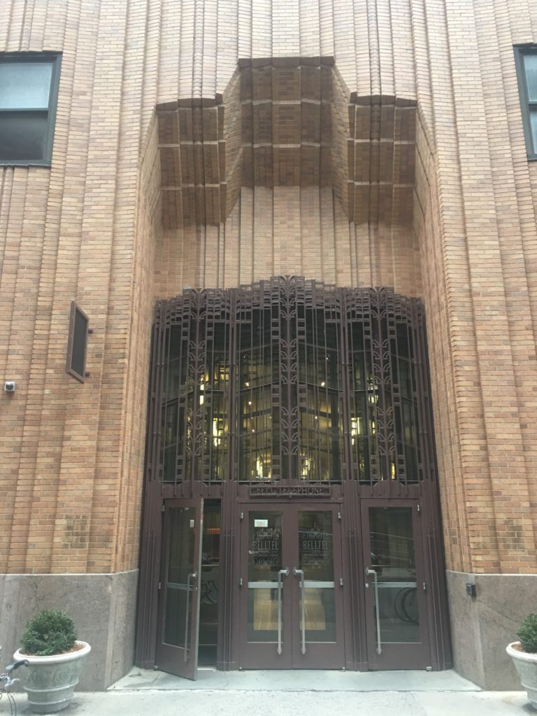
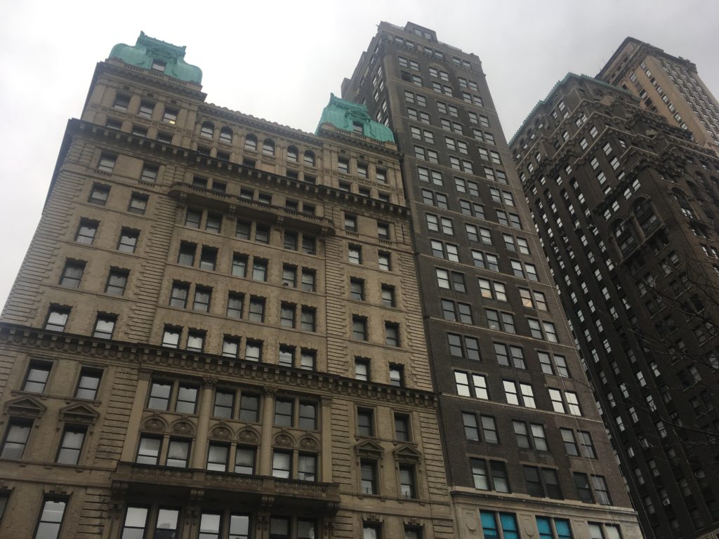
The New York Telephone Company Building and the NY and NJ Telephone and Telegraph Building both remain standing amid a sea of new supertall residential construction.

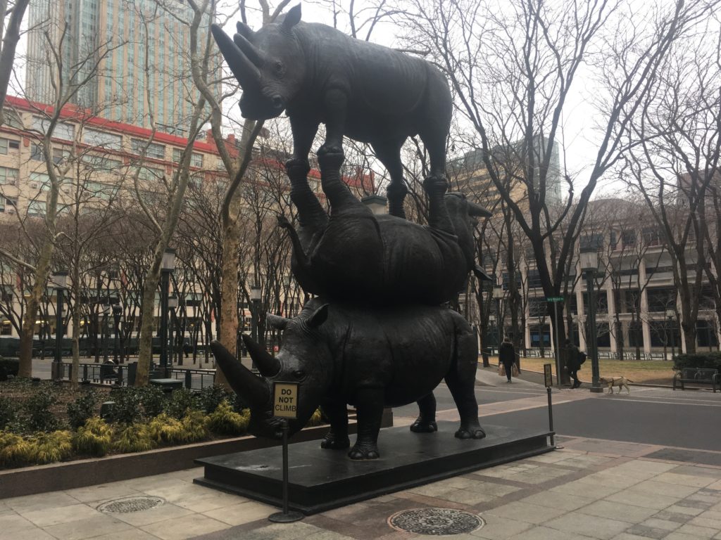
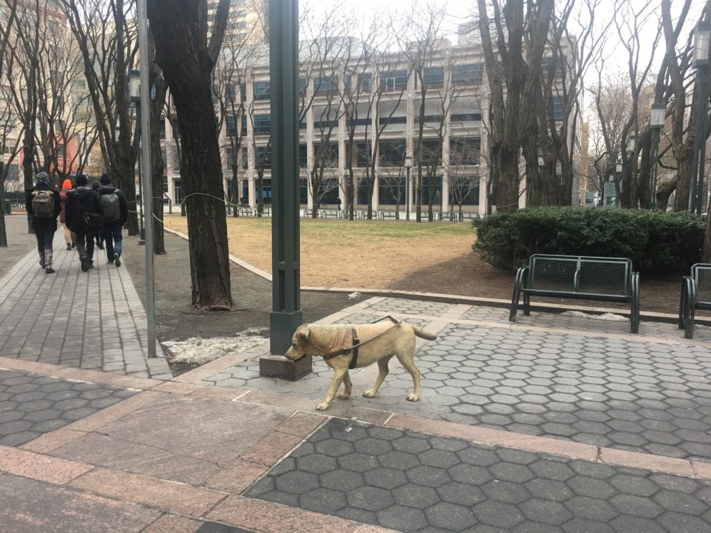
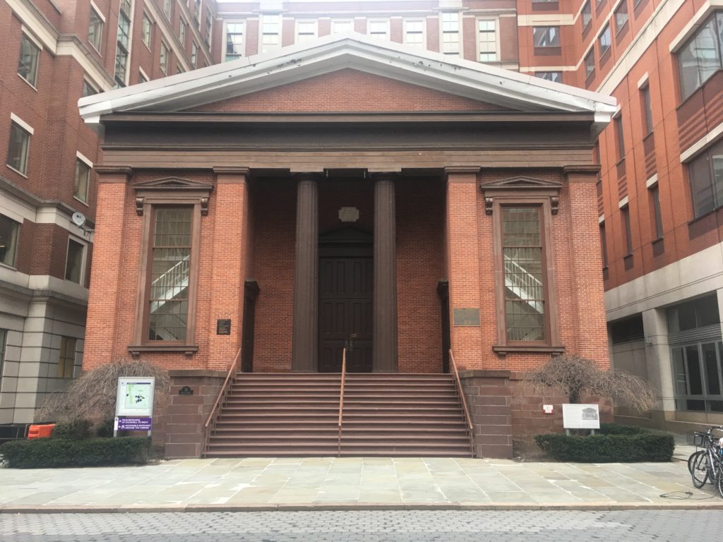
Some curious features of MetroTech Commons — two whimsical animal-themed sculptures and the Bridge Street Church, a historical landmark associated with the Underground Railroad.

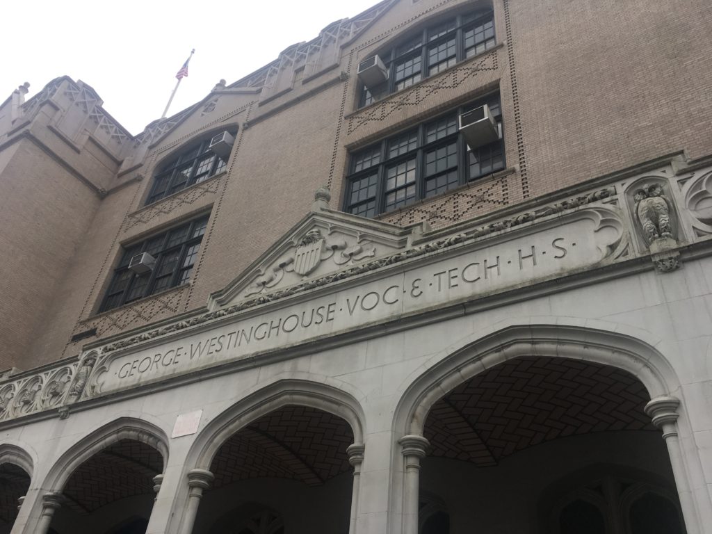
A block north of MetroTech Commons, you’ll find the historic George Westinghouse High School.

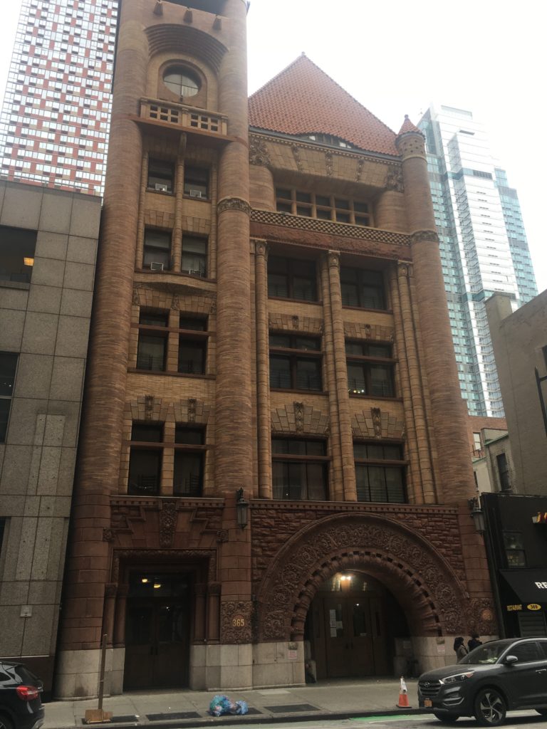
The old Brooklyn Fire Headquarters on Jay Street, built in 1892 in a style most unusual for the neighborhood — Richardsonian Romanesque Revival.

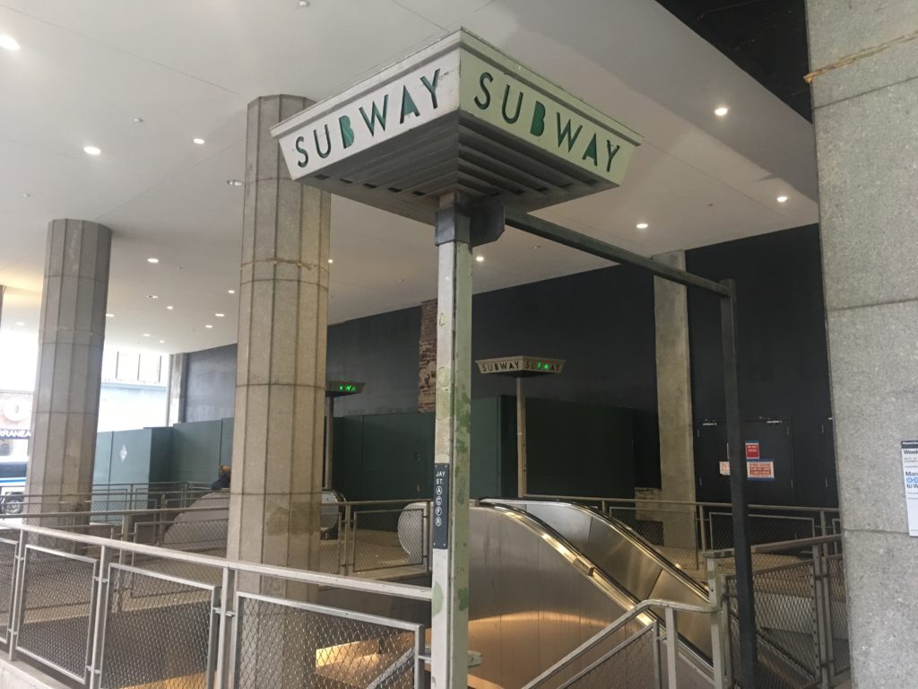
The Jay Street-MetroTech station still contains some quirky details from the past.

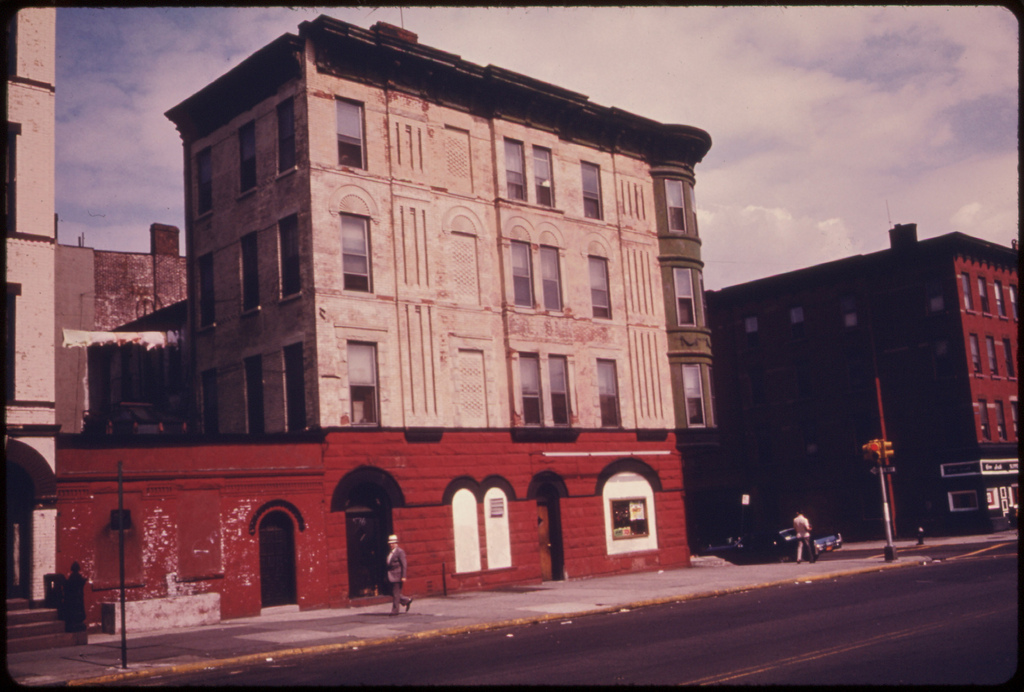
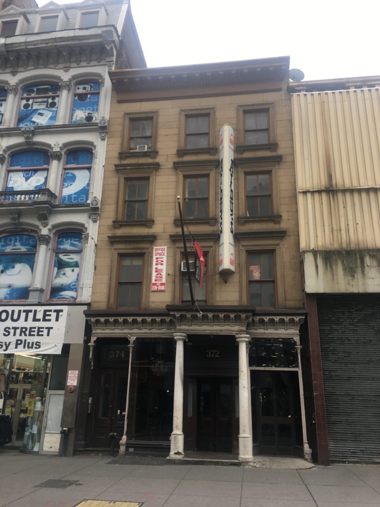
This undistinguished old building was once the home of Gage & Tollner’s, the most exclusive restaurant in Brooklyn.

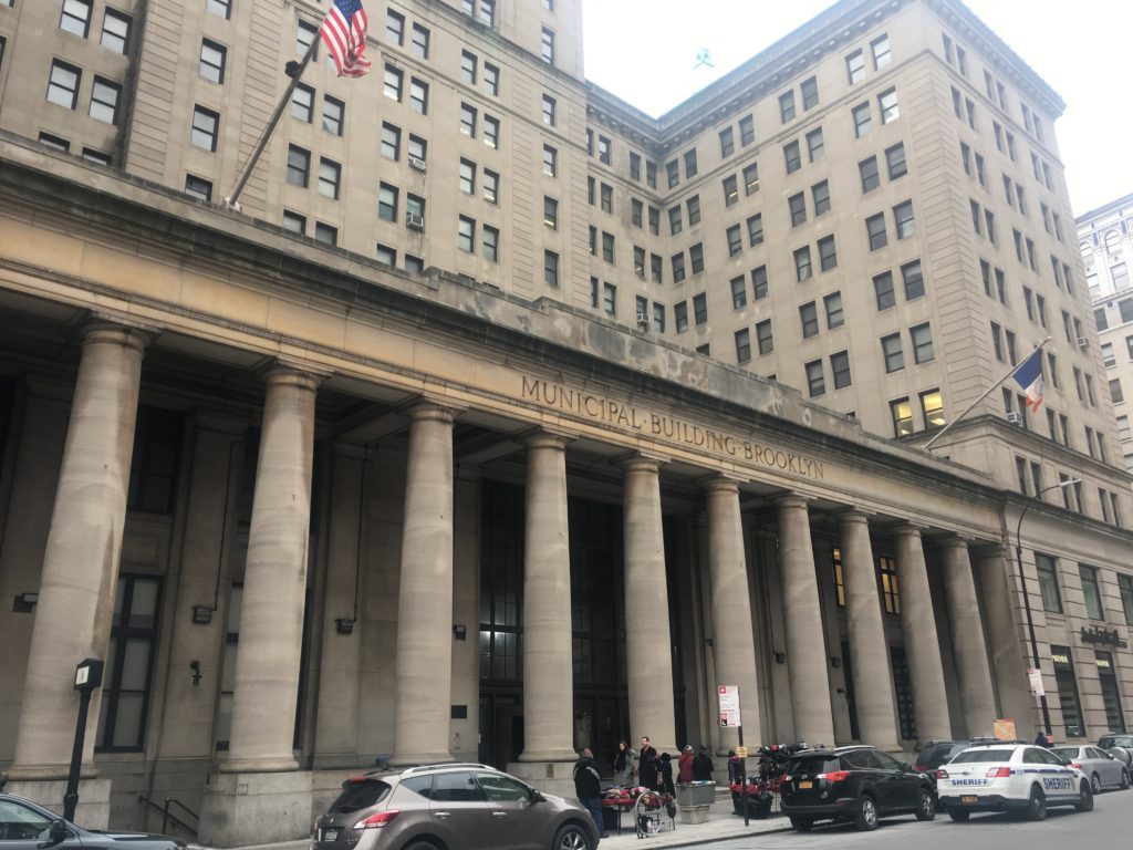
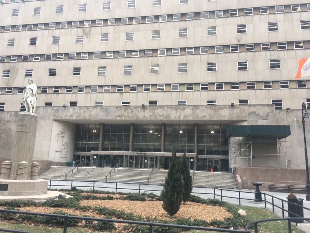
The austere Municipal Building was constructed in 1924 and the skyscrapers which surround it also joined the neighborhood in the same decade.

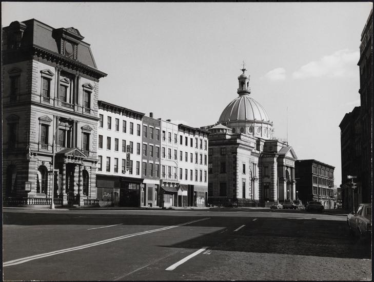
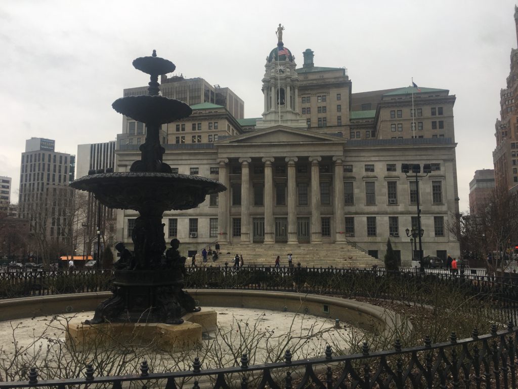
Brooklyn Borough Hall and Columbus Park:

The 1892 Federal Building and Post Office with a tribute to Henry Ward Beecher (which once sat closer to Brooklyn Borough Hall).

Further Listening:

If you like Brooklyn history, check out these episodes from our back catalog that are referenced in this week’s show.

Categories
Brooklyn History Podcasts

The History of DUMBO, the Brooklyn neighborhood built upon a legacy of coffee and cardboard boxes

PODCAST The history of Brooklyn’s DUMBO neighborhood — from its industrial past to its hi-tech future.

Down Under Manhattan Bridge Overpass (DUMBO) is, we think, a rather drab name for a historically significant place in Brooklyn where some of the daily habits of everyday Americans were invented.

This industrial area between the Brooklyn and Manhattan bridges traces its story to the birth of Brooklyn itself, to the vital ferry service that linked the first residents to the marketplaces of New York. Two early (lesser) Founding Fathers even attempted to build a utopian society here called Olympia.

Instead the coastline’s fate would turn to industrial and shipping concerns. Its waterfront was lined with brick warehouses, so impressive and uniform that Brooklyn received the nickname ‘the Walled City‘.

The industries based directly behind the warehouses were equally as important to the American economy. Most of their factories comprise the architecture of today’s DUMBO, grand industrial fortresses of brick and concrete, towering above cobbled streets etched with railroad tracks.

The cardboard-box titan Robert Gair was so dominant in this region that his many buildings were collectively referred to as Gairville. But coffee and tea traditions also came here — not just the manufacture, but the revolutionary ways in which people with buy and drink those beverages.

How did this early New York manufacturing district become a modern American tech hub, with luxury loft apartments and splendid coffee shops? This story of repurpose and gentrification is very different from those told in other neighborhoods.

PLUS: And, no, really, what is up with that name?

Listen Now: DUMBO History

Or listen to it straight from here:

________________________________________________________

The Bowery Boys: New York City History podcast is brought to you …. by you!

We are now producing a new Bowery Boys podcast every week.  We’re also looking to improve the show in other ways and expand in other ways as well — through publishing, social media, live events and other forms of media.  But we can only do this with your help!

We are now a member of Patreon, a patronage platform where you can support your favorite content creators for as little as a $1 a month.

Please visit our page on Patreon and watch a short video of us recording the show and talking about our expansion plans.  If you’d like to help out, there are five different pledge levels (and with clever names too — Mannahatta, New Amsterdam, Five Points, Gilded Age, Jazz Age and Empire State). Check them out and consider being a sponsor.

We greatly appreciate our listeners and readers and thank you for joining us on this journey so far. 

_______________________________________________________

The DUMBO neighborhood, Brooklyn Heights and downtown Brooklyn on this 1908 survey map.

New York Public Library

This painting by Francis Guy) actually depicts the area of downtown Brooklyn as it looked during the area’s ‘Olympia period’.

MCNY

The waterfront in 1974 — the Empire Stores, the former Gair building (1 Main Street) and Sweeney Manufacturing (the kitchenware company)

MCNY
MCNY

While the neighborhood is dominated by industrial architecture today, it wasn’t always so. This picture from 1924 (looking down Main Street with the wooden building sitting at Howard Alley) and the same view today

NYPL

Plymouth Street, west from Pearl Street, showing at the right one of the Arbuckle Bros. Coffee Co. building. April 4, 1938.

NYPL

John Street, east from Jay Street, 1938

Brooklyn waterfront was lined with warehouses during the 20th century. Here’s a view of the coastline from the Fulton Ferry area down to Red Hook.

Brooklyn Historical Society

A 1908 view of waterfront properties from Jay Street to Washington Street (pre Manhattan Bridge of course)

MCNY

Today you’ll find dozens of people every day on the street, taking selfies in front of this view. But back in 1978, the district was virtually abandoned.

MCNY

Inside the repurposed Empire Stores, now the headquarters of West Elm and home of the Brooklyn Historical Society annex.

EXHIBITS
Waterfront at the Brooklyn Historical Society’s DUMBO gallery
Featuring many aspects of life along the Brooklyn waterfront. Plus an excellent short film At Water’s Edge surveying 20,000 years of Brooklyn history.

FURTHER LISTENING
We mentioned these past Bowery Boys podcast on the show. After you’ve finished listening to our DUMBO: Life on the Brooklyn Waterfront show, give these a try!

Categories
Brooklyn History

Ungentrified: Brooklyn in the 1970s

The new Bowery Boys podcast that comes out this Friday will be about Brooklyn. So let’s get in the mood with some pre-Instagram tinted photography from the U.S. National Archives, most of them taken in 1974 by Danny Lyon. followed by some black and white images by Edmund V Gillon.

You might have seen many of these photographs before (perhaps even here on this blog), but it’s striking to revisit them in context of Brooklyn current gentrification patterns.

The homes of Brooklyn Heights began seeing the arrival of ‘bohemians’ as early as the 1910s, and brownstone revivalists (the so-called ‘pioneers’) discovered the neighborhood after World War II.

But a noticeable trend of Brooklyn gentrification happened in earnest in the late 1950s, with wealthy escapees from Manhattan (fending off the urge to suburbanize) moving into South Brooklyn brownstones and row houses and giving enclaves attractive new names like Boerum Hill, Cobble Hill and Carroll Gardens.

The most successful example occurred up on the park slope as a movement of urban activists and historical preservations refurbished and brought to life one of Brooklyn’s original Gold Coasts. Its official name became, of course, Park Slope.

While the ‘brownstone Brooklyn’ movement was well at hand in 1974-5 — the date of most of these photographs — much of the borough was still facing blight and deterioration then.  Most of the neighborhoods pictured below are today considered ‘hot’, trendy places with incredibly high rents.

DUMBO, a name invented in the late 1970s, Down Under the Manhattan Bridge Overpass.

Landscape

The RKO Bushwick Theater, at the Bushwick/Bed-Stuy border.

Portrait

Bushwick Avenue

Landscape

Two pictures of Bond Street

Landscape
Landscape

Across from Lynch Park, near the Brooklyn Navy Yard

Landscape

There’s no location listed in the caption but probably Park Slope?

Landscape
Landscape

Fort Greene, across from the park.

This is taken on Vanderbilt Avenue but I can’t ascertain exactly here. Perhaps today’s Prospect Heights area.

Landscape

Images of the Fulton Ferry area in 1975 (courtesy the Brooklyn Historical Society)

V19891866
V19891847-1

And a couple images from the Museum of the City of New York archives, all from 1975, taken by Edmund V Gillon. You can find many more of astounding photographs here:

397 Dean Street, considered part of Park Slope today

MN112866

Williamsburg, looking east on Broadway from Bedford Avenue and South 6th Street.

MN112215

Boarded-up buildings and the Bedford Avenue façade of the Smith Building, 123 South 8th Street

2013_3_2_ 546

Clinton Hill: Row houses on the eastern side of Washington Avenue between Dekalb and Lafayette Avenues

66cm_2013_3_2_ 025

New York and Brooklyn’s first ferry — for a handful of wampum and the toot of a horn


ABOVE: A detail from an illustration of the northern points of the New Amsterdam colony, 1640.

The year 1642 saw the very first regular ferry service in New York Harbor, between the two small villages of Breuckelen and New Amsterdam. The populations of both areas numbered less than 1,000 at most, combined, and most were employed by the Dutch West India Company. New Amsterdam, under Peter Kieft, had a modicum of defenses (notably Fort Amsterdam) but that famous wall demarcating its northern border would only come many years later, as would Peter Stuyvesant.

Across the water, Breuckelen was nothing more than a cluster of basic structures along the shore, near the area where the anchorage of the Brooklyn Bridge sits today. Its long stretch of flat shore in full view of the harbor and a high bluff (later Brooklyn Heights) made it a choice spot for adventurous Dutch settlers who made it their home in 1636. In contrast, other areas of Long Island were settled by other nationalities under Dutch authority, e.g. the English settlements of Gravesend (modern Gravesend and Coney Island).

Just north of New Amsterdam resided a man who would be the first to link the two tiny settlements. Cornelius Dircksen was a farmer and inn owner with prime real estate, even in 1640, along the eastern stretch of Mannahatta at Peck Slip, just north of the city.

In the early 1630s, Dircksen’s ferry was an irregular service, a way to earn extra income. Perhaps he considered it a special accomodation for guests of his inn. And who was staying at his inn, at this time? Mostly newcomers to New Amsterdam, or Dutch West India fur traders passing through.

As legend has it, if one of his guests or a passerby wanted conveyance across the river, they needed only to take a horn hanging from a tree and blow it. Cornelius would drop what he was doing to arrange the voyage, even if he was tending to his own fields. (I imagine the money must have been good.) His small boat would take passengers from the foot of his farm to a small landing on the other side — not surprising in the area that would later develop the Fulton Ferry in the 19th century.

In 1642, Cornelius decided to jump into the ferry occupation full time. Dircksen was, according to old histories, “the earliest ferryman of whom records speak and was, probably, the first person who regularly followed that calling.”

In a modest skiff, Cornelius (or his assistants) would take passengers across the harbor for shells: “the small price of three stuivers in wampum, meaning nine purple beads or eighteen white beads.” Wampum would be the colony’s most versatile form of currency, usable in both the Dutch settlements and with the Lenape themselves. The ride, often choppy and unpredictable, would sometimes take a full hour.

Cornelius owned the land on both sides but later sold the Breuckelen landing in 1643 to Willem Jansen — who then opened a competing tavern there himself.

Know Your Mayors: George Hall

An engraving of Brooklyn Heights in 1854, the year before George Hall took office a second time

Our modest little series about some of the greatest, notorious, most important, even most useless, mayors of New York City. Other entrants in our mayoral survey can be found here.

I’ve been very Manhattan-centric in this column, so it’s about time I introduce you to a man pivotal to Brooklyn’s history: George Hall, its very first mayor from its days as an independent city (1834-1898).

The various townships of Kings County were growing at such rapid pace that the state officially bestowed a city charter to the town of Brooklyn in 1834. This would leave the county with one true city (Brooklyn) and five official remaining townships (Bushwick, Flatbush, Flatlands, Gravesend and New Utrecht) all of whom would eventually be conjoined in coming years through development and annexation. Later, a second city — Williamburgh — briefly competed for dominance, but it was no match for Brooklyn’s incredible growth and was absorbed in 1850s (hurling its dangling ‘h’ into the East River forever).

By 1896, Brooklyn would come to mean everything within the boundaries of Kings County, just in time for its consolidation with the city of New York just two years later.

That’s the history of Brooklyn in a nutshell. But that first year, 1834, heaped huge pressures on the growing new city, as influential landowners (such as the Pierreponts) raced to reshape the surrounding area to attract residents and new businesses. And the man planted in the driver’s seat, appointed by the city’s municipal charter by Common Council, was George Hall.

Hall was a self-made tradesman, borne of Irish immigrants in Flatbush, a painter and glazier (glass seller) whose successes in the rapidly growing city made him a natural candidate for elected office, first as a ward aldermen then at last as the first mayor.

In 1834, Brooklyn had 20,000 residents and few paved roads outside of its city center (around Fulton Ferry). “There were, within the city, two banks, two insurance companies, one savings bank, fifteen churches and three public school,” Hall later described the scene. “Sixteen of its streets are lighted with public lamps.” Hall brought omnibuses to the city and passed measures to improve the water supply. Working with city leaders, he also purchased a site that would become the future home of Brooklyn City Hall.

Hall was not merely concerned with the physical growth of young Brooklyn. Mindful of the intersection of commerce and morality, the tee-totalling Hall cracked down on “unlicensed rum shops” and reduced that awkward but somewhat common method of street-cleaning — releasing pigs into the street.

Over twenty years later, as the city of Brooklyn expanded to consolidate with Williamsburg, city residents turned to Hall again, electing him for a two-year term in 1855-56.

Below: Brooklyn in 1851. See if you can find where the picture above might fit in with the city as depicted below!

In the same speech, Hall gleams with pride over the greatly expanded city that elected him. “Brooklyn, judging from its past increase, yesterday contained a population of about 145,000 persons, and on this day the three places consolidated [Brooklyn, Williamsburg(h), along with the township of Bushwick] into one municipal corporation, takes its stand as the third city in the empire state, with an aggregate population of about 200,000 inhabitants.”

Crisis came to Brooklyn during his tenure with a massive cholera outbreak, which nearly sent Hall himself to his grave. He lived the remainder of his life on 37 Livingston Street.

One of Brooklyn’s most respected men, when Hall finally died in 1868, Henry Ward Beecher rose to give a rousing eulogy to thousands of mourners who filled the streets of Brooklyn Heights.

Unfortunately, I couldn’t find any portraits of George to put in the blog today; however I believe you can find one if you visit the Brooklyn Historical Society. Aafter you’re visiting them, you can take a walk to Hall Street in Fort Greene, which is named after him.

Some info above was obtained from research from thehistorybox.com