Categories
New Amsterdam

Peter Stuyvesant is also a cigarette, the “international passport to smoking pleasure”

Oh, that Peter Stuyvesant. He was all about luxury, high class athletic sport and international travel. The Concorde! Monte Carlo! Caviar!

Less than three centuries after the iconic Dutch director-general of New Amsterdam died at his palatial farm in today’s East Village, his name was employed to sell a brand of stylish, premium cigarette, still enjoyed today by smokers in Australia, New Zealand, South Africa and other counties, most being places Peter Stuyvesant had no idea existed.

The cigarette was developed by a German company in the 1950s and soon became associated with an international sensibility due to its ‘American blend’ of various tobaccos from different countries. “The smell of the large far world: Peter Stuyvesant” went the slogan in 1958. It was test marketed in New York in 1957. Stuyvesant was not the only Dutch historical figure to make his cigarette debut that year; Rembrandt cigarettes also hit the streets of New York that year.

“Stuyvesant people having fun!” went the jingle, accompanied by rigorous activity that might prove challenging for those enjoying one too many of their advertised product:

By the 1980s, the Peter Stuyvesant cigarette was advertised as a high adventure, Donald Trump-like symbol of masculinity and wealth, trying to closely align with upper class leisure. In London, during the 1980s, the cigarette company even sponsored the Peter Stuyvesant Pops in London. In 2003, the cigarette was even bought by a British company, which would have disturbed the actual Peter Stuyvesant to no end.

The company even experimented with Peter Stuyvesant travel agencies in some places, clever ways to advertise their cigarettes in places with strict advertising laws.

The cigarette embodied the American ideal, a distillation of glamour, capitalism and excess, ‘further testimony to the adoption by European of American dreams’, according to author Alexander Stephan.  “Feel the Big Apple beat!” went this promotion in 1985. “It’s fun! It’s fabulous! It’s fast!”

Meanwhile, over in Brooklyn, the neighborhood which bore the Stuyvesant name (Bedford-Stuyvesant) was hardly tasting the fruits of prosperity advertised in Stuyvesant commercials half a world away. And it was hardly Polos and champagne in the East Village, the neighborhood which developed from Stuyvesant’s old farm to become the gritty backdrop for 1980s art and punk music.

Not that Stuyvesant cigarette executives turned their backs to the promotional opportunities provided by the fight for freedom and human rights. In 1989, employees in ‘Come Together’ shirts distributed Peter Stuyvesant cigarettes to East Berliners on their way to the vote in the election that would unite the former Soviet sector with West Berlin.

Here’s an older ad for you German speakers!

Tomorrow, the Bowery Boys will return to the world of Peter Stuyvesant in our newest podcast.

 Image at top courtesy Museum Victoria

Dr. Johannes La Montagne: Manhattan’s first physician


Nothing underscores the harshness of early New Amsterdam more than the notion that the Dutch settlement, which first formed at the tip of Manhattan in 1625, didn’t actually have a trained physician for almost twelve years.

Most likely, in these earliest years, medical emergencies were handled by ship surgeons and non-professionals skilled in a set of rudimentary practices. More practiced professionals eventually came, such as the man who can lay claim to being Manhattan’s first practicing physician Johannes La Montagne (also known as Jean Mousnieer de la Montagne), a Huguenot who arrived in 1637 and initially settled outside the colony in the village of Haarlem.

Johannes soon became “the only doctor in Manhattan in whom the settlers had any confidence,” practicing surprisingly sophisticated innovations in Dutch medicine.

Shockingly, before La Montagne, if one needed actual surgery, one went to the barber. According to one old history, “it might be remarked that at that time barbers were commonly looked upon as surgeons. Any skilled barber was likely to be applied to for surgical procedures.”

These ‘barber-surgeons’, adroit in “performing minor operations“, mostly worked on ships and were hardly skilled in the modern advances of 17th century medicine. Eventually La Montagne was able to regulate these barber-surgeons himself, issuing permits to those practicing in the colony and even those who sailed out of New Amsterdam ports.

Like the millions of doctors who would follow in his footsteps, Johannes would soon benefit handsomely from his expertise, gaining a vote in the first official voting council of the new colony under director-general William Kieft.

Johannes was also the first of many Manhattan physicians who was also versed in the art of networking; within a year he became Kieft’s right hand man and an extension of of the director-general’s wishes, however misguided. He even briefly took over a small farm (around the area of upper Central Park today) maintaining the production of tobacco.

Unfortunately, this devotion to Kieft and the desires of the Dutch West India Company over the needs of the colonists proved to help undermine the new colony, eventually leading to Kieft’s ouster and replacement by Peter Stuyvesant. To his credit, La Montague then won over the steadfast Stuyvesant, who kept him on as a member of his council.

He and his family stayed in the colony after its possession by the British, and it is believed to have spent the remainder of his life in Albany.  Today, descendants of the good doctor have set up their very own genealogical society. 

This article originally ran on May 9, 2009. Original is here

Lovelace’s Tavern: Early New York history, under foot

Lovelace’s Tavern is assumably the building to the left, with the Stadt Huys the main structure at center. You can find the foundations of this building still hanging out on Stone Street.

FRIDAY NIGHT FEVER To get you in the mood for the weekend, on occasional Fridays we’ll be featuring an old New York nightlife haunt, from the dance halls of 19th Century Bowery, to the massive warehouse clubs of the mid-1990s. Past entries can be found here.

LOCATION: Lovelace’s Tavern
Stone Street, Manhattan
In operation 1670-1706

If you’re a wanderer like I am, you’ve walked by Lovelace’s Tavern many times. People regularly walk on it; investment bankers take smoking breaks nearby it. It’s about 100 feet from the more famous Fraunces Tavern and just a block from the Alexander Hamilton Custom House. It’s history under glass, underfoot, remains trapped in a dusty cavity, the intervening eras heaped above it.

When Lovelace’s opened its doors in 1670, the Custom House was a fort and Fraunces was the home to the first mayor of new York, Stephanus van Cortlandt. The city extended a few blocks north, then abruptly stopped at a earthen wall fortified with timber planks 15 feet in height. The tallest building in New York in 1670 was next door to Lovelace’s — all of five or six floors.

All that remains of the tavern of Governor Lovelace today are a few foundation walls set underfoot outside the former Goldman Sachs headquarters at 85 Broad Street. A rather unsightly office tower, 85 Broad Street was built during the glamour of the 1980s financial boom, a brown monolith of “inconspicuous plainness” that hovers above historic Stone Street. They’ve traced a path through the lobby so you can see where Stone Street used to linger before they planted this building here.

If wasn’t for Goldman Sachs, of course, nobody would have ever found Lovelace’s Tavern, whose foundations were unearthed in 1979 during construction. With a little imagination, you can rebuild it in your mind and refit it among the other historical recreations along Pearl and Stone streets.

The Stadt Huys was the center of New Amsterdam’s civic life — its municipal structure, its meeting hall, its sturdy town center. Built as a tavern in 1641, Peter Stuyvesant transformed it into the young settlement’s city hall, but kept it as a place to serve alcohol, all the while restricting many others in New Amsterdam from doing so.

When the British took over in 1664, the building kept its place of importance. Underscoring is position was the building to the southwest that was erected in 1670, a tavern (“an inn, or ordinary“)owned by the governor of New York, Colonel Francis Lovelace (at right).

Francis was in good with the Duke of York during his territorial expansion of the New World and was installed in 1668 as the second governor of the recently acquired New York after the first (Richard Nicolls) was recalled.

Built right next door to the aging Stadt Huys, Lovelace’s tavern may have always been conceived as a second-tier administration building and seemed to offer the same services as the larger building. (It’s sometimes referred to as the King’s House.) In fact, the tavern connected right into municipal chambers, effectually an annex. Even so, the halls of the tavern would be illuminated until late at night with revelers, drinking wine and smoking their pipes.

This was the first of many changes made under Lovelace’s watch. He inaugurated the first postal service to Boston; its first route would become the basis for so many major thoroughfares today, most notably the Bowery. He also strengthened New York as a merchant hub, forcing farmers from surrounding areas to funnel their product through the city, and giving New York merchants a virtual monopoly of posts along the entire Hudson River.

At right: Another depiction of Stadt Huys and Lovelace’s Tavern from a few years later. The tavern also played host to most of the prominent leaders in town. Perhaps even ole Stuyvesant dragged his pegleg along its floors; he did, after all, live on a large farm north of the city and was alive during the tavern’s first two years of operation.

Lovelace, unfortunately, would be dead in a few years. During the short period when the Dutch regained control of New York — from August 1673 to December 1674 — Lovelace was recalled to England and squarely blamed for the loss. He was thrown in the Tower of London and died there in 1675.

But the tavern bearing his name lived on, even incorporating nearly all official New York business for a short time in 1697 when the first structure was deemed too decrepit to continue in. (An official city hall was finally built in 1700 where the city wall once stood.) The tavern burned down in 1706 and the land re-allotted for the growing merchant district.

Below: the remnants of Lovelace’s, in the shadow of 85 Broad Street

Photo courtesy J Gatz/Flickr

New York and Brooklyn’s first ferry — for a handful of wampum and the toot of a horn


ABOVE: A detail from an illustration of the northern points of the New Amsterdam colony, 1640.

The year 1642 saw the very first regular ferry service in New York Harbor, between the two small villages of Breuckelen and New Amsterdam. The populations of both areas numbered less than 1,000 at most, combined, and most were employed by the Dutch West India Company. New Amsterdam, under Peter Kieft, had a modicum of defenses (notably Fort Amsterdam) but that famous wall demarcating its northern border would only come many years later, as would Peter Stuyvesant.

Across the water, Breuckelen was nothing more than a cluster of basic structures along the shore, near the area where the anchorage of the Brooklyn Bridge sits today. Its long stretch of flat shore in full view of the harbor and a high bluff (later Brooklyn Heights) made it a choice spot for adventurous Dutch settlers who made it their home in 1636. In contrast, other areas of Long Island were settled by other nationalities under Dutch authority, e.g. the English settlements of Gravesend (modern Gravesend and Coney Island).

Just north of New Amsterdam resided a man who would be the first to link the two tiny settlements. Cornelius Dircksen was a farmer and inn owner with prime real estate, even in 1640, along the eastern stretch of Mannahatta at Peck Slip, just north of the city.

In the early 1630s, Dircksen’s ferry was an irregular service, a way to earn extra income. Perhaps he considered it a special accomodation for guests of his inn. And who was staying at his inn, at this time? Mostly newcomers to New Amsterdam, or Dutch West India fur traders passing through.

As legend has it, if one of his guests or a passerby wanted conveyance across the river, they needed only to take a horn hanging from a tree and blow it. Cornelius would drop what he was doing to arrange the voyage, even if he was tending to his own fields. (I imagine the money must have been good.) His small boat would take passengers from the foot of his farm to a small landing on the other side — not surprising in the area that would later develop the Fulton Ferry in the 19th century.

In 1642, Cornelius decided to jump into the ferry occupation full time. Dircksen was, according to old histories, “the earliest ferryman of whom records speak and was, probably, the first person who regularly followed that calling.”

In a modest skiff, Cornelius (or his assistants) would take passengers across the harbor for shells: “the small price of three stuivers in wampum, meaning nine purple beads or eighteen white beads.” Wampum would be the colony’s most versatile form of currency, usable in both the Dutch settlements and with the Lenape themselves. The ride, often choppy and unpredictable, would sometimes take a full hour.

Cornelius owned the land on both sides but later sold the Breuckelen landing in 1643 to Willem Jansen — who then opened a competing tavern there himself.

Greenwich Village, when it was green and a village

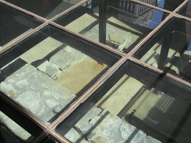
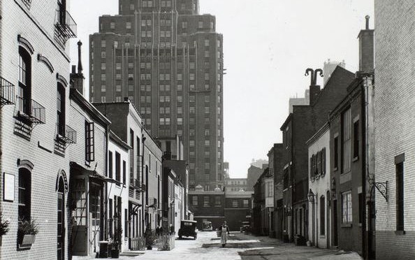
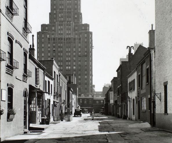
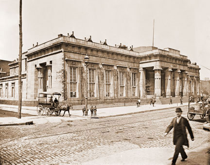
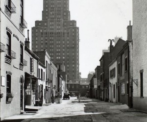
Above: Macdougal Alley in 1936. The plantation home of New Amsterdam director-general Wouter van Twiller would have been situated very close to where this picture was taken. (Find the alley here.)

NAME THAT NEIGHBORHOOD Some New York neighborhoods are simply named for their location on a map (East Village, Midtown). Others are given prefabricated designations (SoHo, DUMBO). But a few retain names that link them intimately with their pasts. Other entries in this series can be found here.

Greenwich Village has been the heart of New York’s cultural identity for over 150 years, the birthplace of city bohemia, where the upper and lower classes collide, the iconic outsider neighborhood between midtown and the financial district. It’s been New York’s home for counter-culture, gay liberation, artistic inspiration, musical innovation and groundbreaking urban renewal. No surprise that it was named New York’s very first historic district in 1969, even as some of its greatest moments were yet to come.

But why do we even call it Greenwich in the first place? And was it ever really a village at all?

I should preface this early history of the Village by saying that the information below deals with Greenwich Village and its sub-neighborhoods the West Village and part of the Meatpacking District (which actually extends farther north). Despite its name, the East Village is actually considered separate from Greenwich, being part of the Lower East Side.

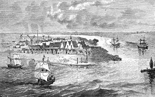
In the wild days of early Dutch occupation of Manhattan, the area of today’s Village district lay 2-3 miles outside the border of the primary Dutch settlement New Amsterdam. That border is approximately Wall Street today.

Imagine the distance between it and 14th street (the generally accepted northern border of Greenwich Village today) as a gradually populated area of hills, swamps and streams, with only a few dirt pathways cutting through the meadows and dense foliage to lands beyond. There was enough farm land to go around if you were brave enough to settle outside city walls, with fears of attacks from both Indians and other Europeans.

To get an idea of how green Greenwich Village used to be, head on over to the Mannahatta Project and type in any Village street name (start with Washington Square North or any listed below).

Back in the day the shore of Manhattan’s west side approximately lay along today’s Greenwich Street; the rest is landfill from later in Manhattan’s development. Near the location of Gansevoort Street today (yes, the Meatpacking District) lay the first village within the Greenwich Village area — the Lenape Indian settlement Sapokanikan or ‘land where the tobacoo grows’. Sapokanikan was essentially a trading settlement and docking point for many traveling native American tribes.

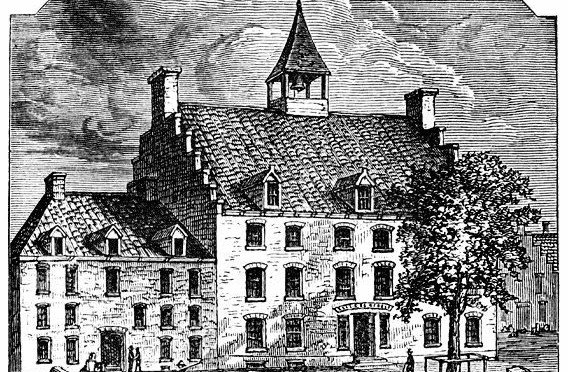
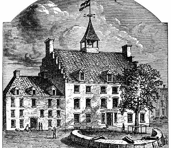
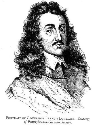
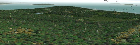
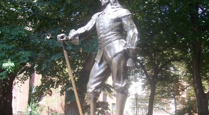
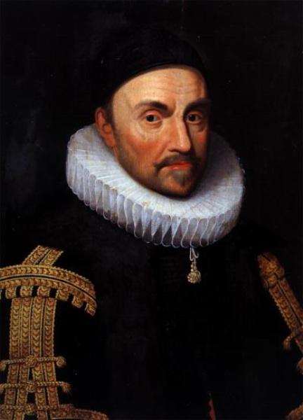
The Dutch took the tobacco reference to heart. The second director-general of New Amsterdam, the colorful Wouter Van Twiller, built a large tobacco plantation ostensibly for the Dutch West India Company but, Wouter being Wouter, mostly for his own personal profit. Wouter’s plantation occupied most of the West Village; his own home sat on plantation ground, at around the area of 8th Street and MacDougal Street. The plantation would be named for the old indian village and also referred to as Bossen Bouwerie (‘farm in the woods’).

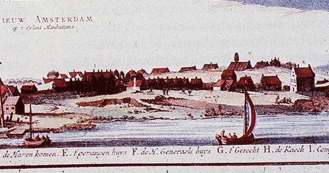
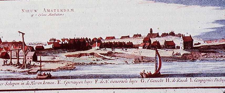
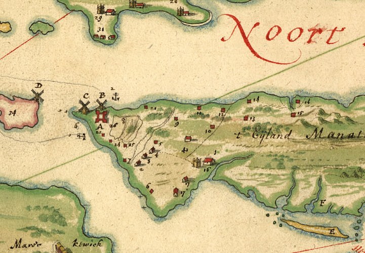
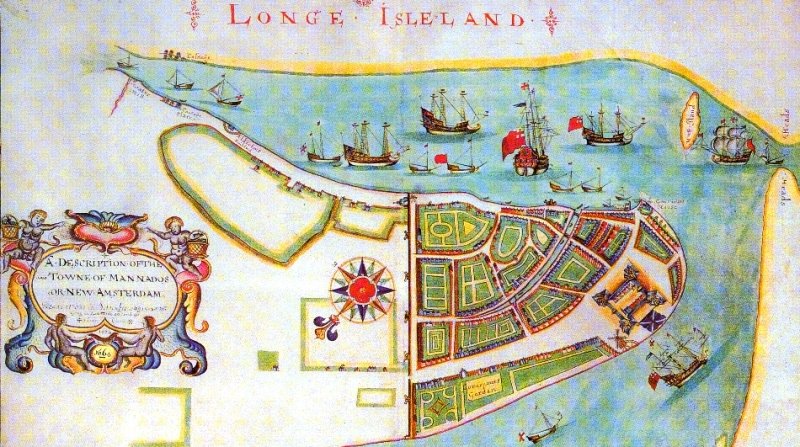
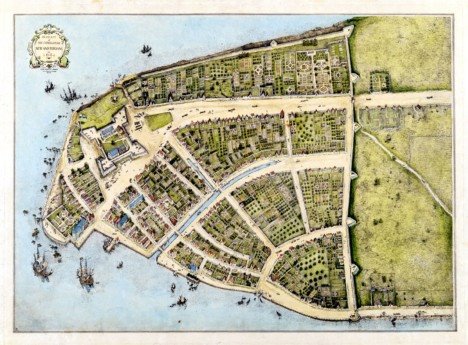
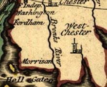
Below: Wouter Van Twiller’s farm is marked #10 on this map by Johannes Vingboons from 1639, one of the earlier attempts at mapping the territory of New Netherland

Van Twiller was later dispatched from his duties as the colony’s leader, but he did grant some of his slaves certain freedoms to build their own smaller farms, defenseless along the Minetta Brook (a vital stream that coursed through the region) and on the southern part of today’s Washington Square Park.

Meanwhile, other Dutch companymen came to the region, including two brothers, Jacob and Paulus Van Der Grift, who moved from old Amsterdam to New Amsterdam in 1644 and into this lush area, “co-patroons” of an area that would become known as Nortwyck or Noortwyck (simply ‘north of the city’).

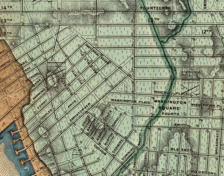
Below: from an 1874 water map designed by Egbert L. Viele, you can see the old Minetta Brook, which formerly cut through the Village district

By 1664, the year of the British takeover of the island, the area was essentially dominated by a handful of landowners who had carefully cultivated their property, but had not changed the general properties of the land.

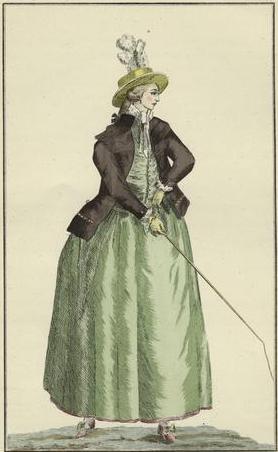
With the British came further development, as well-to-do English citizens began scooping up property for their own lavish mansions. In fact, it became quite fashionable for the wealthier of British citizens, too refined to deal with the growing and quite crowded New York, to situate just outside the city. This is where Nortwyck, a loose assemblage of farms, becomes Greenwich, the domain of idyllic estates.

I’ve seen reference to the name change as reflecting that of the London district of Greenwich, a very tony British resort in the 17th century. But the name may have first come to the area long before the British elites did. According to the New Netherland Institute, a settler in the 1670s, Yellis Mandeville, bought a farm here and named it for an old Long Island Dutch town — Greenwijck, or Pine District.

Once the wealthy British came, it must have seemed natural to simply alter the name to Greenwich, with all the upper-class and luxurious implications that came with it.

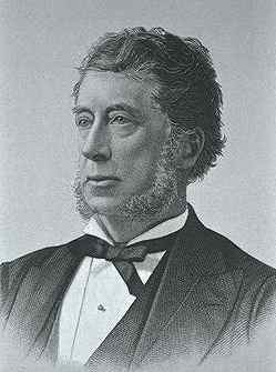
There were several principal British landowners of the Village area at this time. One of note, Thomas Randall, would own the area around Washington Square; later, his son Robert Richard Randall would bequeath the area to the city as a respite for retired sea captains and sailors. The city, seeing far greater value to this land for residential townhouses, instead moved the sailors rest home to the northern shore of Staten Island and called it Snug Harbor.

Another, Captain Thomas Clarke, would retire on property further north and call his mansion Chelsea, also named for a London neighborhood (or specifically for a hospital there).

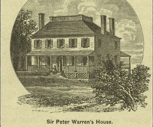
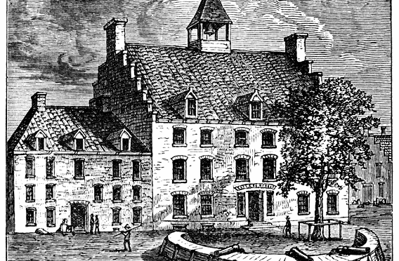
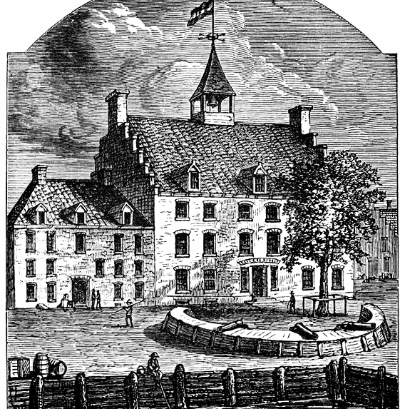
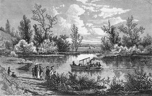
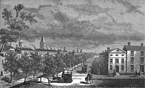
Below: an engraving of the Greenwich Village home of Peter Warren (courtesy NYPL)

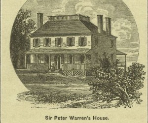
But the real forebear of the Village was an Irishman. Sir Peter Warren, vice-admiral of the British Navy and commander of its New York fleet, who amassed a vast land tract here in the 1740s, almost the entire ‘Green Village’. Warren was without a doubt one of New York’s more renown British citizens. Like the great old New York families that would influence society in the 19th century, Warren’s presence assured that other British clans would race to buy up countryside to create Manhattan’s first suburbia.

By the 18th century, these massive lots would be divvied up and sold off, as demand grew from New Yorkers fleeing the city to escape disease and overcrowding. In these years before far-thinking city planning, the Greenwich lots were haphazardly divided with unorganized streets. This urban chaos was preserved by the 1811 Commissioners Plan, which chopped most of the entire island into uniform blocks but left the Village in its uniquely confounding geography.

Still today, after so many years of living in the city, I routinely get lost there.

Paging Dr. La Montagne, Manhattan’s first physician


Nothing underscores the harshness of early New Amsterdam more than the notion that the Dutch settlement, which first settled at the tip of Manhattan in 1625, didn’t actually have a real trained physician for almost twelve years.

Most likely, in these earliest years, medical emergencies were handled by ship surgeons and non-professionals skilled in a set of rudimentary practices. More practiced professionals eventually came, such as the man who can lay claim to be Manhattan’s first practicing physician Johannes La Montagne, a Huguenot who arrived in 1637, settling outside the colony in Haarlem.

Johannes soon became “the only doctor in Manhattan in whom the settlers had any confidence,” practicing surprisingly sophisticated (for the day) innovations in Dutch medicine. Like the millions of doctors who would follow in his footsteps, Johannes would soon benefit handsomely from his expertise, gaining a vote in the first official voting council of the new colony under director-general William Kieft. Johannes was also the first of many Manhattan physicians who was also versed in the art networking; within a year he became Kieft’s right hand man and an extension of of the director-general’s wishes, however misguided.

Unfortunately, this devotion to Kieft and the desires of the Dutch West India Company over the needs of the colonists proved to help undermine the new colony, eventually leading to Kieft’s ouster and replacement by Peter Stuyvesant. To his credit, La Montague then won over the steadfast Stuyvesant, who kept him on as a member of his council.

Shockingly, before La Montagne, if one needed actual surgery, one went to the barber. According to one old history, “it might be remarked that a that time barbers were commonly looked upon as surgeons. Any skilled barber was likely to be applied to for surgical procedures.”

These ‘barber-surgeons’, adroit in “performing minor operations“, mostly worked on ships and were hardly skilled in the modern advances of 17th century medicine. Eventually La Montagne was able to regulate these barber-surgeons himself, issuing permits to those practicing in the colony and even those who sailed out of New Amsterdam ports.

Categories
Uncategorized

Name that Neighborhood: what exactly is a Throgs Neck?


Some New York neighborhoods are simply named for their location on a map (East Village, Midtown). Others are given prefabricated designations (SoHo, DUMBO). But a few retain names that link them intimately with their pasts. Other entries in this series can be found here.

What is a Throgs Neck? And why isn’t it a Throggs Neck?

Of course that’s the name of a pleasant peninsular neighborhood in the Bronx. Many people with cars are probably as familiar with the Throgs Neck Bridge, a 1,800-foot Robert Moses/Othmar Ammann production which connects the Bronx to Queens. But where did that unusual name come from? Is a throg some kind of creature native to New England?

The “Neck” part is easy. The slender Throg’s Neck peninsula dangles where the East Rivers finally empties into the Long Island Sound. The neighborhood expands up the peninsula and out through the mainland.

For the throg, you’ll have to go back to the Dutch occupation of the region to find the answer. There was of course a contentious relationship between the Dutch and the British regarding territorial boundaries in the New World, a dispute that resulted in the eventual takeover of all Dutch lands in 1664. However, over 20 years earlier, the leader of the New Amsterdam colony, William Keift, seemed to take a more charitable view towards individual English families, especially those fleeing British rule due to religious intolerance.

The most famous of these satellite English settlements on alleged Dutch soil was that of Anne Hutchinson, a charismatic and determined leader who fled Massachusetts and Rhode Island out of religious persecution by the Puritans. Perhaps simmering with delight at Englishmen fleeing their own kind, Keift allowed Hutchinson and her flock to settle in the areas that are now called Pelham and Eastchester today. The Hutchinson River, which runs through these areas, reminds us of the impact of this ballsy lady.

Just a year earlier (1642) however, Keift allowed another persecuted religious leader to settle just downstream. The Rev. John Throggmorton (or Throgmorton or Throckmorton, take your pick, depending on which ancient document you prefer) and 35 others families were allowed to settle on this peninsula, valuable real estate if your living required contact with water, but dangerous because of the potential of being bottled in by an enemy.

The land had previously been known as Vredeland by the Dutch (or ‘land of peace’) owing to the lush natural beauty of the region. They dropped the old peaceful name and changed it to Throggmorton’s Neck.

Keift, who frequently provoked Indian anger, may have thought that additional European settlements could be used as a buffer against Lenape attacks to New Amsterdam, just 24 miles south. Eventually the Indians did attack; in one horrifying massacre on September 20, 1643, tribes exterminated the Hutchinson settlement, then traveled down to do the same to the Throggmortons. (Few in the future Bronx neighborhood escape the slaughter, including the borough’s namesake Jonas Bronck.)

Many families on Throggmorton’s Neck were brutally massacred, although a passing boat managed to rescue a few distraught family members. Strangely enough, Throggmorton himself was away that day. He never returned the area which would forever keep his name.

Within 150 years, the name would be shortened to Throgg’s Neck. Or, better yet, according to George Washington himself, “Frog’s Neck.”

You may have noticed that John’s last name has two g’s in it, while most common spellings have only one. Legend has it that this is another thing you can blame on Robert Moses. Not exactly known for reaching out to communities for their thoughts and opinions, Moses decided to drop a ‘g’ in 1955 when the bridge started construction, believing it would fit on more traffic signs without an additional and needless letter. Who cares if it was in use that way for over 300 years!

Purists prefer Throggs Neck. It is Throggs Neck. Either way, it’s an unforgettable name, with an unforgettable story.

Name That Neighborhood: Wall Street Blues

A simplistic but colorful view of “Man Mados” or “New Amsterdam” in 1664 (click in to inspect the detail)

One of the first facts you learn as a student of New York City history is that Wall Street, that canyon of tall buildings and center of the American financial world, is named for an actual wall that once stretched along this very spot during the days of the Dutch. The real story is rather fuzzied by the presence of a small community of French-speaking Belgians known as the Walloons.

The original ‘De Waal Straat’ was the center of a small Walloon community in New Amsterdam. There was most definitely a walled fortification nearby on New Amsterdam’s northern boundary, and it certainly did stretch along about the same area as Wall Street does today.

But the present name seems to be a formation of mixed meanings that only a tangle of languages and hundreds of years of history can create. The Dutch themselves referred to an actual street alongside the wall as the ‘Cingel’ — according to an old history, meaning “exterior, or encircling, street.”

The real reasons for New Amsterdam building its famous wall are also up for grabs. It’s commonly held that the wooden palisade was erected in defense of Indian attacks, and certainly the residents of New Amsterdam did their part to rile the anger of the native landowners. But the Dutch had been living at the tip of Manhattan for over 25 years by the time the wall was built in 1653. In truth, it was commissioned to keep out a different sort of enemy.

You’ll be pleased to know that one-legged director-general Peter Stuyvesant was the man who ordered the construction of the “high stockade and small breastwork” that cleaved the Dutch community from the natural wilds beyond.

This was an incredibly important year for New Amsterdam in two respects. In February 1653, New Amsterdam was chartered as a official Dutch city. Although Stuyvesant was quite against the outpost receiving such official recognition, he eventually took advantage of it, appointing the first town council himself rather than putting it up to such trivial inconveniences as elections.

But in 1653 the tides of the motherland spilled onto their shores, as the war between England and the Netherlands threatened the remote and undefended new city. The Dutch intended to launch ships from New Amsterdam harbor in battle against the English.

As a result, the English colonies up north were sure to retaliate, either by sea or, feared Stuyvesant, over land, possibly teaming with hostile Indian forces, down through undefended Manhattan island. Essentially, the wall that helped give us Wall Street was built because Stuyvesant feared attacks not just from Indian tribes, but from the European colonies of Connecticut, Massachusetts and New Haven!

Above: looking at this more well known map of New Amsterdam, once can see the two gates very clearly

Stuyvesant called upon the 43 richest residents of New Amsterdam to provide funding to fix up the ailing Fort Amsterdam and to construct a stockade across the island to prevent attacks from the north, while it took New Amsterdam’s most oppressed inhabitants — slave labor from the Dutch West India Company — to actually build the wall.

The barrier was constructed out of earth, rock, and 15 feet timber planks sold to the Dutch, ironically enough, by the “notorious” Englishman Thomas Baxter. In a turnabout that one would expect from hiring your enemy, Baxter later led a group of “Rhode Island marauders” and pirated Dutch fishing ships.

Early in the 1660s, the Dutch upgraded its wall to include brass cannons and two sturdy gates — one at today’s intersection of Wall and Broadway (for land), the other at Wall and Pearl Street (according to an early account, a water gate and access to a ‘river road’).

The British took over New Amsterdam in 1664 and renamed it New York, but the wall still remained, becoming more a relic than a serious defense.

By the turn of the century, the fear of land attacks had almost completely subsided and the city was beginning to feel crowded. So in 1699 the wall was torn down with some of the material salvaged to help construct a new City Hall at the corner of Nassau Street and the newly cristened Wall Street. When the British were forced out in 1783 by the Americans, the City Hall building was renamed Federal Hall — the first official center of American government.

A plaque honoring the old wall sits today at the corner of Wall and Broadway, where the gate to the city once opened:

Manhattan’s first taverns: Wooden Horse and City Tavern

New Amsterdam city hall, once one of Manhattan’s very first taverns

McSorley’s Ale House certainly deserves to throw that Old in its title, happily swilling the devil’s juice for 154 years. But it’s positively a youngster compared to evidence of Manhattan’s first two taverns, opened in the days when New York was just barely even New Amsterdam.

Henry Hudson first set eyes on Mannahatta in 1609. Fifteen years later, the Dutch came into New York harbor to begin their permanent settlement. In 1625, work began on Fort Amsterdam, which served as protection from the Indians and as the heart of the developing town. But by that time, New Amsterdam already had a brewery, which began production in 1612!

This young settlement was filled with young traders and shipmen who enjoyed their drink. Their liquor requirement was most likely fulfilled by captains selling it out of their own boats or residents from their own homes. But it’s fur trader Philip Geraerdy that wears the distinction as first private tavern owner. He was granted a lot on “Stone street, between Whitehall and Broad Street,” in 1641 (or possibly 1642, depending on which source you look at) to open his Wooden Horse Tavern (Het Houten Paard).

According to author Mark Caldwell, the name was probably a jab at punishment he had received as a soldier, forced to straddle “two boards nailed together to form a sharp wedge that rested on four legs” due to some sort of subordination.

Geraerdy most likely served no more variety than what can be found at McSorley’s today, ale and possibly wine.

A more official tavern also opened in the same year. Governor of New Amsterdam William Keift had a costly stone structure built at what is today Coenties Slip and Pearl Street and called it City Tavern. Taverns of course were far more than booze dispensaries. They served as inns, meeting halls, social networking places and sometimes even offices. It makes sense then that when the city was incorporated in 1653, City Tavern morphed into what would be New Amsterdam’s very first city hall (Stadt Huys or State House).

By that time, many other taverns had opened with names like Three Small Pigeons and the Blue Grape. In fact, the Dutch brewery business was booming by this time, supplying local ales to Dutch settlements throughout New Netherland.

Categories
Podcasts

PODCAST: Collect Pond and Canal Street

Collect Pond (and what I assume to be Bunker Hill) as depicted in watercolors by artist Archibald Robertson in 1798

We celebrate a year of New York City history podcasting by re-visiting the topic of our very first show.

Downtown Civic Center used to have a big ole pond in the middle of it which provided drinking water for the island’s first inhabitants.

What happened to it, why is it important today and how did it give rise to Canal Street, New York’s biggest traffic thoroughfare?

From the Mannahatta Project, a visualization of downtown Manhattan, with Collect Pond and acres of forest

Hard to believe, but this is downtown Manhattan and Collect Pond

An early 19th century map of Collect Pond and the streets that usurped it. (Click into it to see details.)

A mid-century depiction of Five Points, this corner in particular being where Paradise Square sprang up, an ambitious residential project doomed by soggy land and noxious odors

The Tombs Prison, in 1890, before being condemned. Its squalid conditions are legendary and are due in part to unsatisfactory construction over the former Collect Pond area

The early days of Canal Street. The actual foul-smellin canal was concealed with a row of lovely trees shielding the new tenements and businesses surrounding it

A tiny park surrounded by government buildings pays homage to the early (and far more natural) days

The most dramatic reminder of the neighborhood’s early days, however, is the African Burial Ground Memorial, which opened last year

Name That Neighborhood: Who is Jonas Bronck?


Some New York neighborhoods are simply named for their location on a map (East Village, Midtown). Others are given prefabricated designations (SoHo, Dumbo). But a few retain names that link them intimately with their pasts. Other entries in this series can be found here.

The Bronx is one of two boroughs with names derived from actual people. The residents of Queens can brag that their borough honors Charles II’s wife Catherine of Braganza. The Bronx, however, gets its name from less regal sources, from Swedish-born landowner Jonas Bronck. However the Bronx is not directly named after Bronck. Confused?

Despite Bronck’s tenacity in forging onto the unknown Lenape Indian territory of Rananchqua in the Dutch colony New Netherlands, his actual role in New York history is quite brief. An ardent intellectual who gave his ship the lofty name Brand van Trogen (The Fire of Troy), Bronck, his wife Teuntje and a boatload of eager voyagers traveled to the new world in 1639 and settled on a stretch of land, 500 acres, across the river from the village of Haarlem.

With permission from the West India company, Bronck had brought builders, his own cattle, boxes of books, and a desire to create a small community of his own. Spread out through the modern neighborhood of Motts Haven, Bronck’s farm (Broncksland) and those of the other settlers sat along a north-south river, called by the Lenape the river Aquahung.

Bronck grew tobacco and traded with the local Indians, keeping the peace through exchanges of goods. Jonas however had arrived at a rather unfortunate time to be a pale blond foreigner.

Relations between the Dutch and the native Indian population were tenuous at best, and not greatly assisted by hot-headed director-general William Kieft of the port city of New Amsterdam. In 1643, driven by growing animosities and the murder of a single settler, Kieft ordered troops to rout the Lenape populations at Corsairs Hook and the area now known as Jersey City, murdering dozens of Indians and ensuring years of bloody battles between settlers and natives.

Bronck was the unfortunate recipient of native Indian backlash. That same year, 1643, Bronck and most of his settlers were murdered in an Indian raid.

Kieft would be swept out of the new world by Peter Stuyvesant. Bronckland would pass into other hands, and after just a few years, the parcel of land would no longer be named for him. Jonas was almost erased from history.

Except for that rather sizable river that ran through his property, the Aquahung. Even as memories of Dutch settlers gave way to their British successors — his farm went to two officers in Oliver Cromwell’s army! — the river was still referred to as Bronck’s River. Eventually it was shortened to the Bronx River, and thus it’s the river that the borough is named after.

Had everybody just kept with the original name as given by the Lenape, we would be referring to our northernmost borough as Aquahung.

By the way, Bronck’s wife and son escaped the Indian raid, and later, Teuntje with her new husband moved to the area now known as Coxsackie, New York. Son Pieter Bronck became a landowner in his own right and built a house that still stands today. It is the oldest home in all of upstate New York.

Categories
Podcasts

PODCAST: Peter Stuyvesant

Back when New York was New Amsterdam, it was the domain of the bullheaded, pear-growing, peglegged Peter Stuyvesant, who cleaned up the city and gave us our most important street. Find out why he still matters and why he’s the king of the East Village.

Listen to it for free on iTunes or other podcasting services. Or you can download or listen to it HERE

The picture above is of the statue of Peter Stuyvesant, created in 1941 by Gertrude Vanderbilt Whitney (as in the Vanderbilts and the Whitney Museum). Note how its posture and stance cleverly convey Stuyvestant’s stubborn character. (Click the pic to get a closer look at that peg leg.)

The park itself is a beautiful block of greenery lined with old churches and brownstones — and interrupted by 2nd Ave, part of the original design — in the approximate location of the original Stuyvesant family mansion.

Another of the neighborhood’s famous residents is also honored here with a statue nearby and a street named after him — composer Antonin Dvorak, who lived at 327 East 17th Street.

The legacy of Stuyvesant leadership would pass on through the generations. Peter’s great-great-granddaughter Elizabeth took the family in another historically significant direction when she married Revolutionary War hero Nicolas Fish. Their son Hamilton Fish (seen right, named after family friend Alexander Hamilton) would become an influential mayor of New York and later secretary of state under Ulysses S. Grant. Hamilton Fish II, Hamilton Fish III, and Hamilton Fish IV (who died in 1996) would all be New York congressmen. The current Hamilton Fish, we’re up to V I believe, once owned The Nation magazine.

Hamilton I was born in the lovely Stuyvesant-Fish house at 21 Stuyvesant Street. Today its one of the loveliest streets in the East Village.

Its odd diagonal through the grid pattern of the Village is a vestige of its original path through Stuyvesant’s old farm.

At the end of path, at Second Avenue, is St. Marks-on-the-Bowery, which is aswirl during the weekend with community activities and sometimes a farmer’s market outfront. St Marks contains the crypt of Peter Stuyvesant (marked Petrus Stuyvesant on the stone, to indicate the formalized version of his first name).

You’ll need to walk a short way to Third Avenue and 13th Street to the plaque honoring the site of Peter’s old pear tree, planted in 1647 from a Dutch seedling, which outlived him by almost two hundred years and drew curiosity seekers from miles around in the mid-19th Century. At the time it was considered the most famous tree in America until it was uprooted by an errant wagon in 1867. (It should be noted that the tree survived the New York Draft Riots, when the neighborhood nearby was in flames.)

Here’s the plaque that hangs in front of Keihl’s. Believe it or not, Keihl’s opened in 1851, the tree standing not far from its doorstep, and John Keihl may have even witnessed the arboreal tragedy. (Click into the picture for a closer look.)

Believe it or not, a slab of the old pear tree can be viewed in the regular collection of the New York Historical Society.

The Stuyvesant family name also pops up in Bedford-Stuyvesant (comprising the Stuyvesant Heights neighborhood), once a cultural mecca for African-Americans, then a former notorious neighborhood — at one time called ‘the world’s biggest ghetto’ — BedStuy has transformed into a ‘hot’ real estate haven, thanks to its many beautiful brownstones. Stuyvesant High School in Battery Park is one of the most revered in the nation (it’s the alumni of several Nobel laureates).

Color me Dutch

Ever wonder why the official colors of New York are orange and blue? They show up in the uniforms of our two favorite teams, the Knicks and the Mets:

And the colors clearly show up on the official New York state flag:

Our flag is so hued as an homage to the flag of the European founders of the state, the Dutch of the 17th Century.

The Dutch flag actually looks like this now:

The Netherlands incidentally were the first country to feature the tri-color, the now familiar red, white and blue colors in their flag. The red was added in the mid 17th Century to replace an orange stripe. Seems that due to the types of dye used on the national flags, the orange stripe turned red over time anyway:

Orange is the color of the Dutch royal family and was added to the Dutch flag in specific honor to the Prince of Orange’s coat of arm. William, the Prince, was the leader of a rebellion during Dutch’s occupation by Spain in the 16th Century. Why, here’s the prince now:

So next time you’re watching a Knicks game, may his face linger forever in your mind.

UPDATE: the Mets website actually says: “The Mets’ colors are Dodger blue and Giant orange, symbolic of the return of National League baseball to New York after the Dodgers and Giants moved to California.” A much likelier theory that just happens to make its connection to New York’s state colors extremely coincidental!