‘Fringe’ benefits light up a forgotten New York fort

I’m an unabashed junkie of the sci-fi TV series ‘Fringe’, and the writers (or at one of them) seems to be a fan of New York history.

One of the conceits of the series involves an alternate universe with things are just slightly different from ours. Most notably, the World Trade Center was never attacked. And there are other changes to the skyline, one of which I wrote about last year — the construction of Antonio Gaudi’s comically absurd skyscraper.

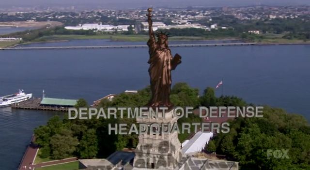
But in this bizarro world where Manhatan is spelled with a single ‘t’, a shining beacon still stands in New York harbor. The Statue of Liberty, ever in stark brown copper, stands in for the ominous “Department of Defense.” And considering that this world is constantly attacked by temporal warps — that’s why Madison Square Garden is encased in amber — this building has an elevated, even sinister purpose.

This correlation is a clever nod to the structure on which Lady Liberty currently stands, the star-shaped Fort Wood.
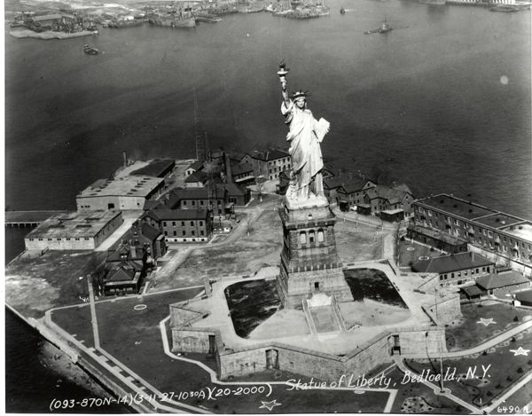
Many of the great forts that dot the New York harbor turn or will be turning 200 years old over the next year or so. Several fortifications, including Fort Wood, Castle Clinton and Castle Williams on Governor’s Island, were construction during the tense build-up of the War of 1812, anticipating that the city would need a tougher coastal defense. Older defenses, such as Staten Island’s Fort Wadsworth, were brought up to speed.

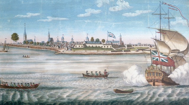
The fort on Bedloe’s Island, the original name of Liberty Island, was constructed like a starburst, a traditional 15th century European design and of the type one might build if your greatest enemy was a cannonball. This dynamic structure must have looked imposing sailing past, one of several a wary vessel would have see on its way into town.

Completed sometime in 1811, it was named after respected fort designer Colonel Eleazer Wood in 1814, the year he died in a battle against British forces near the Canadian Fort Erie.
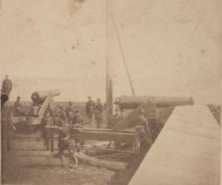
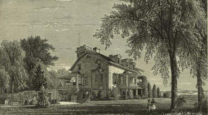
That intense conflict that re-matched the British with its young former colony never drifted into the harbor, and so the forts were thankfully never used. It and the forts on Governor’s Island prepared for battle again during the Civil War, holding ammunition and, on occasion, infirm Confederate prisoners. (At left, from a stereoscopic view of Fort Wood, equipt with manned cannons, most likely during the 1860s, pic courtesy NYPL)

With little need by the 1880s for so many fortifications, Bedloe’s Island prime location in the harbor made it an ideal home for Fredric Bertholdi’s elaborate piece of outdoor art, the Statue of Liberty. The fort was refitted for this new usage, and the statue of officially dedicated in 1886.

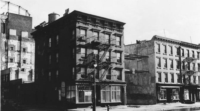
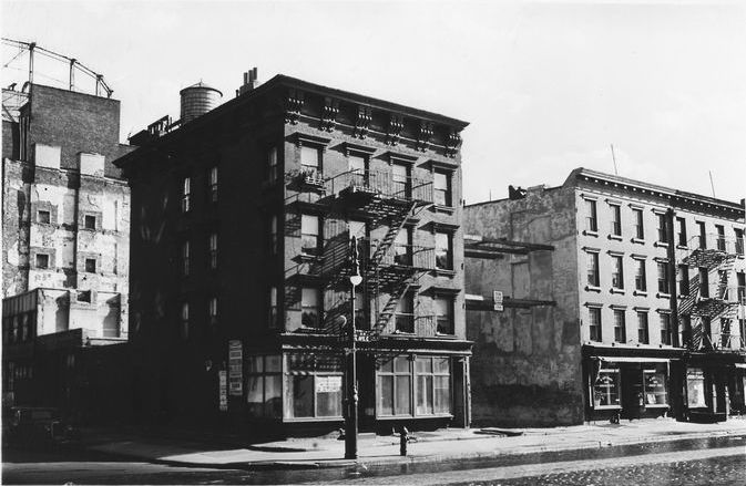
However, even after the statue arrived, the military remained on the island in new barracks, believe it or not, until 1937. (You can see them in the black and white photo above.) And in a sense, old Fort Wood has been besieged ever since, with millions of tourists, and has become central to an American icon, at least in our universe.

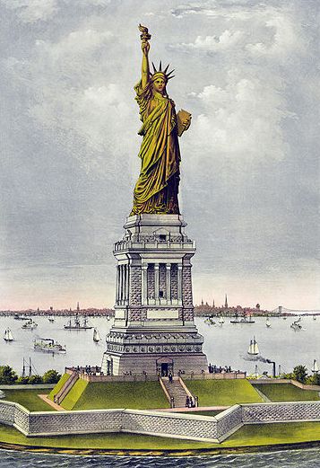
Below: Liberty as rendered by Currier & Ives, years before she went green
Why go to Kentucky? New York’s horseracing history

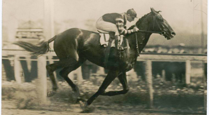
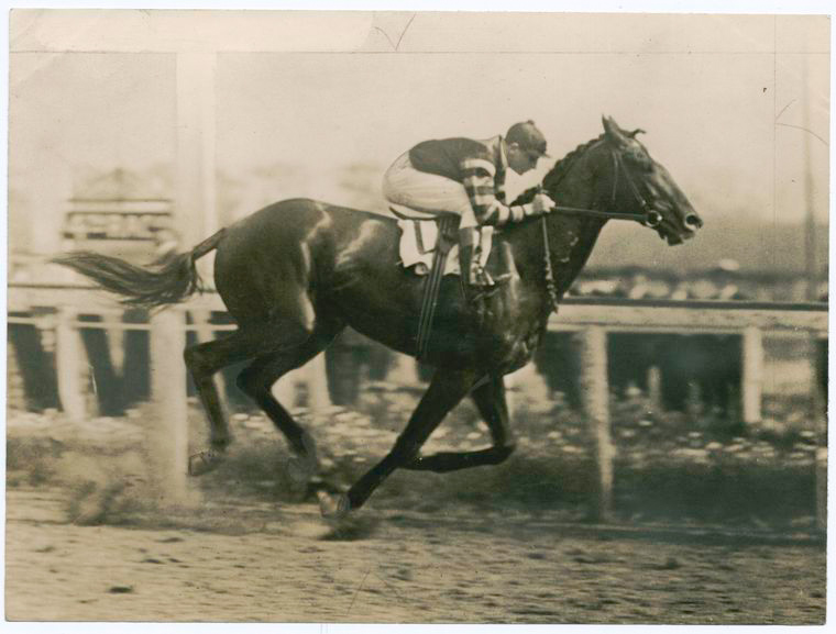
Above: Man O’ War, racing at Belmont, where one of the world’s greatest thoroughbreds cemented his reputation. The horse was actually owned by the son of Belmont Park namesake August Belmont. (NYPL)

The Kentucky Derby is this Saturday: two minutes of race and a day of fanciful hats, mint juleps and fanning oneself with a program at Churchill Downs. As the event that kicks off horse-racing’s Triple Crown competition, racing fans then gallop to Maryland for the Preakness before finishing in the Belmont Stakes. That final event takes place in New York City (well, kind of, a little bit, see below) at Belmont Park, which officially opened its gates 106 years ago today.

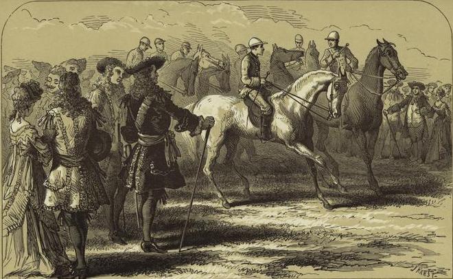
New York City has a healthy horse-racing tradition stretching to its very beginnings. In fact, the very first specially built race track in America was constructed in 1665 by New York’s colonial governor Richard Nicholl. Called Newmarket and located in the Hempstead Plains (just outside today’s border with Queens), it proved an enduring enterprise for colonists over a 100 years later. Smaller tracks were soon built in countryside closer to Manhattan island, some aristocratic British landowners would even built personal tracks on their estates.

Below: The track at Newmarket, “sixteen miles long and four wide, unmarred by stick or stone.” [NYPL]
As it’s often considered today, horseracing represented vice, gambling and drinking among its prime distractions. It was discouraged by the Patriots during the Revolutionary War, but the British, holed up in New York for the entire conflict, blew off a little steam at the racetrack, constructing a new course, appropriately named Ascot Heath, approximately around today’s Brooklyn neighborhood of Flatlands.
New Yorkers threw the British out of the city in 1783 only to immediately indulge in their former oppressors’ racetrack pleasures. Seen as a corrupting British-era vice, horseracing was banned entirely for two decades then later allowed to carry on in one place — Queens County.

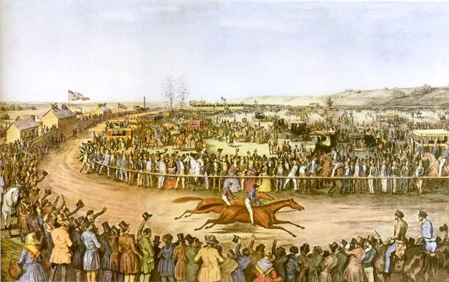
With regional exclusivity, horserace lovers looked to the popular trotting lane along Woodhaven Boulevard and built Union Course there in 1821. It became the most important race track in America and, for moral New Yorkers, a sesspool of sin. By the end of the decade, the track was being managed by former mayor Cadwallader D. Colden, once known for cracking down of alcohol consumption during his tenure.

Below: The galloping goings-on at Union Course, in the future neighborhood of Woodhaven

For those horrified by such vulgar activity, horsetrotting — a more civilized cousin to racing — was also popular in New York by this time, especially among the wealthy, making bucolic Harlem the prime destination for proper horsing around. Financiers and millionaires named Vanderbilt, Gould and Fisk made the upper reaches of Manhattan their own private race tracks, builting lavish stables in the neighborhoods near Harlem Lane.

By the start of a new century, horseracing defined a few region in Brooklyn. When William Engeman carved out some land east of Coney Island and called it Brighton Beach, one method they used of attracting city-goers to his luxury hotel there was building a racetrack. The Brighton Beach Race Course, located between Ocean Parkway and Coney Island Avenue, was soon joined by the nearby Sheepshead Bay Race Track, the product of a wealthy jockey club that included grandson to the Commodore, Willim Kissam Vanderbilt.

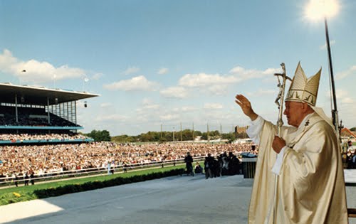
Not to be outdone, a former water conduit in Queens became the Aqueduct Racetrack in 1894 around the time the surrounding undeveloped land became the planned community of Ozone Park. It still enterains sports fans today and is one of the few venues in all of New York City to have hosted a visit by the Pope (the newly beatified Pope John Paul II, in 1995, see below).

The rich might have planted more racetracks for their amusement throughout the city had the the state not banned gambling in 1908. (Off-track betting returned to the city in the 1970s.) Some tracks tried to transition to speed competitions for those newfangled automobiles, but most closed.

Interestingly positioned by 1905 was Belmont Park, a swanky racing track near the original place where Newmarket once stood long ago. The Park is technically in Elmont, Long Island, but it abuts the border of Queens and can be easily reached by the Long Island Railroad. By this time, horseracing was neither the wiling of the rich or the indulgent of the poor, but a pasttime for all. According to the New York Tribute’s coverage of opening day, 106 years ago today, on May 4, 1905:

The attendance, morever, was not restricted to any one locality nor to any one class…. The Bowery and the Avenue mingled in the surging democracy of the betting ring. And both the Bowery and the Avenue wore its best clothes — and went home with them tattered and torn. In the more exclusive precincts of the clubhouse and the paddock there was a tendency to affect the raiment of Goodwood and Ascot, and tall hats and frock coats stood out conspicuously in the picture.”

It was so signficant that even Thomas Edison’s film crew was there to document the big day:

The famous third of the Triple Crown, today held at Belmont Park, became a part of the horseracing tradition in 1866 at the most famous former track in the Bronx — Jerome Park Racetrack, constructed by Belmont friend and racing afficionado Leonard Jerome. After moving briefly to a track in Morris Park, it moved to Belmont in the park’s opening year and has been saddled there ever since.

Categories
Current Events Podcasts Queens History

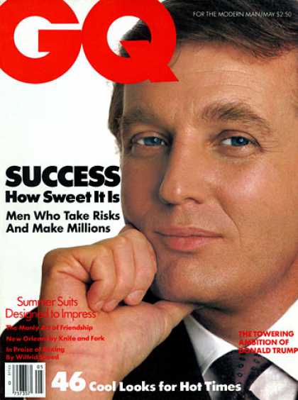
A short history of Trump: the roots of Donald’s wealth, from quiet Queens beginnings to glitzy Midtown excess


PODCAST Sick of Donald Trump yet? (Probably.) Figured him out yet? Is he a financial wizard, reality sideshow, or political distraction? Or all of the above? The solution may be contained in the roots of his fortune — a saga that stretches back to the 1880s and begins with a 16-year-old boy named Drumpf who made his living in a barber shop. The story unfolds during the early days of Queens, a borough once sparsely populated but by the 1920s, a land ripe for growth.

By the 1960s, Donald’s father Fred had built thousands of middle-class homes throughout Queens and Brooklyn and embroiled himself in some controversy regarding the remains of two Coney Island theme parks. The Donald built upon his father’s reputation to become a successful Manhattan developer and a flamboyant celebrity with seemingly bottomless levels of lucre. But of course everyone has their limit.

FEATURING: Trump Tower marbles, a miracle on 34th Street, and the magic that would have been Television City.

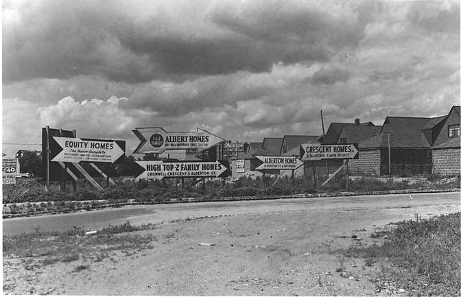
A home building frenzy in Woodhaven, Queens, at the corner of 64th Road and Woodhaven Boulevard. A massive population influx into the borough induced home development at a rapid pace. Fred Trump’s first constructed homes were in the neighborhood in the 1920s.

woodhaven
 

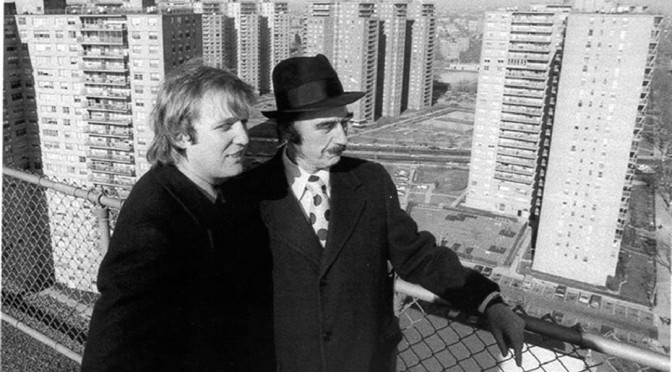
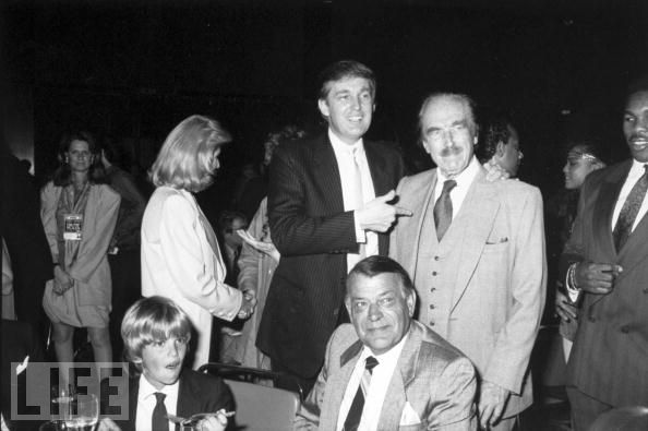
Donald and his father Fred Trump, two of the most powerful developers in the city by the 1970s and 80s. Of course, the elder Trump constructed mostly dwellings for the middle class, while Donald focused on the wealthiest New Yorkers.

50580899
 

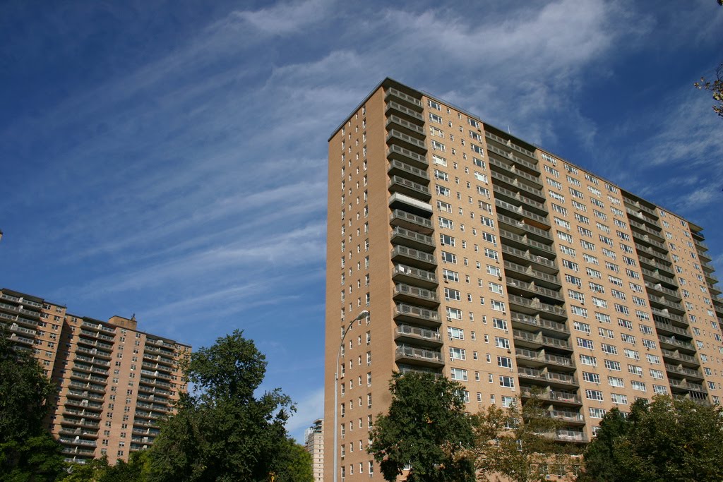
Trump Village, Fred Trump’s largest apartment co-op when it opened in 1964. (Courtesy flickr/TheFadedPast)

village
 

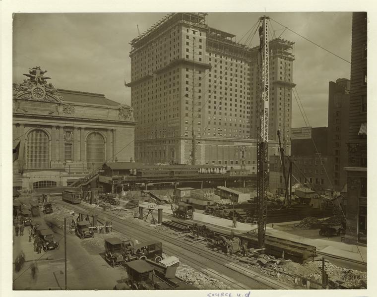
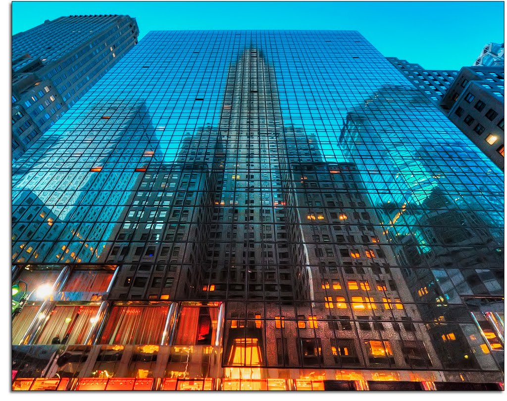
The Hotel Commodore under construction in 1918. Sixty years later, young Donald Trump would redevelop the property to become the Grand Hyatt, encasing the stripped-down hotel in a sleek glass tower that literally reflects Grand Central on one side, and the Chrysler Building on the other (below). (1918 pic courtesy NYPL; modern pic courtesy flickr/kw-ny)

commodore
 
grand-2Bcentral

Trump rode a wave of personal connections, business drive and opportunity to become New York’s hottest developer by the 1980s, fueled by media attention and spectacle to become one of New York’s most ubiquitous celebrities.

241-1
 

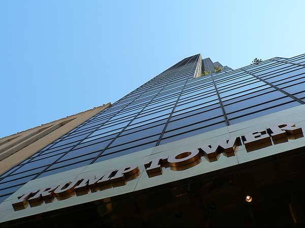
Does anything typify New York in the 1980s more than Trump Tower, that fortress of wealth gleaming with imported marbles, finished in 1983 and offering the most expensive apartments in the city?

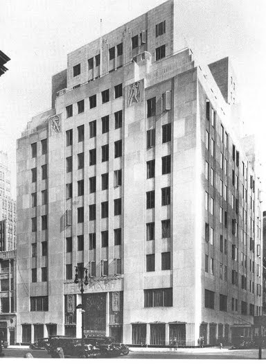
Bonwit Teller, the luxury department store that had the misfortune of having an address that Trump wanted for his Trump Tower.

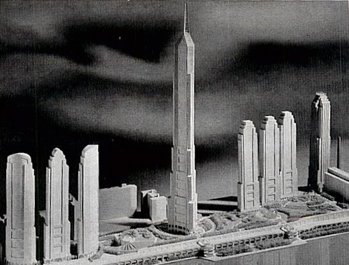
Behold — Television City, the Trump plan for the west side involving a 152-story skyscraper and a studio for NBC, originally at a total of 16 million square feet of space.

Trump the Game! From 1988. “It’s not whether you win or lose. It’s whether you win!”

Photos at Wollman Rink and of Donald/Fred courtesy Google Life images

South Bronx and the days of new American aristocracy

What you think about when you think about the South Bronx: the Morrisania estate built by Gouverneur Morris. (NYPL)

NAME THAT NEIGHBORHOOD Some New York neighborhoods are simply named for their location on a map (East Village, Midtown). Others are given prefabricated designations (SoHo, DUMBO). But a few retain names that link them intimately with their pasts. Other entries in this series can be found here.

NEIGHBORHOOD: Morrisania, the Bronx

Was there an estate in New York ever as beautiful as Morrisania, nearly 2,000 acres that hugged the Harlem River until it opened out into the turbulent East River as it coursed past small islands and flowed into the Long Island Sound? A property that varied from western hills looking over the river to the rolling spread of Manhattan below, to eastern marshes and flatlands suitable for farming.

Today’s Bronx neighborhood of Morrisania is only a small portion of the original property owned by the Morris family since the 1670s, during the dawning years of British dominance in the New York region. The original parcel, purchased by Welsh captain Richard Morris, was only 500 acres, a part of original land settled by Bronx namesake Jonas Bronck.

When Richard died, brother Lewis Morris (for reasons that will soon be evident, let’s call him Lewis 1) moved from the West Indies to claim the property. He would be one in a succession of Lewis Morrises to live here and place an imprint on what would some day contain much of the South Bronx.

The Morris family was feisty, business savvy, well connected, extremely aristocratic and entirely unoriginal with names. Another Lewis Morris (Richard’s son, or Lewis 2) became the governor, at separate times, of both New York and New Jersey. Yet another Lewis (Lewis 3) became a powerful New York justice. His son Lewis Morris (Lewis 4) was a signer of the Declaration of Independence.

If you haven’t gleaned it already, the clan carried themselves like some kind of royal family. They were, artificially at least, as were many families in the New World who quickly made fortunes here and staked claims in manners similar to what their forebears were accustomed to in Europe. Over the decades, the Lewises would blend by marriage into other elite, bold-faced families to form a tangled ball of interlinked faux American royalty.

Morrisania for most of the 18th century resembled a miniature British kingdom, with a spread of small farms, dairies and cattle pens operated by those leasing from the Morris family, a proper workaday serfdom common for the era. However, during the early decades, the land was even worked with slave labor, although the practice was phased out in later generations.

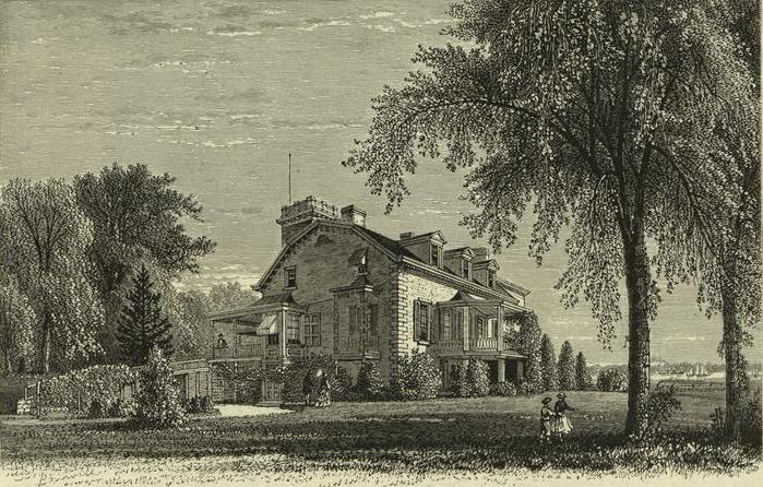
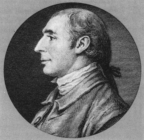
When Lewis 3 passed in 1762, this massive property was split in two. West of the small babbling Mill Brook (honored today with a playground and a housing development) belonged to Lewis 4 and his brothers, but the more bucolic eastern side fell to Lewis 3’s second wife Sarah and eventually her only son. That’s right, Gouverneur Morris (pictured below).

Gouverneur fled his home during the Revolutionary War, but his mother Sarah stayed behind. During this time, the rich farmland was vandalized and the family’s voluminous library, one of the largest collections in North America at the time, was ransacked.

Gouverneur was quite busy in the late 18th century doing things like penning the Constitution and being minister to France in the midst of their bloody revolution. But wherever he traveled, he always felt a closeness to Morrisania.

After the war, while Gouverneur in France, Lewis 4 offered up the family estate of Morrisania be used as the site for the new American capital. One can just imagine the history of New York had Congress taken him up on that offer!

In 1798, when Gouverneur returned from France and claimed the property for himself, he built a new home here and filled it with all his gathered French finery. Perhaps no household was more beautiful — or as pretentious — as Morris’ new manor.

Gouverneur, of course, facilitated the growth of New York with his roles in the development of both the Commissioners Plan of 1811 and the Erie Canal. His old farms, however, were technically part of Westchester Country. In the 1840s, his son Gouverneur Morris Jr. emulated New York’s former estate owners and began to develop his property for commercial and residential use.

Chief among these decisions was becoming vice president of the New York and Harlem Railroad (eventually to be owned by Cornelius Vanderbilt) and allowing the railroad to cut through the old property. Townships formed around the railroad station, include one small village named the old manor, Morrisania. That village is the root of today’s neighborhood of the same name.

Gouverneur Junior was cut from the visionary mold that would define many in the 19th Century. One pet project was the development of a port village along the old family property on the eastern shoreline, today’s Port Morris area.

Given that Gouverneur Senior was partially responsible for Manhattan’s grid, it’s no surprise that a different grid patterns were adhered to the old Morris properties over the years. In emulating Manhattan’s pattern, all traces of the area’s early farm existence was eradicated. The following years was hold many strange detours in the history of the South Bronx: opulent boulevards, the Yankees, 1970s crime sprees. But the Morrises live on, if in name only.

Categories
Uncategorized

Notes from the Podcast (#122) The Manhattan Grid Plan

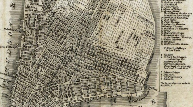
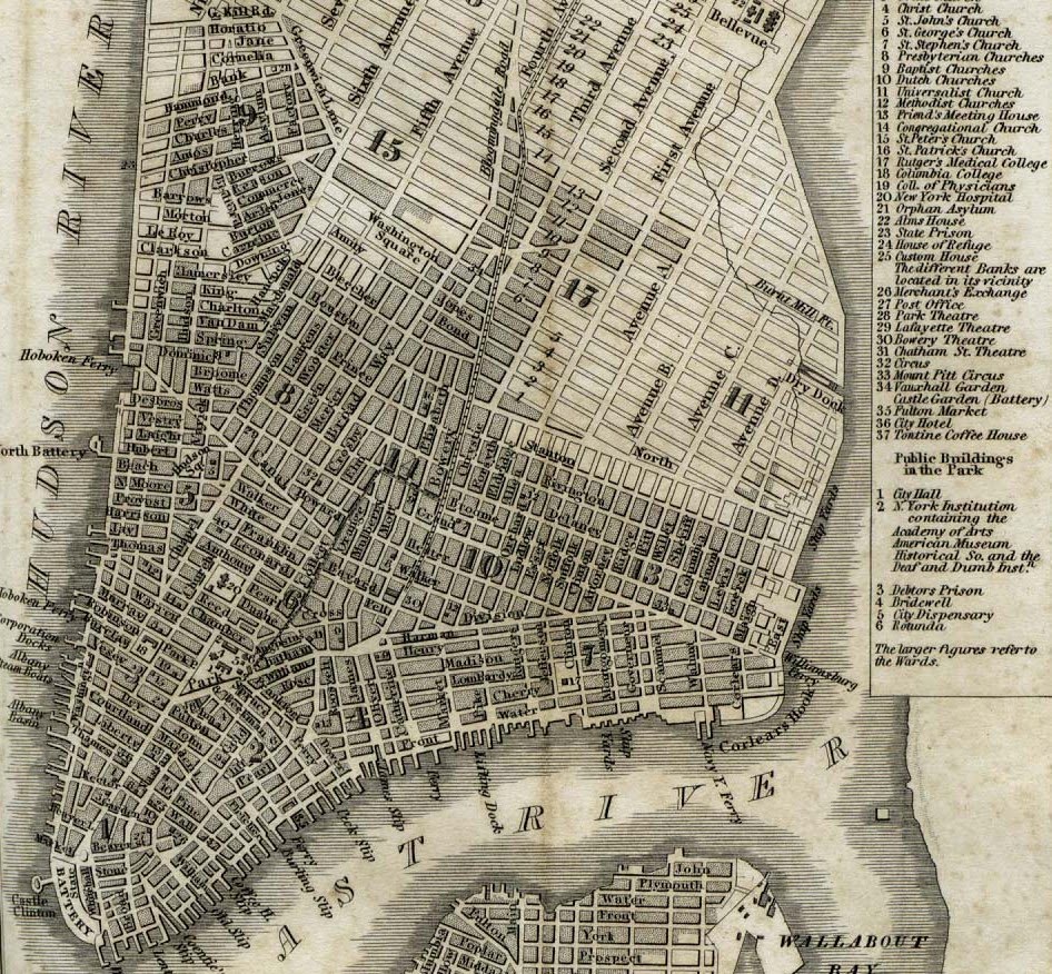
From H.S. Tanner’s ‘The American Traveller; or Guide Through the United States’, 1836 (book published book 1840)

Stuyvesant Street is mentioned as one of the few streets in New York that was allowed to break the grid, and its diagonal path between Second and Third avenues is a reminder of the original farm grid of Peter Stuyvesant. But as a few listeners have pointed out, it holds another unique distinction.

The original estate owners of Manhattan often carved up their own lands into the shape of small grids. For instance, the grid of the DeLancey farm is still impressed upon the Lower East Side below Delancey Street. The Stuyvesants also had a system of streets on their property that ran true east to west. (Manhattan is obviously not on a true north-south axis, and its grid streets do not truly run east to west, but progress at a slight diagonal. Charles Petzold has a very detailed article on the island’s true orientation.)

Thus, Stuyvesant Street is the only street in Manhattan that actually runs east to west. Walk its length with a compass and be amazed!

—–

Not too far from Stuyvesant Street is the beginning of grid plan, First Street and First Avenue, Kramer’s “nexus of the universe”. This is the spot were near-uniformity along New York’s streets and avenues begins.

The southern border of the grid plan was, ironically, called North Street at the time, for it was truly north of the city. As I mentioned back in the Niblo’s Garden podcast, today’s Houston Street is actually the adjoining of two roads, the other being a path that cut through the property of Nicholas Bayard, land that is today’s SoHo. Bayard renamed his street after his daughter’s new husband, the esteemed Georgian patriot William Houstoun. Later, it made sense to link Houstoun’s street to North Street, and thus the whole thing was called Houston Street (with a ‘u’ vanishing in the process).
—–

The occasion of the Commissioners Plan is presents a good opportunity to peer into the extraordinary collection of old New York maps in the David Rumsey Collection. The original 1811 Randel maps are there, as well as others that chart the course of development during the 19th Century. This Tanner map from 1836 shows the grid progressing nicely.
—–

So, if I didn’t quite get it across on the show, let me say it now: Gouverneur Morris is awesome. I devoured two different biographies on the controversial Founding Father, and I highly recommended them both. Although Richard Brookhiser’s “Gentleman Revolutionary” is a breezier read, the quieter “Gouverneur Morris: An Independent Life” by William Howard Adams still makes room for some salacious details.
—–

And to repeat one major CORRECTION: Due to my complete misreading of my own handwritten notes and in the flurry of wrapping up the show, I said that Manhattanhenge occurs on March 28 and July 12 or July 13. I meant MAY 28, not March 28.

Categories
Health and Living Podcasts

Building Blocks: The Commissioners Plan of 1811, inventing a New York grid of streets and avenues

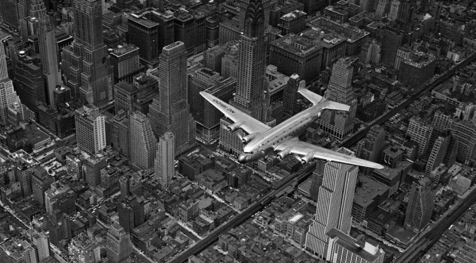
The simplicity of the New York grid system, seen overhead in a 1939 classic photo by Margaret Bourke-White.

PODCAST The Commissioners Plan of 1811 How did Manhattan get its orderly rows of numbered streets and avenues? In the early 19th century, New York was growing rapidly, but the new development was confined on an island, giving city planners a rare opportunity to mold a modern city that was orderly, sophisticated and even (they thought at the time) healthy. With the Commissioners Plan of 1811, uniform blocks were created without regards to hills and streams or even to the owners of the property!

Join us as we recount this monumental event in New York’s history — how land above Houston Street was radically transformed and also how the city revolted in many places. What about those avenues A, B, C and D? Why doesn’t the West Village snap to the grid? And why on earth did the early planners not arrange for any major parks?!

ALSO: A podcast within a podcast as we focus on the biography of one of those commissioners. Give it up for Gouverneur Morris, the casanova with Constitutional connections, a Bronx estate and a wooden pegleg.


CORRECTION: Due to my complete misreading of my own handwritten notes and in the flurry of wrapping up the show, I said that Manhattanhenge occurs on March 28 and July 12 or July 13. I meant MAY 28, not March 28. Chalk this one up to my senility. I apologize for the error.

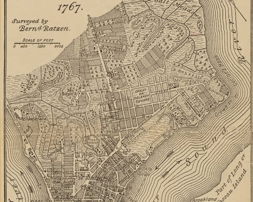
An early view of the area that would one day become the Lower East Side, SoHo and Chinatown: a network of farms and jagged roads, with some organization on individual properties. This map features details of James DeLancey’s farm. That property would be carved up after the war. (You can check out the whole 1767 map here.)

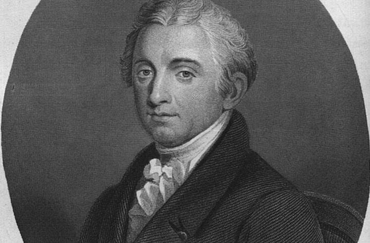
Gouverneur Morris, the Founding Father who led the commission to plan New York’s future streets and avenue.

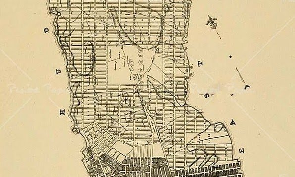
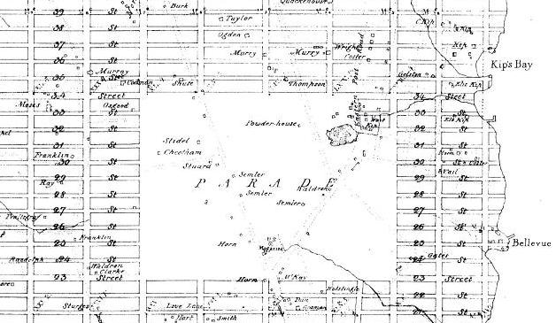
A detail from the original 1811 grid plan map of John Randel. The grid starts at irregular intervals due to keeping Greenwich Village intact, but begins right about Houston Street to the east. As it heads north, two big interupptions were planned — a market place in east around 10th-11th Street and a ‘parade ground’ about 23rd Street.

A close-up on the parade ground.

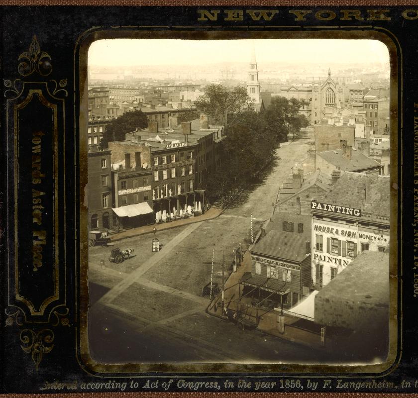
Not everything conforms to the original plan. Take Stuyvestant Street in the East Village. A main thoroughfare into the original estate of the Stuyvesant family, the small road was allowed to break the block between 9th and 10th streets. The street is hardly recognizable in this extraordinary photo from 1856, but the top of St. Mark’s Church gives away the location. (Courtesy East Village Transitions)

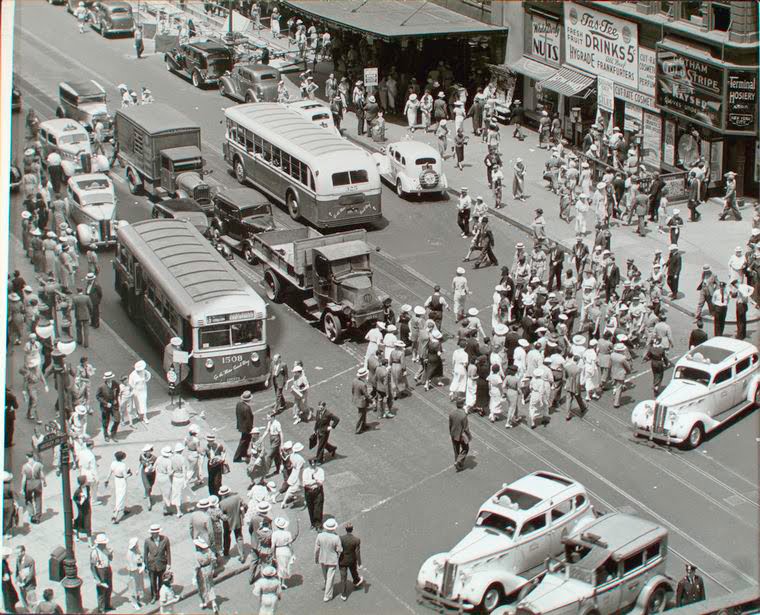
Crossroads: Herald Square, on a hot summers day in 1936. The intersection was partially created by the grid plan (the intersection of 34th Street and Sixth Avenue) and by one feature that later city planners ignored: Broadway which, according to the plan, was never supposed to extend past 23rd Street. (NYPL)

Here’s a look at the entire Randel map in color.

Check out the New York Times wonderful interactive map, overlaying the original plan on top of modern changes to the city.

Categories
True Crime

William ‘Boss’ Tweed meets his end on Ludlow Street

Today is a day of big historical remembrances, from the 150th anniversary of the first battle of the Civil War to the 50th anniversary of man’s first entry into space.

But to me, April 12th will always be the day that William ‘Boss’ Tweed died in his cell at the Ludlow Street Jail in 1878, locked up for his far-reaching crimes of corruption and graft.

We’re working on putting together a new podcast for this Friday, but in the meantime, here’s a reprint of an article on the Ludlow Street Jail I wrote back in 2008, in support of the Riker’s Island podcast:

top1

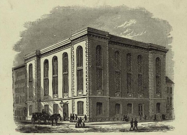
Above: the Ludlow Street Jail, at the corner of Ludlow and Grand streets. (Courtesy NYPL)

Despite being in sight of two boroughs and a very large airport, Rikers Island lulls us with psychological assurance of feeling remote and entirely sequestered from our regular world. But never fear, New Yorkers; there are prisons all over the damn city.

Take the Bayview Correctional Facility, a former Seaman’s YMCA turned medium security prison for women. It’s in Chelsea, 20th street and 12 Avenue, not far the Chelsea Piers sporting facilities. Or the modern day version of the Tombs, officially the Manhattan Detention Complex and once called the Bernard Kerik Complex. (Poor Kerik. Imagine being so disgraced from misdemeanor charges that they strip your name off of a jail.)

But our current correction system benefits from increased security advancements, better run facilities, and relatively humane treatment of inmates. Quite unlike the world which greeted Rikers Island when its first jail opened in 1932.

The prisons of New York City were notorious for atrocious conditions, disease, frequent escapes, corruption and disorganization. The most notorious of these jails, the original Tombs, sat in the festering shadow of a drained Collect Pond, creating a leaky, damp world, or as James Baldwin once described, “a place of sorrow and tears and dread forebodings.” The original Tombs, which opened in 1838, with its ostentatious Egyptian facade, sat close between Five Points and City Hall and often filled its cells with residents of both.

The prisons and workhouses on Blackwell’s Island (later Welfare Island, then Roosevelt Island) were equally as moribund when paired with the island’s wretched asylum, smallpox hospital and other places one wouldn’t wish to throw a birthday party.

We have the beautiful garden of West Village’s Jefferson Market as a keepsake to the former New York Women’s House of Detention. Its proximity to West Village foot traffic was the bane of the neighborhood until it closed in 1974. Activist Angela Davis was kept here before being acquitted of murder charges in 1972. Florrie Fisher was also a regular here.

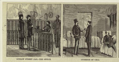
But my favorite former prison location, however, has to be the Ludlow Street Jail, formerly at the corner of Ludlow and Broome, opened in 1862 and sat for many years smack in the middle of a stretch of residential tenements. Originally a debtors prison, the red-brick jail complex, with its 87 cells and an open courtyard, later kept county detainees, some of whom could pay to receive slightly better accommodations as though it were a hotel.

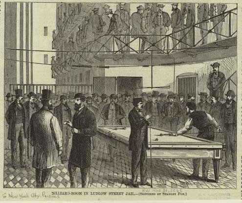
From this picture of the Ludlow jail interior, things don’t look so awful there. I mean, billiards in top hats?

images-nypl_

Victoria Woodhull, the free-love advocate who became the first woman to run for president, spent her 1872 election day in a jail cell here at Ludlow Street for sending obscene materials through the mail, documenting the alleged womanizing of Plymouth Church’s Henry Ward Beecher.

More notably, the king of Tammany Hall corruption, ‘Boss Tweed, died inside a prison cell here on April 12, 1878. Although some accounts claim the Ludlow jail to be better than most — with wide windows allowing sunlight and “probably not surpassed by any prison in the United States” — the doctor who pronounced Tweed’s death mentions it was brought on by “prolonged confinement in a unhealthful locality.”

Curiously, the once-powerful Tweed had partially overseen the construction of Ludlow’s jail and, according to his biography by Kenneth D. Ackerman, his former friends remarked, “If Mr. Tweed had known he was going to patronize it, he would have made the rooms more commodious.”

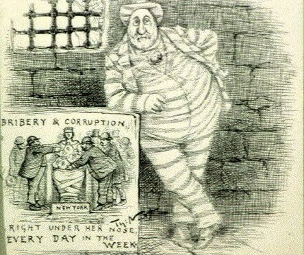
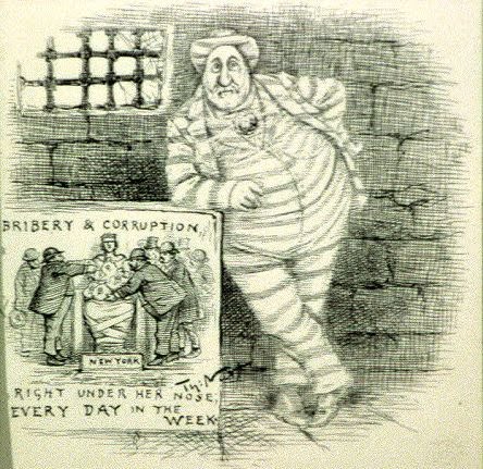
Below – From a Thomas Nast cartoon, with the caption:  The spirit of Tweed is mighty still “…and even yet you don’t know what you are going to do about it!”

tw

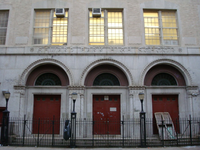
By the 1920s, the prison was affectionately referred to as Alimony Jail for the number of deadbeat husbands contained there. In 1929, the block was cleared to make way for what many would consider a new form of incarceration — the new Seward Park High School. (The original, which actually did sit next to Seward Park, was moved due to subway construction.)

It should be noted that this school was notable for poor performing students and an alarming amount of dropouts and was eventually closed in 2006. Five new smaller high schools now share the building. Former “inmates” of this institution include Tony Curtis, Estelle Getty, and Jerry Stiller.

(Below) Seward Park High School today, a prison for some, built over the site of an actual prison

1

Bridge Whist Club: The worst booze your taxes can buy!


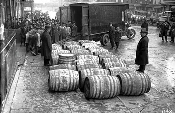
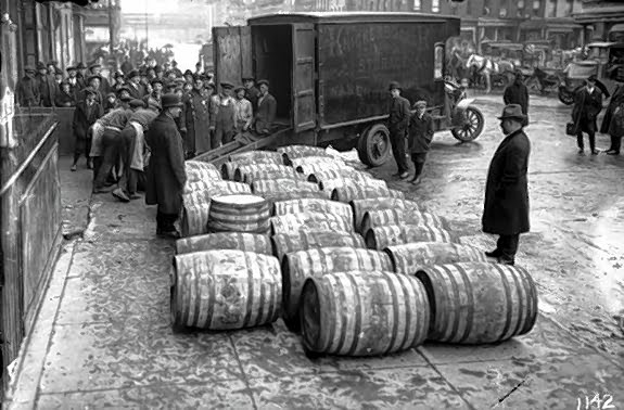
Just a barrel of laughs: Prohibition agents dump illegal containers of wine into the streets.

FRIDAY NIGHT FEVER To get you in the mood for the weekend, on occasional Fridays we’ll be featuring an historic New York nightlife haunt, from the dance halls of the old Bowery, to the massive warehouse clubs of the mid-1990s. Past entries can be found here.

LOCATION: The Bridge Whist Club
44th Street between Madison and Fifth avenues, Manhattan
In operation: 1925-1926

Prohibition in the United States didn’t extinguish the taste for liquor. The Eighteenth Amendment, ratified in 1919, outlawing the sale and transportation of alcohol, merely inspired those who sold it to become more creative.

In New York, prohibition even redefined midtown. Where once nightlife gathered around supper clubs and cabarets in major plazas like Times Square and Columbus Circle, speakeasies now slithered down the side streets and into previously unremarkable buildings. Some of the most famous of these illicit 1920s booze joints were housed in old tenements and small storefronts, down numbered streets off of Times Square and further downtown in Greenwich Village.

Outside the spotlight, a new regime of proprietors, building newfound nightlife empires with mob ties, quenched the thirsts of a populace thirsty for that which they weren’t legally allowed to partake. A great many vied for this business, with a reported “30,000 to 100,000 speakeasy clubs” formed by 1925.

That is an absurd number, reflecting the diversity in establishments — from the gentlemen’s clubs behind secret doors and the high-kicking lounges owned by Larry Fay and Texas Guinan to rundown tenements hastily fashioned with a bar and a few bottles. With no liquor sold there were no liquor licenses required. Everybody could get in the game.

How could the federal government even try and combat such widespread and diverse abuses of a virtually unenforceable law? One tactic manifested in 1925 when, in certainly one of the strangest undercover operation in the history of U.S. law enforcement, the feds got into the speakeasy business themselves. If you can’t beat ’em, drink up and join them.

In the fall of 1925, the United States Bureau of Prohibition sunk a few thousand dollars ($5,576.50, according to official documentation, almost $70,000 today)
to rent a building at 14 East 44th Street to construct its own speakeasy, called the Bridge Whist Club. The dive, called a “plush booze joint” by Herbert Asbury in his history of the Prohibition years, was named for a card game, and it is likely men gathered there to partake in this diversion.

But most were there for the liquor. The undercover agents, meanwhile, used the joint to gather “information concerning the activity of liquor smugglers.” Rubbing elbows with drinkers, agents could theoretically get names of other speakeasies and establish connections to leaders in New York’s underworld. Tables were even equipped with recording devices to pick up incriminating details.

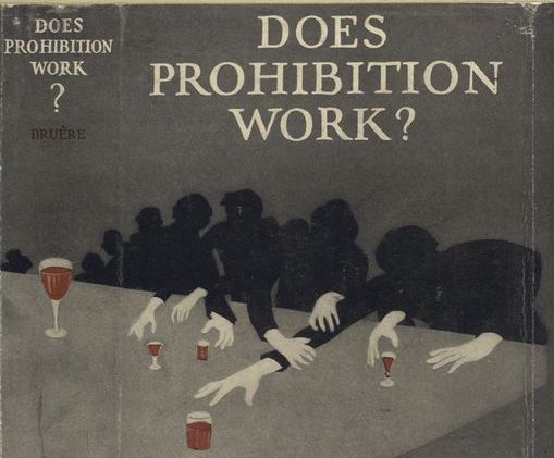
Below: From the jacket of a 1926 book by author Martha Bensley Bruere (courtesy NYPL)

In essence, they were feeding the small fish to draw out the larger ones. The Treasury Department, tasked with enforcing Prohibition by 1925, was well aware of the shifty nature of the enterprise. But an ethical distortion in the philosophy of the Bridge Whist actually put its patrons at risk.

As Wayne Wheeler, head of the Anti-Saloon League, put it, “The government is under no obligation to furnish people with alcohol that is drinkable when the Constitution prohibits it.” So the Bridge Whist served up a mixture containing wood alcohol, also known as Methanol, linked today with causing blindness.

This is not the first time that the U.S. government introduced dangerous substances into illegal drink. Realizing that many bootleggers stole industrial alcohol to make their product, enforcers directed that the industrial stuff be polluted with Methanol, hoping the foul taste and physical illnesses would deter consumption. (Slate Magazine ran an eye-opening article about this last year.)

Some of this toxic mix was sold at the Bridge Whist; other batches infiltrated through speakeasies throughout New York. According to author Deborah Blum, “In 1926, in New York City, 1,200 were sickened by poisonous alcohol; 400 died. The following year, deaths climbed to 700.”

Still, the Bureau claimed such tainted booze was “the most effective denaturant which the government could use, since it was the most difficult denaturant to remove” by bootleggers with their own chemists, tasked with cleaning up the toxic stew.

Having the government in the speakeasy business did not settle well with many in Congress. Anti-Prohibition members equated it to entrapment. Indeed, many arrested due to information gleaned from the Bridge Whist were later set free. Only one “mid-level bootlegger” was ever caught from information gleaned from the speakeasy operation.

New York congressmen Fiorello LaGuardia, ardently against Prohibition, petitioned against the use of ‘under-cover funds’ and extreme measures of enforcement. Ultimately, the Bridge Whist could not weather the scrutiny, and thanks to the efforts of the future mayor of New York, the experiment was officially shut down in May 1926.

Stories from Midtown: The journey of an old church, surviving Civil War riots to become a garage


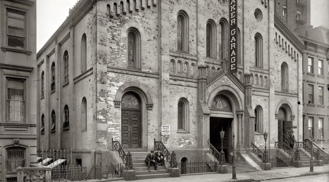
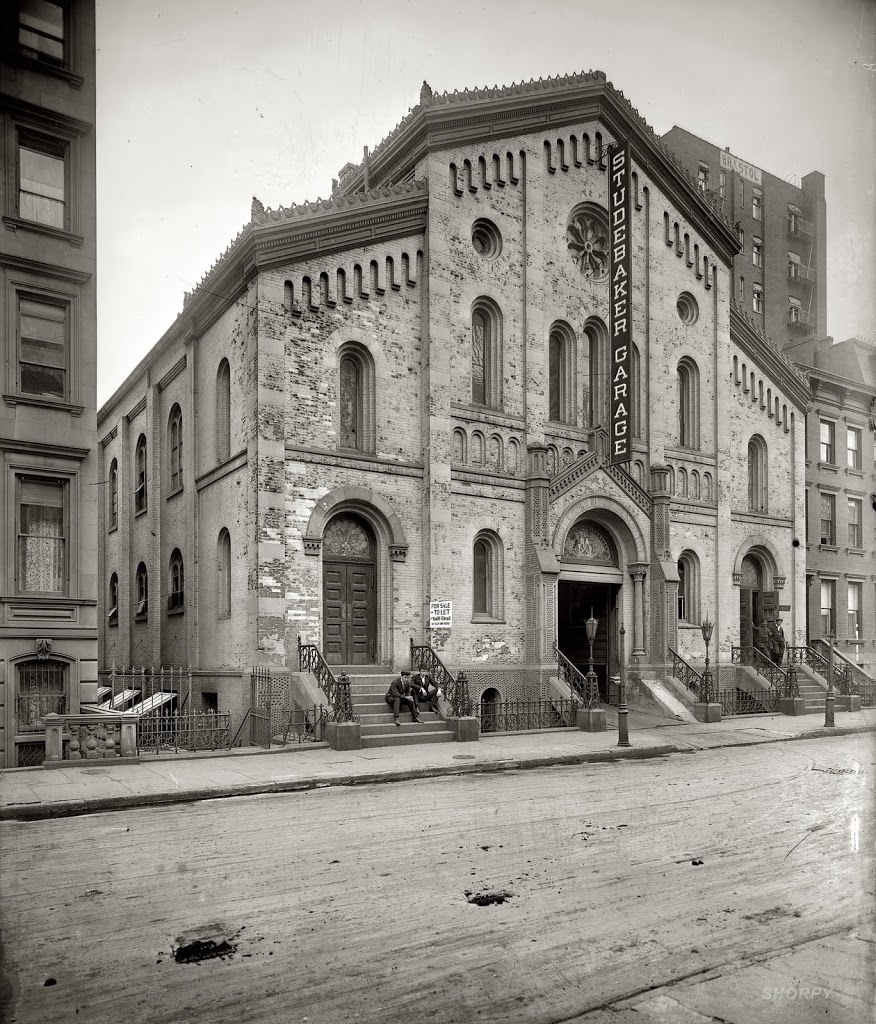
Drive-in salvation: the former All Souls church welcomed automobiles into the fold in 1908. (Courtesy Shorpy)

Another story of a long-gone, forgotten building and one that would have celebrated its dedication 150 years ago this week. This time the story has a strangely sacreligious twist!

It’s safe to say that most Americans were extremely anxious in April 1861. Even as a new president Abraham Lincoln settled into office, most of the Southern states had already seceded from the Union. One week later would begin the battle of Fort Sumter, commensing what would become the Civil War.

In a city of competing loyalties between its country and its rich Southern allies, it would have been difficult to get anything done in New York without lively debate on the matter. Newspaper were consumed with war talk. Irish and German workers excavating Central Park argued with each other about it; society was abuzz, from the Gramercy Park mansion of George Templeton Strong (a proponent for the Union) to the corridors of City Hall and the office of Mayor Fernando Wood (who was very much sympathetic to the South).

War consumed conversation; many New Yorkers feared the future. With everything going on, how can you possibly focus on anything else?

It was in this light, 150 years ago, that a simple little church, a Gothic brownstone structure of red and white brick, was dedicated on West 48th Street between Sixth and Seventh avenues. The All Souls Episcopal Church was nothing particularly fancy, “there were several oriel and oblong windows, not differing from those in churches generally,” the Daily Tribune said frankly.

All Souls would not have been terribly lonely in 1861, but West 48th Street was far from populated. Theaters wouldn’t make it up this far for decades, and nearby Long Acre Square was only now beginning to conjure the horse and buggy industries that would make its late 19th century reputation. Over on Fifth Avenue sat the new campus of Columbia College, its classrooms escaping the growing business district of lower Manhattan.

The congregants had much to pray about in its first years. Those competing loyalties and a conscription lottery that many thought targeted the city’s poor led to riots during the summer of 1863. Angry mobs stormed Columbia College and some nearby factories and residences, but All Souls was spared. Other Episcopal churches weren’t so lucky. (Harlem’s St. Philip’s, for instance was used as a barracks for police and Union soldiers fending off the rioters.)

All Souls survived the war and by the 1870s brandished a new name, the Memorial Church of the Rev. Henry Anthon. Rev. Anthon was a beloved leader from St. Mark’s-On-The-Bowery, and the building on 48th must have been closely connected to that congregation by this time. By the 1880s, it was also known as a charitable ‘bread and beef house’, “for the relief of worthy poor people between Thirty-second and Fifty-ninth streets.”

In 1889, the building went Methodist. Then for a time, in 1896, the church became ‘rented quarters’ for the New York City Christian Science Institute, one of the first New York headquarters for the fledgling religious practice and formed by Augusta Stetson on the orders of the church’s leader Mary Baker Eddy.

According to a 1904 issue of Architectural Record, the former All Souls building “was acquired and radically changed in structure, only the walls being left undisturbed.”

The Christian Scientists eventually moved out to much fancier digs (designed by the renown Carrere & Hastings) on the Upper West Side. But stripping out the detail of old All Souls Church may have ultimately doomed the structure. For in its next incarnation, it became a garage .

The carriage-industry district of Long Acre Square briefly became home to many of New York’s first automobile dealerships at the start of the 20th century.

The Studebaker company was among the most successful. Its main factory and showroom was just down the street at 48th Street and Broadway in what would now be called Times Square. By 1904 it began selling ‘horseless carriages’ that ran on gasoline. In that same year, the Studebaker company bought the old church and turned the former house of worship into a garage for its new vehicles.

The picture at the top of this posting shows the state of the building in 1908. In not a single way has the building’s original purposes been obscured, as though the owners wanted to make their automobiles new objects of worship. I do wonder if more religiously sensitive people thought this new purpose to be a bit blasphemous. What’s worse than turning a church into a garage? Turning a church into a nightclub, then a shopping mall, perhaps.

The garage was torn down one hundred years ago in 1911 and turned into a small theater, reflecting once again the changes of the neighborhood. It too was demolished and replaced — appropriately, with a garage — for the McGraw Hill building.

Photo above courtesy Shorpy

An ode to Sbarro Pizza, a long way from Bensonhurst

On the grim news today that Sbarro Pizza has filed for bankruptcy, I thought I would reprint my article from July 2009 on the Brooklyn origins of this fast-food slice joint.

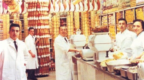
The Sbarro family in their original salumeria in Bensonhurst

In my July 2009 roundup of famous New York-style pizzerias, I left out the one pizza company that could technically be called the most recognizable New York pie — at least to those who live outside the city.

Sbarros Pizza is a fixture of shopping malls and roadside traffic stops across the nation. In fact, “across 30 countries” according to the website. In many of these countries, Sbarros is most likely introducing the actual concept of pizza, much less its modified ‘New York style’ offering.

I was surprised to learn that Sbarros actually got its start in Brooklyn, over 50 years ago, and in a fashion similar to Lombardi’s Pizzeria, the tourist-heavy pizzeria in Little Italy.

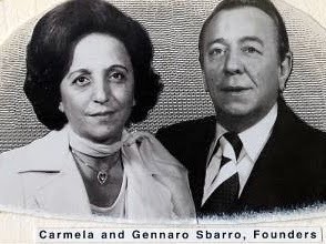
It too was started up by a Neapolitan named Gennaro — the highly alliterative Gennaro Sbarro, to be exact — with his wife Carmela and their three sons. Like Gennaro Lombardi, the Sbarros didn’t start off selling pizza either. Their original salumeria (delicatessen) in Bensonhurst, Brooklyn, was located at 1701 65th Street and 17th Avenue, opening in 1959 and serving the usual Italian-style deli fare, eventually incorporating pasta and pizza onto the menu — and sit-down service along with it.

The similarities to Lombardi’s stop there. The Sbarros had a mind to expand, keeping a tight reign on their operation as they opened 14 additional New York locations well into the 1970s, with all the food made at the original Bensonhurst location. Carmela even continued to personally make the cheesecake.

They could have been content to stop there, but keep in mind that the 1970s was the age of the shopping mall, and the lure of the food court greatly appealed to the Sbarros. Their first experimental pizza outlet was at the King’s Plaza mall in Marine Park. It was here that Sbarros became a counter fast-food restaurant, shedding its salumeria image for a bright, uniform place with a set menu of popular Italian standards.

Needless to say, it was a successful experiment. Incorporating the family business in 1977 and opening the brand up for potential franchises, the Sbarro sons took their restaurant chain national by the 1980s after their father’s death, and rolled it out to international locales by the 1990s.

The original Bensonhurst Sbarros was closed a few years ago, and it’s difficult to find the inherent Brooklyn-ness in a standard-issue Sbarros restaurant today. But if you look carefully, you might find some dusty, fake-looking meats hanging in the window, harkening back to its early Bensonhurst roots. It’s definitely the closest you’re ever going to find New York-style pizza in, say, Salt Lake City or even Kazahkstan. (Picture courtesy PMQ Pizza magazine)

With the state capitol on fire, a wealth of history lost

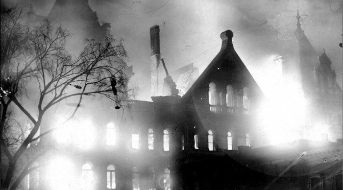
This is not New York City related, but it pertains to the state capital. New Yorkers woke up this morning 100 years ago to see the haunting portrait above in the morning papers. The state capitol building in Albany , completed just 12 years before, caught fire on the evening of March 29, 1911, destroying most of the state library and killing one man. Many documents from the early days of New York history — from the founding of New Amsterdam and the early colonization of the region — were destroyed.

Images like the one above momentarily pushed aside stories and images from Triangle Factory Fire, which had just happened a few days previous.

For more images from the New York state archives, take a look here.

Other scary animals that have escaped the Bronx Zoo

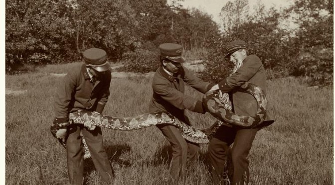
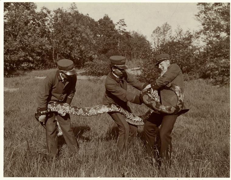
These 1906 Bronx zoo employees won’t let this snake out of sight. (NYPL)

Escapes from the Bronx Zoo are relatively rare today, so news of a 20-inch Egyptian cobra slithering away last Friday — its current whereabouts unknown — struck fear and excitement in the hearts of Bronx residents. The slithery beast has even inspired its own Twitter feed @BronxZoosCobra. (Its latest Tweet: “Taking the Sex And The City Tour!!! I’m totally a SSSamantha.”)

But the institution once known as the Bronx Zoological Park is a 111-year old zoo after all, and during the park’s early years, animals were escaping all the time, almost yearly in fact. And the creatures making the prison breaks back then were far larger than a mere snake. Here’s just a sampling, culled from some early New York Times articles:

July 1902 — A rather plucky Mexican panther broke loose from his new home behind the puma house and crashed a noontime picnic full of women and children. Soon the grounds were buzzing with panicked families and people fleeing for indoor safety. This made life easier for the animal, who feasted upon abandoned picnic lunches. The headlines claimed, “He Eats Sandwiches and Ham for Lunch, but Balks at Pie.” The panther eventually jumped into the Bronx River and swam away.

The original article [found here] makes mention of a bear that had escaped the previous summer. It is unclear whether this was the same “tiny black bear” granted to the zoo by Theodore Roosevelt in 1901 — actually a bear named Teddy Roosevelt, years before the animals that might have inspired the ‘teddy bear’.

July 1904 and 1905Both snow leopards in captivity at the Bronx Zoo escaped in successive years. The first was “shot dead after an all night hunt,” and the next year its mate tried to make a break for it, disappearing “like a ghost” until it was found the next morning. [source]

July 1908 — The iguana would have been quite an exotic beast to children one hundred years ago, so imagine the shock when two Cuban iguanas escaped from their confines during a crowded summer day in the reptile house. Women and children ran to the doors. “One man sprang over a low iron fence into the alligator cage in his excitement and scrambled out again as soon as he realized where he was.” They were thrown into burlap sacks and returned to their confines. [source]

August 1908 — Later that year, an 36-foot long East Indian python (perhaps the one pictured above) briefly fled while being transferred to a pit and had to be recaptured by police officers.

November 1916 — Most unusual is the tale of Loco, the ring-tailed cat, who escaped his cage but hung around the zoo for over two months, killing various birds and rats. Loco was a donation from a Texas animal owner, who gave the cat that particular name because he “must have eaten of the loco weed” before being captured. After feasting with abandon on the zoo’s bird collection, Loco was recaptured and returned to his cage, “mus[ing] upon the good time he has had.” [source]

For more information on the history of the Bronx Zoo, you can download our podcast on the subject right here (recorded in April 2010).

Categories
American History

Where they lived: Victims of the Triangle Factory Fire, the homes they left behind, a hundred years later


Lonely tenement on Avenue C and 13th Street, near many homes of the Triangle Fire victims. photo by Percy Loomis Sperr [NYPL]

From cable television to museums and campuses all over the city, you’ve been able to find a host of remembrances of the tragic fire at the Triangle Shirtwaist Factory one hundred years ago. At the bottom of this post, I’ll reprint my list from a couple weeks ago (with a couple new additions) outlining some easy ways to learn about the history.

I wanted to focus on something a little different. Thanks to the research of Michael Hirsch and the Kheel Center at Cornell University [found here], it’s possible to actually come up with a map of the homes of all 146 victims of the Triangle fire. It would look something like the map below. Just zoom into it to look at the individual sites and take a gander at which neighborhoods and boroughs that were most affected:

NOTE: The addresses are accurate, but a few of the points are approximately placed. In a few cases, the streets no longer exist, so I placed the points in close vicinity.

To nobody’s surprise, the neighborhood most devastated by the tragedy is the Lower East Side (The east side above Houston Street — i.e. today’s East Village — didn’t take that new designation until the 1960s.) There doesn’t seem to be a block in the neighborhood with an empty home that day one hundred years ago.

A few years before the Triangle fire, the Lower East Side has experienced an even more ghastly tragedy — the explosion of the General Slocum paddle steamer on June 15, 1904. Among the 1,021 victims of that horrific event, most lived in this neighborhood and specifically in the German area of Kleindeutschland. As the victims were mostly women and children, the disaster effectively marked the end of the German enclave here. New York wouldn’t see such a large loss of life until September 11, 2001.

The deaths of the 146 garment workers on March 25, 1911, did not produce the same effect to the neighborhood, but certainly the loss was gravely felt in tenements and houses throughout the city. The map shows that the disaster’s immediate impact reverberated even into the other boroughs.

East vs. West
Of the 146, most all of them were born in three countries — Italy, Russia or Austria. A handful were born in the United States, presumably the children of first generation immigrants. So its no surprise most of them found homes in the Lower East Side, still the heart of immigrant life in the early 20th century. But I really didn’t expect it to be so decisive. Outside of a small cluster of people who lived in Greenwich Village close to the factory, there were no victims who listed addresses anywhere on Manhattan’s west side — not in Hell’s Kitchen, the Upper West Side, or anywhere else.

Yorkville and Beyond
I’m fascinated by those who lived further out, near the growing immigrant village of Yorkville on the Upper East Side, for instance. A great many took streetcars and elevated trains into work from Brooklyn and the Bronx, and some might even have taken advantage of the new subway (although in 1911, its route was very limited). No surprise that none of them lived in Queens; the ethnic neighborhoods of that borough would really flourish after the 1920s.

And then there’s young Vincenza Billota, a 16 year old girl who lived out with her uncle in Hoboken, NJ — the only one of the victims to commute into the city. Her uncle came in from New Jersey that night to identify Vincenza who burned alive inside the factory. He identified her because her shoes had recently been repaired; he recognized the cobbler’s work.

Missing TenementsThere’s something moving about finding and identifying the homes of the victims. Most of these people had no solid roots, no property they owned. Only an address, a home they most likely shared with family members and other tenants. Every year the sidewalks outside these addresses are marked with chalk, the names and ages written on the ground as a yearly reminder. You can look at a photo array from the most recent chalk excursions here.

They didn’t live in fabulous Beaux-Arts mansions or apartment buildings. Their homes were tenements, most overcrowded and poorly maintained. Thus, many of the actual buildings themselves are gone. In the cases of the victim’s homes on Monroe Street, even most of the street itself is gone, replaced with more modern housing projects. At left, 135 Cherry Street, the home of fire victim Rose Cirrito. The photo is from 1939 (courtesy NYPL); the entire row of buildings was later demolished.

509 East 13th Street was the home to two Italian girls, Antonietta Pasqualicchio and Annie L’Abate, and an older Italian woman Annina Ardito, who all lost their lives that day. But that building has been replaced with a most modern apartment.

Family and Friends
To grasp a disaster of this magnitude — at a vantage one century later — you have to deal with it in generalities. The victims were mostly girls, mostly immigrants, mostly uneducated. However, by singling out a particular address, the individual tragedies come into focus. And oddly, you get to place that person’s life next to what inhabits that address today. In the case of the Lower East Side, some of these places are now restaurants, bars and luxury condos.

143 Essex Street was the home of two victims — two teenage brothers Max and Sam Lehrer from Austria. Both had arrived in the United States via Ellis Island in 1909; another Austrian, Sigmund Freud, also arrived at Ellis Island that year. Last year, that building itself caught on fire.

Young Jennie Stellino had lived in New York since she was 12 years old; she died in the blaze at age 16. She walked to the factory every day from her home at 315 Bowery, one of the few with a fairly easy commute. Jennie survived the blaze but died from her burns three days later. Decades later, the building at that address became internationally renown for the tenant at its ground floor, CBGB’s.

I’m not sure there’s even a 35 Second Avenue anymore. The street is inhabited by a diner and a few bars today; the Anthology Film Archives sits across the street. But it was the home to three women who lost their lives that day — Catherine Maltese and her two daughters.
________________________________________________________

There are several events lined up for this evening and throughout the weekend. You can find the whole lineup at the website Remember The Triangle Fire.

Here’s some ways to get yourself caught up on the facts of the event, in time for memorial ceremonies on March 25:
TV: PBS will be airing its one-hour American Experience ‘Triangle Fire’, while HBO has its own documentary Remembering The Fire. Check your local listings, as both should be rerunning over the next couple days.
Press: Lots of articles will be generated about the fire, but I recommend you start with the excellent coverage by the New York Times, including a story last week about researcher Michael Hirsch and his quest to identify the last six remaining victims of the fire whose names until now had been unknown. [New York Times]
Books: There are several books in print, both non-fiction and narrative retelling, but the one I can most passionately recommend is Dave Von Drehle‘s ‘Triangle’ The Fire That Changed America‘, focusing on some of the early voices for worker’s rights and unrest prior to the tragedy. And Von Drehle’s depiction of the fire itself is both methodical and heartbreaking.

Websites: The School of Industrial and Labor Relations at Cornell University has organized an extraordinary repository of information about the event and the aftermath, including a huge collection of photographs and audio interviews from some of the survivors. [Remember The Triangle Factory Fire]

Podcast: And finally, I recorded a podcast on the Triangle Factory Fire back in April 2008 (Episode #42) that gives a dramatic overview of the event. You can check it out by downloading it straight from this link or getting it on iTunes from our back catalog feed Bowery Boys: New York City History Archive.

Notes from the Podcast (#121) Fraunces Tavern

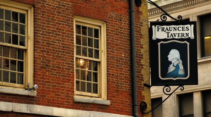
Courtesy Flickr/Harry J. Bizzarro

A slight correction:
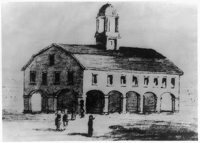
I inferred in this week’s show that the very first Supreme Court — with Chief Justice John Jay — met in Federal Hall. They actually first convened on February 2, 1790, in a building very close by to Fraunces — the Royal Exchange Building. Also called the Merchant Exchange, the Court’s first home was located at Broad and Water streets, making it practically Fraunces’ neighbor. At the time there were only six justices that served on the court.

It was completely unsuited for such important work. According to writings from 1920 by Joseph Bucklin Bishop, the Exchange was “a very curious structure, for its ground floor was open on all sides, and in tempestuous weather the merchants who gathered there for business found it extremely uncomfortable. It had a second story which was enclosed and consisted of a single room” [source] Here’s an illustration of this odd building:


By 1791, the court moved to Philadelphia. A more dignified Merchants Exchange was later built in New York and featured a well-regarded statue of Alexander Hamilton in its rotunda. Unfortunately this building was promptly burned down in the Great Fire of 1835.

Oldest Building?
So, is Fraunces Tavern really the oldest building in Manhattan? It really depends on how much leeway you’re willing to give it. There’s been a continually standing structure there since 1719, easily outdistancing two other Manhattan buildings, St. Paul’s Church on Broadway and Fulton streets (1766) , and the Morris-Jumel Mansion in Washington Heights (1765).

Fraunces, however, has gone through a host of radical changes to its appearance, with floors added and removed, its rooms reconfigured and its exterior entirely altered as to render it almost unrecognizable. A renovation in the 1900s by architect William Mersereau did bring it closer to its original state. There are certainly elements from the original structure that remain. Is that enough to bestow it the title Manhattan’s oldest building?

There are several buildings in Staten Island, Brooklyn and Queens that lay claim to being much older. You can read about some of them here.

Downstairs at Fraunces:
You can read the story about the alleged ‘dungeon’ underneath Fraunces Tavern here: MAY HIDE DARK SECRET OF FRAUNCES’S TAVERN; Proprietor Likely to Conceal Noisome Dungeon from “Blisters.” SO HE TERMS THE BUYERS

Places to Visit:
You can find directions and hours to the Fraunces Tavern Museum here. We recommend hanging a right at the second floor and watching the short introductory video before exploring the room.

When you’re done with the museum, head on up Pearl Street one block north to see some curious ruins under foot, the remnants of old Lovelace’s Tavern. Bricks embedded in the sidewalk also indicate where the Stadt Huys (or New Amsterdam’s city hall building) once stood.

Learn more:
Pearl Street sat along the edge of Manhattan in the 1660s, meaning the land Fraunces sits upon today would have been water and docks. This interactive map from PBS’s Dutch New York display illustrates this pretty effectively.

Curious to learn more about New York during the Revolution? Check our two-part podcast series from 2008: The British Invasion: New York 1776 and Life In British New York 1776-1783.

There’s not any real contemporary books on Fraunces Tavern history, but you might find this artifact from 1919 of interest — A Sketch of Fraunces Tavern and Those Connected With Its History, a short ‘official’ history by Henry Russell Drowne, a member of the Sons of the Revolution.

Drowne was best known as a collector of coins and printed money but was active in New York historical preservation as well. In stark contrast to his name, Drowne died in a house fire on the Upper West Side in 1934.

How some rough Saint Patrick’s Day hangovers almost destroyed New York

The harbor in 1730, with a view of New York’s Fort George by the engraver John Carwitham

It was 270 years ago this week that a truly foul period in New York history began, starting with a host of fires sprouting up throughout lower Manhattan and ending with several black residents of the city hanged and accused of treason, a reign of terror known as the Conspiracy of 1741 (or the Negro Plot of 1741), a hellish inquisition fueled by hysteria, racism and rumor.

Believing that local slave and freed blacks — along with white ‘traitor’ conspirators — had conspired to wreck havoc in the city, the authorities gathered up suspects and accused them of crimes based on scant evidence. In the end, over 30 people were executed for their part in this supposed ‘conspiracy’. Modern historians are unsure such a plot existed at all, and if it had, most of the executed would still have been innocent of wrong-doing.

This violence, which kept the city in a grip of heightened suspicion for most of the spring of 1741, have often been called New York’s version of the Salem witch trials.

For a rich description of these events and some measured speculation to its cause, I direct you to Jill Lepore’s excellent book from a few years ago New York Burning, one of the few books that turned on my enthusiasm for New York City history.

The reason I’m bringing this up today is that St. Patrick’s Day — or rather, the Catholic Feast of St. Patrick from which the holiday derives — actually figures into the story. Just like the modern holiday, it appears that both Catholics and non-Catholics took part in the March 17th celebration, and in particular, the imbibing. According to ‘Gotham’ by Edwin G. Burrows and Mike Wallace, soldiers at their posts at Fort George on March 18th were “recuperating in their barracks from their hearty celebration” the night before. Essentially, an epidemic of hangovers.

As a result, the fort was scantily patrolled that morning. As guards slept the morning away, unknown arsonists stole into the fort and set fire to several buildings inside, including the old governor’s house, once the home of Peter Stuyvesant (who, trust me, never would have allowed this to happen). The blaze quickly spread to the chapel , the soldiers barracks, and even to buildings outside the fort perimeter. It might have blossomed into a raging inferno that would have consumed the city had it not rained and doused the blaze from spreading further. (Thank you St. Pats!)

Had the men at Fort George been more alert, perhaps they would have identified the mysterious culprit. Not only would it have prevented the fire, it might have clamped down the later hysteria and prevented further arson from occurring throughout the next few weeks. The alleged ‘conspiracy’, either real or imagined, might not have materialized at all.